
Showing posts with label leaf-peeping. Show all posts
Showing posts with label leaf-peeping. Show all posts
Leaf-peeping in Saku, Nagano. Teishoji Shrine
 I'm the caveman. My mancave is the mountains. Google dislikes me so nobody can find my blog. I keep doing it though, because I want to remember all the great places I've been able to see and I have a bad memory.
Mts. Maru, Makiyose and that other one with the long name. Dayhike between Uenohara and Hinohara.

S'up, peeps?
I had some business to attend to on a Saturday night in Tokyo. Since I was heading down there and had some free time during the day, I decided to drop by some of my old stomping grounds.
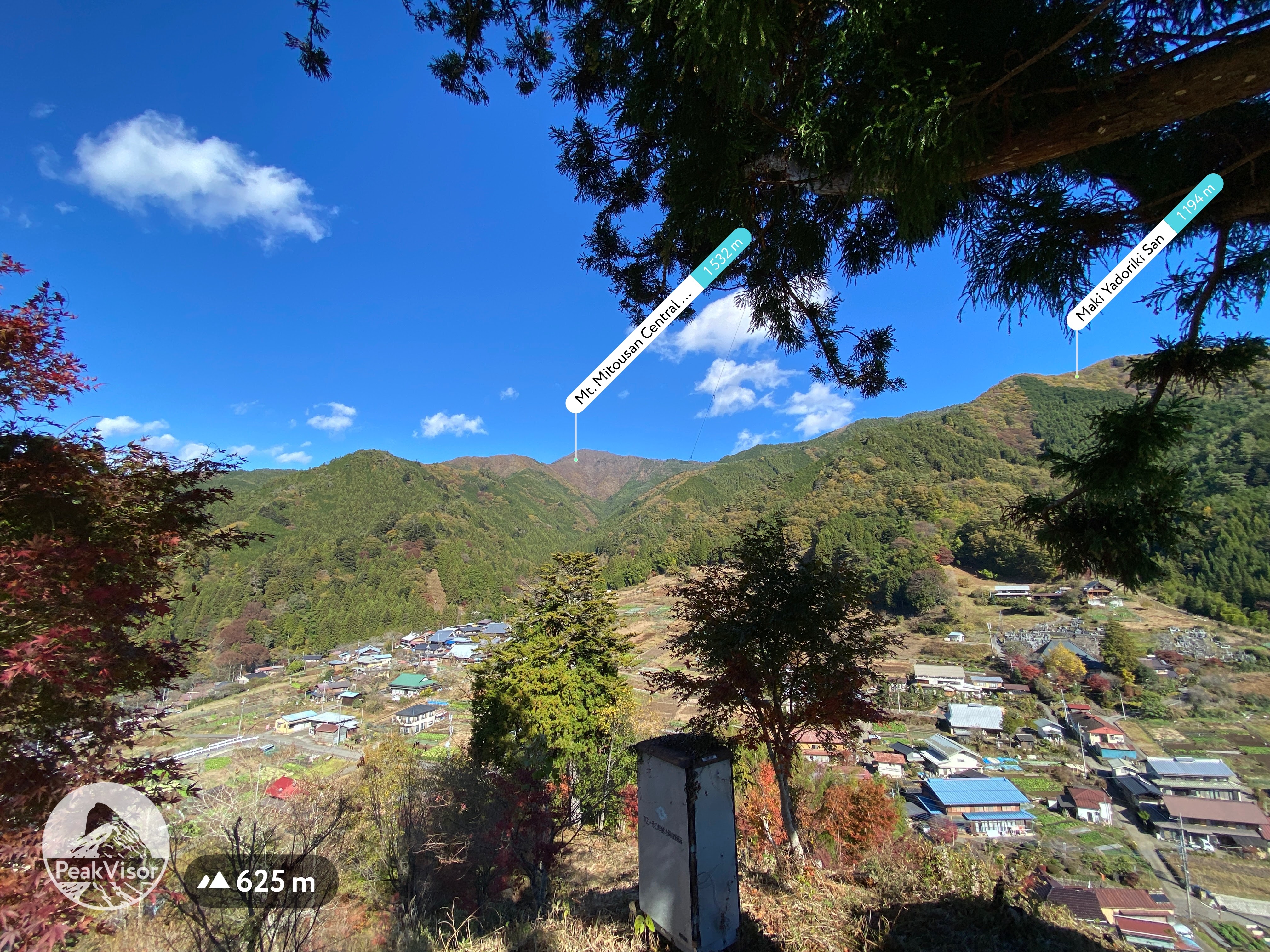
My initial plan for the day was to retrace my footsteps from a hike I made a few years ago up to Mt. Mito. Saihara to Mito, Sept, 2019 Mt. Mito is a very nice mountain. Unfortunately, I wasn't able to fit it into this day's schedule and turned back two peaks before reaching there.
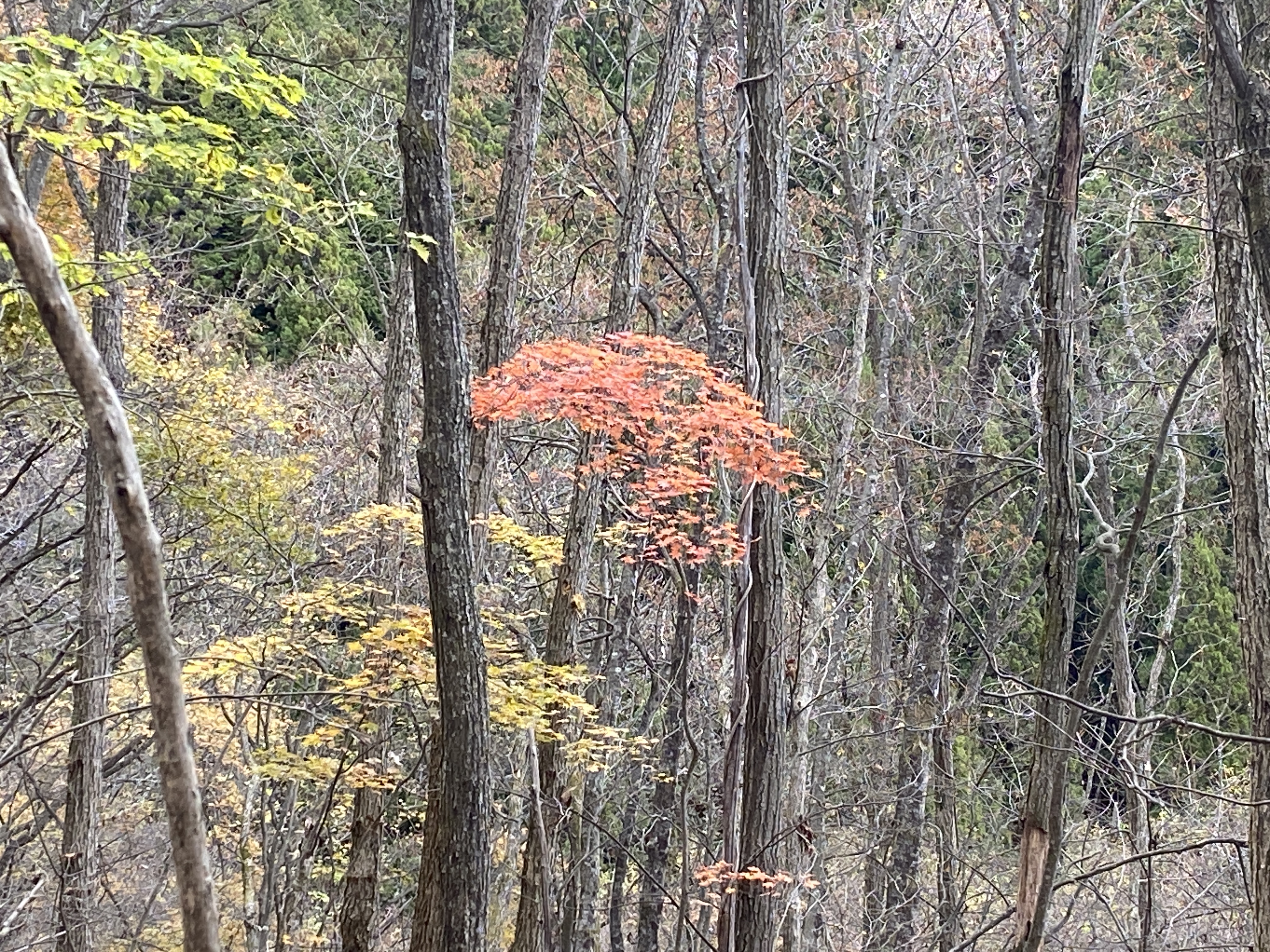
Nevertheless, it was a bit nostalgic to hike in that area. The weather in the morning was gorgeous. Unfortunately, it got cloudy by the time I reached the ridgeline and I was denied some of the better views. That said, it was still a great day.
Location: Around Mt. Makiyose in Uenohara, Yamanashi and Hinohara, Tokyo
Starting and stopping point: Uenohara-shi, Saihara
Peaks bagged: Maruyama ~ Makiyose ~ Hachizasusawanoto
(First-time) peaks #839 (This was my 8th time to Makiyose. Maruyama is the only new one for this day.)
Getting there/getting around: My car. There are bus stops nearby that can be reached after about a 50 minute ride from Uenohara Station on the Chuo Line. That bus only runs a few times a day.
The most popular route from Uenohara is probably the one from the Tsuru Pass (鶴峠). This trailhead is to the west of Mt. Mito is much shorter than the route I took. The rise in elevation is also only about half of what my plan was. The Tsuru Pass can be reached by bus from Uenohara. That takes about 1 hour and 20 minutes. I passed that trailhead/bus stop on my way to my trailhead. I was really surprised how many people were there! The one time I took that bus, I was the only passenger.
Map: 山と高原地図 奥多摩 御岳山・大岳山 24 Okutama Area Yamatokogen Map
Weather Information: Weather for Mt. Makiyose (Japanese)
Total Time: 3:30 Break time: :16 Distance: 9.6km
Elevation: Lowest: 549m Highest: 1,371m Total Ascent: 1,028m Total Descent: 1,028m
Technical considerations/difficulty: No ropes, chains or ladders. Steep. If you aren't good at finding the trail, you could get lost.
Facilities: Nothing on the trail.
Thoughts/observations/recommendations: The Sasa One (Sasa Ridge) runs from Mt. Jinba to Mt. Mito. I have climbed up to it and along it more times than I can count. 😄 Hiking up to this ridgeline from the Yamanashi side is quite secluded. The routes to this ridge and these mountains from the Tokyo side are more crowded because of their accessibility.
Today's listening: Bible in a Year
Here are some pictures.

Coming from Nagano down into Yamanashi, I got some nice views on the way.


This is from "Mt." Maru. It's not very high but is still called a mountain by my app.
I love the variety of flora you can see in Japan. On the same day you can see fall foliage, you can see flowers blooming. In the winter, you can still see vegetables being grown under snow cover.


The top of Mt. Makiyose (槇寄山)

This is as far as I went this day. I always forget the name of this peak. It's Hachizasusawanoto. "Bee-Aim-Stream-Head"


I dropped by the Seoto no Yu Onsen on my way through Akiruno. I was amazed at how crowded it was. This line was to get into the baths.
Look carefully at the sign on the left. Tattoos are taboo here.

That's all for today. Have a good one! Hit the subscribe button if you have not done that yet.
Caveman, out.
I'm the caveman. My mancave is the mountains. Google dislikes me so nobody can find my blog. I keep doing it though, because I want to remember all the great places I've been able to see and I have a bad memory.
Trail run (?). Hirao Fuji. Saku City. Nice fallviews.

This morning I took a run up Mt. Hirao. Hirao is one of my go-to places if I have time for a run before the sun sets after work. It's located in the northeast of Saku City, just above the highway. It's visible from most of the city--and it has great views.
Location: Mt. Fuji Hirao/Hirao Castle Ruins
Starting and stopping point: Sakudaira IC Parking Lot
Peaks bagged: Hirao
(First-time) peaks #xx (Not my first time here)
Getting there/getting around: I drove. There is plenty of parking. The parking lots at the onsen don't open until 8 but I was able to park at the highway parking lot.
Map: Yama to Kogen Chizu #21 西上州 妙義山・荒船山
Weather Information: Mt. Arafune's weather (not too far away)
Total Time: 2:09 Break time: :00 Distance: 12.1km
Elevation: Lowest: 788 m Highest: 1,155 m Total Ascent: 727 m Total Descent: 727 m
Technical considerations/difficulty:
There are a variety of trails that I used on this run. There are hiking trails, ski trails and some forestry roads.
I lost a lot of time by trying to run under one particular ski lift. There are two lifts I ran under. The one on the lower half of the mountain is easy to proceed up. The entrance to the hiking trail is near the top of that lift. Until today, I'd always left the ski trail there and entered the hiking trail. This morning, I tried to continue toward the top following under the upper ski lift. This turned into a slow exercise in bushwhacking up a very steep, prickly, wet, slippery slope. I lost a lot of time there but got to burn a few calories--and collect a few scrapes and scratches to the delight of my inner-9-year-old.
Most of the trails and some of the roads up here aren't on maps. It's quite easy to get twisted around. I would stick to the marked trails if you don't have some kind of gps device.
Facilities: Nothing on the trail.
Thoughts/observations/recommendations: Do it if you can.
Today's listening: Bible in a Year

Winter's coming. Brace yourself.


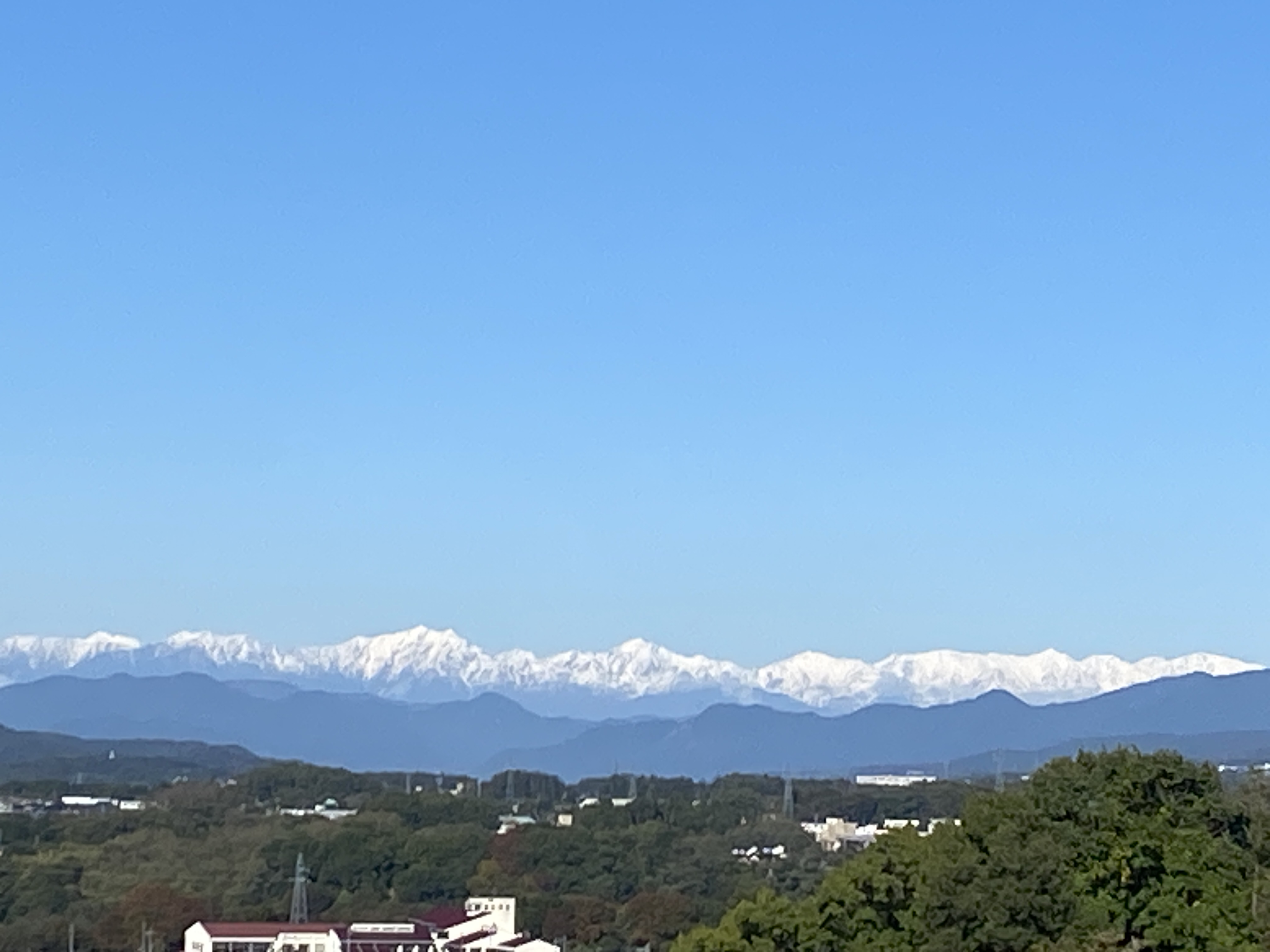
Yatsugatake

Alps


Mt. Asama

This escalator from the onsen down to the Sakudaira Toll booth and parking lot really sticks out. You can see it for miles around.


That's all for now.
Subscribe. Tell your friends, etc.
Or not.
Caveman out.
I'm the caveman. My mancave is the mountains. Google dislikes me so nobody can find my blog. I keep doing it though, because I want to remember all the great places I've been able to see and I have a bad memory.
Subscribe to:
Posts (Atom)