Getting there/getting around: The nearest station is Takaosanguchi on the Keio Line. Free parking is available for bicycles and motorcycles smaller than 125cc.
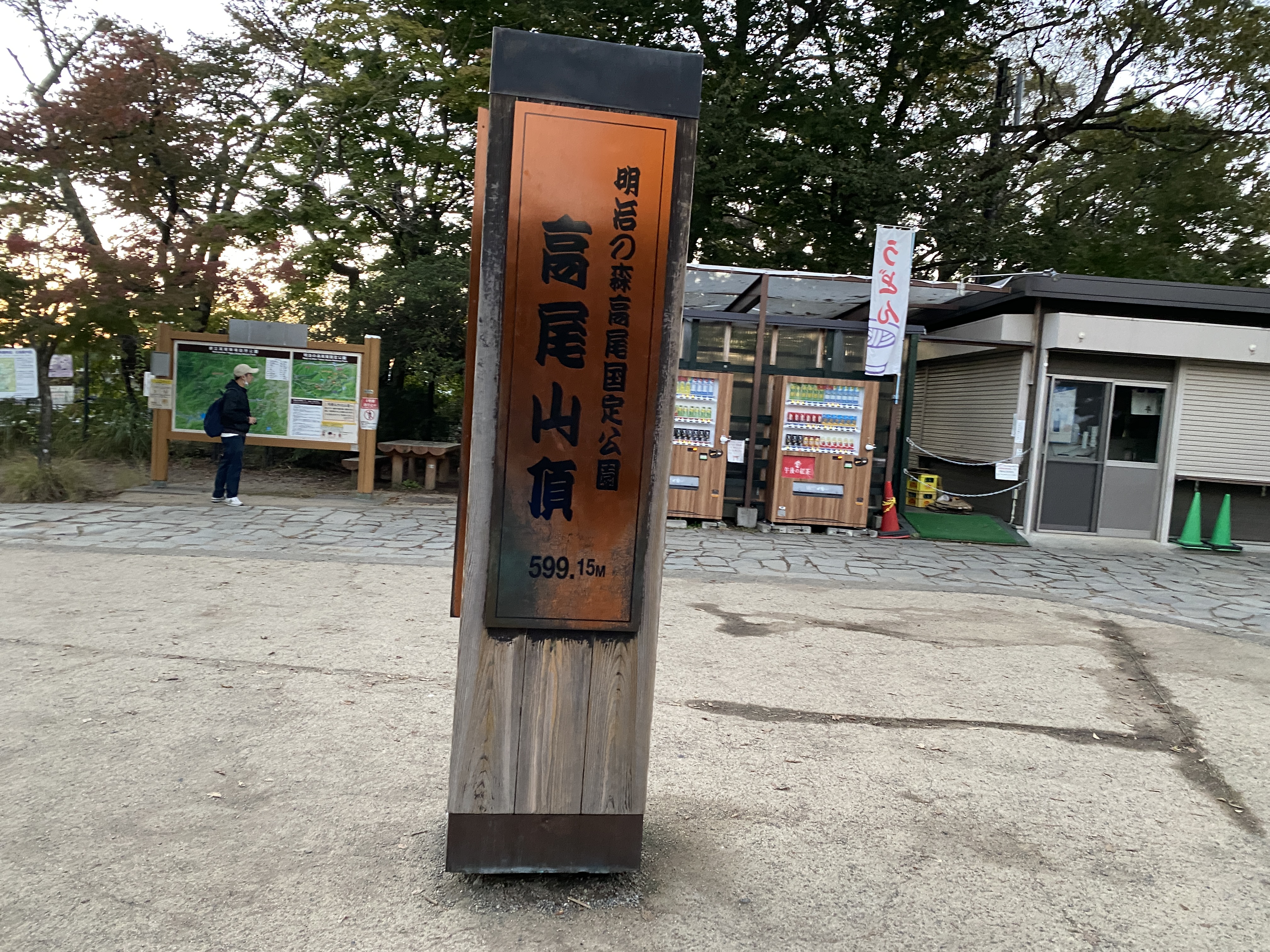
Elevation: Lowest: 188m Highest: 599m Total Ascent: 499m Total Descent: 499m
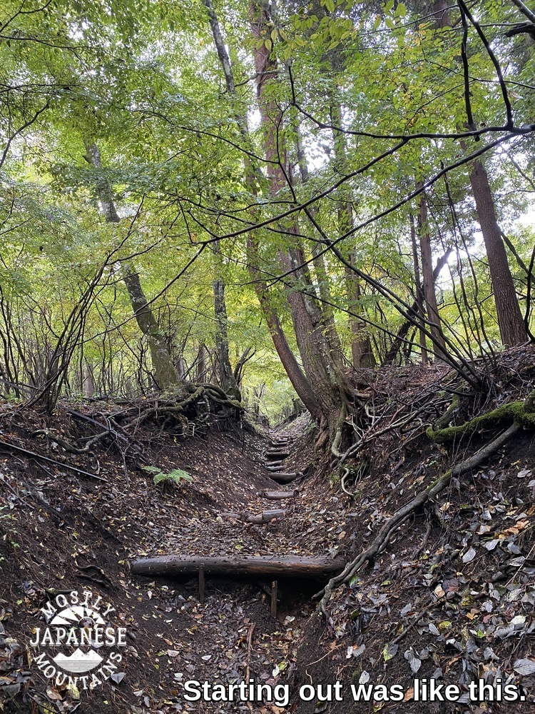
Technical considerations/difficulty: This isn't a long hike but it is steep. I wouldn't suggest running here at peak tourist time. Takao is a very popular mountain. The route I ran is paved. Many trails on Takao aren't.
Facilities: Lots. Public restrooms. Free water. Monkey park. Beer garden. Cable car
Thoughts/observations/recommendations: I wanted to see the sunset so I ran up after work. If you do this, bring a flashlight. There is no light on much of the trail. Also, after dark, some of the paved walkways through the shrines and temples are closed and you have to run through the woods.
It was a nice run. We've had so much rain and clouds these days. I was so happy to have some nice weather.
On the way up, I ran into my friend, Caleb who happened to be gazing out at Tokyo down below. Readers of this blog know Caleb. He is the guy with the famous boots from our trip to Kamikochi in August. https://mymancaveisthemountains.blogspot.com/2022/08/broken-boots-in-kamikochi-mt-hotaka-one.html He took a picture of us. If he sends it to me, I'll post it.
He did. Here it is.
That's all. Here are some pictures.
Looking east toward downtown Tokyo. I'm really tempted to come here for a sunrise someday.
Come again, soon. Don't be afraid to subscribe or to comment.
Greetings cave dwellers. Welcome back to the cave. I was able to dodge the rain drops long enough to take a hike in the Fujigoko (Fuji 5 Lakes) area yesterday. The weather didn't cooperate enough to give me any great views to speak of, but at least I didn't get rained on.
Here are the statistics:
Location: Mountains overlooking Lake Yamanaka from the south side.
Getting there/getting around: There are buses running to Kagosaka Pass, where I exited the mountains on the west, and to the Mikuni Hiking Course Iriguchi, where I started.
Map: Yama to Kogen Chizu #32 富士山 御坂・愛鷹山 FUJISAN MISAKA・ASHITAKA
Elevation: Lowest: 984m Highest: 1,381m Total Ascent: 810m Total Descent: 812m
Technical considerations/difficulty: No ropes or chains. Much of it is flat.
Facilities: There is a public restroom at the panorama dai. That's it.
Thoughts/observations/recommendations: This would make a nice route for a trail run. After getting up to elevation, much of the trail is flat. There are very few tree roots. The trail is mostly composed of volcanic gravel or sand, so traction is great, even where it is wet. I think there probably are amazing views in the area. I'll have to go back on a clear day.
A few years ago I was really spoiled in being able to work at a school that was located near the mountains and that gave me a lot of time off. Often I could go hiking or biking after school or even between classes. The extra days off the school gave me allowed me to take advantage of the chance to hike on weekdays and to really pick and choose the best days for being outdoors. I usually didn't go anywhere on weekends and was able to spend all those days off with Mrs. Caveman. During this time, my friend Bill asked me if I ever went out when the weather was less than perfect. I said no. It seemed like I would never have to settle for less-than-perfect weather. He noted that I would know that I really had caught the bug when I would feel the call of the mountains regardless of the weather.
Well, I guess I've caught the bug. I don't work at that school anymore but I still have a desire to keep hiking at the same pace. If I don't get out at least once a week, I feel a real lack. Now, I often find myself heading to the mountains on weekends like everyone else--the people I used to think of as some kind of peasant. If the weather isn't great on the weekend, I'm out of luck.
I've really caught the bug so I went out yesterday even though it was cloudy again. Actually, I got rained on for most of the two-hour ride down to Yamanashi.
This is a map of where I was. It is not oriented to the north. My hike brought me to a ridge straddling Yamanashi and Shizuoka Prefectures. It overlooks Lake Yamanaka to the north and Oyama and Gotemba to the south. Mt. Fuji is just a few miles to the west.
I saw two large bucks early in the morning. Unfortunately I didn't get a great picture.
Something like sunshine!
I came across a few of these holes. Bears?
Looking down toward Gotemba. I'm sure it would be a spectacular view.
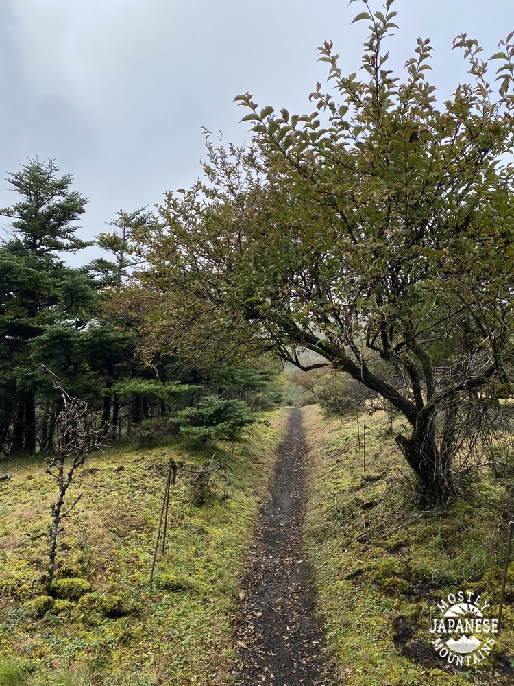
Much of the trail is like this. I found myself running a few times.
Fall is coming!
I saw a lot of deer on this hike. And a LOT of deer tracks--on the mountain and by the lake. I saw a sign cautioning people to watch out for deer hunters. The "season" is every Wednesday all year-round. The deer in this picture are in the yard of someone's mountain villa.
Speaking of mountain villas, I passed many of them after exiting the mountains at Kagosaka Toge ("Basket Hill Pass") and walking down to the lake where my bike was. There are several neighborhoods which have some great vacation homes and company/school retreats around there.
After a few more miles after the Kagosaka Pass, I reached the lake.
The videos are probably boring. Don't feel compelled to watch. I liked taking them, though.
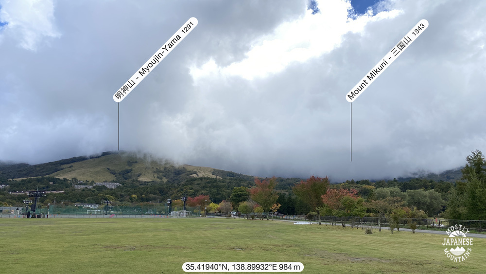
These two pictures are looking up from my starting/finishing point. Mt. Myoujin was the first mountain and Mikuni was the second mountain of the day.
I moved a lot faster on this hike than I'd estimated. I ate lunch at the end of the hike.
That's all for today. Don't forget to subscribe. Comment at will. Come back again.