Ome on the first day of fall, 2021. Sawai Station to Ikusabata

Went for a little hike off the Okutama Line in Ome the other day with my buddy, Mike.

We had thought about going to Mitake and Otake a few days before but decided on something a bit less trafficked when our plans turned out to be to go hiking on the holiday.  Good choice.  The top of Iwatakeishi at lunchtime was packed.  I shudder to think what someplace like Hinode or Mitake was like at that time.  


Again, not the most photogenic day...but it's a nice hike if you're interested in the information.  We started at Sawai Station and ended at Ikusabata Station.  Going in the other direction and ending at Sawai Station might be fun.  Below Sawai Station, there are some udon places by the river with outdoor dining.  There is a brewery there with tours, too.  (I think there are tours.  I don't drink so am not interested.)  

You could also do basically the same route starting at Mitake Station.  It was about 9km.  

This area is about an hour and a half from Shinjuku.


More soon.  I am hoping to get someplace high in the next few weeks!


Hikeling around Akiruno September 14, 2021

One thing I have enjoyed about living in fairly close proximity to the mountains is what I call hikeling.  I can ride my bike for an hour or two (or ten) and get off and hike.  The bicycle enables me to get to mountains and trails that trains, buses, and cars just can't.  I like to take the forest ranger roads(林道 "rindo") to hiking trails.  Sometimes I don't even need a trail to get to a peak from a ranger road.  

On this particular day, I took my bike along the Bonbori River on the Bonbori Forest Road (林道盆堀) in Akiruno to Iriyama Pass and climbed Mt. Ichimichi from there.  


We've had a lot of rain this year so the streams and rivers have been flowing.  I did run into a few guys doing 沢登 ("sawanobori"--climbing up streams).   That looks fun, but kind of dangerous.  Some of these gorges and streams are pretty gnarly.


Clear blue skies are really scarce these days.


These 林道 are really fun to ride on.  Even the regular streets in these areas are justifiably popular with bicyclists.  If you're not lucky enough like me to live within biking distance, you can find rental bikes at many stations.  I know there are bike rentals available at Musashi Itsukaichi Station, Mitake Station and Okutama Station.  If you do some research, I am sure you can find them other places, too.

More later.  Take care.


Hatsukari Station to Otsuki Station (Chuo Line in Yamanashi)

These are from a hike I did on September 7.  Evidently, Mt. Takagawa has a great view of Mt. Fuji.  Unfortunately, it was obscured by clouds this day.

The high point of the day was probably the glimpse I got of a kamoshika (serow, looks kind of like a cross between a goat and an antelope).  Couldn't get a picture, though.

I don't think I'll do this hike again.  The view from Takagawa aside, it was just too noisy.  I could hear construction trucks down below all day.


This is the billboard outside Hatsukari Station.


Otsuki


Iwadono.  That is behind Otsuki Station.  Iwadono has a relatively short hike to the top and it has a great view.


This day's route.


More of Saitama; Shiroku Station to Bushu Nakagawa Station via Mt. Toridani

 Greetings cave cretins, oops, I meant critters.  Fall has fallen.  


I haven't blogged in a bit because it seems like forever since I've had a really good day for pictures in the mountains.  I really want to share the beauty I get to experience out there and therefore want to post the best pictures I can.  

Real-life isn't your typical "influencer's" instagram account, though.  There are less-than-perfect days in real life that are still pretty darned good!

The real reason I get disappointed with less-than picture-perfect days is not that the mountains lose their beauty.  They are always beautiful.  My dissatisfaction is mainly because I like to see where I have been before and where I'm going next.  It is frustrating to know that I am facing directly at something I've climbed in the past but that I can't see just because there is a cloud in the way.

This week I got out twice.  I'll post about my longer of the two hikes here.  

I left home early and was on the trail from about 8:20 in the morning til nearly 8 that night.  It was a longer day than planned!  I was hiking in Chichibu City in Saitama.  I parked my scooter at Shiroku Station on the Chichibu Line and hiked in a counter-clockwise semi-circle to Bushu Nakagawa Station.  There I hopped on the train and rode the two stops back to where my bike was.  I took my bike to Shiroku because it worked out that I could get there earlier by riding than I could if I took trains.  I'd have to change trains several times to get out there, and some of the lines out in the country don't run that often.


As you can see from that picture, this path took me over a lot of peaks.  It turns out the stats on this hike are more impressive than the typical climb up Mount Fuji.  This hike was much longer in distance. There was more gain and loss in elevation on this hike than on Fuji.  It's harder to make time on this trail than on someplace like Fuji because the trail isn't marked so well.   Also, there are lots of "iwaba"; areas with lots of rocks and boulders which necessitate using hands as well as feet.

Let's look at some pictures.


This is Chichibu City


It's like a wrinkly carpet, or a pug's face.  Or a pug's butt, now that I think about it.


I am not sure what this is but I found a nice set of bear bells inside it.


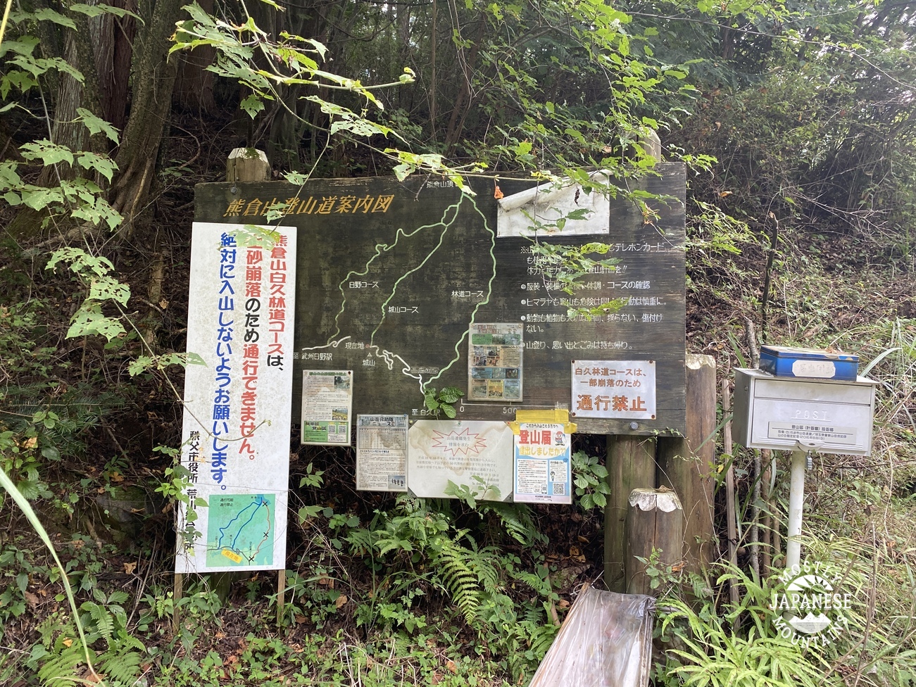
This sign gave me pause for thought.  It has a flyer on it detailing accidents in the area in the last year or so.  There were several fatalities on mountains I've been on multiple times.  Yikes. 


I love rocks and roots.


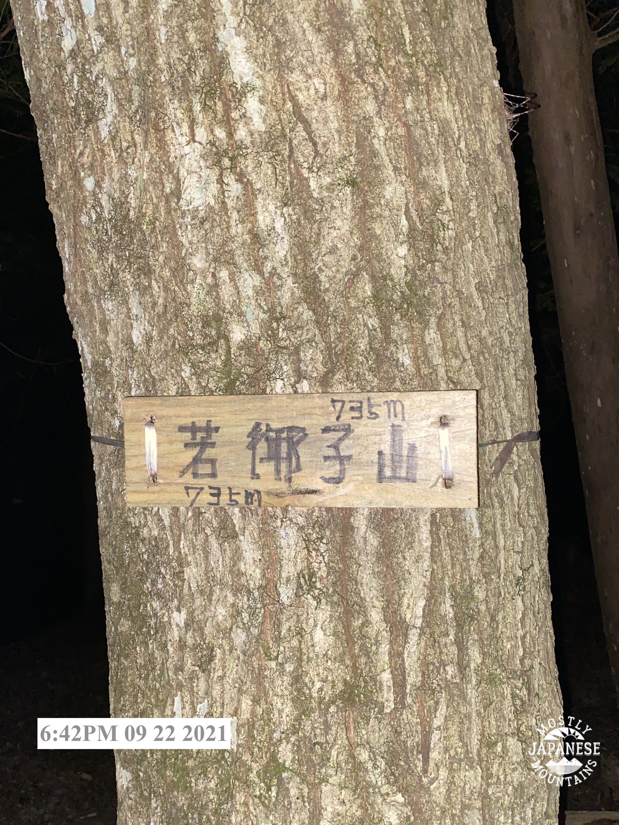
In case you are wondering what was in that last picture.


Mt. Toridani was the furthest mountain in my plan for the day.  Just past that, I just had to turn left so I could start heading back to civilization.  It was already after 2pm when I left Toridani so I was a bit concerned about time.  I was relieved because the trail flattened out and I started to really make up time.  I started to think I might get out of the woods before sunset!

Then I realized that I'd missed my turnoff . . . about 45 minutes after I'd blown past it.

Making good time when you're going in the wrong direction is not a good thing.  
(Musing on what is good reminds me of a Chesterton quote.)  

“The word "good" has many meanings. For example, if a man were to shoot his grandmother at a range of five hundred yards, I should call him a good shot, but not necessarily a good man.”

― G. K. Chesterton

I realized that if I wanted to get where I wanted to go, I would have to take advice from another giant of letters.  As C.S. Lewis said, 

“Progress means getting nearer to the place you want to be. And if you have taken a wrong turn, then to go forward does not get you any nearer.
If you are on the wrong road, progress means doing an about-turn and walking back to the right road; and in that case the man who turns back soonest is the most progressive man.”


I did end up hiking in the dark.  Thank God I had a headlamp.  (Actually, I have two.)  It was so dark in the woods, and the trail was so rugged I would have had to spend the night but for that light.

People sometimes make fun of me because I seem to carry a lot of stuff in the woods.  Screw 'em.  Carrying heavy stuff is good exercise and you just don't know when you might need that stuff.  

I don't want to end up a cautionary statistic on a flyer on a billboard in the middle of nowhere.


Can you spot the tanuki (raccoon)?


Chichibu City


I was pleasantly surprised to reach the station just 10 minutes before the next train.  Only about one an hour runs by here.

This train line is so quaint.  There was nobody manning this station or the one where I got off.  The train itself is limited to just one staff person, the driver.  You can't use an electronic pass here.  You buy a ticket, even though there are no ticket gates to pass the ticket through.  I guess it's the honor system because there is just a box to drop your ticket in at the destination.  

That's all for this hike.  It was, as always, a great day in the woods.

More real soon.  I went for a hike the next day too--and there are a few I've been on since I last blogged.


"Nothing to see here, please move along." Mt. Takigo (滝子山)

 Hello Cavedwellers.


Yesterday was my last hike of the summer.  Leslie Nielsen summed it up pretty well.


On July 28, I dropped by Mount Takigo in Otsuki City, Yamanashi Prefecture.  Supposedly it has once of the best views of Fuji, so I was really looking forward to it.  

This is what I saw.

Bummer


Not to be deterred by one bad day, I decided to try again.  

This is what it looked like yesterday!


Pretty amazing, wasn't it?


It happens.  I've finally resigned myself to not expect to see anything on summer hikes.  There are mountains I've been on 4 or 5 times from which I've yet to see any view because I've only been on them in July or August.  

Despite the poor visibility, I'm often surprised how often I still get satisfying pictures even on days like this one.  Let's take a look at some.


This one is just after leaving Hatsukari Station.  The corn is all in.  So are most of the summer vegetables, but the rice is still in the ground almost ready for harvesting.


The mountain to the left-center in this picture is Takagawa.


This tree was planted the month before my wife was born. That one month makes a difference I guess.  This tree is this tall but my wife is still under 5 feet!  Maybe she'll have a growth spurt this month.


Regardless of the lack of a distant view, yesterday did have the cool misty vibe going for it.  Also, this particular hike had me walking along streams with plenty of falls for about one third of the day.  I really like walking along the water.


For this hike, I took my scooter to Hatsukari Station on the Chuo Line and parked there.  My plan was to descend to Sasago Station and ride the train back to my bike.  When I was getting near the train line, I checked the train times against my ETA on foot and decided just to walk back to Hatsukari.  It was only a difference of about 5 to 10 minutes and I saved the ¥200.  This hike was 19.6km and took me almost 7 hours.  If you look at the map, you can see near the beginning I went on a loop to a place marked with a yellow called 殿平.  I could have skipped that.  There was nothing there to see.

As I often try to do at the end of a long day, I gave my dogs a treat at the end.


I'll leave you with some more water gifs.  See you next time.


This post deserves some attention

Of frigid wives, faithful husbands and virgins of various types. Karuizawa's Mt. Hanamagari.

Location:  Mt. Hanamagari on the line between Gunma and Nagano Starting and stopping point:    P Peaks bagged:   Mt. Hanamagari (鼻曲山) (First...

Subscribe

Subscribe
Become a cool kid cavedweller