Mts. Kurodake Happu Nakattou and Awazu


Greetings visiting spelunkers.  Welcome back to my man cave.
Today's explorations brought me back to the shores of Lake Kawaguchi and its surrounding mountains.

Lake Kawaguchi is in the prefecture of Yamanashi and is one of 5 lakes around Mt. Fuji which together are called--wait for it--the Fuji 5 Lakes.  (Who saw that coming?)

This area is beautiful and is treasured as a tourist destination year-round.  There's fishing, camping, flower-viewing in spring and summer, foliage to enjoy in the fall and spectacular views of Mt. Fuji in the winter.  If nature isn't your bag, you can enjoy the popular Fuji Q Highland amusement park. 


The pointy mountain near the middle of this picture was the main destination for the day.  It's called Kurodake, (黒岳), Black Mountain in English.


Whatever public transportation you get to the area on, your first stop in the area is most likely Kawaguchiko Station.  That's a bus and a train terminal.  From there, most people take a local bus to their final destinations.  This link can give you more info.
https://www.japan-guide.com/e/e6905.html

I'm a cheapskate and I like to walk anyway so I just started walking from Kawaguchiko Station.  It meant walking on the street for an hour before getting to the trailhead but most of that walk was over and around the lake.  It's a win-win.


I took this picture from the bridge over the lake.  My initial plan was to descend at Shindo Pass (the yellow line) but spaced out and missed the turnoff.  When I realized my mistake, I just decided to press on to the next pass.  I hate to turn back.


If you wanted to follow the same route I did but start from the lake rather than way back at the station, think Hirose Bus Stop ( 広瀬バス停) near the  Shuhoukaku Kogetsu onsen would be a good starting point.

The first interesting thing I encountered was a ratty, closed-for-the-day gift shop.   The shop sells already-made models of WWII weapons.  Especially Japanese warplanes.   There was a smattering of Japanese battleships and carriers but there must have been about 10 zeroes on the shelf.  As far as non-Japanese planes, I noticed there were 2, maybe 3 corsairs.  Tellingly, no B-29s or B-24s.  When I got past the building and saw what was outside, I was in for a surprise.


Wow!  That was unexpected.


I would like to have gone into the yard for a closer look but there were signs all over that said "No Entry" (立ち入り禁止).  Those signs and the vibe I'd just picked up after looking at the shop's shelves were all the deterrent I needed.  LOL.  One of the reviews on googlemaps seemed to confirm for me that it was probably best to stay outside.

https://www.google.co.jp/maps/place/%E6%9C%A8%E5%B7%A5%E6%A8%A1%E5%9E%8B%E5%B7%A5%E6%88%BF/@35.5261982,138.7600204,17.86z/data=!4m5!3m4!1s0x60195fba7d654883:0x115d2dec4fa3509d!8m2!3d35.5262159!4d138.7619232


Back to my mancave . . . 
Soon after that place, the trail started.  It was quite steep a lot of the way.  This rope at the very start of the trail was just a hint of what lay ahead. 


The morning was warm and clear.  I was treated to many beautiful views of Fuji.


Unfortunately, it got cloudy about noon so Fuji started to hide even before I got to my first peak.

Did I mention there were a lot of ropes?


It really is a pity that Fuji went into hiding.  I walked along this ridge after taking this picture and, were it not for the clouds, would have had unobstructed views of Fuji all along the way.


The city of Fuefuki must have laid out a bit of dough to build this.  They must expect crowds because there are two of these brand new observation decks they just built near the Shindo Pass.

I had them all to myself.  One of the nice things about today's hike is that I saw only 3 people in the mountains all day.


Mt. "Nkattou" (actually, "Nakattou") on the far right is one of the last mountains of my day.


That's all for today.  Drop by the cave again.

There is a spot to comment below.  Use it.  There is also a button for subscribing down below the comment section.  You don't have to smash it or slap the subscribe button.  Just a simple click of the mouse will do the trick.


Magical Mt. Gozen


I wasn't planning on hiking yesterday.  When I woke up and looked out the window towards the mountains, my plans changed.  It had snowed the day before and the mountains were white.  I couldn't give up the chance to play in the snow (at least) once more before it melts.

Mrs. Caveman hails from an island paradise where snow never falls.  I'll never forget the look on her face one morning in New England when we opened the curtain and for the first time, she saw snow falling.  She said, "It's magic!"  Being from New England, I am not so apt to think of snow as magic all.   But, she is right.   It's magic!

I opted to head for Mt. Gozen yesterday.  Mt. Gozen is the tall mountain on the right in the picture below.  The pointy one on the left is Mt. Otake.   


Mass Ave 975, 100109 (37)CC BY-SA 3.0

Those two mountains, along with nearby Mt. Mito, make up what is called the Okutama Sanzan 奥多摩三山.  That means something like the Famous Three Okutama Mountains. 

For my hike, I took my scooter to the Fujikura Bus Stop on Route 205 in Hinohara Village.  You can get there by bus.  The bus from Musashi Itsukaichi Station takes 49 minutes.  Yikes.  

This was my fifth time up Mt. Gozen and each trail I've taken up there has one characteristic in common.  Each one is steep.


Really, after just about 5 minutes I had risen this high.


And it continued like that, unrelentlingly.  No wonder I always have wobbly ankles for a day or so after climbing Gozen.


The snow made for a nice walk.  Most of the time it was about 4~6" (10~15cm) of powder.  It was easy to walk on and the rhythmic crunching sound of the snow being packed under my feet was meditative.


This picture below was my only glimpse of the mountain on the way up.  Gozen seems to like to keep a low profile and it's not as popular as the other two members of the 3 famous mountains.  Mt. Mito has the Tomin No Mori tourist facilities and a fantastic winding highway around it which both attract crowds.  Mt. Otake is just a hop skip and a jump from uber-popular Mt. Mitake with its shrine, shops and its cablecar.  Gozen has nothing commercial and is hidden from the view of downtown Tokyo behind the pointy-topped Otake.  

It's almost like Otake is sticking its nose in the air like some kind of alpine snob.

Maybe Otake does that to compensate.  It's actually shorter than Gozen but keeps up the illusion of being tall because it is between Gozen and downtown.  Maybe we should rename it Mt. Napoleon.


From downtown, you can't even see Mt. Gozen because of Otake.  This is what Otake looks like from the other side, though.


It is nice that Gozen is less popular.  It was nice to walk on virgin snow.  The only tracks on it were those of Bambi and Thumper.


This is the refuge hut below the summit.  It's a nice spot and I've stayed there twice.  They discourage hikers from using these huts these days though since the Coronavirus hit.


There's a water hole right next to the hut.  The sign is cautioning people to boil the water because deer might be pooping in the stream.


Another shot of Mt. Otake.


This part is not far from Mt. Sogaku.  It's awful.  The first time I encountered it I was climbing up it.  It seemed so treacherous that I thought I'd lost the trail.  Yesterday was even worse.  I was going down it and the snow cover hid slick mud and loose rocks.  
It's also much steeper than it looks.


 The 3rd member of the triumvirate appears, Mt. Mito.  Mito (三頭山) translates directly as "3 Head Mountain".  It got its name because it has 3 peaks.


This is the trail I took.  It wasn't a very long hike distance-wise, but it did take me over 5 hours.  The 1,167-meter change in elevation and the snow were factors.


Well, I think that's all for today.  I am still on spring break and have my fingers crossed to get out again real soon.  Drop by the cave anytime.


Shizuoka and Mt. Fuji tourism video

This is a webinar marketing Shizuoka produced for travel professionals.  I know many of you cave dwellers seem to like information about Fuji more than anything else I post so I hope you enjoy this.  Maybe it will give you some ideas for sightseeing.  I found it interesting because I am much more familiar with the Yamanashi side.

  I'm not a travel agent and am not making any money off of this.  I do want to give a h/t to my cousin Brian Magrane for telling me about this webinar though.  Drop by and see him at https://www.magranetravel.com/.

Thanks to the producers of the webinar for letting me post it.


Just press play to watch


The webinar made the powerpoint and a few other pdfs of brochures available.  Let me know if you want to see that stuff. 

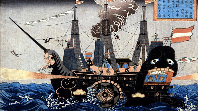
Keep your fingers crossed that Japan will re-open soon.  We could use some black ships and someone like Commodore Perry about now!


A day for viewing o' the green. Hikeling on St. Paddy's Day

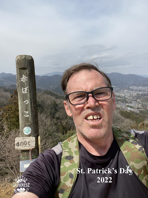
I am Patrick, a sinner, most uncultivated and least of all the faithful and despised in the eyes of many.

St. Patrick


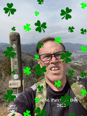
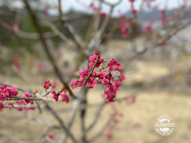
For March 17, I did a bit of hikeling and even a little hanami (flower viewing).

I worked for about 15 years in Akiruno and I came to love the mountains so much in large part because of these trails and forestry roads that are so accessible to my former workplace.  It was a huge treat to be able to take a hike right from the school grounds.

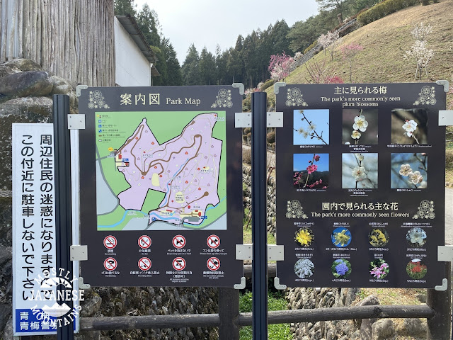
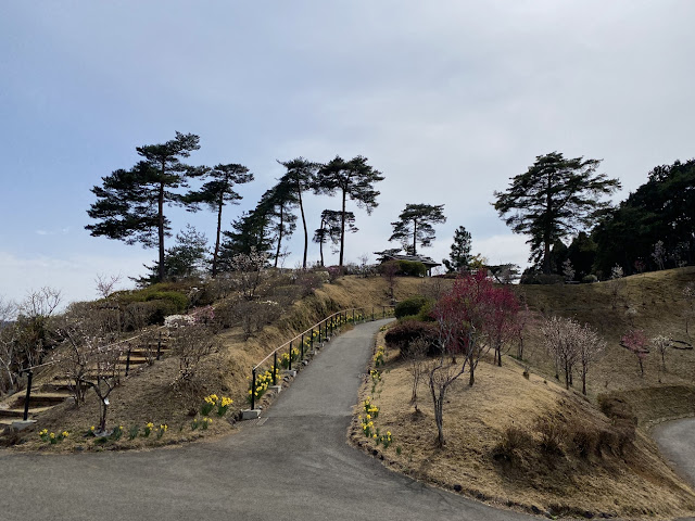
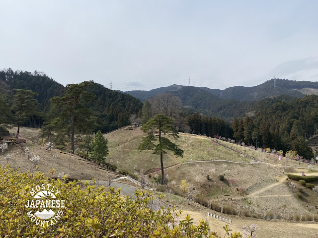
Yesterday I headed out on my bike to a trail that runs between Hinode and Ome City.  I passed over a nice little bump called Mt. Akabokko on my way to 梅の公園 (Plum Park).   I was not actually planning about blogging this because it wasn't the most photogenic tour but I do think I can share some information that people looking for hanami or hiking recommendations in the area might like.  Don't expect a lot of beautiful pictures in this post, though.


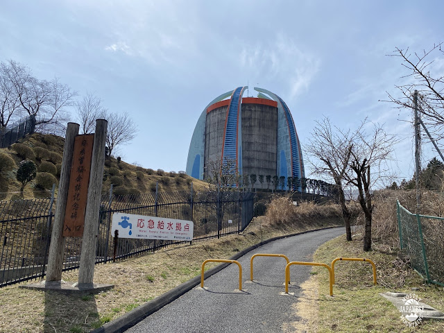
On the way out there, I passed through Oguno.  If you have spent any time in Akiruno or Hinode, maybe you've noticed this thing in the picture and wondered what it is.  It's an emergency water tank on top of a hill.  It's visible from quite a distance.  It's behind a junior high school and there is a little park and a peace memorial nearby.  The memorial commemorates a visit by President Ronald Reagan to Japan.  I always wondered if it wasn't a backhanded compliment to put that memorial in a place where it's a sure bet that almost nobody will ever see it.  The Gipper is like Rodney Dangerfield; he don't get no respect.  No respect at all.

  This spot is a worthy destination if you need an excuse to go for a bike ride.


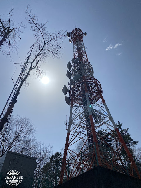
I entered the woods near Futatsuzuka Pass at Tokyo FM's antenna.  


It's a hiking trail but about 50% of it is ridable.


That's much steeper than it looks.  And bumpier.  Those are stairs.


This is Akabokko.  This little hill has surprisingly nice views.  This is looking west towards Yoshino Kaido and Okutama.


This is at the Umenokoen (梅の公園).  
https://www.omekanko.gr.jp/spot/81501/

I have walked or ridden past this place a few times because one of the trailheads to Mt. Hinode is nearby but this was my first time to go in.  The nearest station is Hinatawada or Miyanohira.  I walked there once after coming out of the woods.  It was a little longer than most people would probably want to walk for a picnic.  I assume you could get there by bus from Ome.  There is parking for cars and bicycles. 


The grounds are very nice but the trees are all very young and small.  Evidently, there was some tree blight that wiped out the trees around 2013 and they had to be replanted in 2015.  It was a nice place for a picnic but not much to write home about.  It's too bad because the neighborhood around the park is geared for tourists.  There is a restaurant right in front of the park and there are plenty of small businesses selling local delicacies.  I'm looking forward to seeing what it will be like in about 15 years.


That's all for now.  More soon, I hope.