I had some business to attend to on a Saturday night in Tokyo. Since I was heading down there and had some free time during the day, I decided to drop by some of my old stomping grounds.
My initial plan for the day was to retrace my footsteps from a hike I made a few years ago up to Mt. Mito. Saihara to Mito, Sept, 2019 Mt. Mito is a very nice mountain. Unfortunately, I wasn't able to fit it into this day's schedule and turned back two peaks before reaching there.
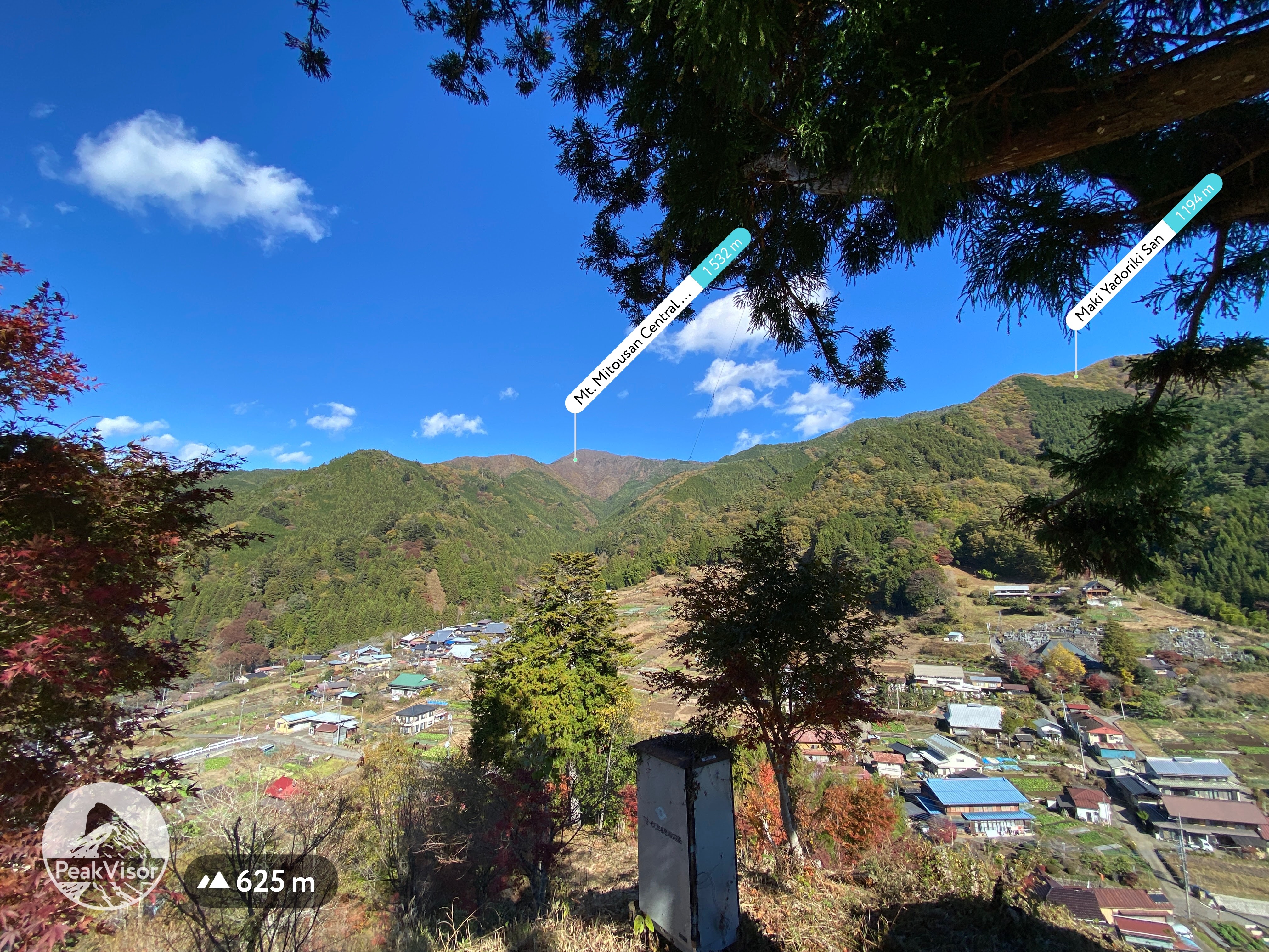
Nevertheless, it was a bit nostalgic to hike in that area. The weather in the morning was gorgeous. Unfortunately, it got cloudy by the time I reached the ridgeline and I was denied some of the better views. That said, it was still a great day.
Peaks bagged: Maruyama ~ Makiyose ~ Hachizasusawanoto
(First-time) peaks #839 (This was my 8th time to Makiyose. Maruyama is the only new one for this day.)
Getting there/getting around: My car. There are bus stops nearby that can be reached after about a 50 minute ride from Uenohara Station on the Chuo Line. That bus only runs a few times a day.
The most popular route from Uenohara is probably the one from the Tsuru Pass (鶴峠). This trailhead is to the west of Mt. Mito is much shorter than the route I took. The rise in elevation is also only about half of what my plan was. The Tsuru Pass can be reached by bus from Uenohara. That takes about 1 hour and 20 minutes. I passed that trailhead/bus stop on my way to my trailhead. I was really surprised how many people were there! The one time I took that bus, I was the only passenger.
Elevation:Lowest: 549m Highest: 1,371m Total Ascent: 1,028m Total Descent: 1,028m
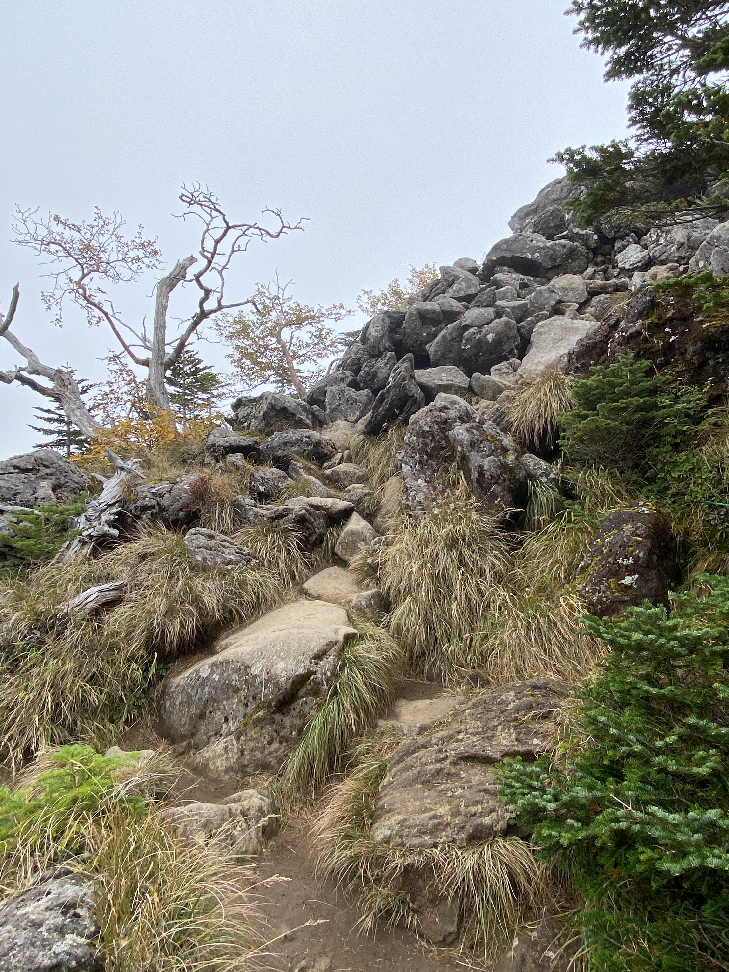
Technical considerations/difficulty: No ropes, chains or ladders. Steep. If you aren't good at finding the trail, you could get lost.
Facilities: Nothing on the trail.
Thoughts/observations/recommendations: The Sasa One (Sasa Ridge) runs from Mt. Jinba to Mt. Mito. I have climbed up to it and along it more times than I can count. 😄 Hiking up to this ridgeline from the Yamanashi side is quite secluded. The routes to this ridge and these mountains from the Tokyo side are more crowded because of their accessibility.
Coming from Nagano down into Yamanashi, I got some nice views on the way.
This is from "Mt." Maru. It's not very high but is still called a mountain by my app.
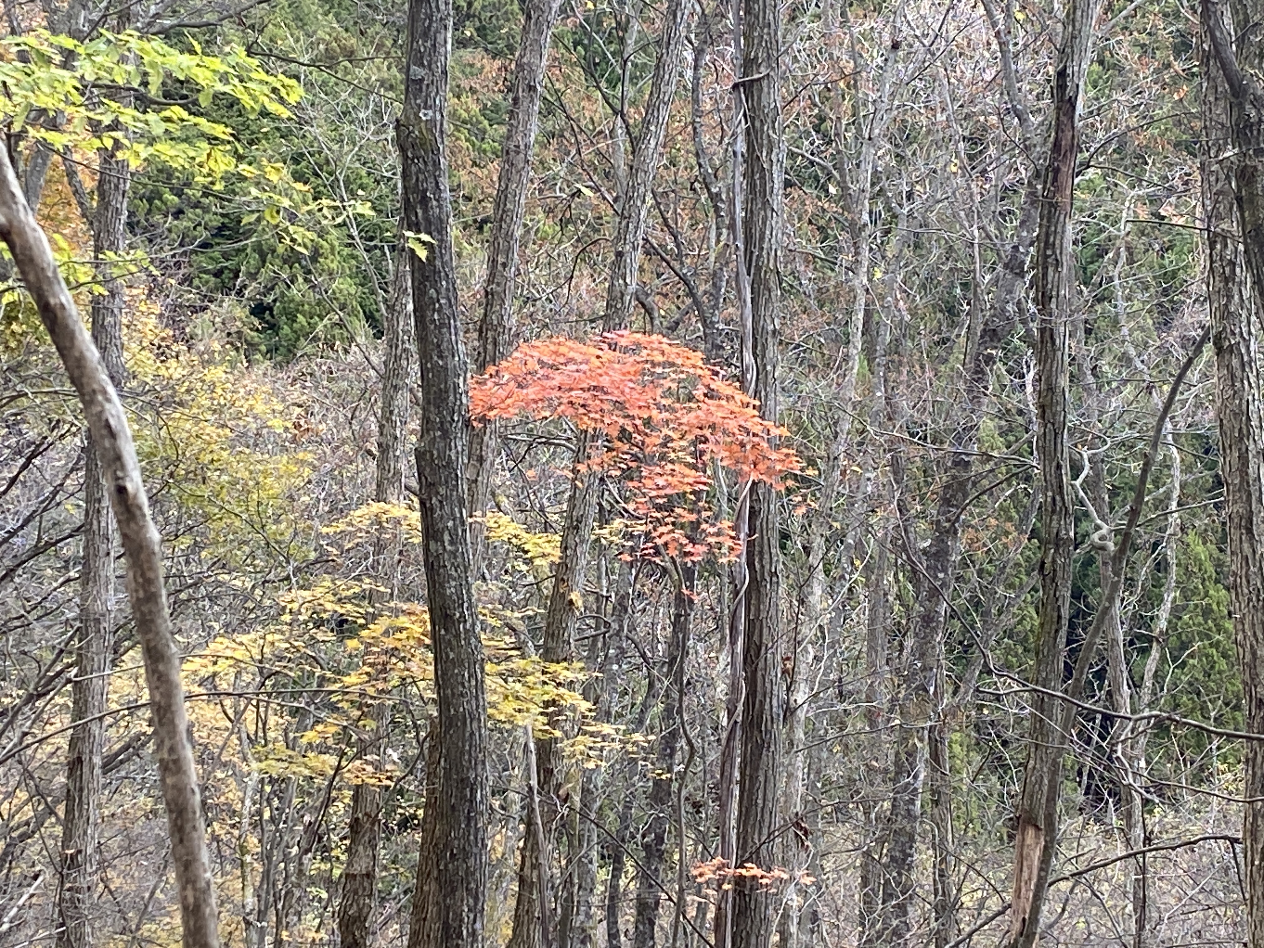
I love the variety of flora you can see in Japan. On the same day you can see fall foliage, you can see flowers blooming. In the winter, you can still see vegetables being grown under snow cover.
The top of Mt. Makiyose (槇寄山)
This is as far as I went this day. I always forget the name of this peak. It's Hachizasusawanoto. "Bee-Aim-Stream-Head"
I dropped by the Seoto no Yu Onsen on my way through Akiruno. I was amazed at how crowded it was. This line was to get into the baths.
Look carefully at the sign on the left. Tattoos are taboo here.
That's all for today. Have a good one! Hit the subscribe button if you have not done that yet.
Welcome ladies and gentlemen, boys and girls, cave visitors of all ages.
How'd you like my clickbait title? It's hard to become an influencer. In my last few posts, I mentioned skinnydipping and you wouldn't believe how many views I got. I'm not sure how I feel about the type of new readers I'm getting, though.
Unlike many internet entities; I'm not lying with my titles. Maybe gilding the lily a bit, but I'm not lying. Keep reading and you'll see what I mean.
Honest. You can trust me. I'm not like the others.
Anyway . . .
I went for a bit of a hike on the Yatsugatake Range yesterday. It wasn't a picture-perfect day, but it was still a great experience.
Getting there/getting around: I drove. There are buses to the trailhead I used. They run between the Nitago Onsen and Koumi Station 4 times a day starting in April 22. I guess they run until the snow makes the road impassible.
Total Time: 7:08 Break time: :36 Distance: 16.5 km (just over 10 miles)
Elevation:Lowest: 1,571 m Highest: 26,46 m Total Ascent: 1,386 m Total Descent: 1,386 m
Technical considerations/difficulty: Much of this is above the treeline. There are not a lot of spots with chains or ropes but a lot of this hike is steep and there are a lot of boulders to negotiate. I think the only places where getting lost would be a possibility would be at trail intersections. Most of them are well-marked, though. If you pay attention, you should be fine.
Facilities: There are lots of onsens, huts and waterholes. There are several campgrounds.
Thoughts/observations/recommendations: This is, I'm sure, a great collection of mountains, but I really don't know just what they look like. It was not clear enough long enough over a wide enough area for me to have gotten a good look! The one peek I got of the peak of Tengudake from below was really cool. This is another on a long list of mountains I have to go back to.
I was surprised at the number of onsens and campgrounds in the area. I also was surprised by the number of people I saw. It didn't ever seem crowded, but there were a surprising number of hikers up there.
"The only possible excuse for this book is that it is an answer to a challenge. Even a bad shot is dignified when he accepts a duel." Orthodoxy
I have listened to or read Orthodoxy, and a few other Chesterton classics, several times. I find more and more gems each time. He's not immediately accessible. I find that the first 90% of a chapter is usually bewildering and takes a lot of concentration. The last 10% or so when he pulls everything together makes the hard work worthwhile! And, along the way, some of the quotes are just so clever and, well, quotable.
OK.....let's look at some pictures
The Shirabiso Hut next to Midori Ike. There are camping sites here as well as some food, etc.
Midori Ike (Green Pond)
Looking up toward my invisible destination, Mt. Tengu.
Looking up from Midori Ike in another direction toward Mt. Inago.
Back on the trail
Mt. Tengu's eastern peak
Looking back at the eastern peak from the western peak.
People were standing and waiting with their cameras for a long time hoping for breaks in the clouds.
This is the first fall foliage I've seen this year. It's at an elevation of about 2,500 meters. It's still all green down below.
The buildings are the Neishi Hut and that is Mt. Io behind them in the cloud.
"Io" means "sulfur". It is the same word as is "Iwo Jima" ("Sulfur Island") Sure enough, it smelled like sulfur around here.
That is a woman taking a bath in Japan's highest outdoor bath. I'm glad she was clothed! Even so, I wish she wasn't there. I really felt creepy taking a picture with a scantily-clad maiden (actually, more like a grandmother) in it--even from a distance. I couldn't not get a picture of this pool, though. That is cool.
The path to the outdoor bath . . .
This is the marker proudly pronouncing Japan's highest outdoor bath. I felt really awkward whipping out my iphone to take a picture here. The woman in the bath was the only person around. I made some small talk with her when I took this picture and tried to make it obvious I was more interested in the sign than in her. Haha. She didn't seem to mind me being there.
Mt. Io
This is the Honsawa Onsen. This is the business that owns the outdoor bath. (1,000 yen, by the way.) They have some indoor baths, too. There is also some lodging and several tent sites there. I saw quite a few people there and they all seemed to be having a great time.
Walking through the Honsawa Onsen
Before heading back to the car, I passed by the Midori Ike again. Thankfully, the clouds had cleared and I finally got a picture of Mt. Tengu.
Well, cave dwellers, that's all for now. Come again.