Showing posts with label 紅葉狩り. Show all posts

Trail run (?). Hirao Fuji. Saku City. Nice fallviews.


This morning I took a run up Mt. Hirao.  Hirao is one of my go-to places if I have time for a run before the sun sets after work.  It's located in the northeast of Saku City, just above the highway.  It's visible from most of the city--and it has great views.


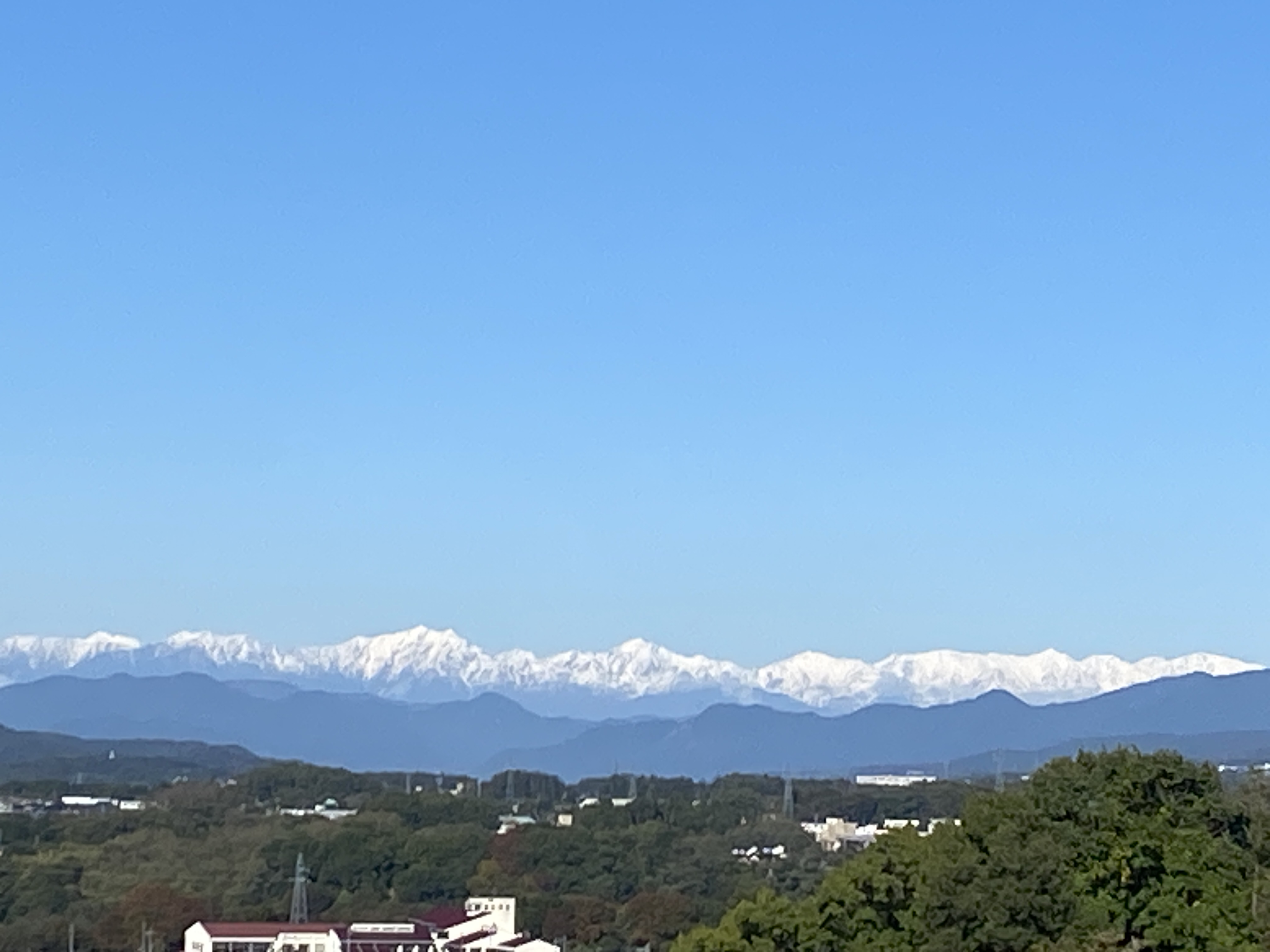
Location:  Mt. Fuji Hirao/Hirao Castle Ruins

Starting and stopping point:  Sakudaira IC Parking Lot

Peaks bagged: Hirao

(First-time) peaks #xx (Not my first time here)

Getting there/getting around:  I drove.  There is plenty of parking.  The parking lots at the onsen don't open until 8 but I was able to park at the highway parking lot.

Map:  Yama to Kogen Chizu #21 西上州 妙義山・荒船山

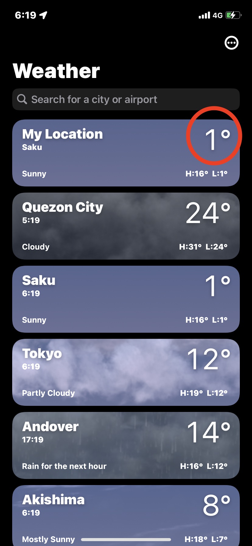
Weather Information: Mt. Arafune's weather (not too far away)

Total Time:  2:09 Break time: :00  Distance:  12.1km

Elevation:  Lowest:  788 m Highest: 1,155 m Total Ascent:  727 m Total Descent: 727 m

Technical considerations/difficulty:  

There are a variety of trails that I used on this run.  There are hiking trails, ski trails and some forestry roads.  

I lost a lot of time by trying to run under one particular ski lift.  There are two lifts I ran under.  The one on the lower half of the mountain is easy to proceed up.  The entrance to the hiking trail is near the top of that lift.  Until today, I'd always left the ski trail there and entered the hiking trail.  This morning, I tried to continue toward the top following under the upper ski lift.  This turned into a slow exercise in bushwhacking up a very steep, prickly, wet, slippery slope.  I lost a lot of time there but got to burn a few calories--and collect a few scrapes and scratches to the delight of my inner-9-year-old. 

Most of the trails and some of the roads up here aren't on maps.  It's quite easy to get twisted around.  I would stick to the marked trails if you don't have some kind of gps device.

Facilities:  Nothing on the trail.

Thoughts/observations/recommendations:  Do it if you can.


Today's listening:  Bible in a Year


Winter's coming.  Brace yourself.


Yatsugatake


Alps


Mt. Asama


This escalator from the onsen down to the Sakudaira Toll booth and parking lot really sticks out.  You can see it for miles around.


That's all for now.
Subscribe.  Tell your friends, etc. 
Or not.


Caveman out.


Exorcism on Aisle 3. Onioshidashi Volcanic Park, Tsumagoi, Gunma


Mrs. Caveman combined a little leaf peeping with some lava leering yesterday.  We dropped by the Onioshidashi Volcanic Park just below the volcano, Mt. Asama.  It was even cooler than I imagined.  If you can get there, go.  Admission is 700 yen for adults.

A word about the name, Oni Oshi Dashi is a compound of the words for "demon/ogre" 👹, "push" and "out."  The name probably is meant to evoke the thoughts of the locals watching eruptions back in the day.  It certainly could cause one to think the earth was spewing something evil--kind of like Linda Blair's green vomit scene in the Exorcist.

My only regret is that it was a bit cloudy.  It was still impressive but I couldn't help but thinking how amazing this would be on a super clear day. 

I'm not going to comment much because I already have something else I'd like to blog about and the pictures say more than I could.  


The Lennon family visited in 1977.  John loved nearby Karuizawa.


That's Mount Asama


They also call this one Godzilla.  I still see King Kong.
Does that mean I fail the Rorrock test?


Can you spot the Karuizawa Toy Kingdom in this picture?


Phosphorescent moss


This one is a dog.  I can see that.


Can you spot the face in the next rock?
It made me nostalgic for New Hamphire's Old Man of the Mountain.


These last few are not from the Onioshidashi Park.  We dropped by the Asama Otaki (Asama Big Falls) before going home.  They are about a 15 minute drive from the volcanic park.


That's all for now. 

Caveman out.

Take care