End of year greetings to all you spelunkers.
This marks my last report of the year. I went for my 86th hike yesterday and knocked off my 161st peak of 2024. It's been a great year in the mountains. I haven't had any injuries and I'm very grateful for that.
I hope and pray that you all have a Merry Christmas and a healthy and happy year in 2025.


. . . about these mountains
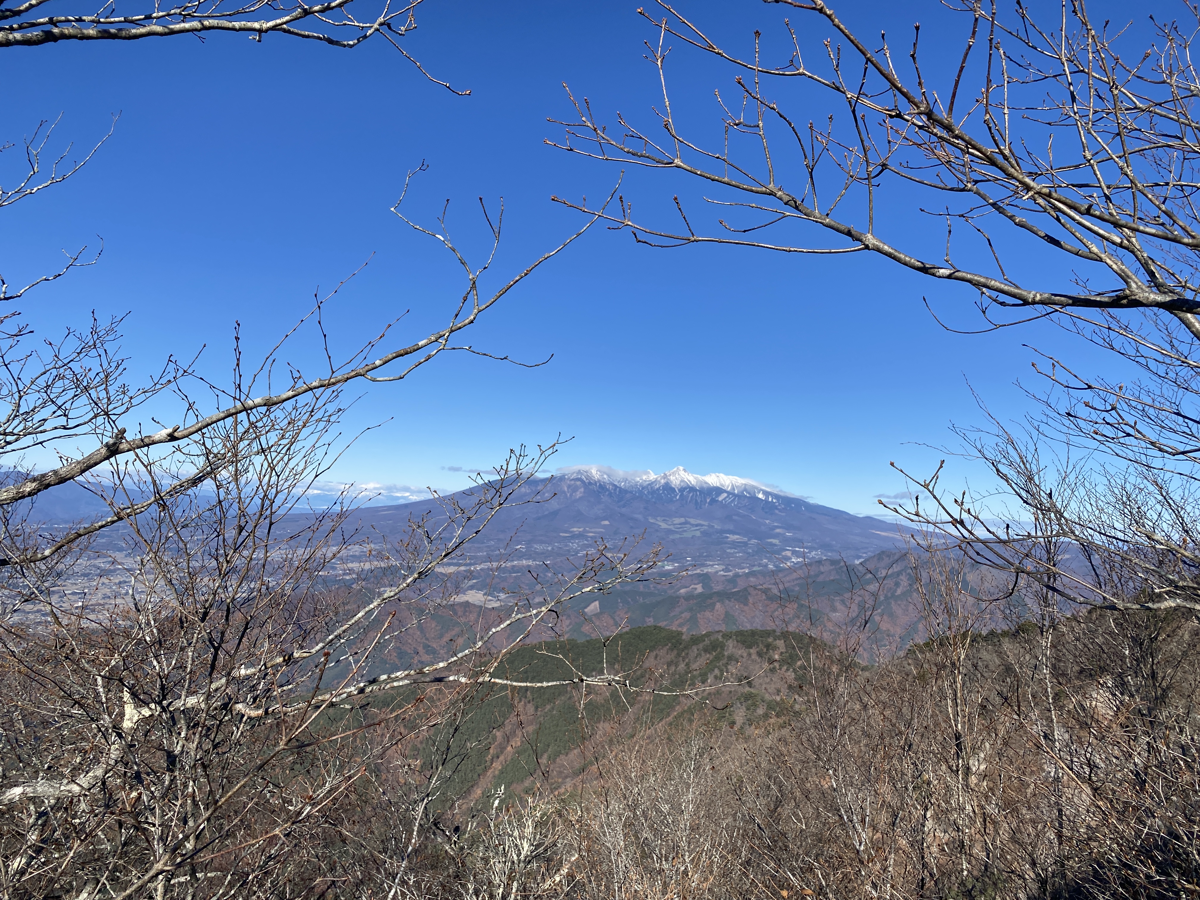
There isn't much to say. These are not famous or particularly spectacular. They just happen to be a few mountains I hadn't yet hiked on. They overlook the Chikuma River's valley, Ueda City and Sakaki Town. There are views of Utsukushigahara, Yatsugatake and Arafune.
Area: Ueda City/Sakaki, Nagano
Location:
Map: ***If you want a link to the latest Yama to Kogen map, comment and I'll get you a link. This link is to a printable topo map
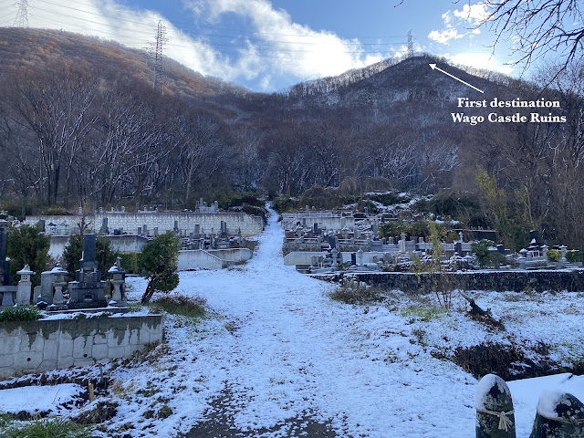
Starting and stopping point: 和合城跡登山口 Wagojoato Trailhead
Peaks bagged: (神場鳥越) Jinbatorigoe ~ (高津屋山) Takatsuya ~ (虚空蔵山) Kokuzo ~ (弥五郎峰) Yagoromine ~ (兎峰) Usagimine
(First-time) peaks # 984~989
Getting there/getting around:
I drove. I borrowed the parking lot at Besia, not too far from the trailhead. It was empty.
The nearest train station is Nishi Ueda on the Shinano Tetsudo. That's easily within walking distance of one of the trailheads. Ueda Station on the Hokuriku Shinkansen Line isn't too far either. If you wanted to come to the area by train, I'd change from shinkansen at Ueda and take a local train to Nishi Ueda.
Helpful Info
Weather Information: Nearby Mt. Taro's forecast
Time and distance
Total Time: 4:45 Break time: :20 Distance: 9.17 km
Elevation: Lowest: 413 m Highest: 1,077 m Total Ascent: 866 m Total Descent: 868 m
Technical considerations/difficulty:
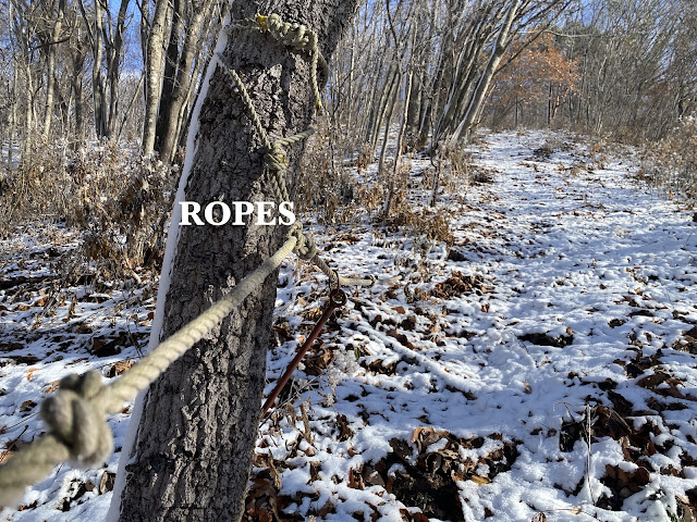
This isn't terribly high but it's steep. It's a challenge to keep your feet under you in slippery conditions like I had today. Thankfully, there are long sections with ropes. There could be more, though! I slipped twice.
Facilities:
There's nothing on the trail except for a few benches here and there.
Thoughts/observations/recommendations:
These are some minor peaks sandwiched between two valleys in Ueda City. I wouldn't make them a destination for a trip from far away. It is a good place for a local to hike, though. The views of the valley below and some of the distant mountains was nice. It would be nice to go there on a really clear day.


The trail starts at a cemetery. I think these are the graves of all the unsuccessful climbers.
(That's a joke.)

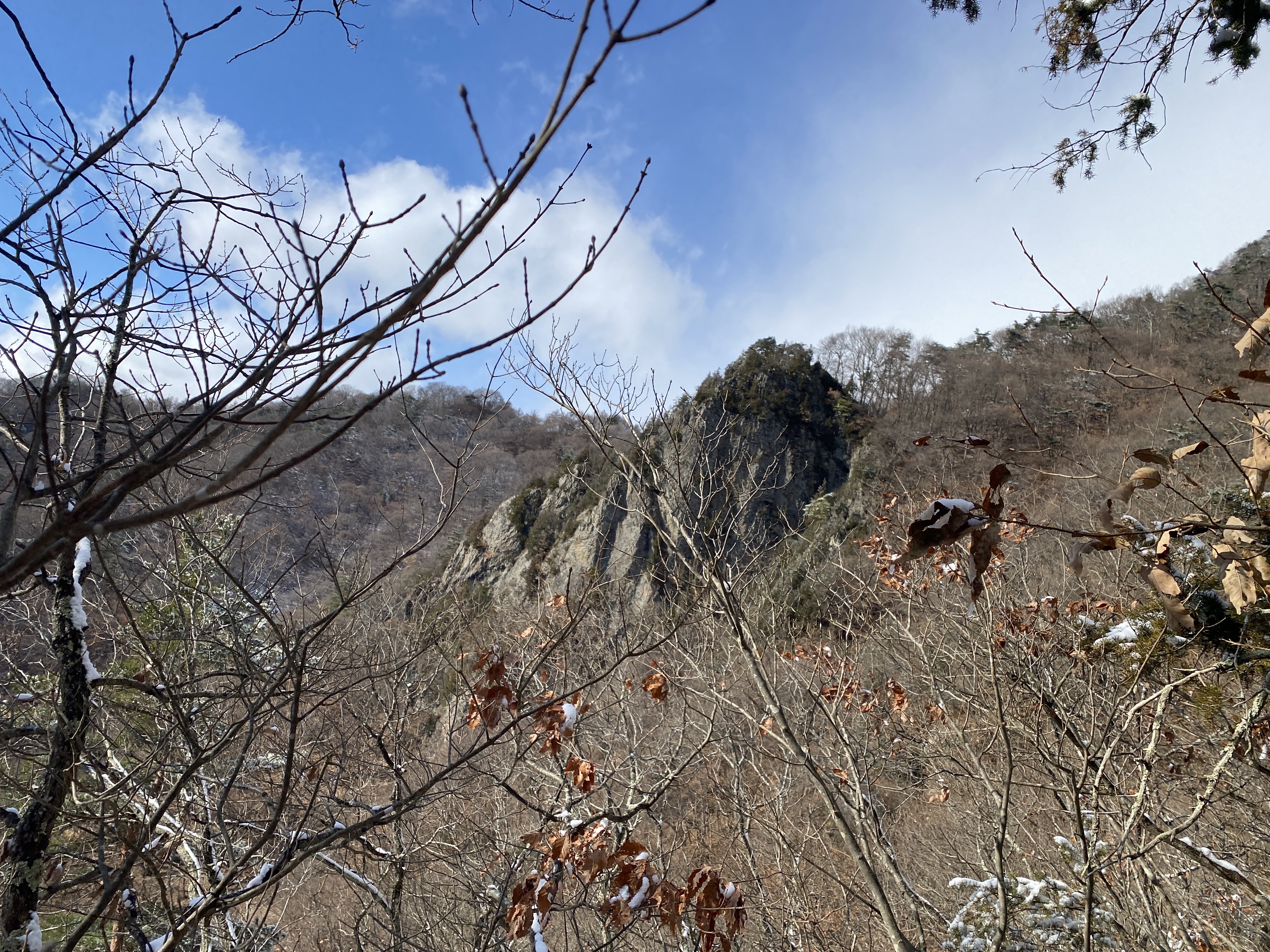
It was steep. The way these hills pop up so drastically from the flat valley reminds me of a whack a mole game.


This is the only picture I took of any ropes. I should have taken more to be representative. There are a LOT of ropes on these trails. I wish there were even more! They are a huge help because there are so many steep slopes with nothing to hold onto. Yesterday was a particularly difficult day for walking because the ground isn't quite frozen. Although there was an inch or two of snow cover, below that the ground surface was fallen leaves on top of mud. It was more slippery than it would be with frozen ground and/or a lot of snow.


This is the top of Usagimine (Rabbit Peak). This was a bit dizzying.
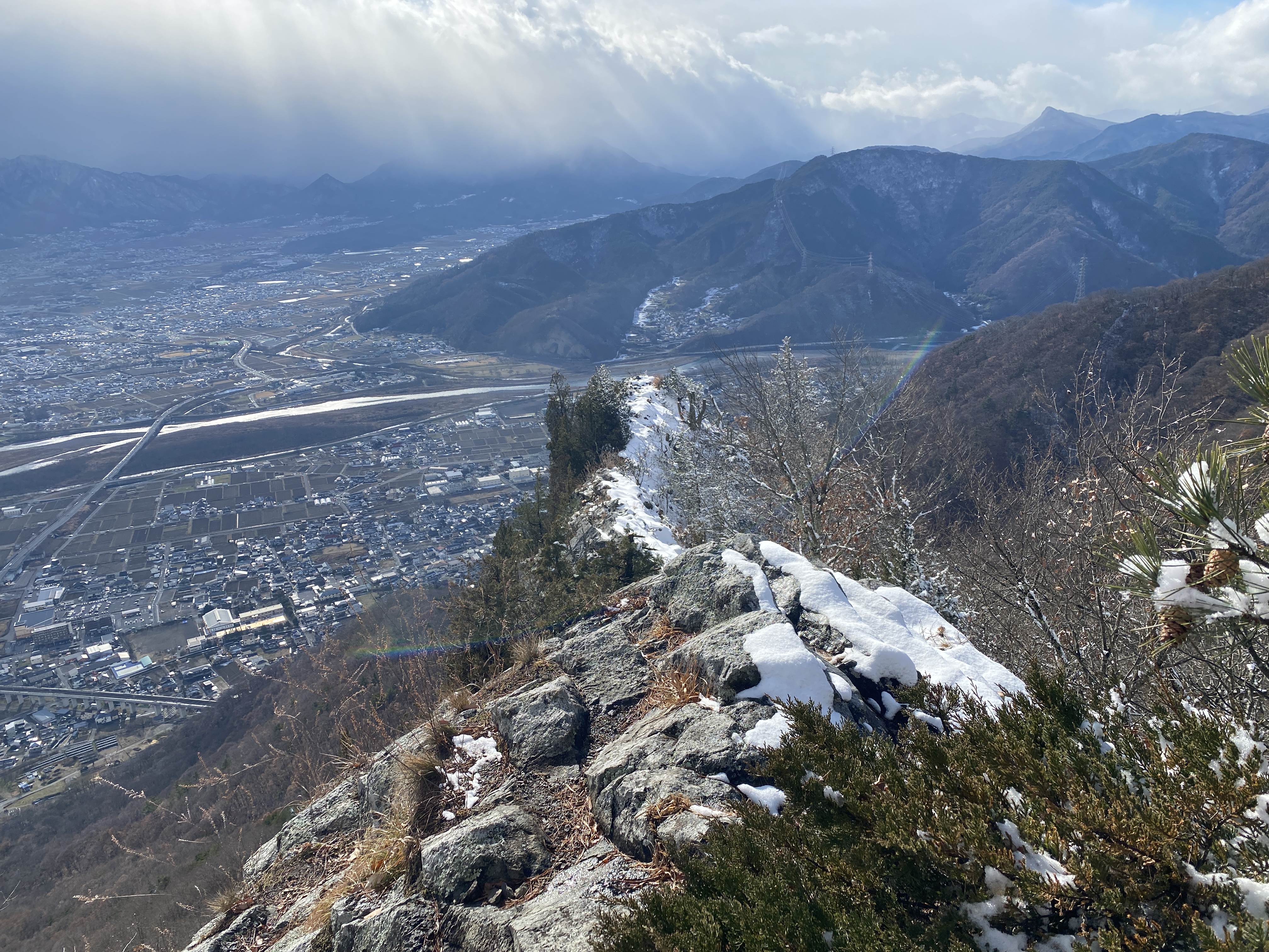


If you're curious about what is visible . . .


This is the Yanagi Yu (Willow Onsen) in Ueda. I really was looking forward to this after the hike.
This place more like an old-fashioned sento than a resort-type onsen. Before it became common for every house or apartment to have a bath, people would take a bath at the local sento. Sentos are communal baths and don't have all the amenities, such as restaurants and massage chairs that onsens do.
When I arrived, the obaachan (old lady) running the place started cautioning me about the hot temps and telling me not to get burned. I figured she was just assuming that I wouldn't be used to hot baths because I'm a foreigner. I asked what temperature the water is and she said 45 ℃ (113 ℉)! (A hot tub is typically about 100~104℉.)
I keep the bath at home at 42 ℃--and that's hotter than a lot of people can stand it.

That's all for this year.
Caveman out