Hello cavedwellers. This will be short, and there will be no mountains involved.
Yesterday I went to Ginza to meet a friend and pick up a new pair of boots that arrived from the states to his p.o. box. We had lunch with a friend in Ginza and it was such a beautiful day so I couldn't help but go for a long walk to break them in. I walked through the Imperial Palace, Hibiya Park, Akasaka, Omotosando, Yoyogi Park, Inokashira Park. 26.6km when I finally got on a train in Mitaka.
I love my boots; I've been buying a pair of the same ones every year for the past three years. Unfortunately quality control doesn't seem to be a priority at Columbia these days.
"You had one job . . . "
I caught this sign in a window as I was walking down the street. I respect anyone who has respect for man caves . . .
but these are too many rules for my taste, though. The only rule of my man cave is "Get off my lawn."
Here are some pics of the walk. Have a nice day.
Around the Imperial Gardens
That's Tokyo Station. It's rumored to a copy of a station in the Netherlands.
Hibiya Park
The National Diet
Harajuku Station had a facelift a few years ago. I liked the old look better but this is more functional.
Olympic Stadium
Yoyogi Park
It's only September and Santa Claus is already making an appearance. I did a doubletake and thought I was in Manila and not Tokyo for a second. Christmas dominates the "ber" months--SeptemBER, OctoBER,... down there.
Greetings cave creatures. Welcome to my cave. Pull up a rock.
We just had the second of two three-day weekends in a row which were affected by typhoons. I didn't think I'd be able to dodge the raindrops long enough to do it, but I was able to run down to Yamanashi for a day hike on Sunday. I didn't get blown away, but fog and clouds were the order of the day.
I hesitate to post this because I really like to make blog posts with stunning pictures showing the beauty of nature. That's the main reason I started this blog. In pointing through the beauty of nature, I hope ultimately to point the viewer to the artist who made it.
The beauty in this post is more of the rain/fog/spider/snake kind than the usual beauty of the breathtaking vistas of distant mountain peaks.
Even if I can't show that many beautiful pictures, I at least want to post this information in hopes it can help someone plan a hike.
Let me get the details out of the way.
Location: North side of Lake Kawaguchi in Yamanashi.
Elevation: Lowest: about 1,030 meters. Highest about 1,793 meters. Total up and down 1,825~1,830 meters.
Technical considerations/difficulty: It was not a super-challenging hike technically. There are some ropes in places but very little exposure. It is a long hike if not scary. I'm not sure if it is the trail or the fact that I was not wearing my favorite boots but the going was slow. It took me more than eight-and-a-half hours and my ankles were stiff by the time I finished.
Facilities: Between my starting point on Route 137 and Mt. Mitsutoge, there is nothing commercial. There is a fresh stream for water for the first hour or so but then no water again until the huts around Mt. Mitsutoge. The first public toilets you'll encounter are the top of Mitsutoge. On east side of Route 137, not far from Mitsutoge, there is the Tenkachaya (Teahouse Below Heaven) which seems to be a happening place to grab a bowl of Houtou or a can of beer--if either of those is your thing. Actually, climbing to Mitsutoge from the Tenkachaya is one of the more popular routes. It's a very short hike so it's the type of place I would feel like I had cheated were I to take it.
Thoughts/observations/recommendations: This is my third time to Mitsutoge and it is the third time that inclement weather has denied me any kind of view worth looking at. 😆 I'm told it is one of the best places to view Mt. Fuji, but I have to take everyone's word for that.
I chose this route basically to connect the dots on my map. The main mountain on the west side of this hike, Mt. Kurodake (黒岳), and the main one on the east side, Mt. Mitsutoge (三ツ峠山), are both worthwhile hikes in their own right. I spent a night on Kurodake and I recall that spot had one of the most wonderful views of Fuji. Mitsutoge, with the vantage point it has facing Mt. Fuji over Lake Kawaguchi, also is great. The stretch of trail between them could be skipped--unless you have O.C.D. like I do and feel compelled to hike every trail around all 5 of the lakes of the Fuji Five Lakes Region. 😜
Here are some pictures.
One of the weapons I carry at this time of year is a stick. The stick is to wave in front of me to wipe out all the cobwebs across the trail.
Speaking of wildlife . . .
I did see and hear several deer, too. I couldn't get any pictures, though.
I like walking by water. Since it's been such a rainy September, these little streams have really swollen.
I got this glimpse of the lake during the approximately 5 minutes that the sun came out.
I took these next ones at the top of Mitsutoge.
These antennae are on the north peak of Mt. Mitsutoge. They are great landmarks because you can spot them from dozens of miles away.
This is looking toward the south peak from the north.
The south peak.
Looking toward Mt. Fuji from the south peak.
Use your imagination for what it must be like on a clear day.
This is just below the peak. I've walked along the trail below the rock climbers. That is not a small wall. Mad respect.
This is the Mitsutoge Sanso (Villa/Lodge).
This Sanso is serviced by a rough and rocky road. The sanso has a bunch of jeeps and some tracked vehicles that drive on it. The last part of my trek started along this road. After a few miles on that, I met a paved road for the last few miles down to my bike.
That's all for now. Have a nice week!
Check out my other hikes around Mitsutoge, if you like.
Yesterday I continued hiking in an area that I've been meaning to knock off for a while but never have gotten around to. Last week I made it down to Lake Tsui (Tsuiko) and Shiroyama in the adjacent Kanagawa Prefecture. (A prefecture is kind of like a state or province.) Yesterday I continued on from Shiroyama down south as far as the Miyagase Dam. There aren't a tremendous amount of mountains between those two points, but making that hike enables me to cross another trail off on the map. I like to have un-broken lines of hiked trails on my maps. I can trace my footprints from Tokyo Station to Mt. Oyama, to the top of Mt. Fuji and beyond, and to Mt. Mizugaki far to the west in Yamanashi.
Recently, a hiker friend of mine mentioned that she is hiking the Kanto Fureai Trail, a trail which, according to wikipedia "circumnavigates the entire Kanto Region . . ., stretching about 1,800km." To which I secretly thought, "Only one trail? I want to do them all." And, it's not even continuous. There are parts of the trail that aren't even connected!
I blame my friend Bill for this obsession with crossing trails off. A few years ago, I mentioned to Bill that I had a topographical map on my wall and he asked me why I didn't trace on it in magic marker where I'd been. At first, I didn't want to do it. I had an aversion to writing in anything but pencil on a map. Once I started, though, I couldn't stop. Now the room where that first map was hung looks something like the RAF command center during the battle of the blitz. It's covered with maps all tacked up next to each other. The trails I've hiked (and roads I've ridden) are all traced out in bright marker and annotated with dates, distances and special items of notice,"Deer here.", "Snake!", "Missed bus. Had to walk 6 more miles.", "Yes, bears do s&%$ in the woods.", "Found monkey skull.", "Got lost here."
Mrs. Caveman, who is an artist, has been kind enough to add some artwork in appropriate places. Come to think of it, it's only appropriate that she does some cave drawings for me.
I love those maps. Thank God Mrs. Caveman puts up with that kind of decor.
Let me get yesterday's details out of the way.
Location: Kanagawa from Shiroyama to the Aikawa Park and the Miyagase Dam
Starting and stopping point: Tsuiko Shiroyama Park 県立津井湖城山公園
Mountains climbed: It's charitable calling these little bumps mountains, but they are on the map as such: Hinomori, Sakura, Amagoi
Getting there/getting around: 20 minutes by bus from Hashimoto Station (Keio Sagamihara Line or JR Yokohama Line). I drove. There is free parking at the Tsuiko Shiroyama Park
Elevation: The lowest elevation was something like 220 meters and the highest was only about 450. Very low level stuff. Despite this, I was surprised to see from my hiking app that I walked up 953 meters and back down 957 meters. I guess that the length of the hike made this possible.
Technical considerations/difficulty: This is a very gentle hike. There's nothing steep. There are no ropes, chains or ladders. Much of it is on paved roads or at least dirt roads by farmer's fields. The geography and the flora are not a problem. The fauna, on the other hand . . . I got attacked by leeches somewhere along the way. I noticed them sucking away on my legs around the tops of my shoes sometime after getting passed Mt. Amagoi. Because of this, I decided to forgo walking through the woods on the return trip and stayed on the streets. Leeches are an issue on this side of Kanagawa around Lake Miyagase. (Fun fact, the name of the highest mountain in Kanagawa--Hirugatake--translates to "Leech Mountain" in English.)
Facilities: There are public toilets at the parks and there are ample vending machines on the streets on the way. The Aikawa Park has ice cream. There are a few convenience stores on the way, too. I passed by the Ogino Bakery (オギノパン) which is famous for Tanzawa anpan 丹沢アンパン--rolls with red bean paste. It might be worth checking out as this local delicacy is popular. It was quite crowded yesterday. I am a cheapskate, though. Even though I've been by the place 5 or 6 times, I've never gone in. Check it out and report back to us, ok?
Thoughts/observations/recommendations: I'm glad I did this hike to make the connection of my footprints between Lake Tsuiko and Lake Miyagase. By doing that, I can now trace an un-broken line from Hachioji to Mt. Oyama and indeed all over the Tanzawa area. Once is enough, though. It was not a spectacular hike. Also, leeches suck. I won't be going to this area in any season other than winter again. If you want a long but not taxing walk, this would be attractive to you. Also, this hike does take in a section of the Kanto Fureai Trail if you're one of those hikers.
Here is what it looked like on the map and in animation.
Each one of these animations is created by my app. They are all 30 seconds long, no matter how far you hike. I like watching animations of a longish hikes like this one because the little guy seems to be sprinting.
Let's look at some pictures. Much of this hike was on the street.
A trap for inoshishi (wild boar).
Mt. Amagoi. ("Praying for Rain Mountain") The highest point of the day.
The trail through the woods was usually like this.
The gentleness of the trail is deceiving. Nature will try to kill you on this path. It was when passing through this seemingly bucolic spot that I looked down to see this:
Pulling off my sock revealed this:
There were actually about 10 of the little vampiric creatures draining me of my life juices but I will spare you any more pictures.
Except for new subscribers. I'll give any new subscribers the gory ones.
Leeches don't hurt, by the way. They have some kind of numbing ability and you don't even know they are there unless you see them.
This is the Miyagase Dam. The last time I was here, the gate was closed because of COVID. Keep this between us, but it's easy to climb over. There's a cable car to get up to the dam, if you're too lazy to walk up. (I'll bet Kanto Fureai hikers would probably take the cable car.) There is also some type of visitor's center which, I'm sure, has educational stuff about dams. There is a cafe and museum. The cable car opens at 10.
Mt. Tanzawa is straight ahead. Mt. Hirugatake--the leech mountain--is to the right of that.
There's even a sightseeing bort!
I took these at the Aikawa Park (神奈川県立あいかわ公園), which is right next to the dam. This park is a great place for picnicking or spending the day with kids. There are tens of thousands of azaleas, a lot of open grassy spaces for throwing a ball around, an obstacle course for kids, a visitors center, snacks, etc. It's a nice spot. It didn't seem too crowded inside the park when I was there but I noticed there was a line of cars about 100 meters long waiting to get into the parking lot.
I've been to the park and by the dam a few times to climb up to nearby Mt. Bukka and the other mountains lining the ridge up to Mt. Oyama ("Big Mountain".) I can see Oyama from my house. It is the last big mountain on the left 20 miles to the south of where I live. I really like being able to look at mountains in the distance and remember being there.
There are some great views from those mountains and Lake Miyagase is beautiful to walk or drive along. These are all pictures I took on past excursions between the dam and Mt. Oyama.
As I said, I decided to stick to pavement on the way back from the dam and I came across this farm as I walked along. This is the Hattoribokujo.
There are lots of animals, ice cream, sausage, etc. I have a retired friend who often goes on daytrips with his wife and their dog so I told him about this place only to find that he'd already been there, twice in the last month. He gave it glowing reviews. Another place that would be nice to take kids or a date.
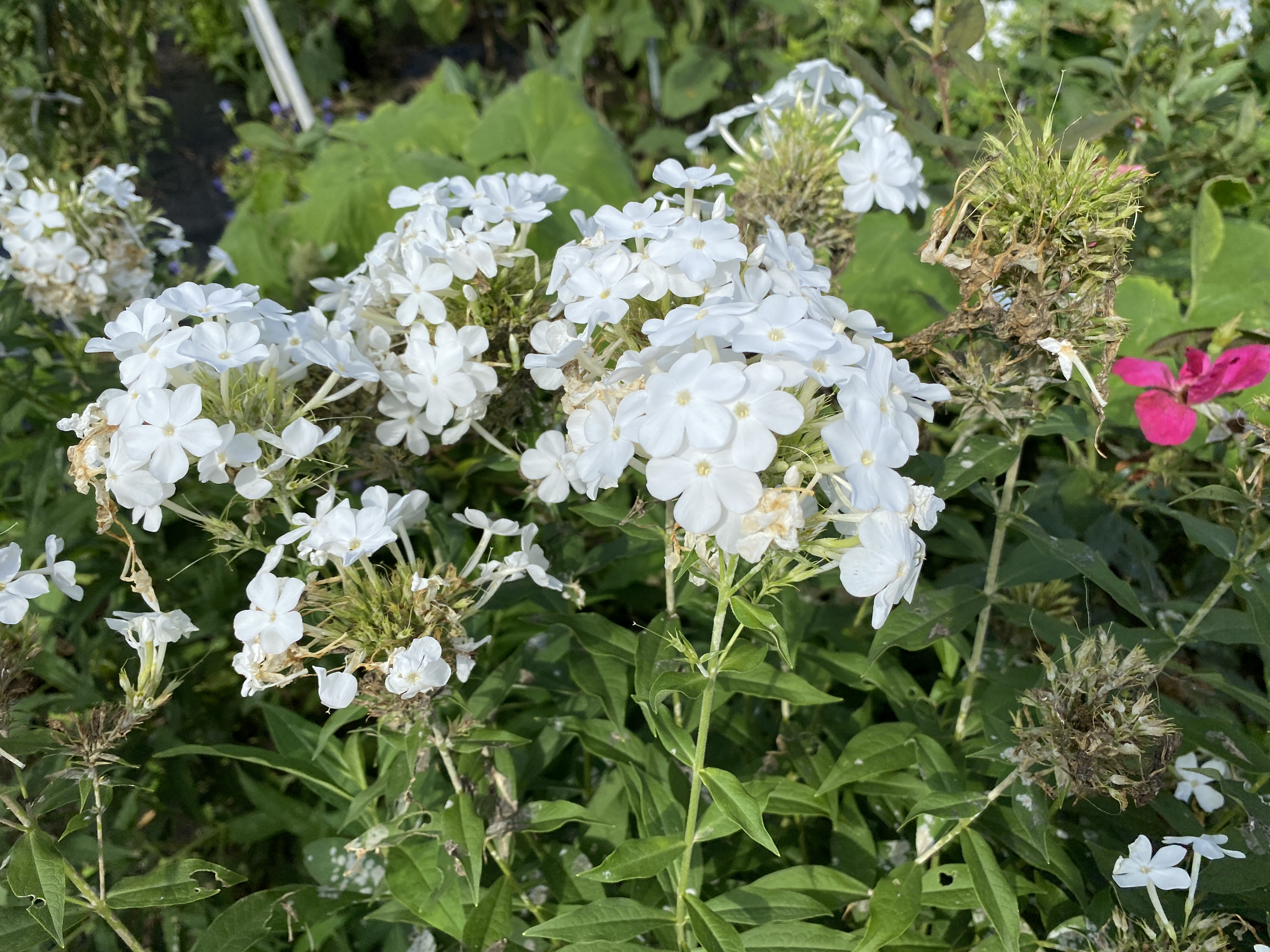
Even walking on the streets here in Japan is a natural/beautiful experience. People really do have nice flower gardens. I'll wind up with pictures I took along my way back.
Well, that's all for today. Until next time.
Don't forget to subscribe if you haven't already. Don't be afraid to comment, either.