Elevation:Lowest: 1,352 m Highest: 1,742m Total Ascent: 410m Total Descent: 411m
Technical considerations/difficulty: Easy, peasy
Facilities: Rest hut near the top for a picnic
Thoughts/observations/recommendations: Just a swell place. The views are not as breathtaking as those from the big boys nearby, but it's a nice mountain. The campground at the bottom looks like a lovely place to stay, too. Kyukamara Campground
Today I bring you a smaller mountain from Tsumagoi Village in Gunma.
This mountain is called Murakami (村上). "Mura" means "village" and "kami" means "up." So, I guess this is an upper-crust mountain.
Actually, I think the mountain probably is suffering from some kind of Napoleon complex. It's the lowest hill in the area and I think it's overcompensating in its choice of name.
It's with some mixed feelings that I finish this hike. It means I've exhausted just about every peak in that area. If I look north from my neighborhood, this is what I see.
Where I've been . . .
Thank God there are mountains in every other direction of the compass!
I've been in the area three times in the last month or so. I was surprised at the amount of snow there was this time. I thought there would be less, but they must have just had a fresh dumping. There was another foot or two more than when I'd visited this particular place in February.
This is a picture I took of Mt. Murakami on one of my recent treks.
And here are some more pictures. I won't comment much more.
This is near the trailhead. That's Murakami above.
Warm!
I was fine in just crampons for this hike but I did sink in a few times.
The top
Mt. Azuma, one of the 100 Famous Mountains.
Looking towards Tochigi. You can see the mountains of Nikko from here.
A panoramic shot
Tashiro Lake
The mountains I've climbed recently are all nearby but there are no unobstructed views.
The Kyukamara Tsumagoi Kazawa Hotel (3 stars)
(It's the same business as the campground linked above.)
Mt. Sashiki is behind it.
Well, cavedwellers and squatters, that's it. I had a blast on this hike and it was fun to recall it.
Subscribe and do all that stuff. Tell your friends, etc.
I'm suffering a caffeine deficiency these days so feel free to buy me a coffee--or a whole plantation if you have the dough.
This is a snowshoeing hike I took around Mt. Yunomaru and Mt. Eboshi on the border between Gunma and Nagano. It was a great day and I hope you enjoy the pictures as much as I enjoyed taking them.
You probably won't. I take way too many pictures and find it difficult to discard any.
On this hike, I climbed Mt. Yunomaru (again) and Mts. Koeboshigatake and Mt. Eboshigatake. E-boshi-take means "crow" "hat" "mountain". The "Ko" of Koeboshigatake means "little."
Elevation:Lowest: 1,730 m Highest: 2,099 m Total Ascent: 692 m Total Descent: 692 m
Technical considerations/difficulty: Not tremendously technical.
Facilities: Nothing
Thoughts/observations/recommendations: What a great area. This was my second time back in the last few weeks. I wanted to connect the dots of my footprints and I wanted to climb the two Eboshi peaks. I was blessed with another day of great weather. It wasn't as clear as last time, though, and I couldn't see Mt. Fuji. That's ok, though.
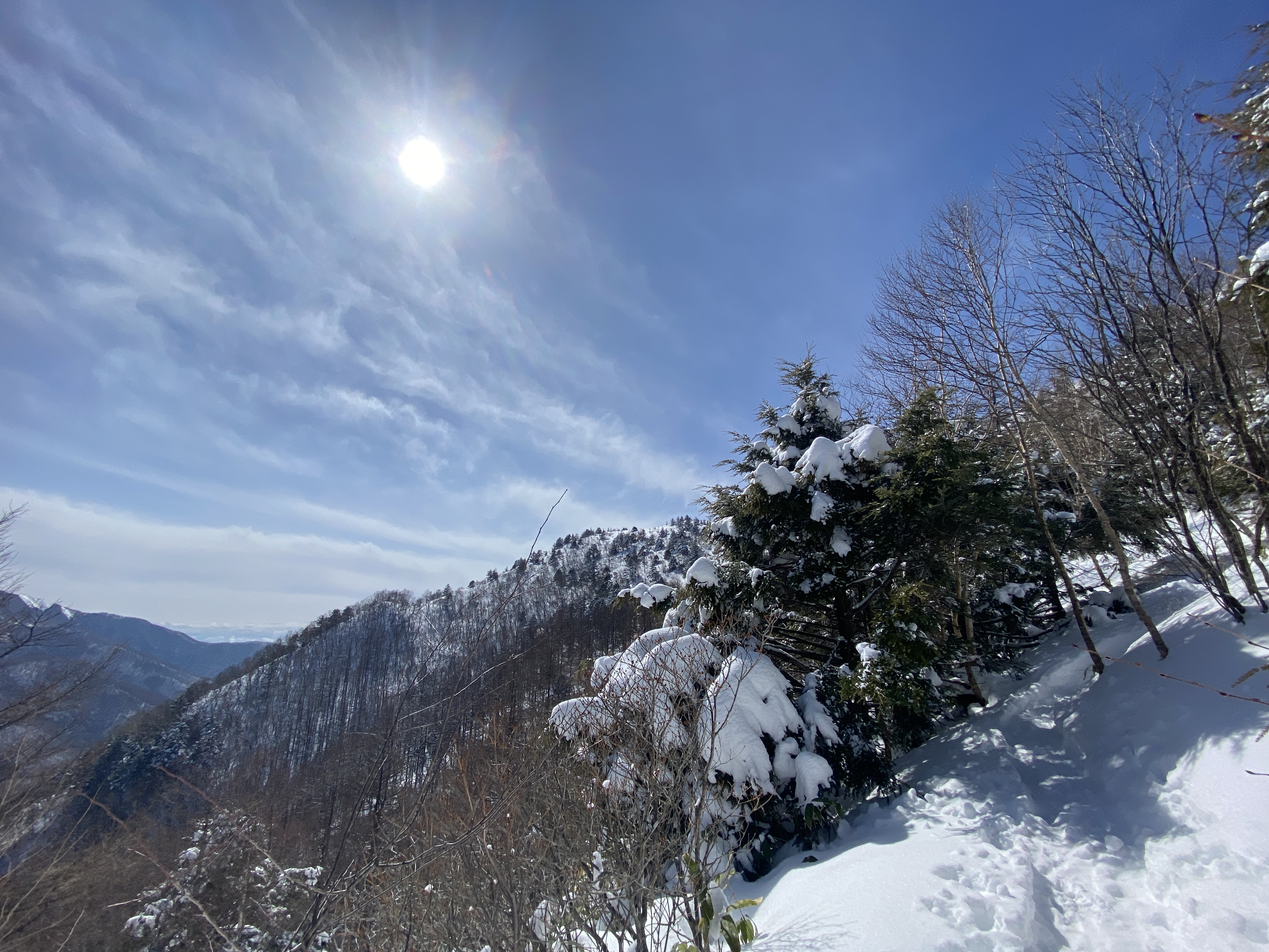
This is todays destination.
I absolutely love looking up and around and being able to say "I've been there."
And away I go!
Lots of critters out there.
Starting out climbing the trail at the Yunomaru Ski Area. I started up the slope even before the chairlift started running.
That bump on the left is Mt. Kakuma. I climbed that last time, but not today.
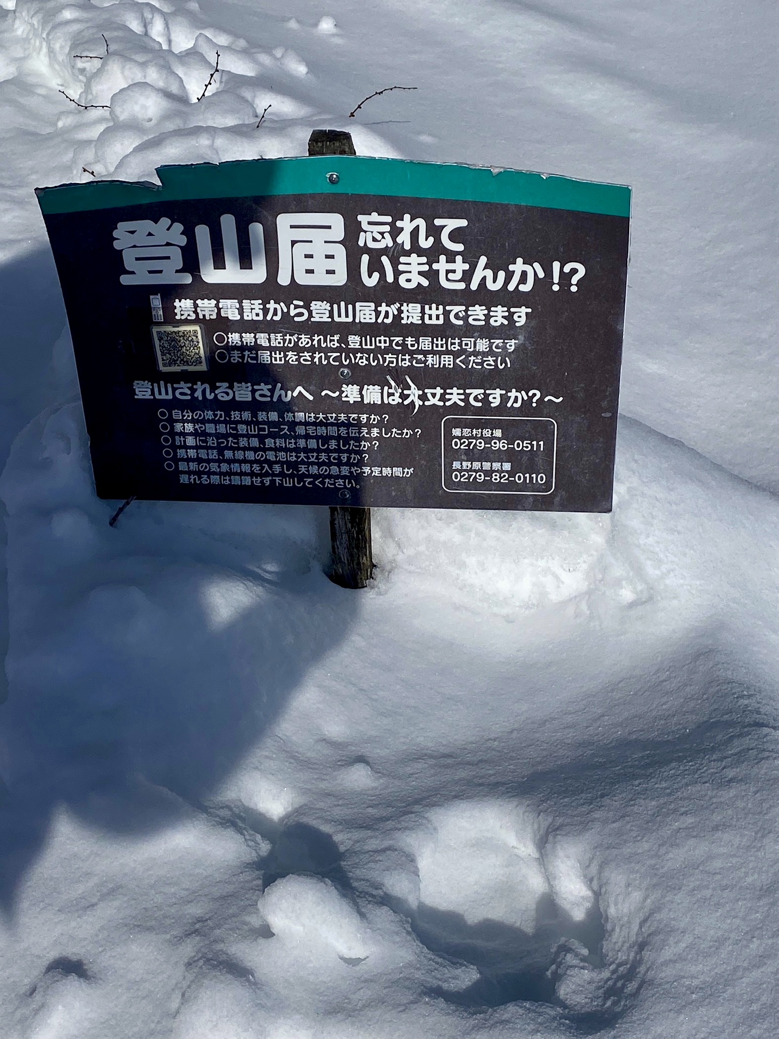
You can register a hiking plan by using the QR code on the sign.
Yatsugatake
Mt. Fuji hid today
Mt. Sajiki on the left. Mt. Kosajiki on the right.
The top of Yunomaru
The pointy one below is Eboshi. That's my ultimate goal for the day.
Most of the day, I didn't really need the snowshoes because there were many traces of previous hikers. I did still sink in a few times, though.
Mt. Eboshigatake
And with that, dear spelunker, I leave you until next time.
Subscribe to the blog. Tell your friends about it.