

Location:
Nagamatsu, Minamiuonuma, Niigata
Mt. Makihata is on the border of Gunma and Niigata Prefectures. It's about 50km from the Sea of Japan. Niigata is one of the snowier of Japan's prefectures.
Starting and stopping point:
桜坂駐車場(巻機山登山口)Sakurazaka Parking Lot/Makihata Trailhead
Peaks bagged:
Waremekidake (Waribikidake) ~~ Ohataya ~~ Makihata ~~ Ushigatake ~~ Maemakihata
Getting there/getting around:
I drove. Parking at the Sakurazaka Parking Lot is 500 yen. The attendant wasn't there when I arrived or when I left. Since I didn't have exact change, I gave what change I had and an IOU for the rest.
Coming by train, it's 40 minutes by bus from Muikamachi Station on the Joetsu Line. About 2 hours to that station from Tokyo Station by shinkansen. There is a bus stop not far from the trailhead. See David Lowe's post for info about taking a trip here from Tokyo https://ridgelineimages.com/hiking/mt-makihata/ Tell him the Caveman sent you.😎
Maps:
Online printable topographic map (Japanese)
Weather Information:
Total Time: 8:20 Break time: 1:04 Distance: 13.29km
Elevation:
Lowest: 700m (ish) Highest: 1,967m Total Ascent: 1,545m Total Descent: 1,545m
Technical considerations/difficulty:
There are two routes I'll address. Both start at the Sakurazaka Parking Lot (桜坂駐車場).
First, the easy one. This is the one on the right. It follows the Ido Ridge up to Makihata and the adjacent peaks. It's fairly steep but well-maintained. No problems there.
The other route, to the left follows the Nukubi Stream (ヌクビ沢) , passing underneath Tengu Iwa (Tengu Boulder) up to the ridge connecting Mt. Waremeki and Mt. Makihata. This trail should be approached with caution. (Or not at all.) It is only used for ascending. Descending is probably just too dangerous. I chose to go up this trail in order to bag Mt. Waremeki along with the other peaks in the area because Niigata is a long trip for me and I wanted to get all the bang I could out of the day. I should have done some more map recon because I missed two items worth noting. One, was that this trail is climbing up a stream. Since the blue line on the map disappeared at a certain elevation, I had assumed that the stream started there and I would be just hiking up a draw (valley). That was not the case. Climbing up streams--called sawa nobori (沢登り)--is not really hiking. It's something I avoid because you can find yourself in all sorts of predicaments unless you have ropes and such. Two, I had only really looked at my Yama to Kogen map about this trail. If I had also looked at my YAMAP app, I would have seen the note that said this trail is for experts.
Hiking up this trail was, at points, really fun. There are beautiful falls and pools just one after the other. The stream was quite wide and there were a lot of large, dry boulders next to the water to bounce up in the lower portions. At other points, it took a lot of concentration and energy. The trail is not well-marked at all and I often had to probe my way to find the safest route up. Often, when the stream would become impassable, a parallel trail above the bank would be necessary. That trail was often steep and overgrown with grass/ferns. The overgrowth not only hid the trail markings but also made it hard to discern what the surface of the ground was. Was it solid rock? Sand? A hole? The pucker factor was high.
At one point, a giant boulder I was climbing let go and slid straight down--with me clinging to it for dear life. Thankfully, it hit something solid after falling only about 1 foot (30cm). I fell back. The boulder rolled away to the side, narrowly missing me. If it rolled on top of me, I would have been a goner. I fell back (bad) but my fall was broken (good) by a sharp rock (bad) on my tailbone (ouch!). It really stunned me. In the few seconds before the effects became clear, I wondered, "Am I hurt? How hurt am I? Am I going to be able to get out of this on my own?" Thankfully, even though it did hurt, I was able to keep moving. I wasn't able to get a full range of motion from my lower back for about a good month after this experience, though. I really bruised my coccyx. Thankfully, I did not break it. It made for an awkward day of hiking since I couldn't bend over anymore.
Makihata couldn't break this old man's ass, though!
Other high points of this part of the trail were the snow bridges over the stream. I have never made a snowball in July before!
Facilities:
The parking lot has a public restroom and water stations for cleaning your boots at the end of the day. He also sells badges and t-shirts--but I didn't see the attendant so I got no swag.
There is a 2-story emergency hut below Makihata. It's quite well-appointed. The biotoilet is a bit nasty but there is a new portapotty soon to be installed.
There is a waterhole near the emergency hut.
Thoughts/observations/recommendations:
This was a long day. Niigata is a 4-hour drive for me and the hike was more taxing than expected. If I had known ahead of time what I learned about the Nukubi Sawa portion, I wouldn't have done it. That said, I'm glad I did. 😉 Fall would be a nice time to visit Mt. Makihata.
Today's listening:
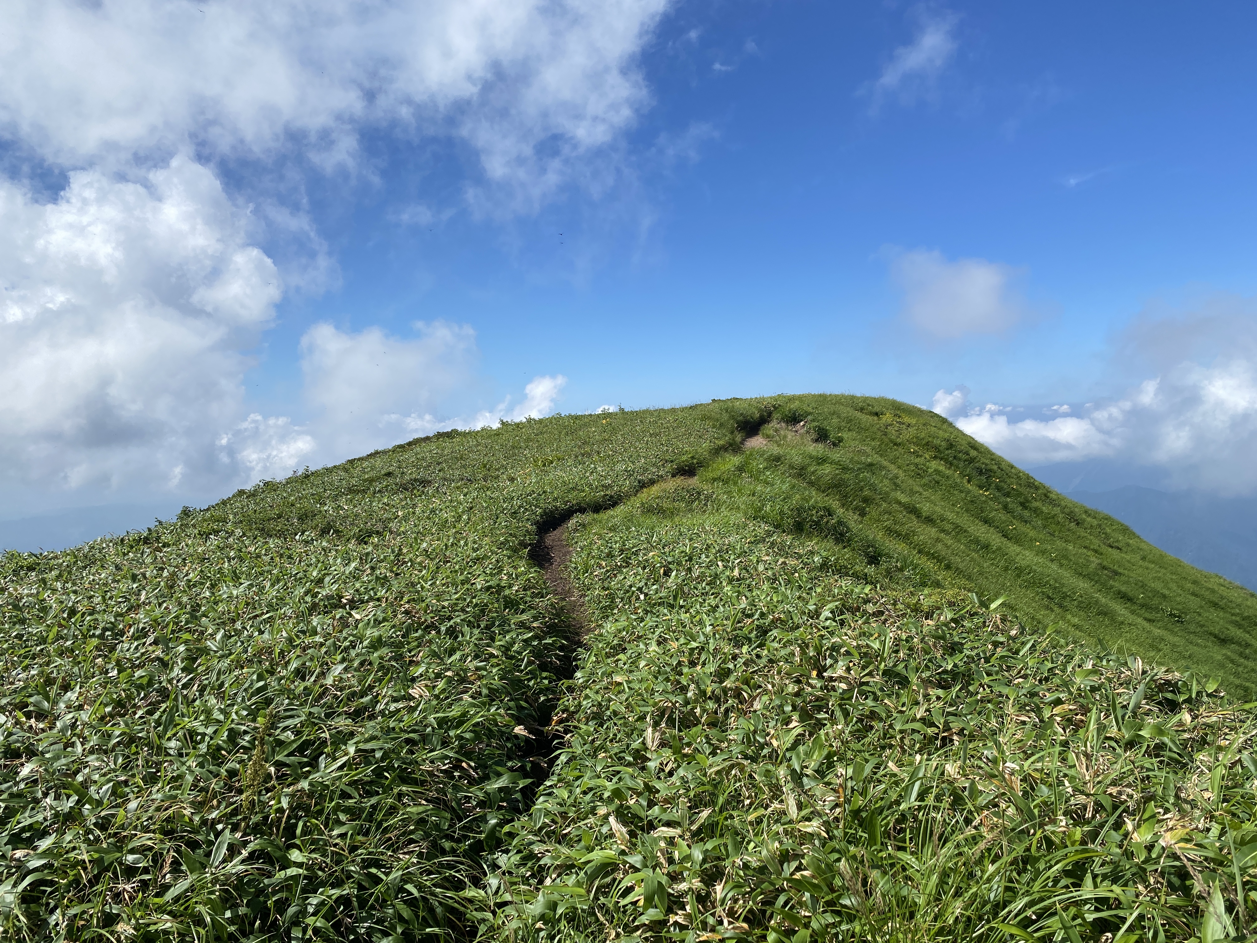
Let's look at some pictures.

From the road


Amazing! Yes, pls do not dawdle under a snow bridge! patsy
ReplyDeleteHi Patsy. You're right! I heard that 1 cubic meter of that snow weighs a ton. Have a good one.
Delete