Elevation:Lowest: 1,017m Highest: 1,422m Total Ascent: 430m Total Descent: 430m
Technical considerations/difficulty: There are some steep slopes off the side of the trail but there are no parts that are difficult to climb. The signage is old and hard to read but if you pay attention, you shouldn't get lost.
Facilities: Nothing.
Thoughts/observations/recommendations: This hike doesn't have much to recommend for views. Better views are to be had on the other end of Mt. Arafune at Tomonoiwa.
Speaking of "Mt. Arafune", the naming of this mountain is odd. The peak I went to today is called "Mt. Arafune (Mt. Kyozuka)" and down the trail a little bit, at a much lower point, is "Mt. Arafune." The mind boggles. Why not choose one distinct name for each place? I'm often puzzled by the names of mountains (and streets and towns and people . . . ) here.
Today's listening: The Great Detectives Jeff ReganBefore Jack Webb was Joe Friday, he played a few private detectives in noir dramas. Jeff Regan was one radio show. He was also Pat Novak for hire. Those shows are a hoot. Some of the one-liners he delivers are so funny:
“It was hard to figure. It was like trying to throw a saddle on a porpoise.”
“I had about as much chance as a snowball in a Turkish bath.”
“When she said, ‘Hello,’ it melted all over you, like honey on a hot biscuit.”
“He was crumpled up against the desk and she was staring down at him as if she forgot to water the plants.”
(h/t to this site https://thrillingdetective.com/2020/09/22/jeff-regan-2/)
Today wasn't super-photogenic. It was just a chance to get into the woods before work this morning. Here are a few pictures.
The top
Well, kids. That's all for today.
Caveman out.
ps A conversation with the little woman I had yesterday.
Caveman: I'm glad I have a blog. I have a bad memory and want to remember where I have been.
Mrs. Caveman: I'm glad you have a blog, too. I can remember you when you're gone.
This morning I took a run up Mt. Hirao. Hirao is one of my go-to places if I have time for a run before the sun sets after work. It's located in the northeast of Saku City, just above the highway. It's visible from most of the city--and it has great views.
Getting there/getting around: I drove. There is plenty of parking. The parking lots at the onsen don't open until 8 but I was able to park at the highway parking lot.
Elevation:Lowest: 788 m Highest: 1,155 m Total Ascent: 727 m Total Descent: 727 m
Technical considerations/difficulty:
There are a variety of trails that I used on this run. There are hiking trails, ski trails and some forestry roads.
I lost a lot of time by trying to run under one particular ski lift. There are two lifts I ran under. The one on the lower half of the mountain is easy to proceed up. The entrance to the hiking trail is near the top of that lift. Until today, I'd always left the ski trail there and entered the hiking trail. This morning, I tried to continue toward the top following under the upper ski lift. This turned into a slow exercise in bushwhacking up a very steep, prickly, wet, slippery slope. I lost a lot of time there but got to burn a few calories--and collect a few scrapes and scratches to the delight of my inner-9-year-old.
Most of the trails and some of the roads up here aren't on maps. It's quite easy to get twisted around. I would stick to the marked trails if you don't have some kind of gps device.
Facilities: Nothing on the trail.
Thoughts/observations/recommendations: Do it if you can.
Getting there/getting around: There is parking at the Myosenji Shrine
Map: I don't think there is a paper hiking map covering this. I just used my hiking app--YAMAP.
Weather Information:
Total Time: :53 Break time: :00 Distance: 3.6k
Elevation:Lowest: 755m Highest: 1,028m Total Ascent: 320m Total Descent: 320m
Technical considerations/difficulty: There are several steep spots with ropes. The lookout spot near the peak of Akaru has a large dropoff. I really wouldn't want to fall off there. Much of this trail is runnable, but large portions aren't.
Facilities: Nothing
Thoughts/observations/recommendations: Today is the first day of the obon holiday. It is also the day that a typhoon is arriving. I had big hopes for big mountains this week but . . . I decided to at least get in a run before the forced hibernation of the coming few days. This is a fun little area. There are some really cool boulders around this temple's precincts.
Today's listening: Nothing
😭😭😭😭😭😭😭That's all for today. Time to start hibernating.
S'up, cave dwellers? It's a glorious spring here in Nagano. Last month I got to Mt. Arafune for the first time. This week I dropped by again from a different trail. It was great.
Location: Straddling the prefectural boundary between Gunma and Nagano. Saku City, Nagano and Shimonita, Gunma.
Elevation:Lowest: 1,063m Highest: 1,342m Total Ascent: 956m Total Descent: 956m
Technical considerations/difficulty: Much of this hike is below the treeline and on a gentle trail. There are some steep spots with chains or ropes, but not too much exposure. The viewpoint at Tomoiwa is not somewhere I would like to fall from--but you'd have to be pretty dumb to get close enough to the edge to fall off!
Facilities: There are portapotties at the Uchiyama Pass Parking lot. There is a waterhole not far from the top. It looks a bit dangerous to access, though. There is an emergency hut at the Tomoiwa.
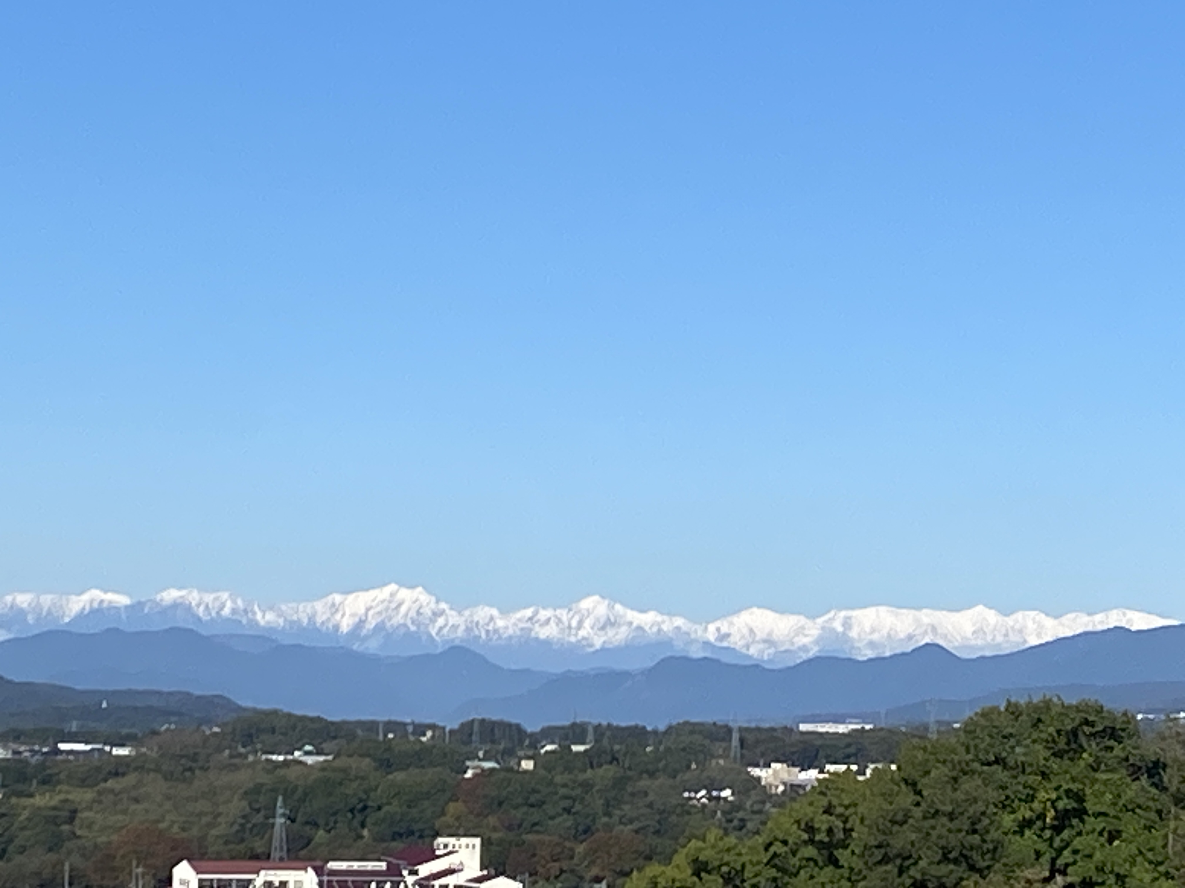
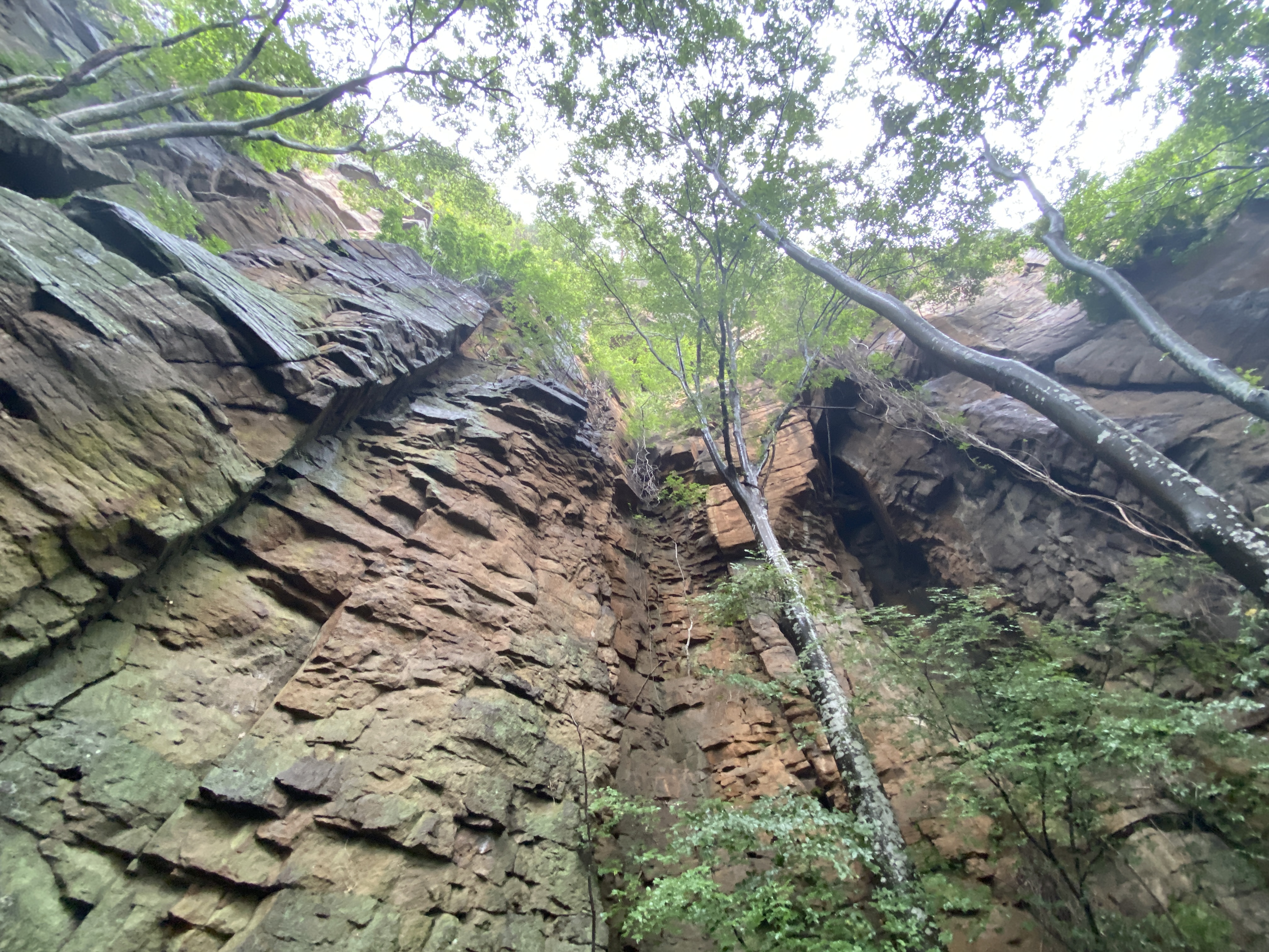
Thoughts/observations/recommendations: This was my second time to the area. The last time I went from the south, this time from the north. I had hoped to obtain some better views looking up at the Tomoiwa from this side. In fact, I did, but I do wish that there was more to see along the way. The Tomoiwa (the big rock) was only visible from the trail once or twice. The view looking out from that point is spectacular, though. The trail was fairly pleasant but for most of the hike, trees obscured any views.
Here are some pictures:
One of the precious few views of the Tomoiwa (Tomo Boulder) from the trail.
Much of the trail was like this. Pleasant.
The Arafune trailhead at Uchiyama Pass. Large parking lot. Portapotties.
Arafune Trailhead
More gentle trails
It was heavy.
Better call Brother Maynard!
Tomoiwa 艫岩
Today's listening:
Bible in a Year"In The Bible in a Year podcast, Fr. Mike Schmitz walks you through the entire Bible in 365 episodes, providing commentary, reflection, and prayer along the way." Very listenable.
Well Cave Critters, that's all for today. Have a great spring or summer or winter or fall--whenever it is you happen to be reading this. Subscribe, leave a comment, tell your friends, buy me a coffee, etc. More soon.