“I would maintain that thanks are the highest form of thought; and that gratitude is happiness doubled by wonder.”
― G.K. Chesterton
(Lake Yamanaka, 7:00 am 11/22/2022 on the way to Motosu area)
Greetings cavedwellers.
I survived COVID and got out for a dayhike as soon as the authorities let me out of my cage. I went to the extreme western edge of the Fuji 5 Lakes region for another whack at climbing Ryugatake and Mt. Kenashi* yesterday.
*"Ryugatake" (竜が岳) means "Dragon" 🐲"Peak" ⛰. "Kenashi" (毛無山) means "Hairless Mountain". Some mountain names are cooler than others.
Mountains climbed: Ryugatake~Amagatake~Takatekki~Oomidake~Kenashi~Kenashi Triangular Point
Getting there/getting around:
Not so easy. I took my scooter. There are buses that run seasonally to the Motosuko Campground. Public transportation would make a dayhike very difficult.
Map: Yama to Kogen Chizu 32 富士山 御坂・愛鷹山 FUJI-SAN MISAKA・ASHITAKA-YAMA
Lowest: 820m Highest: 1,964m Total Ascent: 1,714m Total Descent: 1,719m
Technical considerations/difficulty:
The climb down to Fumotoppara Campground (or up from it if you are going in the other direction) is a bit steep. This is the only spot where you encounter many ropes. On the other end of the climb--up to and over Ryugatake--bamboo grass is the bugaboo. In spots where it hasn't been trimmed back, it obscures the trail making hiking a bit dangerous as you can't see what you are stepping on.
Facilities:
Nothing in the way of water, toilets or commerce once you enter the trail.
Thoughts/observations/recommendations:
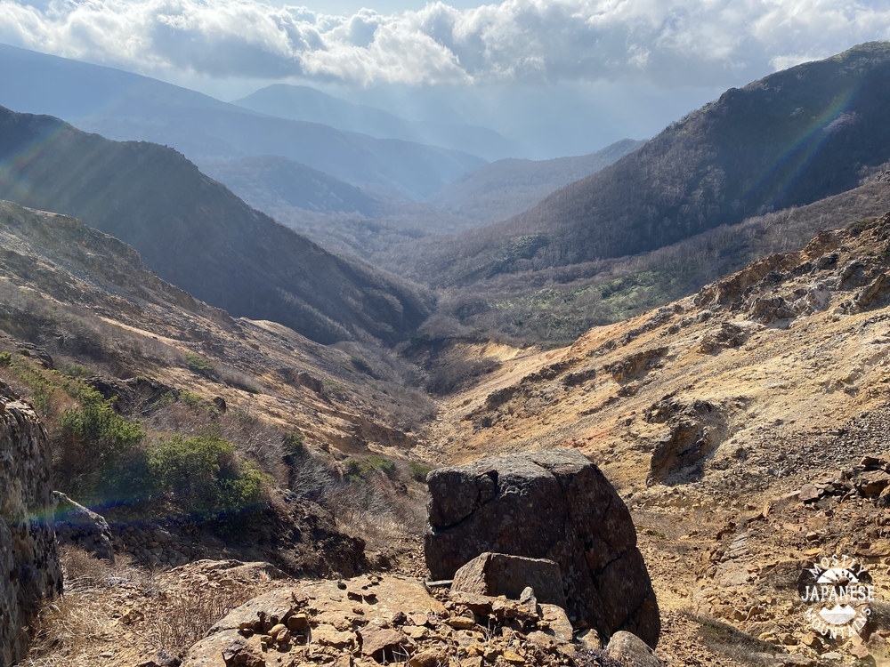
This was my second attempt at these mountains. I had basically the same plan in August by turned back just 90 minutes into the hike because it was cloudy and it just wasn't fun knowing that the views here must be spectacular when it's clear. Yesterday, the sky was clear until about noon and there were great views until then. In the afternoon, I felt like I got gypped again. The sight from Mt. Kenashi must be gorgeous because of it's unobstructed view Fuji. Alas, I will just have to imagine.
The bamboo grass was trimmed back as far up the trail as the top of Mt. Ryugatake. After that, it was overgrowing the trail and was waist to chest deep. The dew on the bamboo grass soaked my lower body and I decided to descend at Kenashi and return on the street rather than retrace my steps through that stuff. This made the trip a few miles longer and I ended up finishing long after dark.
I'm not going to write that much today. I'll just show you some pictures. If you have any questions or feedback, feel free to comment.
This is Lake Motosu.
Starting out
You can see the bamboo grass here has been trimmed.
Looking west toward the Minami (Southern) Alps
"Omidake" 大見岳
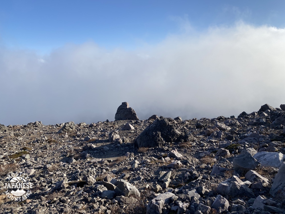
After crossing the second or third peak of the day, the sun disappeared.
The top of Mt. Kenashi.
Apparently, this is an emergency helipad! Their rescue helicopters must be the size of drones. You'd have to have a heckuva pilot to land here!
Fumotoppara campground. It looks like Yasgur's farm (where Woodstock was held) to me.
I was surprised to catch some last glimpses of fall foliage around here.
Dinner on the way home. Hoto. It's a local specialty. What is hoto, you ask? ほうとう
By the way, today is a holiday in Japan. It is Thanksgiving for Labor day. (How Japanese does that sound?) Tomorrow is Thanksgiving in the U.S. There, it's thanks to God. I like labor--but I think our Thanksgiving is more fitting.
Have you ever made a gratitude list? It's a good thing to do. I find when I start counting my blessings, there is no end to them.
May you/we all reflect on all the uncountable gifts we've received and may we then try to give to others just as profligately.
Don't forget to comment and subscribe if you haven't already. See you next time.
I shouldn't be making this post. I should be in the mountains now. I've caught the Wuflu and have to stay in for a week or so. (I'm really not feeling that ill and am getting better quite rapidly. Don't worry about me.)
Since I can't be there in person, I've decided to go there virtually and blog about a few trips I made before starting this blog. This first one is of one particular bike trip I made out to Okutama and back.
Elevation: Lowest: 106m Highest: 1,161m Total Ascent: 4,120 m Total Descent: 4,120m
Thoughts/observations/recommendations: This was a very cool ride. The Shuyudo winds up and between Mts Mito and Tsukiyomi from Lake Okutama on the north to Hinohara Village on the south. It's a popular road with bicyclists, motorcyclists and sports car drivers. It gives breathtaking views of the lake below and there are a few parking lots with great lookout points to take in the sights. You can get a great view of the profile of the mountains along the Ishione (Rock Ridge) across the lake. The weather didn't cooperate very well for visibility on this day, unfortunately.
You do need to keep your wits about you. I have come upon more than one accident on that road.
This closeup is focused on the Shuyudo area.
One thing I like about these animations is that they are always 30 seconds long. If it is a short hike, the little guy just crawls along. On something long like this, he runs faster than Charlie Sheen on Bolivian marching powder.
This particular bike ride is one I've done a few times. It takes me a couple of hours to get to Lake Okutama. Then, I ride along the north side of the lake for a few more miles . . .
. . . before crossing over to the south side and entering the Shuyudo around the base of Mt. Mito.
Shuyudo translates to something like excursion/circular/fun road. It's gated and locked at night. The opening hours are 8 to 7 from April through the end of September. The rest of the year it's open from 9 to 6.
On this particular trip, I encountered lots of monkeys.
And, of course, I encountered the monkey remains you saw in the first picture.
I still kick myself for not bringing that skull home. It was so cool.
If I recall, I actually saw that skull 3 times in 3 weeks. Once was on this trip. Then, I passed by the dead monkey a week later when hiking to Mt. Mito with my son. I managed to lose my wallet on that trip and returned the next week to retrace my steps. I didn't find my wallet on that trip but eventually, JR (Japan Railways) contacted me. They found my wallet near one of their ticket machines. I got it back in completely intact weeks after dropping it. I love Japan.
The Shuyudo is fairly steep and winding. It's a lot of work to go up it, but the views make it worthwhile. And going down is just too cool for school.
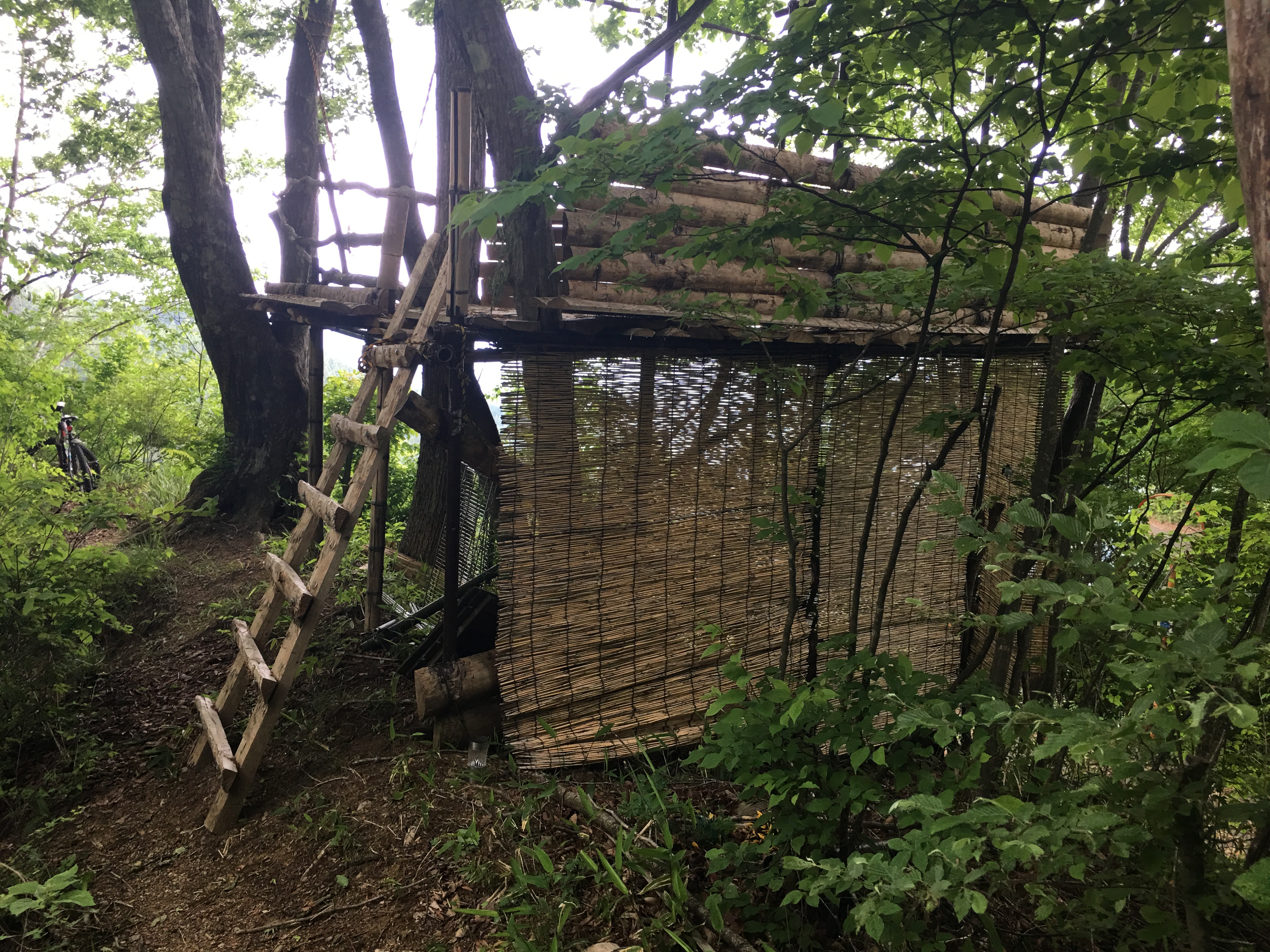
This is where I left the Shuyudo. Were I to continue on it, I would have soon passed the Tomin no Mori and then on into Hinohara Village from there. Instead, I did a little B and E to get through this gate into what I came to think of as Deliverance country. Seriously, you could almost hear Dueling Banjoes in the distance.
There were a few structures like this in that area. Is it a hunter's hide?
I got off the bike for just a short time to walk up to the top of Mt. Kurakake. It wasn't the safest place to be.
And that's all I'm going to say about that.
I'm stuck at home for another 3 or 4 (5?) days so I'm sure I'll be blogging more later. Take care and be sure to subscribe. If you don't, a pit viper might come and bite you.
Before I begin, let me just say that Mrs. Caveman is the best wife in the world. Today's post comes to you because of her generosity. She gave me the dough to take the train for this past trip and it was greatly appreciated!
Yesterday, I climbed another one of the 100 Famous Mountains. Mt. Nasu is in Nasu (city), Tochigi (prefecture). Nasu is at the extreme northern part of the Kanto Plain, bordering the Tohoku ("East"-"North") region of Japan. Actually, I entered Tohoku on this hike because I stepped over the prefectural boundary into Fukushima for just a bit.
One reason that I put off this trip for so long is that it was difficult for me to balance the expense in time and money for the travel against the amount of time in the mountains. Taking the local trains up and back can be done much more cheaply than taking the shinkansen. But that would take so long as to make overnighting a necessity. Also, the actual hike up and back from the top of Mt. Nasu can be done in just over an hour. When Mrs. Caveman asked me what I wanted for our anniversary, I asked if I could take a shinkansen ride. She said yes. She is the vest! (That means very best. I just coined that word. Feel free to use it yourself.)
So, I took the shinkansen and added several mountains to the suggested itinerary and had a great daytrip.
Here are the details. I'll add pictures and commentary later.
Getting there/getting around: I took the shinkansen to Nasushiobara. From there, there are buses to the Nasu Ropeway and all the onsens and other tourist attractions on the way. One-way bus tickets to the ropeway costs about ¥1,300. A two-day free pass costs ¥2,600. The Ropeway is a separate expense. See here for business hours and prices Nasu Ropeway .
Map: Yama to Kogen Chizu # . . . Beats me. I just printed a map off the internet (YAMAP) this time.
Time and Distance: 6 hours, 15 minutes plus a break for lunch 16.16km (Just shy of 10 miles)
Elevation: Lowest: 1,200m Highest: 1,915m Total Ascent: 1,498m Total Descent: 1,039m
Technical considerations/difficulty: There are some steep spots, but most of this area is actually pretty easy. There are not a lot of chains or ropes and the trail is very well-maintained while still keeping a very natural feel. There are large areas of bamboo grass and I especially appreciated that they had trimmed the trail. Bamboo grass is nice to look at but it is really annoying if you have to wade through it.
Facilities: Not a lot. Once you are on the trail, you won't encounter any restrooms or commercial entities. There is one waterhole on a spur that I took but that water was un-drinkable--unless maybe one was dying of thirst. 😉 That would make it ok.
Thoughts/observations/recommendations: Boy, what a great area to hike. It's been on my list for quite a while. I am so glad I finally did it. It exceeded my hopes.
OK. Here are my reflections looking back on the day. I will start with the journey up from Tokyo . . .
This was something neat to come upon when pulling into one particular station on the way up. I think this might have been in Oyama.
Rather than start at the ropeway, I opted to start at a bus stop a few miles away and take a roundabout route up to the mountain. For the first few hours, my hike was a very solitary pleasant excursion. One of the first sights I encountered was these falls.
Komadome Falls
The Yosasa River
The Kita Onsen (Hotspring) is next to the river.
It was just such a picture-perfect, pleasant day. The temperature was around 8~9 C (50ish in Fahrenheit) for most of the day.
The first landmark I got to was the top of the ski area, Mount Jeans. I've been skiing there many times in the past but this was my first time up there without snow--or people.
I am glad I brought water with me. This was the only waterhole and the water was crunchy. 😱
There is a video if you want to see how it operates.
This is totally natural but it looks like something that was arranged for a zen garden.
From Mt. Jeans, I headed up to Mt. Mae (Maetake). That was really not much to see. Then I headed up to Sanbonyaritake ("Three" "Spear" "Peak") and had lunch. That's where I first started to encounter people.
This is the only time that visibility got bad. That was unfortunate because you are supposed to be able to see Mt. Bandai in Fukushima from here. I like that mountain and would have liked to have gotten a glimpse of it from afar.
On Sanbonyaritake. This disc is oriented so that north is up and south is down. It shows all the mountains you should be able to see from that point.
This spot is just below Mt. Asahi's peak. It's cool. Check out the video to get an idea on how windy it is.
The top of Mt. Asahi
The top of Nasudake
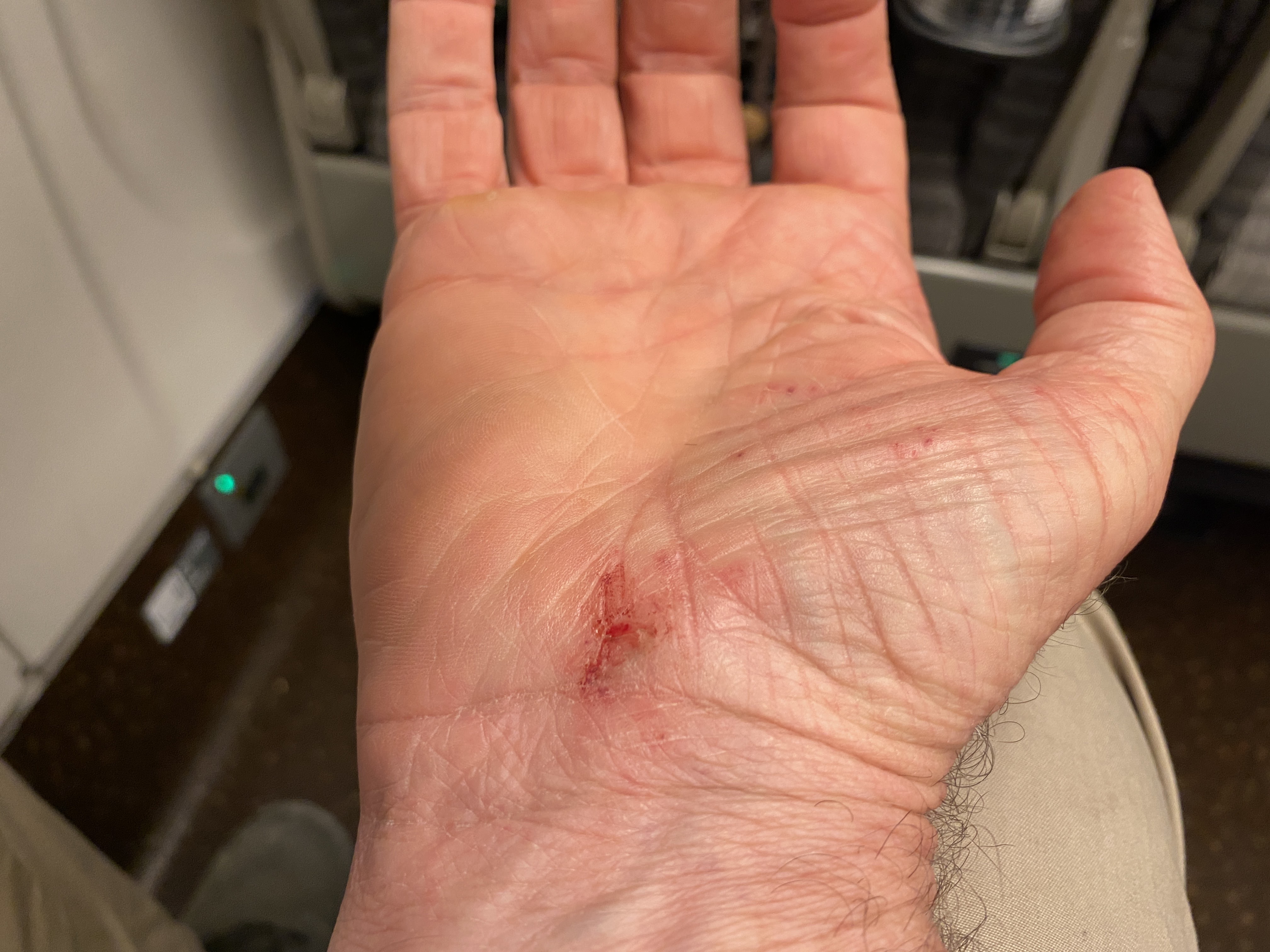
No trip is complete without a memento. I was fortunate enough to take a digger into the gravel on the way down. These little scars 🩹will give me happy memories until they heal. 🙂
That's all for now. Don't forget to subscribe. All the cool kids are doing it.
Addendum:
Here at work today I took a look to the north with my Peakfinder app and was astonished to find that Sanbonyaritake, one of the mountains on the other day's hike, is in the line of sight from here. That's 174km away! It's obscured by clouds in this picture, unfortunately. Just knowing it is there made it a little hard to concentrate at work. 😜
Mts Nantai (男体) and Shirane (白根) are very visible in the picture. Those are 124km away in Nikko.
Want to check out one of the other 100 Famous Mountains in Tochigi?