Showing posts with label 日帰ハイキング. Show all posts

Kitayatsugatake area: Yabashira (八柱山) ~~ Shimakare (縞枯山) ~~ Chausu (茶臼山) ~~ Nakakoba (中小場)


I lied.  

I said the other day that I would not be hiking for a while but I went for one last hurrah on my last day of vacation.  Blame Mrs. Caveman.  She asked me the night before, "Are you going hiking tomorrow?"  I hadn't planned on it until that moment.  

I wonder if she was trying to get me out of the house, or if she just knows me better than I know myself.  The last time she did this was last year.  "Are you climbing Fuji this year?"  I wasn't even thinking of it until that moment but found myself suddenly overtaken by the urge to climb Mt. Fuji.

The weather was still overcast yesterday, as it's been the past few weeks--until the last hour or so of my trek.  

Fate is cruel.  I'm going back to work this morning and the sky is blue and the birds are singing.  Grrr


Location:  Around the Yachiho Kogen.  Sakuhocho and Koumi.  The area just north of the Mugikusa Pass

Starting and stopping point:  Yachiho Kogen Nature Park

Peaks bagged: Yabashira (八柱山) ~~ Shimakare (縞枯山) ~~ Chausu (茶臼山) ~~ Nakakoba (中小場)

(First-time) peaks # 809, 810, 811, 812

Getting there/getting around:  

I drove.  I parked at the Yachiho Kogen Nature Park.  

There are buses to the area.  From Chino Station, a bus takes about an hour and 5 minutes to Mugikusa Pass.  I DIDN'T START OR STOP HERE, but I did go by the pass on my hike, and that is as far as the bus from Chino goes.  This route runs from July through October (2023)  

From Yachiho Station, there are buses run by the Chikuma Bus Company.  Find a Japanese friend (or ask me) for help puzzling through their very limited timetable.  

Map:  Yama to Kogen Chizu 33 YATSUGA-TAKE TATESHINA・UTSUKUSHIGAHARA・KIRIGAMINE 八ヶ岳蓼科・美ヶ原・霧ヶ峰

Weather Information: Mt. Shimakare

Total Time:  6:32 Break time:  :09 Distance:  19.3 km

Elevation:  Lowest: 1,585 Highest: 2,403 m Total Ascent:  1,055m  Total Descent: 1,055m

Technical considerations/difficulty:  No serious chains or ladders.  You have to watch your step around boulders.  

Facilities:  Nothing to speak of on the trail.  No water, no toilets.  There are many campgrounds/ski areas in the area.  The Yachiho Kogen Nature Park, where I started, has a mallet golf course.

Thoughts/observations/recommendations:  I saw and heard lots of deer.  Saw a lot of tracks of various critters.  I was startled a few times by pheasants.  There was one wild animal I saw for the very first time up here in the woods.  A bunny rabbit!  I've seen lots of animals, but that was my first bunny.

Today's listening:  

Bible in a Year

Napoleonicist I listened to the episode about Napoleons's Spy.  I'm not really a fan of Napoleon but this discussion with a novelist about a book he wrote about the Russian campaign was interesting.


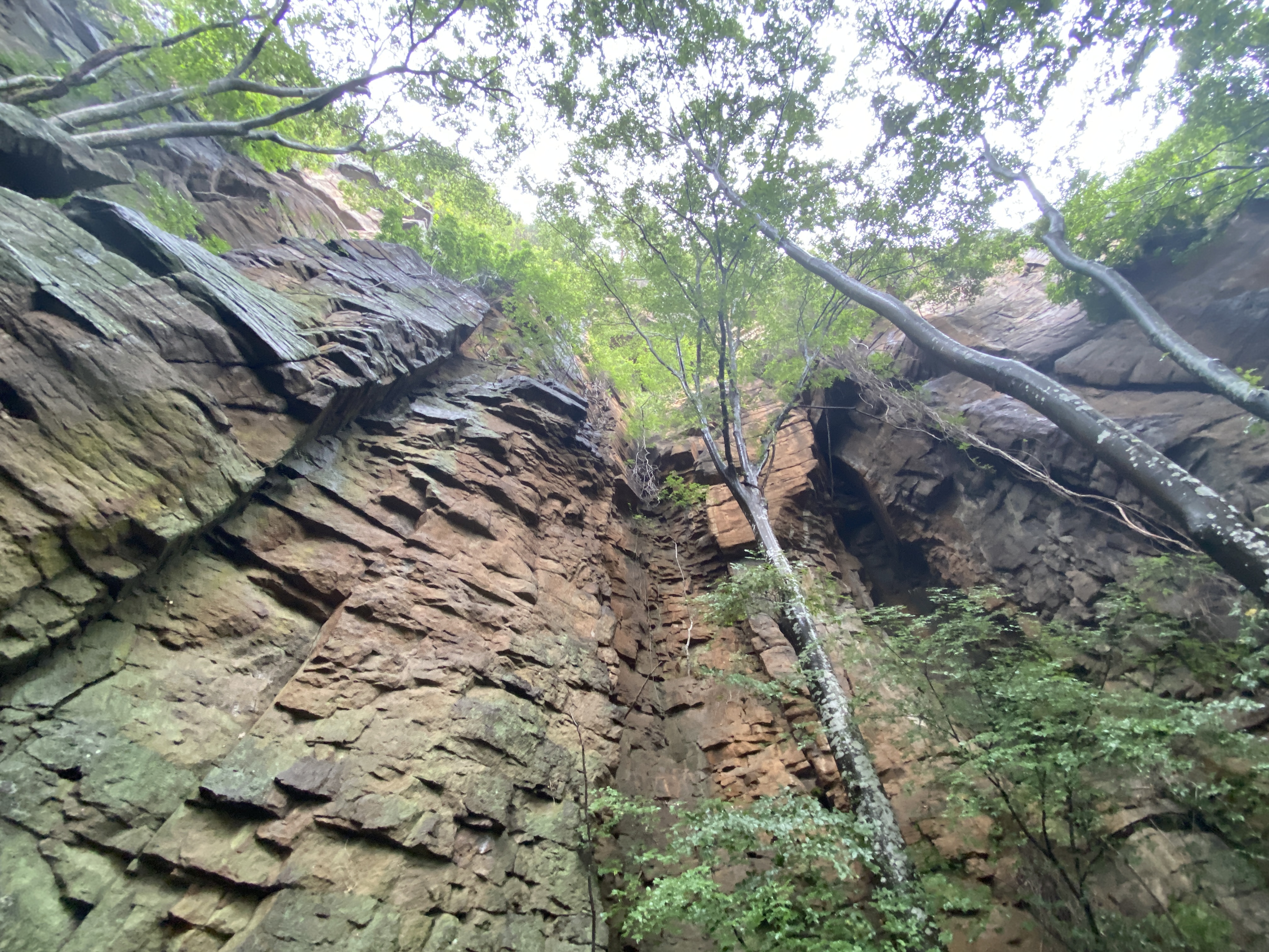
Here are some pictures.  I didn't get any vistas during the day.  Sorry.


Starting out from the Yachiho Kogen Nature Park, you pass along a forest road-林道- which is closed to cars for the first hour or so.


There is a lot of bamboo grass up here.  I'm very grateful that someone has trimmed it back from the trail.


Amaike 雨池 ("Rain"-"Pond")


This waterhole is like a bar or a disco.  This seems to be the social place to be.


The box is for donations to the volunteers maintaining the area.  They do a lot.  That boardwalk is really long.


Temperature-wise, it was perfect!
People-wise, too.  I didn't see anyone!


Like I said, there were a lot of deer around.

Turn up the speakers.  You can hear what a deer's bark sounds like.


As my day--and my vacation--was drawing to a close, the sun finally came out over my back.


That's all for now.  Subscribe, tell your friends, etc.  If you like.
Caveman out.


The last mountain for a while. 😭 Mt. Arakuru trail run before the typhoon

 Location:  


Starting and stopping point:  Myosenji

Peaks bagged: Akaru (閼伽流山)

(First time climbed) peaks None today

Getting there/getting around:  There is parking at the Myosenji Shrine

Map: I don't think there is a paper hiking map covering this.  I just used my hiking app--YAMAP.

Weather Information: 

Total Time:  :53 Break time: :00  Distance: 3.6k 

Elevation:  Lowest: 755m  Highest:  1,028m Total Ascent: 320m  Total Descent: 320m

Technical considerations/difficulty:  There are several steep spots with ropes.  The lookout spot near the peak of Akaru has a large dropoff.  I really wouldn't want to fall off there.  Much of this trail is runnable, but large portions aren't.  

Facilities:  Nothing

Thoughts/observations/recommendations:  Today is the first day of the obon holiday.  It is also the day that a typhoon is arriving.  I had big hopes for big mountains this week but . . .  I decided to at least get in a run before the forced hibernation of the coming few days.  This is a fun little area.  There are some really cool boulders around this temple's precincts.


Today's listening: Nothing


😭😭😭😭😭😭😭That's all for today.  Time to start hibernating.
Caveman out.


100 Famous Mountain, Mt. Kisokoma in Nagano


Yesterday I climbed one of the 100 Famous Mountains, Mt. Kisokomagatake, Kisokoma for short.  Kisokoma is the tallest of the Kiso Mountains which are located in the Chubu region in the prefecture of Nagano.


Location:  Central Alps (Kiso Mountains)

Starting and stopping point:  Chuo Alps Kisokomagatake Ropeway

Peaks bagged: Mt. Hoken (宝剣岳) ~~ Mt. Naka (中岳) ~~ Mt. Kisokoma (木曽駒ヶ岳) ~~ Mt. Kisomae (木曽前岳)

(First-time-climbed) peaks #801, 802, 803 and 804

Getting there/getting around:  See the website for the ropeway.  They have comprehensive information about transportation and lodging.  https://chuo-alps.com/lang/en/

Map: 山と高原地図41CENTRAL ALPS KISOKOMA・UTSUGI-DAKE 中央アルプス木曽駒・空木岳 Link

Weather Information: 

(English site)

(Japanese site)

Total Time:  4:24 Break time: :32  Distance: 6.5km (just over 4 miles)  

Elevation:  Lowest: 2,612m Highest: 2,956m Total Ascent: 812m  Total Descent: 812m

Technical considerations/difficulty:  From the ropeway to the main attraction, Mt. Kisokoma, the hike is do-able by people of all shapes and sizes in a couple of hours.  Deviating from that well-trodden path to the peaks on the side is where it gets exciting.  

Facilities:  There are a lot.  Around the area where the bus departs for the ropeway, there are hotels, gift shops, onsens . . . At the top of the ropeway, there is a hotel and restaurant.  On the mountains, there are about 5 mountain lodges.

Thoughts/observations/recommendations:  

I have to go back.  I was robbed of long views again because of the weather.  

For a few reasons, I took the most popular route to the top, via the ropeway.  Doing that cost nearly ¥5,000 (about $50) and ensured that I was hiking around a lot of people.  Actually, on the most heavily trafficked parts of the trail I was reminded of pictures of Mt. Everest with the long lines of people waiting to summit.  It wasn't actually that bad.  It wasn't even as bad as Mt. Fuji looks this year.  (It's super-crowded!)  Next time I will definitely skip the ropeway and start at a lower elevation.  Doing so, I'm sure I'll avoid the crowds.  After all, this is my mancave.  I go there to get away from people!  

There are a few reasons I don't like using ropeways.  1.  I'm a cheapskate.  2.  I feel like I'm cheating.  3.  This is similar to the second point, I don't think you can appreciate how high you are when you are just deposited there from a little capsule that was transported via a metal thread.  The change in temperature, vegetation and fauna is less sensible.  

Today's listening: 

Bible in a Year

A Short History of . . . the French Resistance


From the ropeway


This is on the way to Mt. Hoken (宝剣岳).  That peak is much spicier than Kisokoma.  宝剣 means "treasure" "sword" 岳 means "peak."


The top of Kisokomagatake


I cut the crowd out of the next picture . . . but around here the line was a bit like Disneyland.  There must have been about 30~40 slow-moving people.


That's the Senjokiki Hotel and ropeway station below.


These two chicks must be "influencers" of some sort.  They were obstructing the whole trail while swinging a smartphone around on a selfie stick.  They were absolutely oblivious to the other hikers who were trying to get around them.


Well, that's it for today.  Subscribe, etc.  If you like.

Caveman out.