Showing posts with label トレールラン. Show all posts

(May 2022 repost) Quick trail run on Takao

 To my dear cavedwellers, I'm sorry if you feel flooded by a bunch of posts today.

Many of my posts on the blog seem to be hidden from public view and I've decided to repost them.

I think this is the last one!

With about 2 million visitors a year, Mt. Takao in Tokyo must be one of the most visited mountains in the world.  There is a monkey park on the top, tons of souvenir shops, a beer garden, more shrines than you can shake a stick at . . .

All that being said, visiting it in the off-season or in poor weather, you can actually experience something like nature and seclusion.

Since I knew I wouldn't be able to get a whole day in the woods this week, I opted for a quick run on Takao after work one day.

The overwhelming majority of visitors arrive at Takao via the Takaosanguchi Station on the Keio Train Line.  That is in a quaint neighborhood with restaurants, souvenir shops, a trick art museum, etc.  From there, many people get on the cablecar that brings you near the top.  You can climb from there if you are a cheapskate like me.

Takaosanguchi is not the only approach though.  Uratakao ("behind" "Takao") has a few trailheads that will access the mountain.  Those trails are always less populated even if the top is busy.

I ran to the top from the Takao Umenosato Machi no Hiroba near the  Jatakiguchi (蛇滝口) Bus Stop in the Uratakao area the other day.  

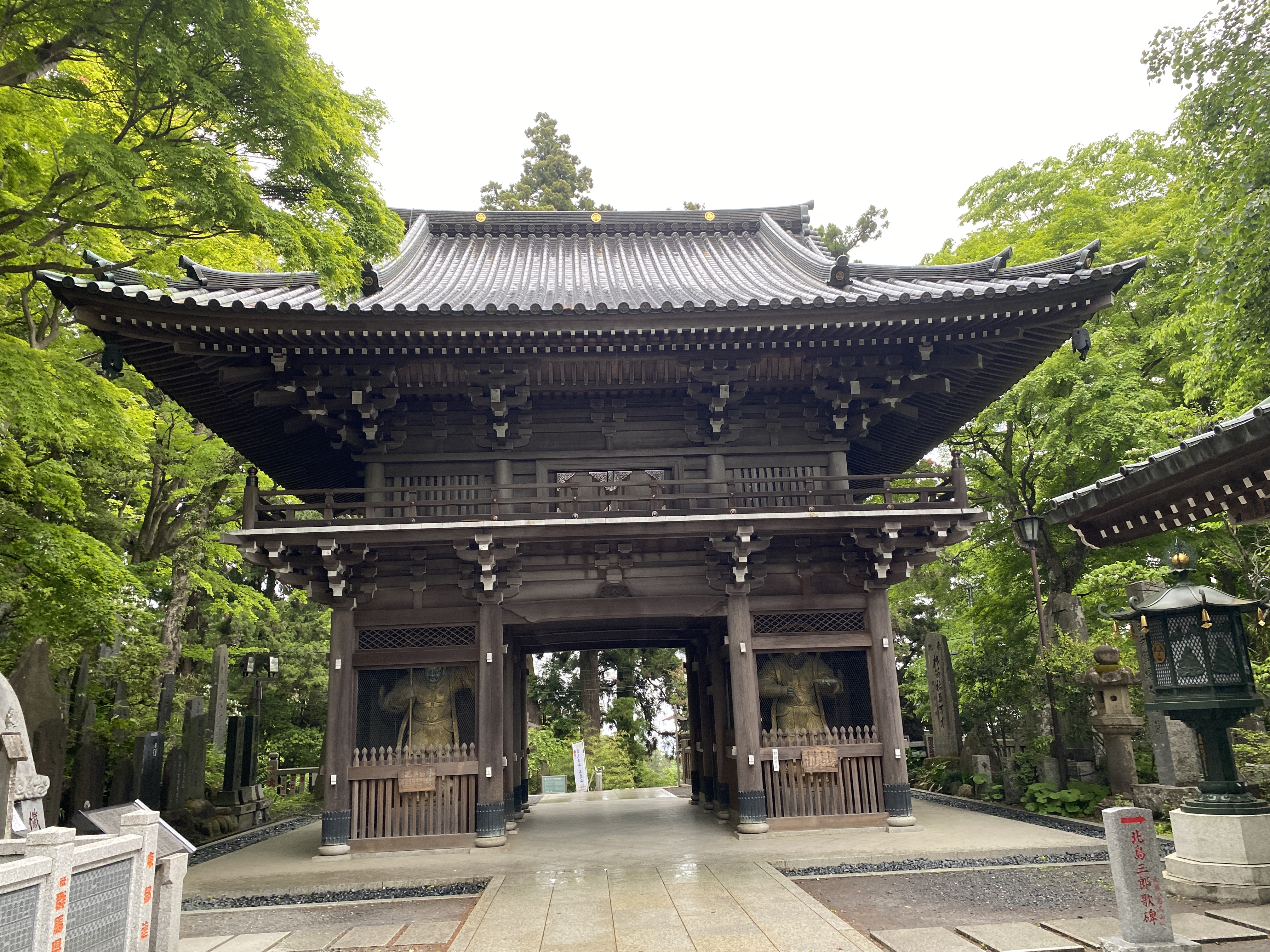
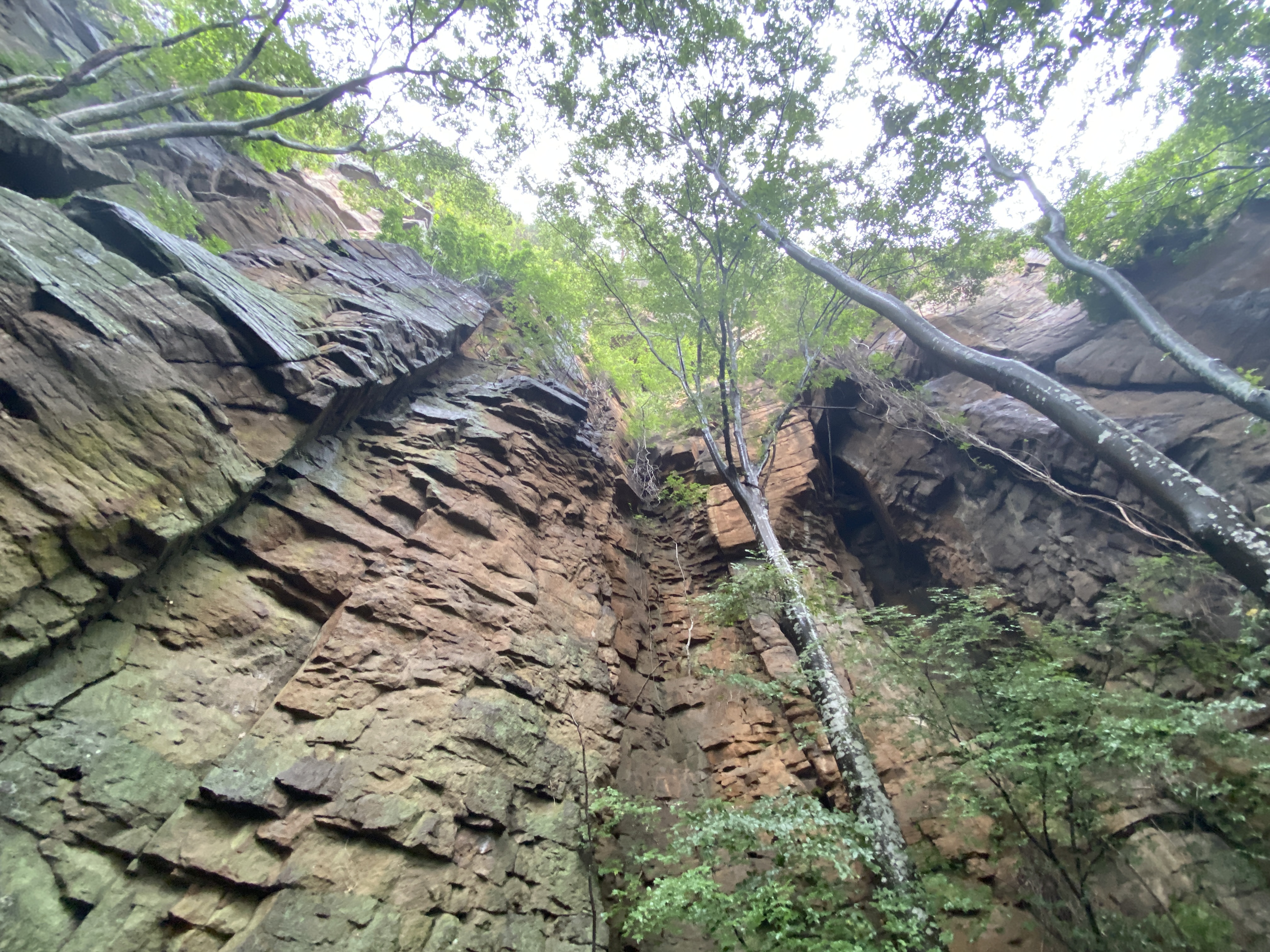
It was great.  The weather was threatening rain and I didn't start until after 4 so everything was closed and I saw only two people on my run.  Much of the trail is concrete so I wasn't that worried about twisting an ankle.  It was about 6km (just shy of 4 miles) to get to the top and back with a rise and then drop in elevation of 525 meters.   Here are some pictures.


Starting out, the concrete trail parallels a river.  Nice.


The top.  Sometimes this place is absolutely packed.
There are great views of downtown Tokyo and of Mt. Fuji from here.
If you live in Tokyo and have not visited Takao yet, shame on you.


Fuji is pretty from here on a clear day.
Those mountains in the foreground are the Tanzawa Range in Kanagawa Prefecture.  There're some wonderful trails there.  Beware of leeches during summer, though!  The mountain in the middle of the picture, the biggest one in the area, is named Hirugatake.  Hirugatake literally means leech mountain.


I deposited my scooter behind that visitor's center under the highway during my run.  Don't tell anyone.  They were closed.  The small building on the right is a public restroom.


Drop by the cave again sometime!

Caveman out.

Sunday am in Karuizawa. Koasama Trail Run


S'up, cave people?

I walked out the door Sunday morning with the idea of going for a trail run on a nearby hill.  As often happens, as soon as I walked out the door I got other ideas.  It was just so beautiful outside that I wanted to do something a bit more substantive.  Looking up at Mt. Asama and its fresh covering of snow gave me the idea to run on its diminutive neighbor, Koasama.  (Koasama means "Small Asama.")  

It was great.  I've already blogged about this run and don't want to repeat myself.  If you want details, check out the old post.  

The old post


This was blown over.


That area just below and to the right of the center of the picture is the Onioshidashi Volcanic Park.  It's a very cool place to visit.


The last mountain for a while. 😭 Mt. Arakuru trail run before the typhoon

 Location:  


Starting and stopping point:  Myosenji

Peaks bagged: Akaru (閼伽流山)

(First time climbed) peaks None today

Getting there/getting around:  There is parking at the Myosenji Shrine

Map: I don't think there is a paper hiking map covering this.  I just used my hiking app--YAMAP.

Weather Information: 

Total Time:  :53 Break time: :00  Distance: 3.6k 

Elevation:  Lowest: 755m  Highest:  1,028m Total Ascent: 320m  Total Descent: 320m

Technical considerations/difficulty:  There are several steep spots with ropes.  The lookout spot near the peak of Akaru has a large dropoff.  I really wouldn't want to fall off there.  Much of this trail is runnable, but large portions aren't.  

Facilities:  Nothing

Thoughts/observations/recommendations:  Today is the first day of the obon holiday.  It is also the day that a typhoon is arriving.  I had big hopes for big mountains this week but . . .  I decided to at least get in a run before the forced hibernation of the coming few days.  This is a fun little area.  There are some really cool boulders around this temple's precincts.


Today's listening: Nothing


😭😭😭😭😭😭😭That's all for today.  Time to start hibernating.
Caveman out.


Lucky 777, Koasama in Karuizawa


Location:  Mt. Koasama, Karuizawa

Starting and stopping point:  Toge Teahouse 峰の茶屋

Peaks bagged: Koasama west peak ~~ Koasama

Getting there/getting around:  I drove

Map:  Yama to Kogen Chizu 19 浅間山軽井沢・長野原の山々ASAMA-YAMA KARUIZAWA-NAGANOHARA-MOUNTAINS

Weather Information: Asama Weather

Total Time: :40  Break time: 0  Distance:  3.6 km

Elevation:  Lowest: 1,404m  Highest: 1,655m Total Ascent: 258  Total Descent: 258

Technical considerations/difficulty: Loose gravel/sand.  Nothing steep.  Very runnable. 

Facilities:  Public restroom across the street from the trailhead.  Emergency shelter (in case of eruption) at the trailhead.

Thoughts/observations/recommendations:  Today I bagged my 777th peak on a quick run after school.  Mt. Koasama ("Little Asama") is a bump on the eastern side of Mt. Asama--the volcano.  It's about 800 meters lower than Asama.  I do wish there were fewer clouds.  The view of the top must be cool.

Today's listening:  Just my own huffing and puffing


S'up, cavedwellers?  I'm not going to write much.  There is no reason to spend more time blogging than I did running!

Hope you're all having a great summer!

This is at the trailhead.  The building is Tokyo University's volcano monitoring station.


This is a campground in Tsumagoi.


The west peak


Explanations of the restrictions and the danger.  Level 1 means un-restricted access to Mt. Asama.  Now it is Level 2.  You can't go closer than a few km from the crater.

The box to the left of the sign is to deposit hiking plans.  (I do mine online.  Ask me if you want to know how.  I never go into the woods without telling someone my plans.)


That's all.  See ya!