Showing posts with label Karuizawa. Show all posts

The Lonely Mountain, Mt. Hanare, Karuizawa, Japan


Hello, cave crawlers.  This post is of the second hike I made yesterday.  The first hike is here.  https://mymancaveisthemountains.blogspot.com/2024/01/blustery-clear-morning-on-mt-koasama.html


Location:  Mt. Hanare, Karuizawa

Starting and stopping point:  School Parking Lot  DON'T PLAN ON PARKING HERE.  I'll explain below

Peaks bagged: Mt. Hanare (離山)

(First-time) peak # 851

Getting there/getting around:  I drove.  I think public transportation is a better bet, though.

Map: Yama to Kogen Chizu 19 浅間山軽井沢・長野原の山々ASAMA-YAMA KARUIZAWA-NAGANOHARA-MOUNTAINS

Weather Information:  Asama Weather

Total Time:  2:07  Break time: :17  Distance:  7.3km

Elevation:  Lowest: 946m Highest: 1,252m Total Ascent:  339m Total Descent: 340m

Technical considerations/difficulty:  None.  This would be an ideal hike for a couple on a date.  Most of the way up is a wide, fairly flat stone road.  It is a steady climb, but there is nothing particularly difficult about it.  I don't think you really need any "gear" to climb this mountain.  

Facilities:  Several rest spots to catch the sights or have a meal.

Thoughts/observations/recommendations:  
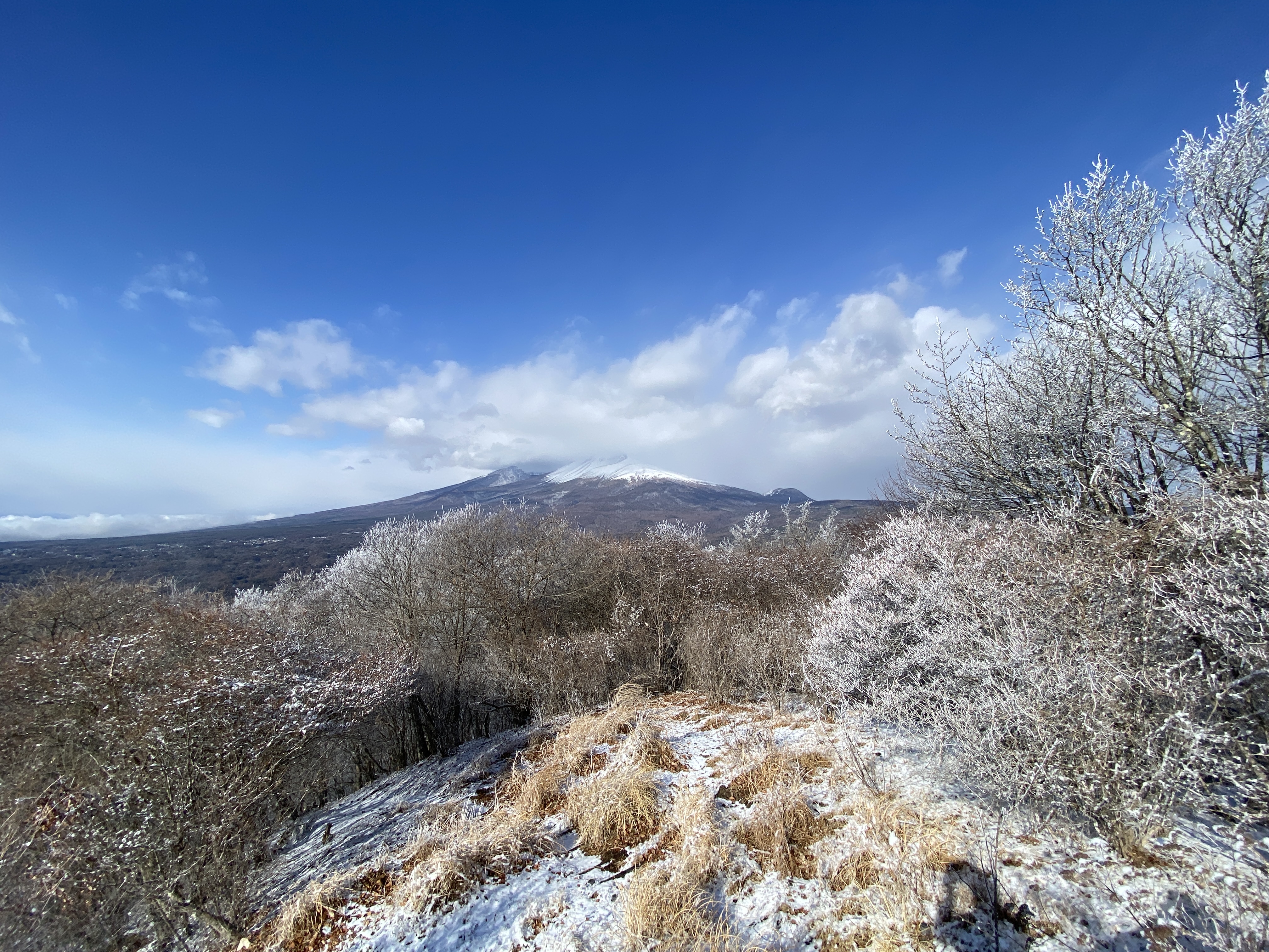
I called this post the Lonely Mountain because this mountain sticks up out of a fairly flat area all by itself.  The word hanare means something like "separate" or "leave".  It fits.  It's not high, but it does have prominence because it is so alone.  

About parking . . . on the map, and on my hiking app, there is a parking space by a bus stop on the Old Nakasendo.  The maps are wrong.  There is no parking there--or anywhere.  There's no parking at the trailhead or in the neighborhood below the mountain.  In desperation, I asked one of the locals where to park and she directed me to a spot by a school underneath a sign with exotic red characters written on it.  I thought she might be pulling my leg because I'm not your average bumpkin foreigner.  No siree.  I could read those exotic characters.  The sign clearly said "No Parking".  When I protested, she told me not to worry, and that since it wasn't a school day, I was ok.  

Thankfully, I was.  

That said, I wouldn't plan on parking there again.  And . . . if you happened to be coming to the area from out of town, you're probably coming by train.  This area is just a short bus ride from Karuizawa Station.  This mountain would really be a nice stroll for tourists visiting Karuizawa.


Today's listening:  Just the birds in the trees


Here are some pictures:

There hasn't been much snow around here yet this year but the ski area at the Karuizawa Prince Hotel is running.


That's Mt. Asama in the clouds.  The little bump to the right is Koasama where I'd climbed earlier that morning.


That's all for today.
Caveman out.

Blustery clear morning on Mt. Koasama, Nagano/Gunma


Good morning (afternoon, evening) cave crawlers.  Welcome to my world for a few minutes.  

Yesterday I went on two hikes in Karuizawa.  I had planned to drive far and go on an ambitious trek yesterday but the road conditions on the way were not great and the afternoon weather forecast was for snow.  I decided to change plans and do some shorter, more local hikes instead.  I'm glad I did.  I caught some spectacular weather in the morning and was home by noon--which is about the time the snow started flying.  I'm glad I wasn't driving home through the mountains in that weather.  Yay, me.

The firs mountain I hit was Koasama.  The second wasn't Mt. Hanare.  I'll write a separate post about that here:  https://mymancaveisthemountains.blogspot.com/2024/01/the-lonely-mountain-mt-hanare-karuizawa.html

Here are the details on Koasama:


Location:  Mt. Koasama Nagakura, Karuizawa

Starting and stopping point:  Parking lot across from the Toge Teahouse 峰の茶屋

Peaks bagged: Koasama east and west

(First-time) peaks # --

Getting there/getting around: Car.  There is a bus stop, though. 

Map: Yama to Kogen Chizu 19 浅間山軽井沢・長野原の山々ASAMA-YAMA KARUIZAWA-NAGANOHARA-MOUNTAINS

Weather Information:  Asama Weather

Total Time: 1:25  Break time: :00  Distance:  4.25km

Elevation:  Lowest: 1,403m  Highest: 1,655m Total Ascent:  354m Total Descent: 355m

Technical considerations/difficulty:  Parts of this are steep but there are no ropes or chains.  In the snow, crampons or some kind of spikes are a must.  If you are into hiking poles, they would be a good idea, too.  In the bare seasons, the trails have many spots of loose sand that make getting a purchase a little difficult.  There are also lots of small rocks on the trail that pose a danger of twisting an ankle.  Even so, this is a nice mountain for running on.

Facilities:  Parking for a few cars at the bottom.  Vending machines, public restroom and an udon restaurant at the bottom.

Thoughts/observations/recommendations:  This is about a 45-minute drive from my home so I've been here three or four times and I grow fonder of it each time.  The scenery changes with the seasons.  Since the trees aren't that thick and the hills are well-defined, it's easy to hop off the trail and still find your way to the top easily.


Today's listening: For You The War Is Over


You may have noticed the "No Entry" on the Google Earth screen shot.  Shh.  Mt. Koasama ("Little" "Asama") is next to Mt. Asama, an active volcano.  🌋  There is a zone of several kilometers around the volcano that you are prohibited from entering ⛔ because of the air quality.  I'm like a cat, though.  And you know cats and their curiosity . . . I wanted to go up the trail toward the big mountain just far enough to look back and get a picture of Koasama.


This picture is looking up at Koasama from the parking lot.  That white building is the volcano research building for Tokyo University.


This sign got blown over.


That's Mt. Asama.


These next pictures are looking back from the trail you're not supposed to enter.

Mt. Koasama straight ahead


The western peak of Koasama is in the immediate foreground.  The other one is to the right.


This was after it had warmed up a bit.


Well, that's all for today.  Come again.  Subscribe.  Tell all your friends to buy me ko fi.  ☕


Sunday am in Karuizawa. Koasama Trail Run


S'up, cave people?

I walked out the door Sunday morning with the idea of going for a trail run on a nearby hill.  As often happens, as soon as I walked out the door I got other ideas.  It was just so beautiful outside that I wanted to do something a bit more substantive.  Looking up at Mt. Asama and its fresh covering of snow gave me the idea to run on its diminutive neighbor, Koasama.  (Koasama means "Small Asama.")  

It was great.  I've already blogged about this run and don't want to repeat myself.  If you want details, check out the old post.  

The old post


This was blown over.


That area just below and to the right of the center of the picture is the Onioshidashi Volcanic Park.  It's a very cool place to visit.


Lucky 777, Koasama in Karuizawa


Location:  Mt. Koasama, Karuizawa

Starting and stopping point:  Toge Teahouse 峰の茶屋

Peaks bagged: Koasama west peak ~~ Koasama

Getting there/getting around:  I drove

Map:  Yama to Kogen Chizu 19 浅間山軽井沢・長野原の山々ASAMA-YAMA KARUIZAWA-NAGANOHARA-MOUNTAINS

Weather Information: Asama Weather

Total Time: :40  Break time: 0  Distance:  3.6 km

Elevation:  Lowest: 1,404m  Highest: 1,655m Total Ascent: 258  Total Descent: 258

Technical considerations/difficulty: Loose gravel/sand.  Nothing steep.  Very runnable. 

Facilities:  Public restroom across the street from the trailhead.  Emergency shelter (in case of eruption) at the trailhead.

Thoughts/observations/recommendations:  Today I bagged my 777th peak on a quick run after school.  Mt. Koasama ("Little Asama") is a bump on the eastern side of Mt. Asama--the volcano.  It's about 800 meters lower than Asama.  I do wish there were fewer clouds.  The view of the top must be cool.

Today's listening:  Just my own huffing and puffing


S'up, cavedwellers?  I'm not going to write much.  There is no reason to spend more time blogging than I did running!

Hope you're all having a great summer!

This is at the trailhead.  The building is Tokyo University's volcano monitoring station.


This is a campground in Tsumagoi.


The west peak


Explanations of the restrictions and the danger.  Level 1 means un-restricted access to Mt. Asama.  Now it is Level 2.  You can't go closer than a few km from the crater.

The box to the left of the sign is to deposit hiking plans.  (I do mine online.  Ask me if you want to know how.  I never go into the woods without telling someone my plans.)


That's all.  See ya!