Getting there/getting around: There is parking at the Myosenji Shrine
Map: I don't think there is a paper hiking map covering this. I just used my hiking app--YAMAP.
Weather Information:
Total Time: :53 Break time: :00 Distance: 3.6k
Elevation:Lowest: 755m Highest: 1,028m Total Ascent: 320m Total Descent: 320m
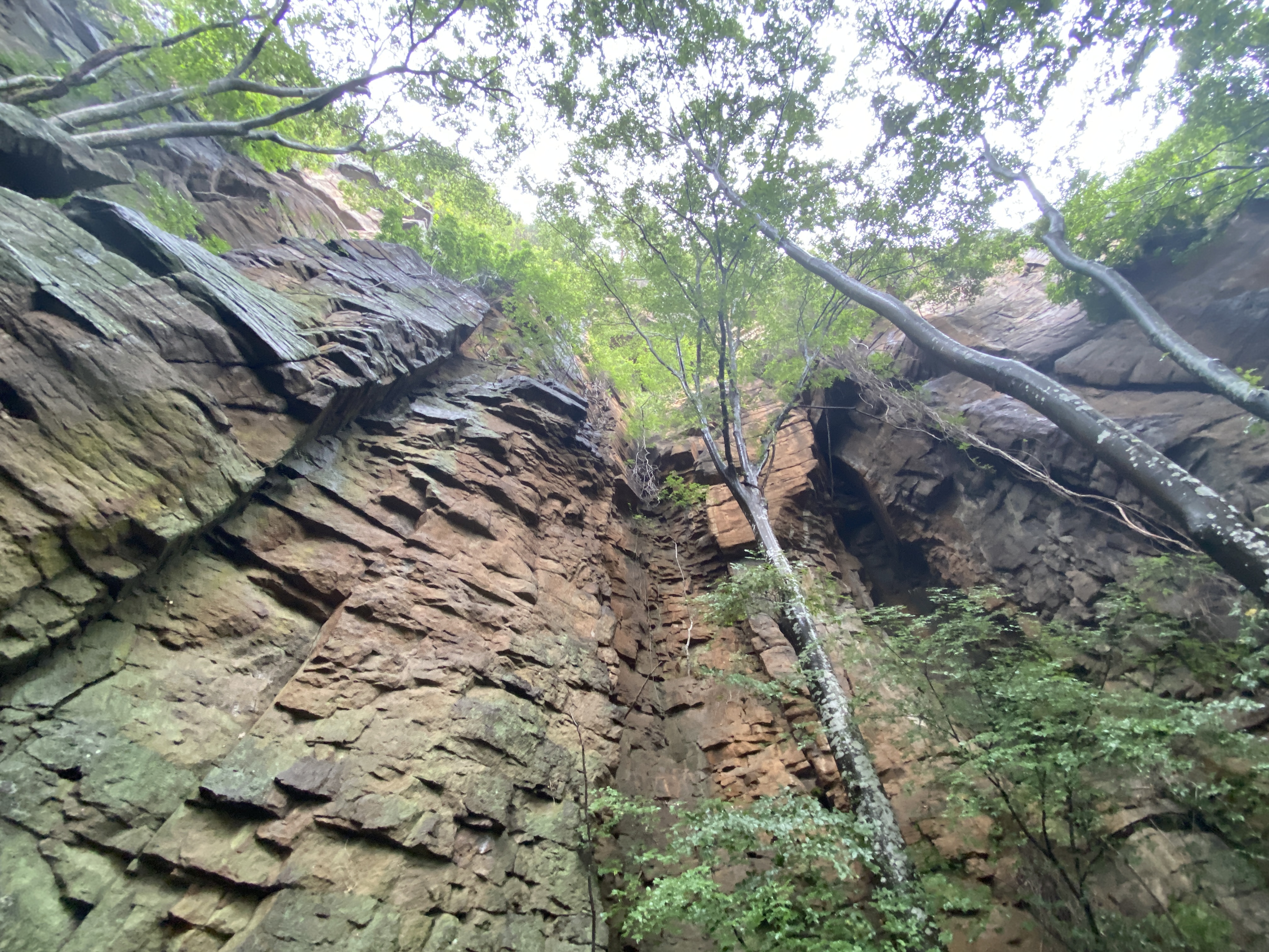
Technical considerations/difficulty: There are several steep spots with ropes. The lookout spot near the peak of Akaru has a large dropoff. I really wouldn't want to fall off there. Much of this trail is runnable, but large portions aren't.
Facilities: Nothing
Thoughts/observations/recommendations: Today is the first day of the obon holiday. It is also the day that a typhoon is arriving. I had big hopes for big mountains this week but . . . I decided to at least get in a run before the forced hibernation of the coming few days. This is a fun little area. There are some really cool boulders around this temple's precincts.
Today's listening: Nothing
😭😭😭😭😭😭😭That's all for today. Time to start hibernating.
Getting there/getting around: I drove. There is seasonal bus service to the Takamine Kogen Hotel from Sakudaira Station. It's 54 minutes from Sakudaira to the hotel. Sakudaira is about 2 hours from Tokyo on the shinkansen.
Total Time: 4:38 Break time: :31 Distance: 11.9 km
Elevation:Lowest: 1,925 m Highest: 2,228 m Total Ascent: 814m Total Descent: 817m
Technical considerations/difficulty: Fairly straightforward hike. No chains or ladders to speak of. It's got a few spots above the treeline but it isn't that exposed.
Facilities: The Kurumazaka Pass has a well-appointed visitor's center with lots of parking, a snack bar and some hiking goods for sale. On the way, I passed an onsen. On the trail there is no water and no restrooms.
Thoughts/observations/recommendations: What a nice day.
This was a nice day. I'm not going to write much. I'll just put up some pictures.
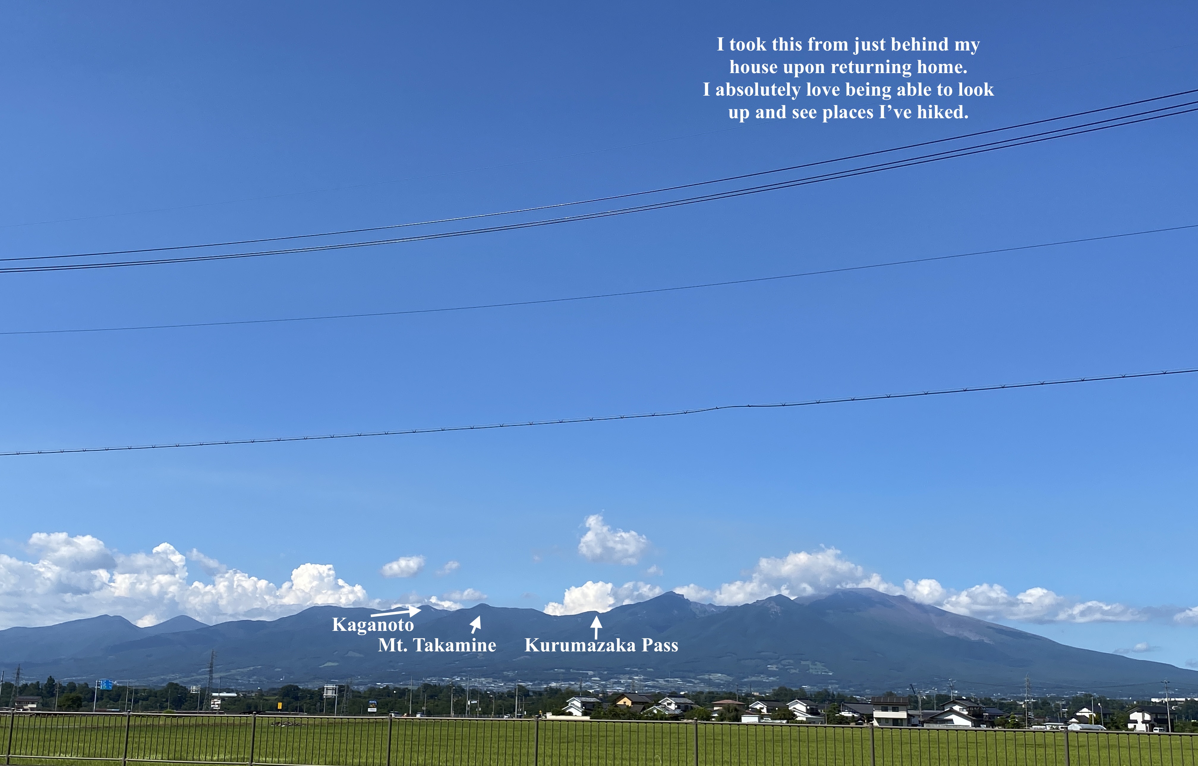
I will say that it was nice to see many mountains I've climbed from today's vantage point. I could see Fuji, Akadake, Tateshina, Kitadake, Kuruma, etc.
It was just clear enough in the morning to catch a glimpse of Mt. Fuji.
I was hoping it would clear up enough to get a clear view of Kuruma and Utsukushigahara since I've been to those mountains in just the past couple of weeks. I could get a glimpse of Kuruma but Utsukushigahara stayed shrouded in clouds.
Drats. Foiled again.
Arriving at the first peak, Mt. Takamine--literally "high-peak."
Forgive me if I put up too many gifs of these butterflies. They were cool!
This is actually on my way back. My path took me over four mountains before I descended to a parking lot at the Taira no Ike and looped back to where I started via a forestry road.
I live down there.
In the green house.
Do you see it?
That's all for today. Subscribe, etc. if you like.
Yesterday I climbed one of the 100 Famous Mountains, Mt. Kisokomagatake, Kisokoma for short. Kisokoma is the tallest of the Kiso Mountains which are located in the Chubu region in the prefecture of Nagano.
Total Time: 4:24 Break time: :32 Distance: 6.5km (just over 4 miles)
Elevation
Lowest: 2,612m Highest: 2,956m Total Ascent: 812m Total Descent: 812m
Technical considerations/difficulty:
From the ropeway to the main attraction, Mt. Kisokoma, the hike is do-able by people of all shapes and sizes in a couple of hours. Deviating from that well-trodden path to the peaks on the side is where it gets exciting.
Facilities:
There are a lot. Around the area where the bus departs for the ropeway, there are hotels, gift shops, onsens . . . At the top of the ropeway, there is a hotel and restaurant. On the mountains, there are about 5 mountain lodges.
Thoughts/observations/recommendations:
I have to go back. I was robbed of long views again because of the weather.
For a few reasons, I took the most popular route to the top, via the ropeway. Doing that cost nearly ¥5,000 (about $50) and ensured that I was hiking around a lot of people. Actually, on the most heavily trafficked parts of the trail I was reminded of pictures of Mt. Everest with the long lines of people waiting to summit. It wasn't actually that bad. It wasn't even as bad as Mt. Fuji looks this year. (It's super-crowded!) Next time I will definitely skip the ropeway and start at a lower elevation. Doing so, I'm sure I'll avoid the crowds. After all, this is my mancave. I go there to get away from people!
There are a few reasons I don't like using ropeways. 1. I'm a cheapskate. 2. I feel like I'm cheating. 3. This is similar to the second point, I don't think you can appreciate how high you are when you are just deposited there from a little capsule that was transported via a metal thread. The change in temperature, vegetation and fauna is less sensible.
This is on the way to Mt. Hoken (宝剣岳). That peak is much spicier than Kisokoma. 宝剣 means "treasure" "sword" 岳 means "peak."
The top of Kisokomagatake
I cut the crowd out of the next picture . . . but around here the line was a bit like Disneyland. There must have been about 30~40 slow-moving people.
That's the Senjokiki Hotel and ropeway station below.
These two chicks must be "influencers" of some sort. They were obstructing the whole trail while swinging a smartphone around on a selfie stick. They were absolutely oblivious to the other hikers who were trying to get around them.
Well, that's it for today. Subscribe, etc. If you like.