

Yo!
What is up, cavedwellers? Mrs. Caveman is the best. The very best. She took me to Hokkaido for my birthday and let me climb two of the 100 Famous Mountains. This report is about the second of the two, Mt. Tokachidake in the Taisetsuzan National Park.
Area:
Location: Daisetsuzan National Park, Center of Hokkaido
Map: Online Printable Topo Map (Now in English!)
***The Caveman is giving up on posting links to Yamatokogen maps. They go out of date and the links die. If you want a map, comment and I'll get you a current link.
Starting and stopping point: Tokachidake Onsen
Peaks bagged: Kamifuranodake Kamihorokamettokusan Tokachidake
(First-time) peaks # 917~919
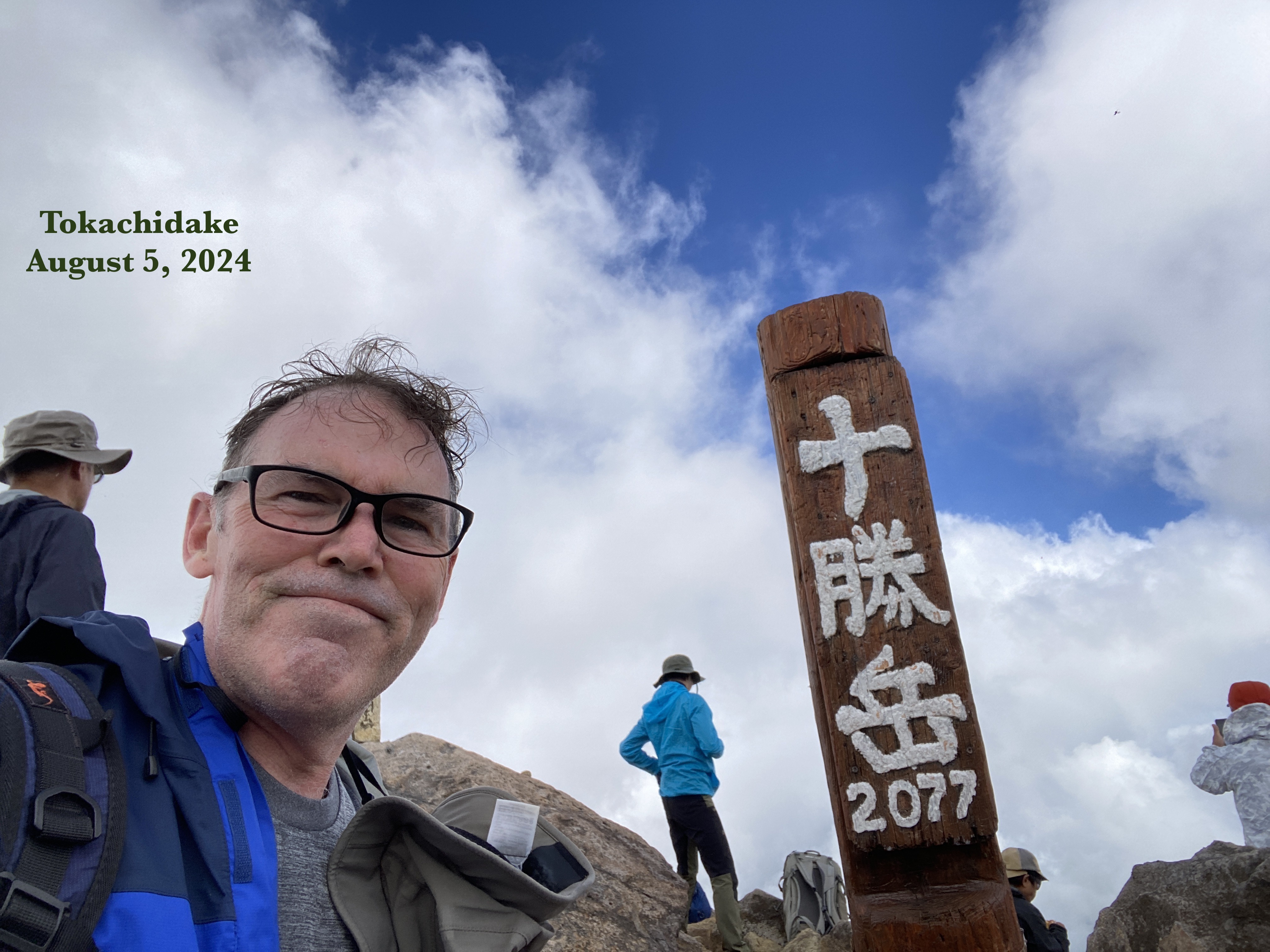
(First-time) 💯 Famous Mountain peak # 36, Tokachidake
Getting there/getting around:
I drove. There is bus service to the Takachidake Onsen
Time and distance*
Total Time: 6:06 Break time: :39 Distance: 13.1km
Elevation: Lowest: 1,268m Highest: 2,077m Total Ascent: 1,231m Total Descent: 1,231m
Technical considerations/difficulty:
For the most part, the trail is very well marked. In clear weather, it would be very difficult to get lost. If the weather turns though, visibility gets very bad and thankfully there are guide ropes along the sides of the trail where it is most needed.
Much of the trail is quite steep. There aren't any chains or ropes that you need to pull yourself up but it is steep.
Facilities:
There's nothing on the trail except for the Kamihoro Refuge Hut/Campsite just off the top of Kamihorokamettokusan. It looks like there is a portapotty there but I didn't go that close to confirm it. There is nothing for sale there.
There is no water on the trail.
The onsen, of course, is a nice place to clean up and get some snacks after the hike.
Thoughts/observations/recommendations:
Do it. If you can get here, do it. I couldn't sleep the night after my trip. I kept waking up dreaming about the cool hike of the day before.
Let's look at some pictures and stuff.


Meoto


Mt. Tokachi

Looking down at the Ansei Crater (安政火口). At the end of my hike, I wandered around inside for a while.


This reminded me of scenes of trench warfare in WWI.

Pushing up to the top of Tokachi


After coming off the ridges, I took a stroll around the Ansei Crater. It was cool (but hot!😜)


Bus schedule at the onsen

The Onsen

Well, cavekids, that's it. I'm still on vacation and am scheming to get to another mountain tomorrow so I want to post this right away. Take care.
Oh yeah, don't forget to subscribe and tell your friends about the Caveman. Google doesn't like me so hides my posts. 😜
If you want to see the other post from our trip to Hokkaido, check it out here.
Caveman out.

No comments:
Post a Comment
Have a comment? Please, keep it clean.