Showing posts with label #100名山. Show all posts

Lake to Summit. Lake Shibarako to 100 Famous Mountain, Mt. Tateshina.


Tateshina


. . . about Mt. Tateshina and Lake Shirakaba

Well, astute readers will know all about Mt. Tateshina because I last covered it just two weeks ago.  If you're not astute, go find that post.  (It's here:  Tateshina by bike)  (Are you back already?)  Lake Shirakaba maybe new to you.  It is a resort area to the west of Mt. Tateshina nestled down below between the Yatsugatake Range and Mt. Kirigamine to the west.  The lake area is a popular place for runners; many high schools and colleges have training facilities there for their track and field clubs.  Along with several ski areas around Shirakaba, there are onsens, canoes, kayaks, hotels, a teddy bear museum, and a small amusement park are just a few of the attractions available around the lake.

Area:

Location:  

Map:  ***If you want a link to the latest Yama to Kogen map, comment and I'll get you a link.  This link is to a printable topo map of Tateshina.

Starting and stopping point: Parking Lot near Tonyagawa Bus Stop

Peaks bagged: Yashigamineseihou(八子が峰西峰) ~ Yashigaminetouhou (八子が峰東峰) ~ Tateshina (蓼科山)* *100 Famous Mountain

(First-time) peaks # 927 and 928


Getting there/getting around:  

I drove.  Alpico does have bus service from Chino Station to Lake Shirakaba but the buses are seasonal and run infrequently.


Helpful Info

Weather Information: 


Time and distance

YAMAP's estimate: 12:07
Yama to Kogen's estimate: 10:40
Actual Time:  9:21 Break time: :34  Distance:  23.5 km
Elevation:  Lowest: 1,419 m Highest: 2,530 m Total Ascent: 1,734 m  Total Descent: 1,734 m

Technical considerations/difficulty:  

From the lake up to the assault on the peak is fairly gentle and really quite pleastant.  There are wide fields of sasa (bamboo grass) with bevies of deer snacking away.

Mt. Tateshina is a bit steep on the final approaches of whatever trail you use.  Much of the hike is above the treeline through boulder fields where you'll need to climb using chains and ropes.  Thankfully, they are conveniently already in place.

The descent from the Tateshina Sanso starts with a dry creekbed which gradually becomes wider and wider until it is a large expanse of scree all the way down to the first turn at the Takinoyu River where the trail conditions change.  Scree isn't that fun to walk on and I most definitely wouldn't want to have to traverse it in heavy rain.  I imagine it would be treacherous.

The real hard work of the hike is over at this point.  The trail paralleling the river is pleasant.  There is still a lot of distance to cover before getting back to the lake, though.

Facilities:  

There is a public restroom and waterhole near where I parked by the lake.  Among the myriad of touristy things around the lake, the Shirakaba Resort has an onsen available to daytrippers.  For shy foreigners, it's worth noting that it is a mixed bathing facility and that they provide everyone with a bathing suit.  I was actually planning on going in after my hike but the ¥2,000 price tag turned me off.

On the trail, you pass a few ski resorts.  I suppose there are vending machines and public restrooms there.

At the Suzuran Pass, there is a public restroom and parking.

Below the top of Tateshina at 将軍平 (Shogun Flats--how cool is that name--) is the Tateshina Sanso  Hut and on top of Tateshina is the Tateshina Sancho Hutte.  Both places have sleeping accommodations and food but no tenting area.  Both places have great swag.  I bought a t-shirt at the Sancho Hutte a few weeks ago that has become a favorite already.

It's not marked on the trail as a waterhole, but I got water from the Takinoyu River (滝の湯川) on the latter half of my trek.  I hit that about one hour after passing the Tateshina Sanso.

Thoughts/observations/recommendations:  

If you can, put Tateshina on your bucketlist.  The lake is also nice to see.  If you want a nice walk but aren't into climbing, you could opt for a walk around the lake and enjoy a soft serve ice cream cone on a bench while taking in the views.

I guess the most popular trailheads are from the Tateshina Tozanguchi at the Suzuran Pass, Ogawahara Pass (inaccessible by car in winter) or by the trailhead at Mt. Tateshina's Seventh Station Parking Lot.  (I have climbed Tateshina from the Ogawahara Pass and from the 7th Station after first biking up there.)  If you go via the Ogawahara Pass or from the Seventh Station and only piston (straight up and back) to Tateshina, you could do the hike in 4 or 5 hours.  Suzuran Pass is a bit longer.  My route from Lake Shirakaba is for people who are gluttons for punishment who want to put in a lot of miles.  In the past, I went from Ogawahara Pass and took in Mt. Futago as well as Tateshina.

Well, that's pretty much it for that

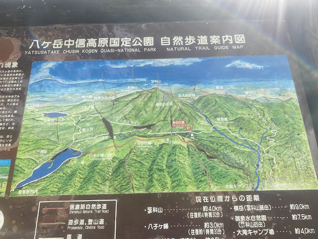
map


Here are some pictures.
 This is Lake Shirakaba


Looking up at Tateshina from the starting point.

Not a lot of bus service here.


Not far from the lake is Zeni Iwa.
They found a lot of old coins here and the theory is that this was the stash of a warlord by the name of Shingen Takeda.


Looking back down at the lake.


The deer love this bamboo grass.
Thankfully, there was a clear path through it.  This stuff is miserable to have to bushwhack through.
Sometimes it is over your head and you cannot see where you are going.


Bambi!


One of many ski lifts on the way


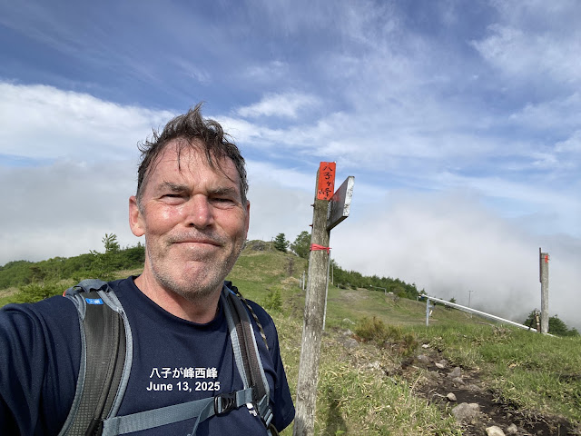
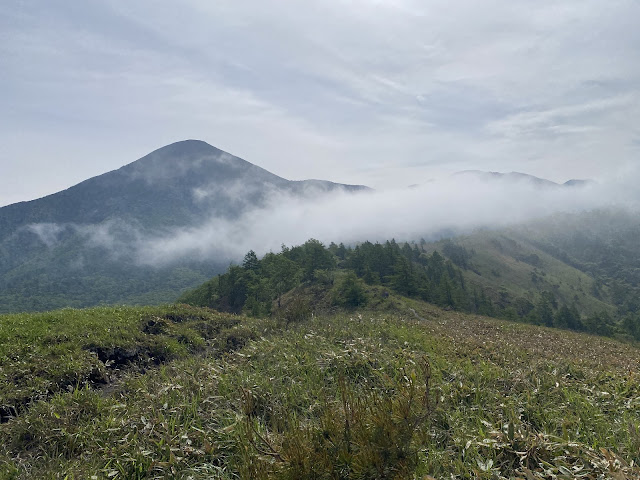
Yashigamineseihou (West Peak, Mt. Yashigamine)


Yashigamine Touhou (East Peak)


Cherry blossoms, still!


Suzuran Pass
(There are restrooms here.)
From here the hike gets more serious


Trailhead at Suzuran Pass


There is a lot of this on the way up.
Actually, it's pretty clear to anyone who has seen Tateshina from a distance that it must be like this.
There are no trees anywhere near the top.


I walked through those ski areas below.  The Lake is on the right side of the picture.


The pin on top.
2,530 meters


The Tateshina Sancho Hutte
The t-shirt I bought has a marten on it.  I think I might have actually seen a marten on this day.  Some small animal scurried across my path too quickly for me to identify it.


Coming down from the top is pretty steep and rocky.
The first time I climbed here was in the snow.


About a half hour ~ one hour below the top is this place, the Tateshina Sanso.
It has really good swag, too, but I've never bought anything here.
I saw a couple that were really at a loss for which t-shirt to buy because there were too many to choose from.


After the Tateshina Sanso, the trail is a dry creekbed of scree.


Looking west.  The lake is below.
Mt. Kuruma is a wonderful mountain.  
In the distance you can see the Northern Alps.


After leaving the scree, the trail becomes gentle again.


The Takiyu River


I came out of the woods here and walked along the paved road back to the Suzuran Pass where I re-traced my steps back down to the lake.
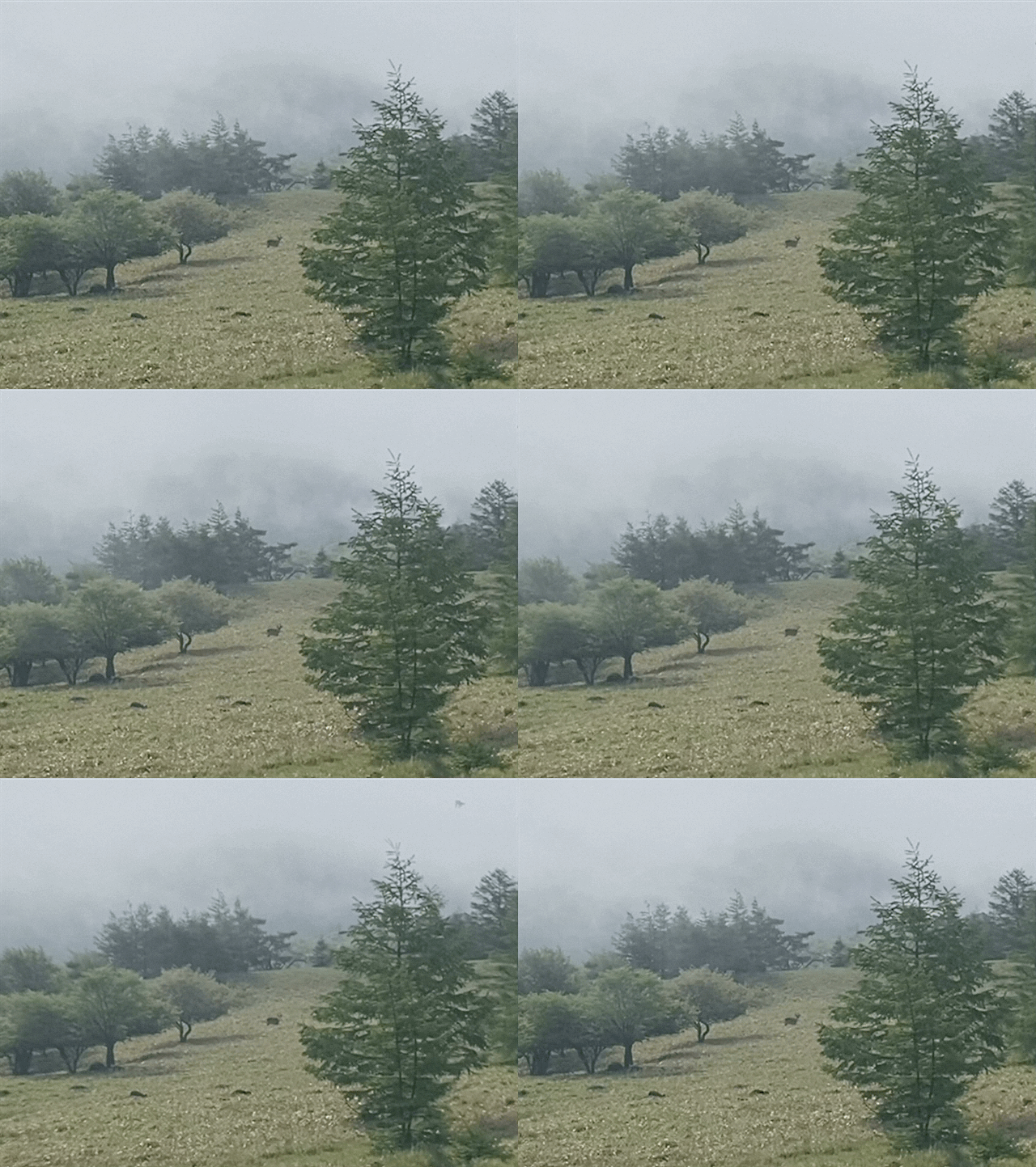


I wistfully took this picture.  My initial plan had been for an overnighter.  I wanted to climb Amigisa, Amida, Akadake and Gongen.  Rain in the forecast thwarted that plan, though.😰


This guy has got game.
I would love to have taken a close-up shot of this couple because their picnic lunch was magazine-cover-level classy.  They had a folding table with linen, real silverware, china, glass goblets . . . with--what would be on a clear day--a second-to-none view of Mt. Fuji.
The license plate shows they are from Tokyo, so this took some planning. 
Hats off, anonymous guy
.
Gals, find you a guy that treats you like this guy treats his gal.


Back to the lake.


Well, cavepeeps.  That's all for today.
I enjoyed that hike a lot.

If you want to see more of the area, check out Mt. Kuruma in snow

Make sure you subscribe.

Have a good one.

Caveman out.


Caveman conquers Tanigawadake in Gunma.


. . . about Mt. Tanigawa
This is one of the 100 Famous Mountains of Japan.  It's not that high at 1,977 meters but it is rugged and great caution must be taken depending on the trail and the season you choose.  There is a requirement to request permission of the local authorities ten days in advance of using certain trails in winter.
There is a ski area not so far from the top so there is a ropeway that can bring you a significant portion of the way up.  There are trails that interweave with the various ski lifts and trails. 

There are breathtaking views when the weather is right.

Area:

Location:

Map:  Gunma.   This link is to a printable topo map.

***If you want a link to the latest Yama to Kogen map, comment and I'll get you a link. 

Starting and stopping point: 

(Start)  Tanigawa Ropeway Parking Lot

(Finish)  Tanigawadake Tenjin Daira

Peaks bagged: Tanigawadake (Tomanomimi and Okinomimi) 谷川岳(トマの耳とオキノ耳) ~ Kumaanazawanoto (熊穴沢ノ頭) ~ Tenjin (天神山) ~ Takakura (高倉山)

(First-time) peaks #971〜975 

100 Famous Mountain #45, Tanigawadake


Getting there/getting around:  

I drove.  There is a very large parking garage at the Doai Ropeway Station.   ¥500.  

Culmina has great information on getting there by public transportation.  I just discovered that blog.  I think it should go onto my list of links that I like. 


Fun facts: 
1.  There are long shinkansen and highway tunnels underneath these mountains.  The Joetsu Shinkansen Line runs under Tanigawa via the Daishimizu Tunnel.  Until the Seikan Tunnel connecting Honshu and Hokkaido was built, this was the longest train tunnel in the world.  Now it's #2.
2.  Nearby Doai Train Station is the deepest one in Japan.  Tell your train otaku friend that and they'll get all excited.  After you finish reading my blog, take a look at this article on Japan's #1 Mole Station.

Helpful Info

Weather Information: 


Do note that the weather on Tanigawadake is notorious for changing quickly.  Be prepared for rain.  Be prepared to be stuck overnight in a shelter.

Time and distance

Total Time:  5:40 Break time: :03  Distance:  10.5 km
Elevation:  Lowest: 733 m  Highest: 1,977 m Total Ascent:  1,697 m Total Descent: 1,120 m

Technical considerations/difficulty:  

This is a steep hike.  There are a lot of boulders where you need to climb hand over hand and a lot of chains on steep rock faces.  It's fun!  But treacherously slippery when wet.  As I said, the weather can (and did on my day) turn quickly and you are well advised to be prepared.  There are two emergency shelters up there.  You should note their locations before you go.

Most people take advantage of the ropeway (both ways).  That makes for about a 6 km trek.  That's not too hard, (but not too easy either.)  I had planned to eschew the ropeway and hike up from the ropeway station at the bottom and then back down to it.  That would be about a 13 km trip.  The turn the weather took prompted me to change my plan and ride the ropeway down.  I really wouldn't want to spend that much time climbing down wet boulders.  

Annoyingly, I found what should have been the least dangerous part of the hike to be the portion where I had troubles.   The first half to three quarters of my hike was in the areas with a lot of boulders.  Then I got to the Tenjin Ridge and a few ski trails.  One would think that hiking on the ski trails would be less prone to calamity than the rocky areas.  Not so.  By then the ground was so saturated with water that the surface I was stepping on would periodically just give way under me.  I slipped and fell on my butt six times in the course of about an hour.  Thankfully, I just fell in the mud and the only thing I hurt was my pride.

Facilities:  


Tanigawadake Katakoya Lodge  (You need reservations to stay there during the hiking season.  Even though it was closed for business the other day, the door was open.  According to the Montbell site, the "rest hut" can be used all year round.  No water.  Restrooms only open during the season.)


No public restrooms on the trail . . . and not a lot of privacy.  It's hard to find a grove of trees to disappear into!


Thoughts/observations/recommendations:  

Do it.  If you can get there, do it.

My only regret is how the weather turned out.  This is yet another in a long list of supposedly beautiful mountains I have climbed that I have not actually seen.  I have to take other people's word for it that the views are great.


google eart


Here are some pictures.

The day started out beautifully.

This is the ropeway station.  It's also the parking garage.


About 5 minutes up the street from the ropeway station is the trailhead.


Still gorgeous!


There are a lot of chains.  It's fun.


Hmmmm...  A few clouds.


Where'd the mountain top go?


More chains


. . .  and still more


This will be the last picture of chains.  You can be assured this wasn't the last time I encountered chains on the trail, though.


I think the height of this sign tells you something about how much snow this area gets.


The first peak to be encountered is Tanigawa's Tomanomimi.


The peak on Tanigawa that "counts" as the 100 Famous Mountain is Okinomimi.


Emergency Hut


The next few pictures are around the chairlift by the peak called Tenjinsan.


Like a kid whose attention is drawn to a shiny object, I started down the trail next to the sign.


It was a wrong turn, though!  I got about 10 minutes down the trail before I realized my mistake.  Good thing it wasn't further.  That trail was not pleasant.  Very steep and very loose topsoil.  Slippery.


The trail proper is on the ski slope.  The only thing to worry about there is bears.


Bears, and mud.  

The muddy grass gave way under my feet and I ended up falling on my jabaffa six times.  (Has anyone else ever heard that word, jabaffa?  It was my dad's preferred euphemism for a particular body part.  My siblings and I were wondering what language it comes from, if indeed it is a real word.)


Time for the ropeway.  (¥1,800 one way.  ¥3,500 roundtrip)

I can't wait for the spectacular view!

The spectacular view:


Well, cavekids.  That's all for today.

Make sure you subscribe.  Tell your friends.
Buy me a coffee.  I'll tell you a secret about that.  
I put the coffee fund towards boots, equipment and gas.