
唐沢の滝 Karasawa Falls

What's up, cavekids?
This is a report on Mt. Ogawa which straddles Hokuto-shi in Yamanashi and Kawakami in Nagano.
It took me three trips to the area to bag this peak but I finally did it.
Area:
Location:
Map: ***The Caveman is giving up on posting links to Yama to Kogen maps. They go out of date after a year or so and the links die. If you want a link to their latest map, comment and I'll get you a link.
Starting and stopping point:
Peaks bagged: Ogawa (小川山)
(First-time) peaks # 927
Getting there/getting around:
The nearest train station (Shinano-Kawakami) is about a 25 minute taxi ride away.
The Kinpusan Sanso has parking. Passenger cars cost ¥500/day.
Helpful Info
Weather Information:
Time and distance
Total Time: 4:29 Break time: :26 Distance: 7.2km
Elevation: Lowest: 1,564m Highest: 2,418m Total Ascent: 934m Total Descent: 934m
Technical considerations/difficulty:
There are a lot of ropes, chains and ladders on these trails. It is very slow-going as the trail is sometimes hard to find and there are many areas where the boulders make it more of a climb than a hike. Often it takes some probing and backtracking to find the trail.
Although the trail is marked with red paint for the most part, some stretches of the trail have no markings. In others, the paint is faded. It is particularly difficult to see when it is overcast.
I often am amazed how closely the GPS on my smartphone tracks the trail on the ground. Usually, if I move just 2-3 meters away from the trail, I can see the deviation on the smartphone. That is not true in this area. Often the trail on the ground little resembles the map on the iphone.
The footing around the Karasawa Falls is a bit nerve-racking. The trail through that area goes through the stream for quite a ways. That necessitates great caution as the surface rocks are very loose and there is often nothing to hold onto.
Facilities:
The Sanso has a camping area with water. There is an onsen as well as coin showers. There is nothing on the trail although water can be gotten at the falls if you go that way.
Thoughts/observations/recommendations:
Mt. Ogawa is something of a mecca for rock climbers. From the pictures below, you can easily see why. It's not ideal for hiking as you can see from my comments on the technical considerations. I'm glad I could bag this peak but probably wouldn't put it as a high priority if I lived far away. The "view" from the top was non-existent. I also had expected to see Mt. Mizugaki--a very cool-looking mountain--because it is quite close but did not see it. I could see it from the road on the way but not from the trail.
Let's look at some pictures.
The first one is my first attempt a few weeks ago. I had planned to do half of the loop and continue on to Mt. Ogawa (小川山) that day but the trail conditions and the rain just made it impossible for me to do it in the time I had available.

After that day, I tried going early one morning on the last day of the Obon holiday. It had been raining a lot but there was a 4-hour window of clear weather forecast one morning. I left home 0 dark thirty and got there about 5:30.
The weatherman was wrong. It was not clear. It was raining. ☔ I gave up and went home.😭
Then I got back the other day and went straight up and back.

All-told, bagging this one peak took about 7.5 hours of driving and 7 hours of hiking. Not to mention gas, parking, etc.
Here are some more pictures. The first four are from the rainy day attempt.


The next are from the clearer day I went.


The Kinpusan Sanso (Mt. Kinpu Mountain Lodge)

I haven't the foggiest idea. Do you?

75 degrees. Nice.


Kinpu is really cool. It's one of the 100 Famous Mountains of Japan. Check out a post on it.
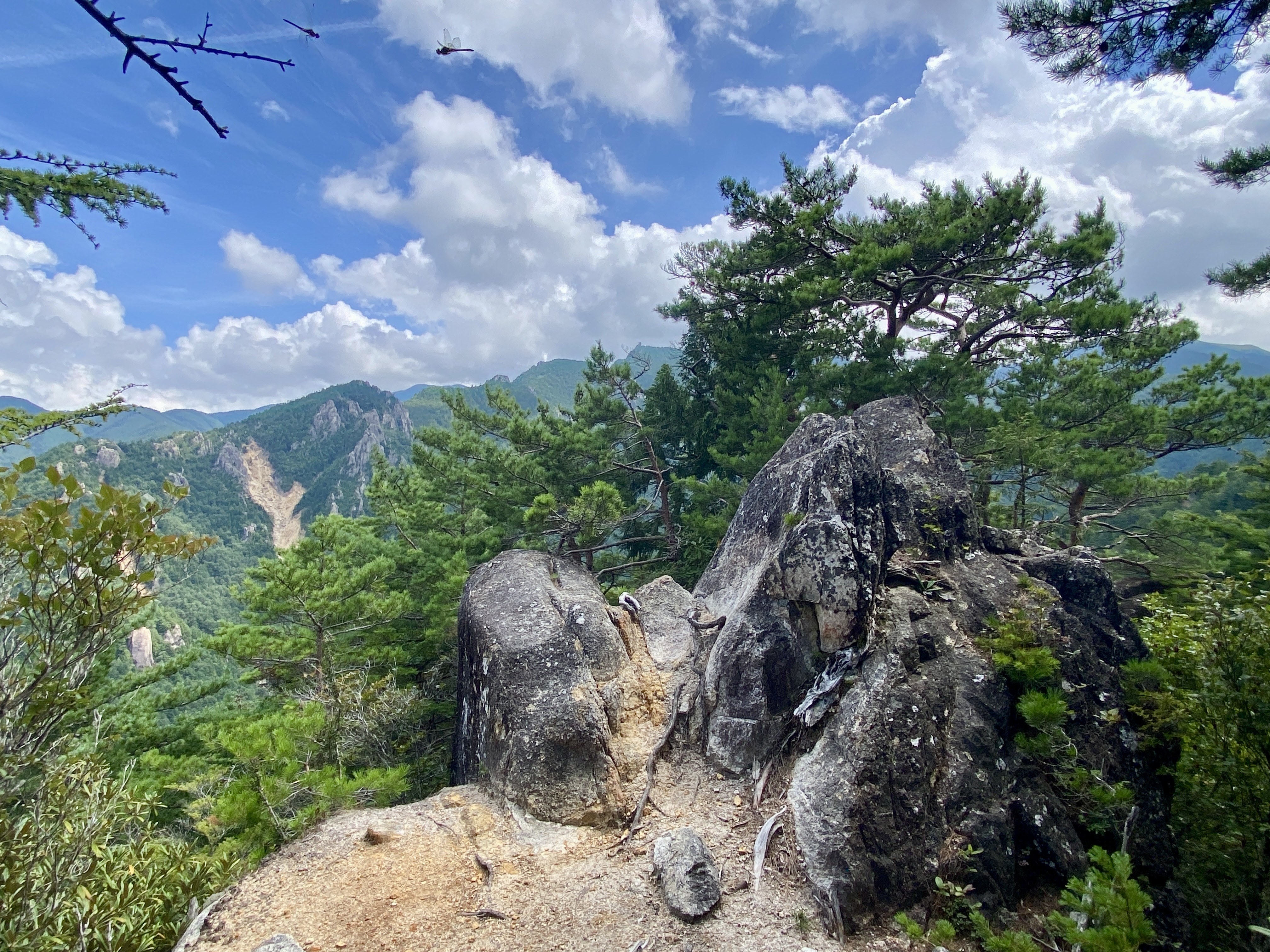
There are so many beautiful spots here. None catch all the beauty, though.
Do you see the photobomber?
There are a lot of ladders and ropes.

. . . and a lot of rocks.

I had to heave myself up over lots of boulders to get to this spot, only to find it wasn't on the trail. Just beyond this point, it dropped off precipitously. I had to go back down and find the way around.

Climbing this mountain was much slower than coming back down. Not just because of the difference between ascending and descending but also because I knew where to go on the way back.


Ever feel like nature is giving you its opinion of you--and it's not good?


Another view of Kinpu

The top of Ogawa
I'll admit it. It was a bit of a let-down. There's no view.
The post notes that it is one of Yamanashi Prefectures 100 Famous Mountains. I found myself wondering why. 🤦♂️

The closest thing to a view from the top was to go to a pointy boulder nearby and hold my iphone up as high as I could while standing on my tippy-toes.
Mt. Mizugaki is somewhere down there.


Oh, yeah. Just what the doctor ordered.

Not only is Tenguyama on the bucketlist. Add Otokoyama to that, too.

Interested in this area?
Check out this post on Mt. Mizugaki. It's one of my favorite mountains.
That's it for today.
Caveman out.

Pat, high five for your perseverance with Ogawa-yama! While the view is hemmed in on the approach, it opens up as you head south, offering a fine view of Mizugaki-san and Kinpu-san. In the spring, the trail is also lined with azaleas.
ReplyDeleteHi David, It is a pretty area, isn't it? When you say "head south", do you mean that you went to Kinpusan from Ogawa? That would be quite a walk. I probably will do that someday. I saw one or two reports of hikes from Shinsu Pass in the west to Ogawa, then down to Mizugaki and back up to the pass in a loop. That's insane. Haha. Have a good one.
DeleteI headed south, turned right at the trail branch and spent a night at the Fujimidaira campsite. The next day caught the bus back to Nirasaki.
ReplyDelete