

Yo!
What is up, cavedwellers? Mrs. Caveman is the best. The very best. She took me to Hokkaido for my birthday and let me climb two of the 100 Famous Mountains. This report is about the first of the two, Mt. Asahidake in the Taisetsuzan National Park.
Area:Location: Daisetsuzan National Park, Center of Hokkaido
Map: Online, printable topo map in Japanese
***The Caveman is giving up on posting links to Yamatokogen maps. They go out of date and the links die. If you want a map, comment and I'll get you a current link.
Starting and stopping point: Asahidake Ropeway Station
Peaks bagged: Tomadake Antaromadake Hippudake Nokogiridake Hokuchindake Nakadake Mamiyadake Araidake Asahidake
(First-time) peaks # 908~916
(First-time) 💯 Famous Mountain peak # 35, Asahidake
Getting there/getting around:
There is a bus from Asahikawa Station. It is run by Asahikawa Denkikidou and takes about 1 hour and 40 minutes. Contact them for clearer information. The schedule seems to change frequently.
Asahikawa Station 1F Bus Information Center, Tsuruha Bldg., 9-2-17 Miyashita-dori, Asahikawa City, 070-0030 TEL 0166-23-3355
I got there by car. There is parking at the ropeway and just below the ropeway, there are several hotels and onsens.
Helpful Info
Weather Information:
Mountain-forecast.com Asahi
Tenki to Kurasa for Asahi (Japanese)
Time and distance*
Total Time: 7:55 Break time: :21 Distance: 18.58km
Elevation: Lowest: 1,597 m Highest: 2,291 m Total Ascent: 1,499 m Total Descent: 1,499 m
*I'm a glutton for punishment. Most people take one of the shorter routes of about 6 km or 11 kmand finish in about half a day.
Technical considerations/difficulty:
For the most part, the trail is very well marked. In clear weather, it would be very difficult to get lost. If the weather turns though, visibility gets very bad and thankfully there are guide ropes along the sides of the trail where it is most needed.
Most hikers do a straight shot up to the top of Asahidake and back to the ropeway with a short excursion on the loop around Lake Sagatami. Lake Sagatami and its environs are a walk in the park. Non-hiking daytrippers go that far. The trail beyond Sagatami to the summit is steep and has a lot of boulders. Mostly it is loose volcanic sand and gravel. The traction reminded me of the Sunabashiri Trail on Mt. Fuji. It can make for a slog going up and for the danger of slipping going down.
I took a much longer route around Tomakkoshi, Hippu, etc. That trail was not hard to follow. It wasn't quite as well marked or trodden as the other ones but there were only two areas worthy of a safety note. First, the ridge between Antaromadake and Hippudake is vertigo inducing. The "trail" is just off the ridge on the right side. You are walking on gravel and the ground slopes down to the right. If you were to slip on that gravel, nothing would stop you. Nothing at all. Indeed, to the left of the ridge is another ridge leading to peak. There is a sign there noting that that ridge is not considered a trail anymore since there was a fatality in 2019.
The other point worth noting is a stretch just below Nokogiri that has a lot of Japanese scrub pine/Siberian dwarf pine (ハイマツ). It obscurs the trail and you have to trudge to get through it. I wore shorts and didn't come out too badly but a note on my paper map advises hikers to wear tights or pants.
Facilities:
The ropeway runs every 15 minutes from 6:00~5:30. There is a store there that closes at 5:00. There is curry, too.
On the mountain, there is a sturdy emergency hut just by Lake Sagatami. It's only for emergencies. There are rungs built into the side of the wall so you can climb up to the window on the second floor for access in winter. The door works in the summer.
There is a booth by the shelter for you to utilize your own portable toilet.
On the far side of the peak is a small camping area with another of those portable toilet booths. That camping area seems to be free. It is un-manned and doesn't look that comfortable. It's very rocky. It's called the Uraasahiyaeishiteichi. (野営指定地)
There is a website about several of these campsites in the area. Some sites have prices listed. Uraasahiyaeishiteichi doesn't, so I assume it's free.
Thoughts/observations/recommendations:
Do it. If you can get here, do it. This isn't as high as the big mountains on Honshu, but they are rugged and beautiful. Be careful about timing. Hokkaido gets a lot more snow than many areas and it lasts longer. I was able to make a snowball on August 1. ❄ 😼 Even in June and July, snow can be a major factor.
Do bring some extra clothes. I usually hike in shorts and a t-shirt 3/4s of the year. I actually had to put on a windbreaker when I was on a ridge and the wind started blowing the other day.
Let's get some visuals going.
(Google Earth obviously took this picture when there was still a bit of snow around.....It was mostly green when I was there.)

The animated feature is here!
This is a 19-minute long video I took on the hike. I don't know how many people have the stamina to watch all of it. I have watched it several times, but I was the director 👨🏻🎨, star☆, best boy👦, gaffer and cameraman🎥 so I am biased. I doubt I could make myself interested in someone else's mountain video of this length!
Let's look at some pictures.

The ropeway ticket window. It runs every 15 minutes from 6:30 am until 5:30 pm.

Upon alighting the gondola, I was so pumped for the hike, I skipped the gift shop. Later I'd come to wish that I had dropped by then because I found it closed when I descended. I'd assumed it would be open until the last ropeway trip. d'oh! I wasn't able to buy the swag I'd hoped to.

A lot of daytrippers just walk around the several ponds just beyond the ropeway. You could kill an hour or two there, I guess.


The smoke rising from below Mt. Asahidake is from Jigokudani--"Hell Valley."


This is where I definitively decided to head up to that ridge.⛰

That turn almost marked the point where I stopped seeing so many people. I didn't see more than a handful of people for the rest of the day.


📸Photobombed!💣


The Piukenai River
My paper map has a warning to watch out for brown bears near here.


This spot is called Tomakkoshi. It's on the way to Mt. Toma.


Japan has so many flowers. Mountains have so many varieties. If I posted all of the various kinds, this blog would be really long.


After Mt. Toma, I started to get near Mt. Antaroma. It was in this area that I really started to be glad I answered the call of that ridge. I was surprised at what I found.

Here I was getting close to Mt. Antaroma. I was surprised at how beautiful it got--and a little scared by the sheer drop-offs.


The next bump is Mt. Pippu. I would next go there along the right side of the ridge.
Pippu is an Ainu word that means a place with a lot of marshes or stones.


Before heading toward Mt. Pippu, I took a few pictures because it was kind of breathtaking.
I also half expected to see the coyote and the roadrunner.


The next stops after Mt. Hippu were Nokogiri and Hokuchin.


No sign

Mt. Hokuchin


This area below is 御鉢平 Ohachidaira. That means something like "Honorable Bowl Flats". Entering the area is prohibited because the fumes are poisonous. I found the Ohachidaira really enchanting. I couldn't look away.

Nakadake, Mt. Naka ("Middle/Center Peak")

Mt. Mamiya

Mt. Arai appears in my hiking app but not on my paper map. It doesn't even get a sign.

About to make the last push. Unfortunately, the sun was soon to go away for good.

The rope is useful in two ways. First, the sand is slippery and it does help you ascend. Second, it provides a good guide in poor visibility.

I almost forgot to take a picture on the top. The pin is behind me.
There was nobody there by the time I got there. I didn't see anyone for probably the last two hours of the hike.


Heading down.
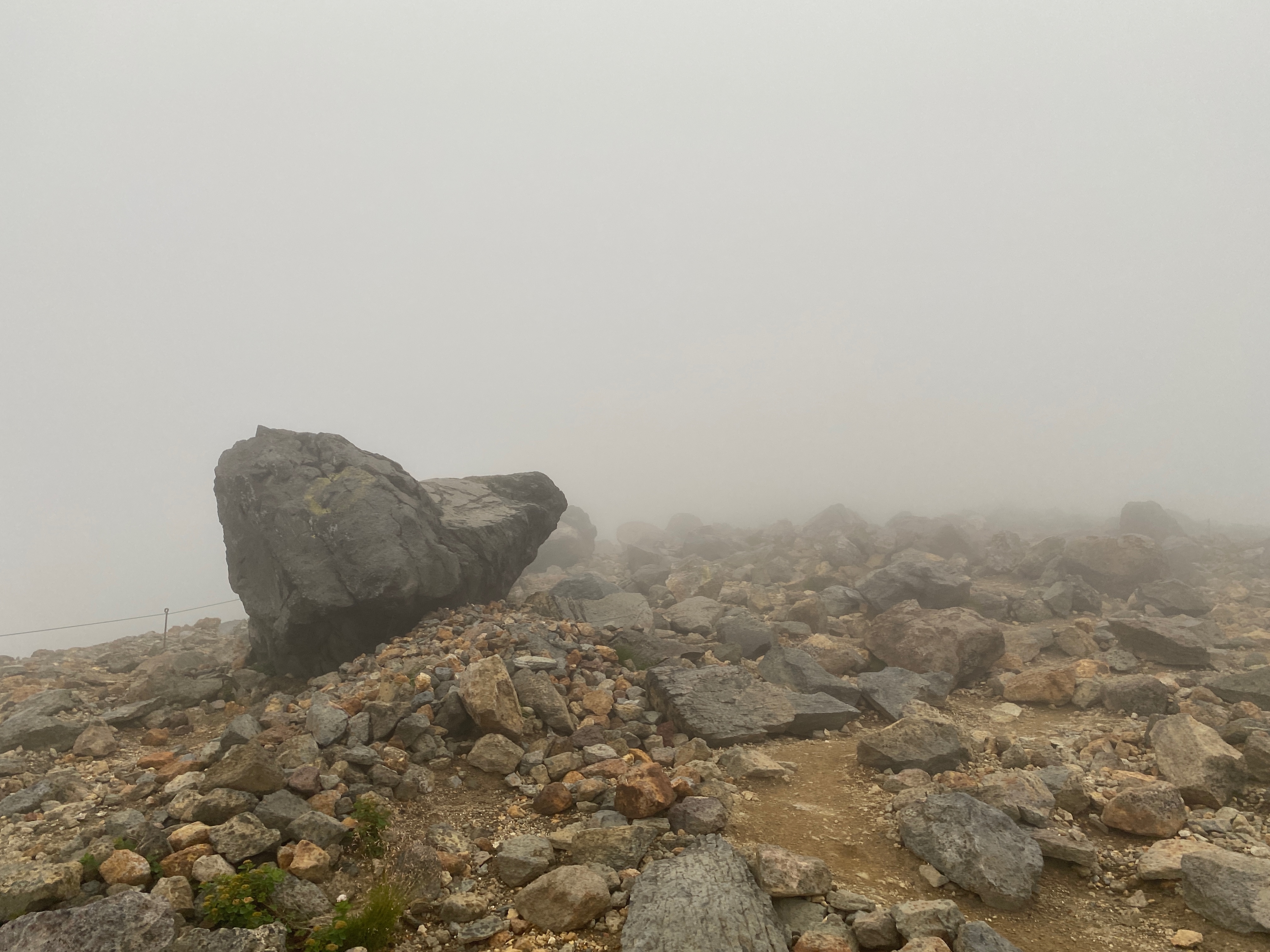
Couldn't see much. The guide rope was helpful.
The refuge hut has a window on the second floor that you can enter through during the snowy season. There are even rungs built into the outside wall so you can climb up to it.
.jpeg)


I traced my route in blue.


The very last push

That's it. I hope you enjoyed it. I know I did. Wow. What a trip.
Thanks, Mrs. Caveman. You are the best.
Check out the other hike from Hokkaido
Want to check out another of the 100 Famous Mountains? Try this one.

No comments:
Post a Comment
Have a comment? Please, keep it clean.