Not too high, but a bit spicy. Mt. Kuwagara and Mt. Ogeta in Gunma.


What's up, cavecrawlers?

Another day, another mountain (or two).

Location:  Tomioka City, Gunma

Starting and stopping point:  Parking Spot

Peaks bagged: Kuwagaradake (鍬柄岳) Ogeta (大桁山)

(First-time) peaks #840 and #841

Getting there/getting around:  

I drove.  There are a few different parking areas.  Getting to the parking lot was a bit nerve-racking.  It meant driving several km on a very narrow road that is strewn with fallen leaves and branches.  The road was so narrow that I don't know what you would do if you encountered a car coming the other way.

The nearest train station is Sendaira (千平) on the Joshin Dentetsu Line which runs between Shimonita and Takasaki.

Map:  Yama to Kogen Chizu #21 西上州 妙義山・荒船山

Weather Information: Kuwagara's Weather

Total Time: 2:23  Break time: 3  Distance:  7.1km

Elevation:  Lowest:  334m Highest: 831m Total Ascent: 683m  Total Descent: 673m

Technical considerations/difficulty:  The hike to Ogeta is fairly straightforward.  There are some steep parts but no chains or ladders to speak of.  The detour up to Kuwagara on the way is another story.  That is a large boulder and has a loooong steep section with chains.  This part had the best (only, really) views but isn't for the faint of heart.  It was a bit spicy.

Facilities:  There is one public restroom by one of the parking lots I passed on the way down.  There's nothing on the trail.

Thoughts/observations/recommendations:  It was fun.  You should do it.  I wouldn't say it should be at the top of your bucketlist, but if you're starting to scrape the barrel for ideas you might go here.


Today's listening:  

Bible in a Year

Winston Churchill on A Short History Of


Since I had limited time for this hike, I bopped over into Gunma and hiked for just about 2.5 hours.  

I was only a few miles from Mt. Myogi but didn't get to see it clearly.  😢

Here's a map and then some pictures.


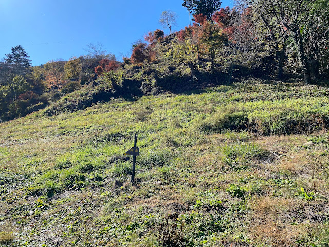
This is visible from the parking lot.

This is the access road.  The picture makes it look better than it is.


Not to far up the trail is the trail junction with a little spur off to Kuwagaradake.  From there it is only about 10 minutes to get to the top of the rock.

This is the beginning of the chains.  You need the chain all the way to the top.


I usually don't like to leave my pack anywhere because I'm paranoid of being separated from my stuff in case of emergency.  Seeing how steep the wall was, though, I decided to leave it for this short excursion.
I'm glad I did.  It would have been too unwieldly.


Looking east toward Gunma and Tochigi beyond.


The top?


Maybe that's the top?


Maybe that is the tippy-top ahead.  No thanks, though.  Mrs. Caveman is too young to be a widow.  The picture doesn't really capture it but there is nothing below to stop you if for some reason you were to fall.  If I were able to hook onto the chain or if there was someone with me I would do it but not alone.


Below the rock, back on the hiking trail.


We interrupt our regularly-scheduled programming for this important announcement.


Nearing the top of Ogeta

The top of Ogeta.  Mostly obstructed views.


That's Mt. Myogi through the trees.  I wish it was visible.  It's a cool looking collection of rocks.


There's still some fall foliage around.


Shakuson Temple


Mrs. Caveman and I took a walk yesterday.

Click on the link if you want to see pictures:

Shakuson Temple, Komoro City

Google Maps

Mts. Maru, Makiyose and that other one with the long name. Dayhike between Uenohara and Hinohara.


S'up, peeps?

I had some business to attend to on a Saturday night in Tokyo.  Since I was heading down there and had some free time during the day, I decided to drop by some of my old stomping grounds.  

My initial plan for the day was to retrace my footsteps from a hike I made a few years ago up to Mt. Mito.  Saihara to Mito, Sept, 2019  Mt. Mito is a very nice mountain.  Unfortunately, I wasn't able to fit it into this day's schedule and turned back two peaks before reaching there.  

Nevertheless, it was a bit nostalgic to hike in that area.  The weather in the morning was gorgeous.  Unfortunately, it got cloudy by the time I reached the ridgeline and I was denied some of the better views.  That said, it was still a great day.


Location:  Around Mt. Makiyose in Uenohara, Yamanashi and Hinohara, Tokyo

Starting and stopping point:  Uenohara-shi, Saihara

Peaks bagged: Maruyama ~ Makiyose ~ Hachizasusawanoto

(First-time) peaks #839 (This was my 8th time to Makiyose.  Maruyama is the only new one for this day.)

Getting there/getting around:  My car.   There are bus stops nearby that can be reached after about a 50 minute ride from Uenohara Station on the Chuo Line.  That bus only runs a few times a day.

The most popular route from Uenohara is probably the one from the Tsuru Pass (鶴峠).  This trailhead is to the west of Mt. Mito is much shorter than the route I took.  The rise in elevation is also only about half of what my plan was.  The Tsuru Pass can be reached by bus from Uenohara.  That takes about 1 hour and 20 minutes.  I passed that trailhead/bus stop on my way to my trailhead.  I was really surprised how many people were there!  The one time I took that bus, I was the only passenger.

Map: 山と高原地図 奥多摩 御岳山・大岳山 24 Okutama Area Yamatokogen Map

Weather Information: Weather for Mt. Makiyose (Japanese)

Total Time:  3:30 Break time: :16  Distance:  9.6km

Elevation:  Lowest: 549m  Highest: 1,371m  Total Ascent: 1,028m  Total Descent: 1,028m

Technical considerations/difficulty:  No ropes, chains or ladders.  Steep.  If you aren't good at finding the trail, you could get lost.

Facilities:  Nothing on the trail.  

Thoughts/observations/recommendations:  The Sasa One (Sasa Ridge) runs from Mt. Jinba to Mt. Mito.  I have climbed up to it and along it more times than I can count.  😄 Hiking up to this ridgeline from the Yamanashi side is quite secluded.  The routes to this ridge and these mountains from the Tokyo side are more crowded because of their accessibility.  


Today's listening: Bible in a Year


Here are some pictures.


Coming from Nagano down into Yamanashi, I got some nice views on the way.


This is from "Mt." Maru.  It's not very high but is still called a mountain by my app.


I love the variety of flora you can see in Japan.  On the same day you can see fall foliage, you can see flowers blooming.  In the winter, you can still see vegetables being grown under snow cover.


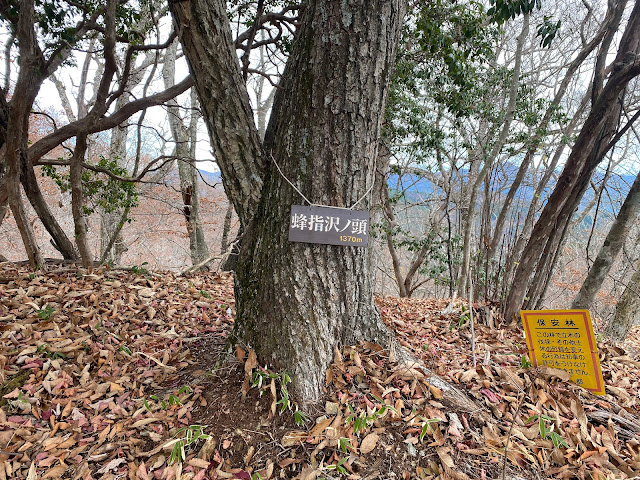
The top of Mt. Makiyose (槇寄山)


This is as far as I went this day.  I always forget the name of this peak.  It's Hachizasusawanoto.  "Bee-Aim-Stream-Head"


I dropped by the Seoto no Yu Onsen on my way through Akiruno.  I was amazed at how crowded it was.  This line was to get into the baths.

Look carefully at the sign on the left.  Tattoos are taboo here.


That's all for today.  Have a good one!  Hit the subscribe button if you have not done that yet.

Caveman, out.


HeARTworks: Share the Joy!


This is from my very talented cavesister, Patsy!

HeARTworks: Share the Joy!: ‘Master, you gave me five talents. See, I have made five more.’ His master said to him, 'Well done, my good and faithful servant. Since ...

Large thanks

 A big shout out and thank you Mrs. Caveman's sisters, Patsty and Meldy, for stepping up and buying me some equipment for the winter hiking season!  That's pretty nice of them, considering I did club their sister over the head and drag her back to my cave all those years ago.


I like this jacket so much that when I went hiking yesterday, I couldn't bring myself to actually put it on.  Even though it was getting a bit windy and cold, I didn't want to put it on because I was all sweaty.


I'm not one for using poles most of the time--but I think when snowshoeing the poles they bought me will come in handy!


At this point of the post, I was planning on berating the rest of you readers as deadbeats for not supporting the cause like Patsy and Meldy did.  (They really are awesome.  We should all strive to be so awesome.  I mean, really strive.)

Then I realized that the button I used to have for "Buying me a coffee" went missing!  

As a great philosopher once said, "d'oh!"

Don't I feel dumb.  I thought nobody cared about me because I hadn't had a donation in two years but I was wrong! 

It's not that you all don't love me.  It's just that I'm incompetent!

Anyway, I'm sure you're all relieved at this chance to make up for lost time by dropping some coppers into my coffer.  While you're at it, tell your friends about this blog . . . and the button.

(Just kidding.  You really don't have to put anything in, but in case you want to, here's the button.) 

Have a good one.  It's Thanksgiving in the US this week.  I hope and pray you are all able to identify many things to be grateful for--and that you all know Who is really the source of all these things.