I finally got my boots on! Arafune, the floating carrier.


Greetings cave dwellers.

I've been living in Nagano for a few weeks now and have really been loving it but between the move and starting a new job, I haven't had much time to spend in the mountains beyond a few trail runs.  I finally got out about a week ago to a really nice mountain called Arafune.

The name Arafune (荒船) has the meaning of boat in it.  The flat shape of the mountain seems to make it look like an aircraft carrier navigating the rough "seas" of the clouds below it.


Cool, huh?


Location:  Mt. Arafune straddles the boundary between Nagano and Gunma.

Starting and stopping point:  Arafune Fudoson Parking Lot

Peaks bagged: Mitake (御岳) Kabutoiwa (兜岩) Tomoiwa (艫岩) Kaminashi (神無) Kyozuka (経塚) 

Getting there/getting around:  There is free parking.  I don't think there's any public transportation in the area.

Map:  Yama to Kogen Chizu #21 西上州 妙義山・荒船山

Weather Information: Arafune weather

Total Time:   4:07  Break time:   :11 Distance:  11km

Elevation:  Lowest:  1,074m Highest:  1,423m Total Ascent: 970m  Total Descent: 970m

Technical considerations/difficulty:  I didn't find it that challenging but other people on the internet are saying it is difficult.  There are some steep parts, but nothing too hairy as I recall.  Maybe my impression is psychological.  I was just so happy to be in the mountains that it felt like I was walking on air.  There are a few spots where people can rock climb.  Candle Rock (Rosoku Iwa) is one spot.  I didn't do any of that, though.  The trail between the highest peak, Kyozuka, and the most scenic spot, Tomoiwa, is especially flat.

Facilities:  Moldy emergency hut at Tomoiwa.  A picnic bench or two there.

Thoughts/observations/recommendations:  There are good reasons this mountain is on the list of Japan's 200 famous mountains.  The boulder formations are really cool and there are some great views.  

I think the hunters in this area must be particularly bad marksmen.  I have never before seen so many live deer at one time!  I'm sure I saw more than 20 in the span of less than an hour.  Check out the pictures and video in the post.

Highly recommend this if you get some time in this area.


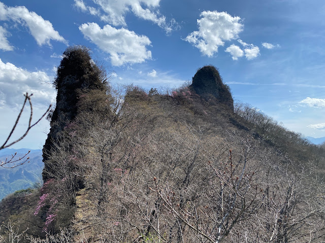
I'm sure this rock has a name but I can't remember it.


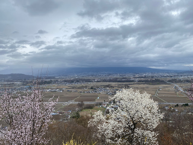
I came up from that valley.


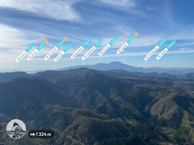
The biggest mountain near the middle of the picture is Mt. Asama, the volcano that erupted in 2019.  I can see it from my house.  

It must be climbed.  Soon.

These two surely have names, too.
I wonder if one of them is Shirley.


On the flat stretch from Kozuka to Tomoiwa, I kept running into deer.  I had to stop myself from stopping and taking pictures because I would never have made any progress if I'd continued doing that.


After passing all the deer, I came to Tomoiwa which has a great panoramic view.
BTW, Tomoiwa means "Stern" "Boulder."  Neat name.


Mts. Tateshina and Yokodake are both part of the 100 Famous Mountains.  I can see them from home, too.  I'm scheming about when to climb them now.


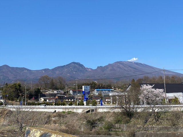
I took this from the street on my way home.  These hills are the ones on the eastern side of my route.


That's all for this post.

I got back from a camping trip last night and want to start working on that post.

Don't forget to subscribe and leave a comment.  Then again, it's ok if you don't.  I get enough endorphins from hiking.  I don't need to be an influencer.  🤓  Have a spectacular day.  Or not.  It's your choice.


We moved

Mrs. Caveman and I moved to Saku City in Nagano Prefecture this past week.  

The cherry blossoms are peaking.  The mountains around Yatsugatake, Mt. Tateshina and Mt. Asama are gorgeous.

The people are really nice, too!  I loved living in Tokyo all those years but these people are special.

I haven't had time for any blog-worthy hikes yet but thought I would like to share some of this beautiful scenery; particularly since the cherry blossoms are so beautiful right now.

I can't wait to get my boots on again.

Yatsugatake

Fun-fact.  Yatsugatake-produced milk is prohibitively expensive in Tokyo. 

Around Yatsugatake it is still prohibitively expensive.

Yatsugatake in April


My new school
Nokita High School


Various places


The Catholic Church in Saku.  The priest is a 91-year-old Franciscan.

Saku Catholic Church


Happy Easter!  He is risen.  He is risen indeed!

Saku Catholic Church inside

Heading toward my first "peak".  This is a little hill I ran up before my first day of work.
Priorities.


From Mt. Kokuzo


Another view of Yatsugatake.


Mt. Asama.  It erupted in 2019.  Can't go to the top because of the air now.


See you soon with a report, I hope!

Take care and Happy Easter!


Matsumoto City, Mt. Naka and Mt. Koubo Trailrun

Cherry Blossoms Matsumoto


Location: Mt. Koubo, Matsumoto-shi

Starting and stopping point:  Minami Matsumoto Station 〜 Matsumoto Station

Peaks bagged: Koubo  Naka 

Getting there/getting around:  The trailhead is about a 1.8 km walk from Minami Matsumoto Station or 3 km from Matsumoto.

Map:  I just used my iphone.  It's not really a mountain trail.

Total Time:  About 90 minutes. Break time:   About 30 minutes taking pictures.

Distance:  10.5 km.   About half of that was on pavement.

Elevation:  Lowest:   585m   Highest:  835   Total Ascent:  354m  Total Descent:  363m

Technical considerations/difficulty:  None

Facilities:  There is parking and a restroom on the way.

Thoughts/observations/recommendations: I was in Matsumoto for some training and wanted to get into the hills. This is a nice walk in the park for the locals.  It's not the type of place I'd set as a destination from far away but it was nice.  

I wanted to get to Mt. Naka and back to my hotel room early enough in the morning so that I could get cleaned up and go on to my training venue on time so I got on a train before 6 and ran instead of hiked.  It was a bit cold starting out as it was 1 degree Celsius and I was wearing just a t-shirt and shorts.  🥶  It was a great morning, though.  Beautiful skies and some of the sakura were peaking.


Here are some pictures.  


Google Earth Matsumoto Trail Run


Subscribe to see 👀 the next post first.

Come again!