. . . about Hakkaisan
Mt. Hakkai is located in Niigata Prefecture and is one of the 3 great mountains of the Echigo region. The other two being Mt. Echigokomagatake and Mt. Nakadake. Being near the coast of the Sea of Japan, the sea should be visible on a clear day.
It's one of Japan's 200 Famous Mountains.
Hakkai (八海山) literally translated is "Eight" "Sea" "Mountain." The mountain is considered sacred and there are even more than the usual number of shrines dotting the long string of peaks that comprise the mountain.
The ridgeline is very jagged and distinctly visible from a distance. The ridge is quite narrow and it is necessary to do a lot of climbing up and over huge boulders to traverse the ridge.
Mt. Hakkai is the water source for a famous brewery by the same name.
Area:
Location:
Map: ***If you want a link to the latest Yama to Kogen map, comment and I'll get you a link. This link is to a printable topo map of Mt. Hakkai.
Starting and stopping point:
Peaks bagged: I won't bother listing them. There were 10 altogether! My climbing app, YAMAP, names 6 of them.
(First-time) peaks # 1,041~1,047
Getting there/getting around:
I drove. That enabled me to get a nice, early start.
If you're coming from Tokyo, get the Joetsu Shinkansen to Echigo Yuzawa Station and then go on to Muikamachi Station on either the Joetsu Line or the Hokuhoku Line. From there, you can catch a bus to the Hakkai San Ropeway. It's about a 3-hour trip.
Helpful Info
Weather Information:
Time and distance
YAMAP's Estimate Time: 10:24 Distance: 18.6 km
The Caveman did it in Total Time: 8:18 Break time: :51 Distance: 18.9 km
Elevation: Lowest: 354 m Highest: 1,778 m Total Ascent: 1,712 m Total Descent: 1,712 m
Technical considerations/difficulty:
The best part of this hike is challenging and I would caution anyone with a paralyzing fear of heights not to bother. There is a tremendous number of sections that you need to climb with chains. Upper body strength is necessary. Some of those chained sections really are quite sheer with few footholds. The ridgeline at the top is razor-sharp in spots with steep, high drop-offs.
Shortening the hike to limit the physical exertion and level of risk is possible. Most people ride the ropeway to the top. (I didn't.) Hiking there added about 4 km (2.5 mi.) in distance and 800 m (.5 mi.) in elevation each way. Also, I assume some people turn back before the exciting part.

Here's a close-up of the spicy bit.

Facilities:
Of course, at the bottom, there is the ropeway. That's open basically from March to December, depending on the snow situation. The first ropeway is at 8, but hikers can board at 7 for an extra ¥500. There are restrooms there and a restaurant.
On the trail, there is one waterhole. There are a few shelters on the trail and two public toilets. (I didn't actually see them, but they are on the map.)
Here is the information on the ropeway.

Prices. It's not listed on this chart but according to the poster on the right, it seems like dogs can ride for ¥1,000. I'm not sure, though. I didn't notice this at the time and I didn't get enough of the poster into the picture.

(Along with all the regular stuff such as maps, headlamps, boots, feet, and brains, . . .) don't forget:
Gloves and a helmet.
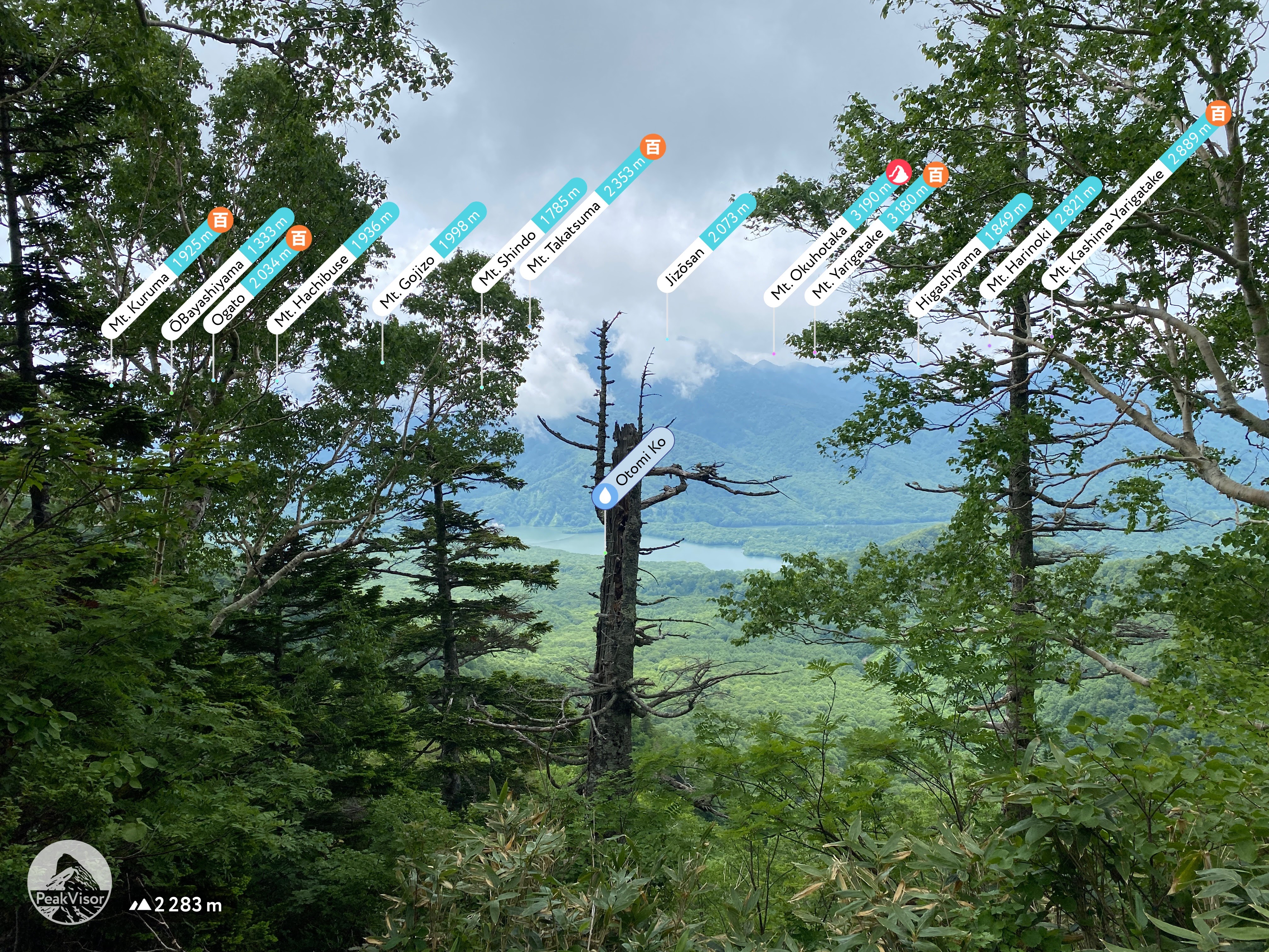
Let me subject you to one more map-type picture before getting onto the other pictures.

6:20, looking up at my destination.


The trailhead is just behind the ropeway.

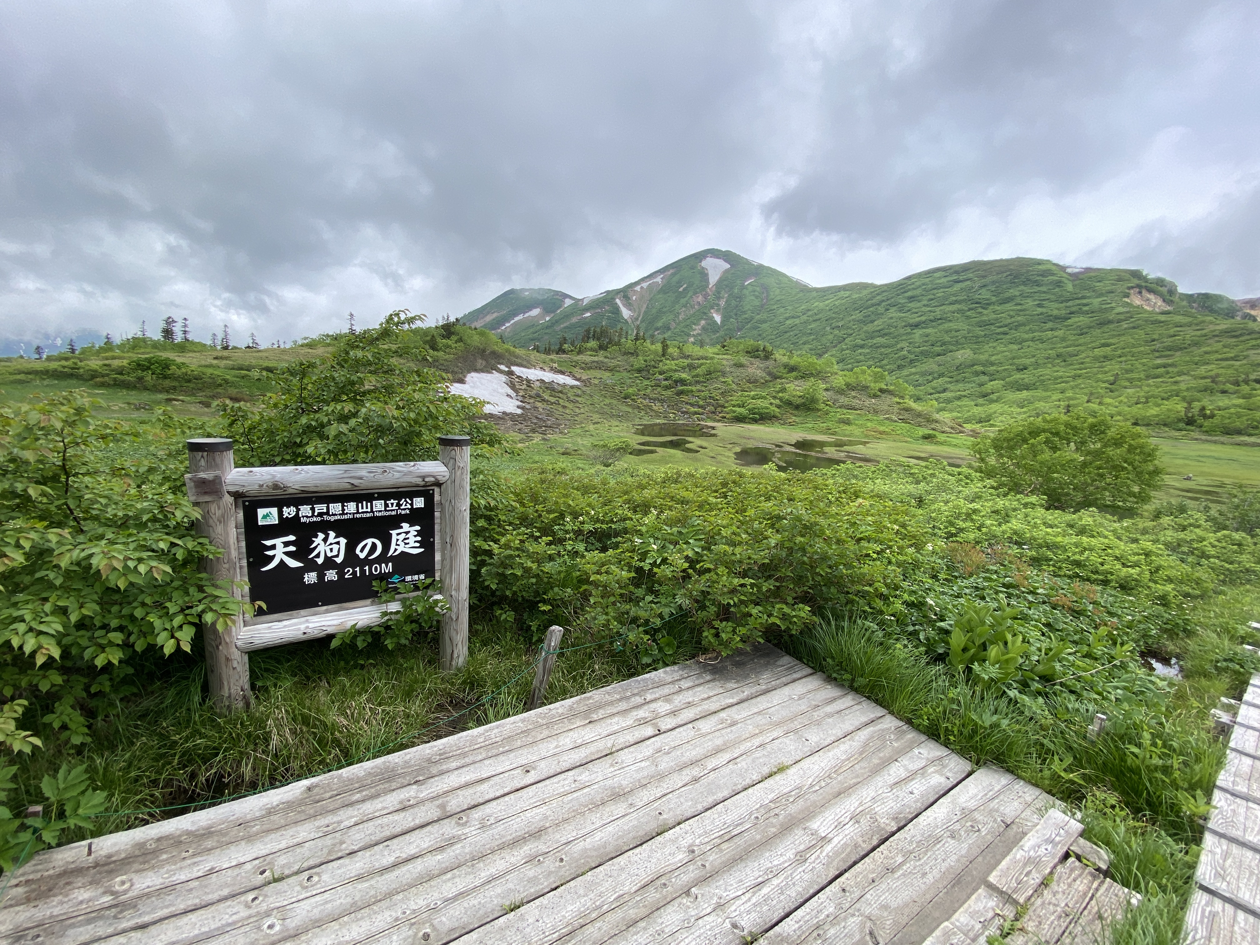
This viewpoint is about a 5 minute walk from the ropeway. I think many day trippers go just this far.


There are a lot of statues up there.


I can't count the number of places with chains.
I also couldn't take pictures of the really scary spots. I needed both hands then!


This information was posted at each end of the dotted-line trail that went along the top of the ridge.


Mt. Echigo-Koma on the left, Mt. Naka, on the right and Mt. Hakkai make up the Echigosanzan--The Big Three of Echigo.


This is at the waterhole. It's just a small stream that runs right across the trail. It is potable.


Japan has so many flowers.


About 20 minutes down the road, I found this onsen. It's a hangout for the locals and was cheap. (¥500).
It smelled like an onsen should--like sulfur.
Map: Moegiensakurionsen
Website: moegien sakurionsen

Final Thoughts/observations/recommendations:
What can I say? It's a great mountain. Do it if you feel adventurous. If chains don't turn you on, try someplace else.
Be flexible. I really wasn't sure about my plans. I had wondered about using the ropeway or not. I wasn't 100% sure what time I'd arrive and whether I would need to take the ropeway up or not. As it turned out, I was quite early and decided to hike instead of waiting for it to open. I also wasn't 100% sure about the hike. I had read all these scary warnings (like I've written in this post!) and wasn't sure if I should go through with hiking over the top along the dotted line trail or not. I also wasn't sure about how far I could/should go. I usually beat the YAMAP time estimates by quite a bit when hiking. In places with a lot of chains and boulders with a lot of climbing, I tend to move closer to YAMAP's estimates so I was concerned about time. I made a tentative plan to go as far as Mt. Nyudo (入道山) but was prepared to cut the plan short if it was too much.
As it ended up, I was able to do everything I'd contemplated and was still back in my car by 3. If I had not been able to do that much, though, I wouldn't have felt bad.
After all, the real goal of climbing is not getting to the top. It's getting back to the bottom alive.
Want to see nearby Mt. Echigokomagatake? Check it out here.
Thank you for your attention to this matter.
Caveman out.