S'up? Welcome back for another tale from the mancave.
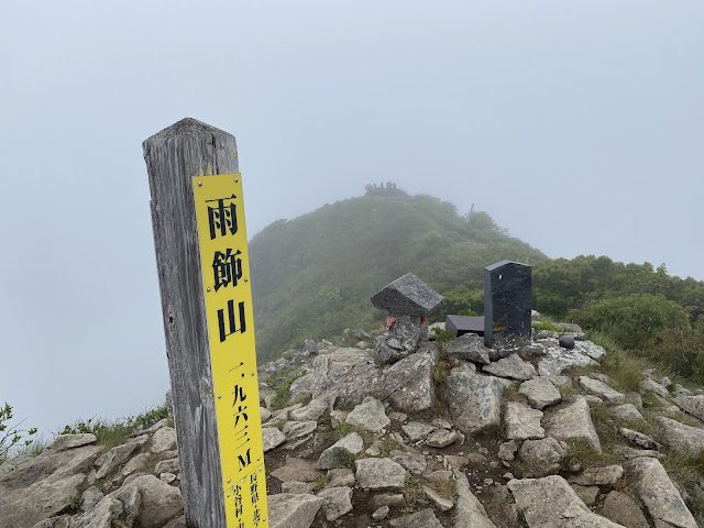
This is about Mt. Amakazari (雨飾山). The name is a combination of two Japanese characters. The first is rain and the second is decoration. I went there during rainy season. I shouldn't be surprised that it rained the whole day and that I didn't see anything. It was well and truly decorated in rain. I have to take everyones' word for it that the views are breathtaking.
Area:
Location:
Map:
Search for 山と高原地図妙高・戸隠・雨飾・高妻・信越トレイル on the Mapple web site to get the latest Yama to Kogen Map.
Starting and stopping point:
Amakazari Kogen Camping Ground (雨飾高原キャンプ場)
Peaks bagged: Amakazari
(First-time) peaks #
#891
100 Famous Mountains peak #
#32
Getting there/getting around:
I drove. There is free parking at the campground. See the campgrounds website for information about getting there via public transportation.
Helpful Info
Weather Information:
Time and distance
Total Time: 4:29 Break time: :17 Distance: 8.24 km
Elevation: Lowest: 1,138 m Highest: 1,963 m Total Ascent: 1,053 m Total Descent: 1,053 m
Technical considerations/difficulty:
The primary concern is that it is steep. There are a lot of ladders and some ropes. No chains. Most of the hike seemed to be hand-over-hand climbing up boulders on the trail. The trail is quite narrow so I am glad I was there on a weekday in rainy season. It is crazily congested during fall foliage time and they have to take measures to limit the number of hikers.
Facilities:
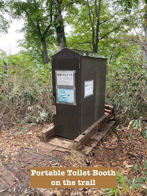
The campground has a public restroom and camp store. There also sell portable toilets that you can use in the portable toilet booth on the mountain. On the mountain, there is a waterhole.
Thoughts/observations/recommendations:
You win some, you lose some. June presents hikers with certain opportunities and risks that demand judgment calls. On the on hand, the days are longer and the chance is there to go for longer hikes farther away than in other seasons. On the other hand, it can rain a lot. Amakazari wasn't my first choice for this day. I had planned on a 4+ hour drive to Fukushima to climb Aizukomagatake. The weather reports on the night before for that area looked less than stellar so I opted for a hike in an area of the map that had a better forecast. The forecast for Amakazari was for just for clouds. The rest of the country seemed to be looking at heavy rain. It didn't look too bad, and it is much closer than Fukushima so I chose that.
Nine times out of ten that I take a risk like this, I'm pleasantly surprised. I usually get at least some clear skies and some views. This was one of those other one times out of ten. 🤦♂️
I probably should have really thought this through better. After all, the word "rain" is half of the name of this mountain.
When I got home, Mrs. Caveman said something like, "Aren't you lucky it was a nice day?" I guess it was nice around our abode. I felt like Charlie Brown hearing that--like I had a cloud just hovering over me wherever I went.
Give yourself time to do this if you need it. Although it is only 8.2 km (about 5 mi.), the steepness seems to slow most people down. The average hiking time seems to be 7 hours but there are signs at the trailhead cautioning hikers that some people take up to 10 hours. I passed a lot of people on my way down whom I had encountered on my way up.
Don't miss the outdoor onsen on the way home. That was nice.
I'm sure it's beautiful during the leaf-peeping season--but it seems to be prohibitively crowded at that time.
Let's look at some pictures.
This is the campground office/store.
Public restroom and hiking notification drop-off spot.
For some reason, they mark off the distance in 400 meter increments. There are 11 markers like this. 1/11, 2/11, 3/11 . . . 11/11. I might not be as smart as an 8th grader but that seems to add up to 4,400 meters.
The first 15 minutes or so of the hike is rather flat. It's through a marshland over a boardwalk.
I thought that I had walked onto the set of Dr. Who for a minute.
Still hoping for a view.
This is the north peak.
That's the south peak, the highest point.
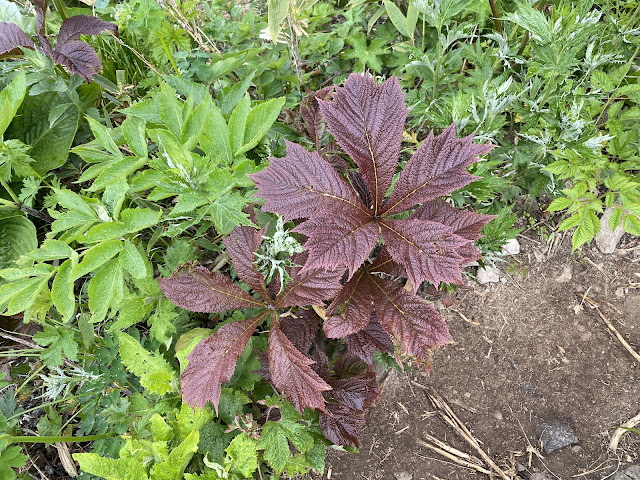
Coming down, there were some nice flowers
In the last 5 minutes of the hike, the sun came out.
Even then, I was denied a view. Mt. Amakazari still managed to hide.
Drat you, Amakazari!
After getting off the mountain, not too far down the road, I dropped by an open air hotspring. (rotenburo). It was awesome. Thankfully, there was nobody on the men's side and I could sneak a few pictures.
There is nobody manning this place. There is a box for donations and the amount you leave is up to you!
After cleaning up, I was very ready for some craft ice cream at my next stop. This is the Otarian Gelato Shop. I had Garden Huckleberry and Red Shiso sherbet. (Shiso is perilla in English. It's an herb related to the mint plant.)
Well, that's all the Caveman has for you today. Tell your friends about the blog. Subscribe. Look at the youtube channel. Or not.
But, if you don't, I hope you get rained on like I did. ☔ 🤣
Until I blog again, how about checking out another of the 100 Famous Mountains in the same national park?
Caveman out.


No comments:
Post a Comment
Have a comment? Please, keep it clean.