Hey there, spelunkers. The Caveman is here to regale you again.
Kitayatsu hike(s)
Location: Northern Yatsugatake Area "Kitayatsu"
Starting and stopping point: **(For the main hike) Ogawahara Pass (大河原峠)
Peaks bagged: Futaga ~ Ootake ~ Kitayokodake *Side hike: Ryugamine
(First-time) peaks #899 Oops. #900.
Getting there/getting around: I drove.
Map: ***The Caveman is giving up on posting links to maps. They go out of date and the links die. If you want a map, comment and I'll get you a current link.
Weather Information: Kitayokodake Weather
Stats (for the main hike only)
Total Time: 4:25 Break time: :31 Distance: 8.9 km
Elevation
Lowest: 1,972 m Highest: 2,480 m Total Ascent: 788 m Total Descent: 788 m
Technical considerations/difficulty:
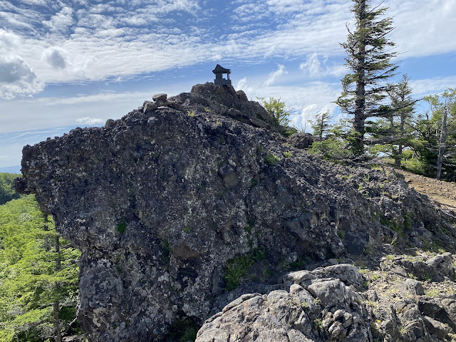
From Futagoike up to Otake and Kitayokodake is a bit strenuous. There are a lot of boulders you need to scramble over. (I actually had a plan to hike from Futagoike up to Kitayokodake in May but had to turn back at Otake because those boulders--especially with snow around them--took more time that I'd anticipated.) Descending from Kitayokodake to Kikkoike is a bit steep, too. From there back to Ogawahara Pass is a walk in the park.
Facilities:
There are restrooms at Ogawahara Pass, Futago Ike Hut and Kitayokodake Hut. There is also a place to rest at the Ogawahara Pass parking lot. The Futago Ike Hut and campground (Tateshina Hut info, too) is seasonal. There is a waterhole on the map at Futago Ike Hut but I don't recall ever actually seeing it. The Kitayokodake Hut's info is at that link. They require reservations by phone and aren't open unless there is someone with a reservation. Click on this link for the Kita Yatsugatake Ropeway.
Thoughts/observations/recommendations:
I love these mountains so much. Since the Caveman lives in the valley below, the views from Yatsugatake and all the surrounding mountain ranges enable me to look down on where I live and across to other mountains I frequent.
If you want to get to experience the views of the area without the stress, you could take a ropeway that goes near the top of Kitayokodake. The other day, I mentioned to a middle-aged woman that I'd climbed Kitayokodake and she said, "Oh, I know that one. That's an easy one." My reaction was, "You must be putting me on, lady." Later I realized that she must have used the ropeway. Either that or I'm a pathetic example of a caveman.
If you want to experience a nice view with even less exertion, you could just take a drive up the Tateshina Skyline to the Ogawahara Pass and take a peek at Mt. Asama, etc. from there.
Today's listening:
War, peace & cherry trees: finding hope after WW2 This was surprisingly good. I learned some new things about Fr. Maximillian Kolbe I didn't know and also about two other great Japanese men. This is an interview with Naoko Abe, author of The Martyr and the Red Kimono: A Fearless Priest's Sacrifice and a New Generation of Hope in Japan.
Had enough preliminaries yet? You haven't left yet?
Here're the visuals. A few days ago, I had a plan to connect the dots with trails I've trodden before. I had been to Otake before from the north side and intended to go there again from the south, passing Kitayokodake on the way. Alas, I only made it as far as Kitayokodake that day--and it was raining so we didn't see anything. That is the yellow portion on the screenshot below. On this trip, I had to cover a lot of ground I've walked on before but managed to tie up the loose ends between Otake and Kitayokodake I'd not been able to before.
(Were you paying attention to that? There will be a quiz. You need to remember the Japanese mountain names, their correct spellings, their English translations, the dates of travel and to each mountain and what the Caveman had for lunch on each day. You will need a score of at least 80% in order to pass.)
Start out at the Ogawahara Pass.
Looking toward the next peaks, Ootake and Kitayokodake.


No comments:
Post a Comment
Have a comment? Please, keep it clean.