Hello all you spelunkers. Welcome back to my mancave.
Today I made my 3rd trip to a mountain I look at all the time. When I look south from my neighborhood, I can see the Tanzawa Mountain Range in the neighboring prefecture of Kanagawa. The last mountain on the left before the terrain drops off precipitously to the sea is Mt. Oyama, (大山)--"Big Mountain." It's got a great nearly symmetrical cone shape--almost like a pyramid.
It's a nice mountain. Most trails can get you to the top in just a few hours. There are a lot of touristy things along the way, many temples and shrines, and some awesome views of Sagami Bay. Today I went up from that touristy side. In the past, I went up from the west side and had a more natural experience.
I started at the Isehara Shiei Oyama Daini Parking Lot near the Oyama Information Center. That's about a 15-minute walk to the cable car. I took my bike, but there are buses to this place.
This is what my trail for the day looked like. It was about 10km and took me a little over 4 hours. It's a bit steep so the change in elevation was nearly 1,200 meters.
If you want to see my avatar do it, head over to youtube.
There are lots of souvenir shops, restaurants and ryokans (Japanese-style inns) lining the road up to the cable car.
To keep you distracted from your aching feet, they pose quiz questions on the way.
Soon after I left the pavement, I ran into this guy eating leaves like a boss. He did not give me two thoughts. Check out his video on youtube, too. He's an influencer.
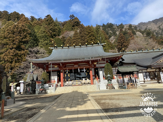
Just above the top cablecar station is the Afuri Shrine Shimosha. There is a spectacular view from here. Unfortunately, it was overcast.
This picture is from the top of the mountain on the west side looking at the Tanzawa Mountains. I love this sign. It's one of the few maps on the ground that are oriented in the direction they are pointing. It was super-easy to interpret. I didn't take any other pictures from the top because it was overcast and because there was a lot of construction going on to spruce the place up for the coming hiking season.
I LOLed when I saw this sign. "Fudou ziri" translates to something like "un-moving ass." Haha.
Looking at Sagami Bay on the way down.
This place is called "Miharashidai." Miharashidai means viewpoint or overlook and I made a special detour to drop by this place expecting a beautiful view. No such luck. Don't feel you've missed out on anything if you go to Oyama and give this place a pass.
Another temple I passed on the way down.
This place must be nice to see at night. All those lamps had light bulbs in them. I'd like to see it lit up because I've never seen any of those stone lamps lit up before.
Spring is almost here!
This isn't the best season for Oyama. It is a great mountain, however. If you're into looking at temples, you'll enjoy this. I'm not actually too much into temples because I'm Catholic. I do appreciate the aesthetic beauty of the Japanese sense, though.
Cherry blossom season and fall here are stunning.
I have several posts on Oyama. Check one of them out here:
It's not that strenuous. Personally, I don't think it's strenuous at all but I hike all the time. I have a co-worker who hiked this once and, to hear her talk about it, it's Mt. Everest, K2 and the Eiger all wrapped into one. (I hope she doesn't read this. In that case, forget what I just said. It is really an impossibly difficult feat to climb this. No one has ever done it without oxygen and sherpas.) It is a little steep but there aren't too many chains. No ladders. There are a lot of stairs. If you want just an easy day trip, you could just take the cable car to the Amefuri Shrine and not hike up to the top. The top is another hour or hour and a half hike from there.


No comments:
Post a Comment
Have a comment? Please, keep it clean.