I was happy to find another mountain peak near Mt. Asama that I haven't bagged yet.
Mt. Kengamine is where I went yesterday.
I took this picture of it from my neighborhood. That is one reason I love living here so much--when I lift up my eyes and look around I can recall hiking on the spots I'm looking at.
Anyway, the name Kengamine is a somewhat common name for mountains. The highest peak on Mt. Fuji is also called Kengamine. It means sword or blade + peak (⚔ + ⛰).
Cool, huh?
Looking at the Google Earth screen capture below you can see why this name fits. Walking on the ridge up to the top is a bit like walking on the edge of a knife.
Here are the details. Then I'll show some pictures.
Getting there/getting around: Parking at the Onsen is ¥500. There is a bus that passes by the entrance to the onsen/trailhead. From there, it's a 4km walk to the trailhead on a dirt road.
Elevation:Lowest: 1,411m Highest: 2,280m Total Ascent: 896m Total Descent: 897m
Technical considerations/difficulty: This is a variation route. ie, it doesn't show up on maps. The route is fairly straightforward, though. A few hundred meters down the main trail heading toward the other mountains of the Asama area, you take a right into the woods and get on a ridge. From there, you just stay on the ridge until you get to the highest point. As long as you don't fall off to either side, you can't get lost. 😂
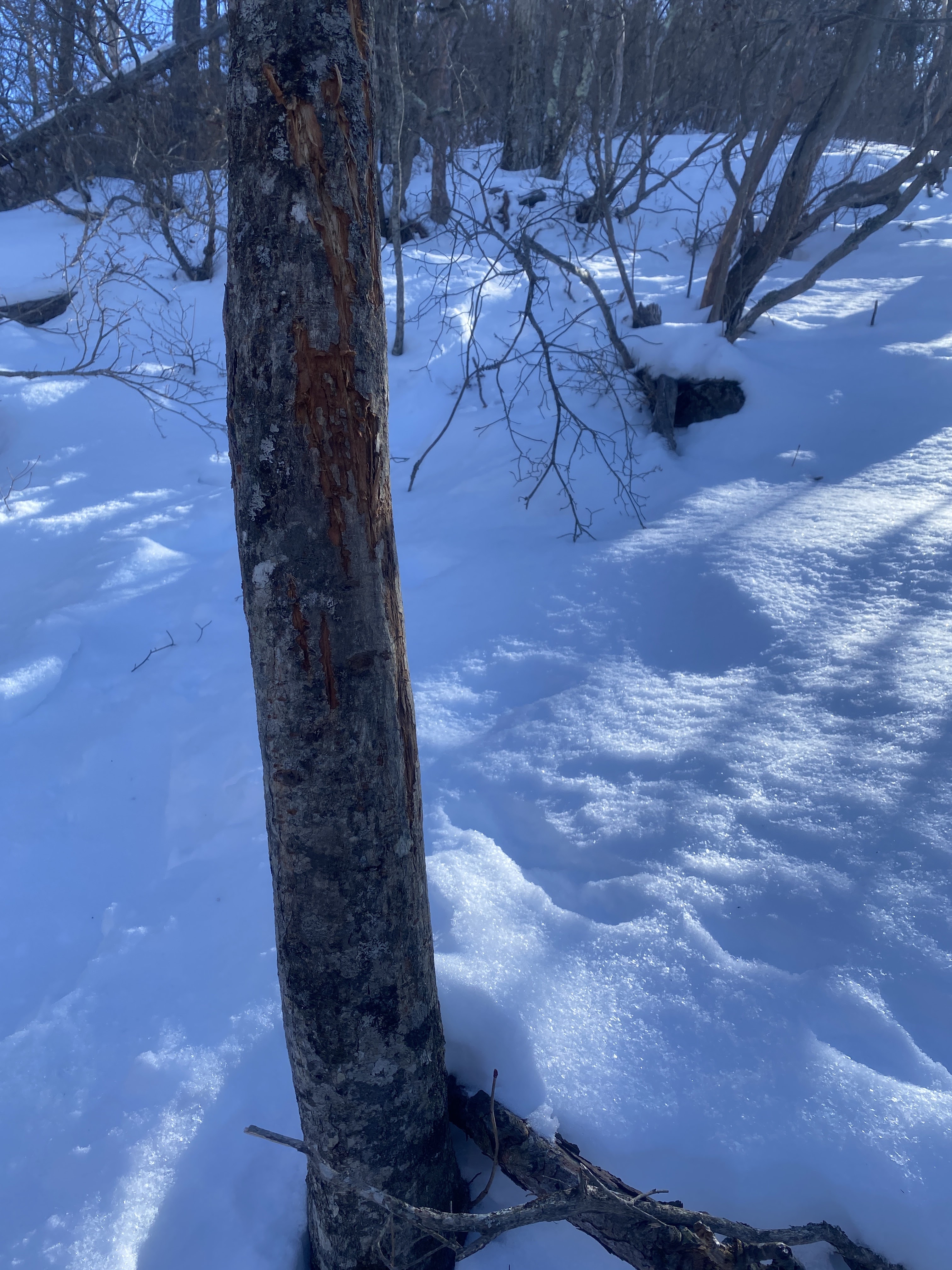
Although it doesn't show up on maps, there are signs of a trail. There are pink tapes here and there and I saw paint on a few rocks. Everything was covered with snow, though, so I am not really sure how well it is marked.
This is a steady, steep climb. I think it would be taxing even in summer. In a few feet of snow, it was very slow-going. I had the benefit of someone else's footprints to follow but that didn't make that much of a difference. There was a lot of fresh powder and for long stretches, I sank knee-deep or more with every step. Coming down was very slippery. I fell a lot and slid down on my butt more than once. Thank God I was slipping and sliding down the trail. If I slipped off the side of the ridge, nothing would stop me.
Facilities: The 👺 ♨ (Tengu Onsen) has a pay toilet 🚻 for hikers. That is closed for the winter. There are sleeping accommodations at the onsen and, of course, the bath 🛀. The onsen also has horse riding and horse-leading activities.🐴
Thoughts/observations/recommendations: This was a blast. What a beautiful day it was.
All the water around here is that color because of the sulfur content.
This is the beginning of the trail up to Kengamine. If you look closely, you can see yellow arrows painted on the trees in the middle and a piece of pink tape to the right.
I also, of course, had the benefit of a previous hiker's footprints as a clue.
Signs that Yogi has been here.
OK, this is a bit gross but interesting.
The icicle in the next picture is actually my spittle. I spit on a tree and it froze before it could fall off.
Inside every middle-aged man, there is an eight-year-old.
Minus 6.9 C is about 20 degrees Fahrenheit. That wasn't too bad considering the forecast was for minus 17 C, (1.4 F).
It was just freezing when I got back to the car at the end of the day. That temperature seemed balmy as I was almost drenched with sweat.
Just coming out of the forest. From this point on the views just got better and better.
The Chuo (Central) Alps
The Dai Kiretto is fairly easy to pick out
It was deep around here.
Really deep. I sank up to my thighs with each step.
It was really deep on the top.
That little sign marks the top of Kengamine
I ate a BLT here. It was nearly frozen.
It was cold so I beat feet as soon as I finished lunch.
The bumpy ridge is Myogi. The ski area in front of that is the Karuizawa Prince Resorts by the outlets.
In front of that and to the left is Mt. Hanare.
Mt. Fuji is in the house.
Saku City below and the Yatsugatake Mountains beyond
I probably broke a law doing this. Taking pictures at onsens is frowned upon. 😛 I was the only patron so I think it was ok.
It's unfortunate the lens on my iphone steamed up so much. It promised to be a great picture. The bath water is the same color as the Jabori River.
That's basically it for this report. The following are just labeled pictures for the edification of anyone like me who likes to know the names of the mountains you're looking at.
Kengamine taken from Mt. Kokuzo in Saku.
That's all for today.
Subscribe, etc.
Or not.
Check out kobushigatake if you want to see a 100 Famous Mountain
Today I took Mrs. Caveman for a traditional Sunday drive. My plan was not to go hiking at all.
Honest.
The plan was to take her for a lovely lunch at a Michi No Eki near the Utsukishigahara Highlands which has a nice view.
After laboring uphill for a long time, just 100 meters of so before the pass from the south side of the Utsugushigahara to the north side--where that Michi no Eki is-- we encountered a locked gate across the road pronouncing it closed for the winter.
Happily, right next to that gate was the parking lot for the Yamamotogoya (mountain hotel)
That hotel is adjacent to the trail up to the Ogato Hotel on Mt. Ogato (王ヶ頭--"King" "Head").
We parked there and initially planned just to walk as far as the first hotel and check it out. The going was easy and we kept on going. We eventually got to the highest point in the area. Despite there being a few feet of snow on the ground and being at an elevation of over 6,000 feet we were able to do the "hike" in regular street clothes. Everyone else was wearing snowshoes but they had packed the snow down enough in places that we could walk without sinking in.
I truly love where we live. The license plates on the cars in the parking lot were from places far away. People had to spend a lot of time and money to get to someplace we're able to get to on a whim. I'm really grateful.
It was a nice surprise of a day. The weather was beautiful and the views were great. Mt. Fuji even made appearances. Not bad, considering that is about 110km away.
Take a look at the pictures below. Maybe Mrs. Caveman will make a cameo on the blog.
There are a few inns up there. Plenty of pay toilets. Restaurants, etc.
Thoughts/observations/recommendations:
This is a really nice place. It's a plateau with great panoramic vistas. Since it's a plateau, you don't have to climb at all. Today we just walked a few miles. I made a longer trip here last August. That post is here: August hike around Utsukushigahara.
Fuji
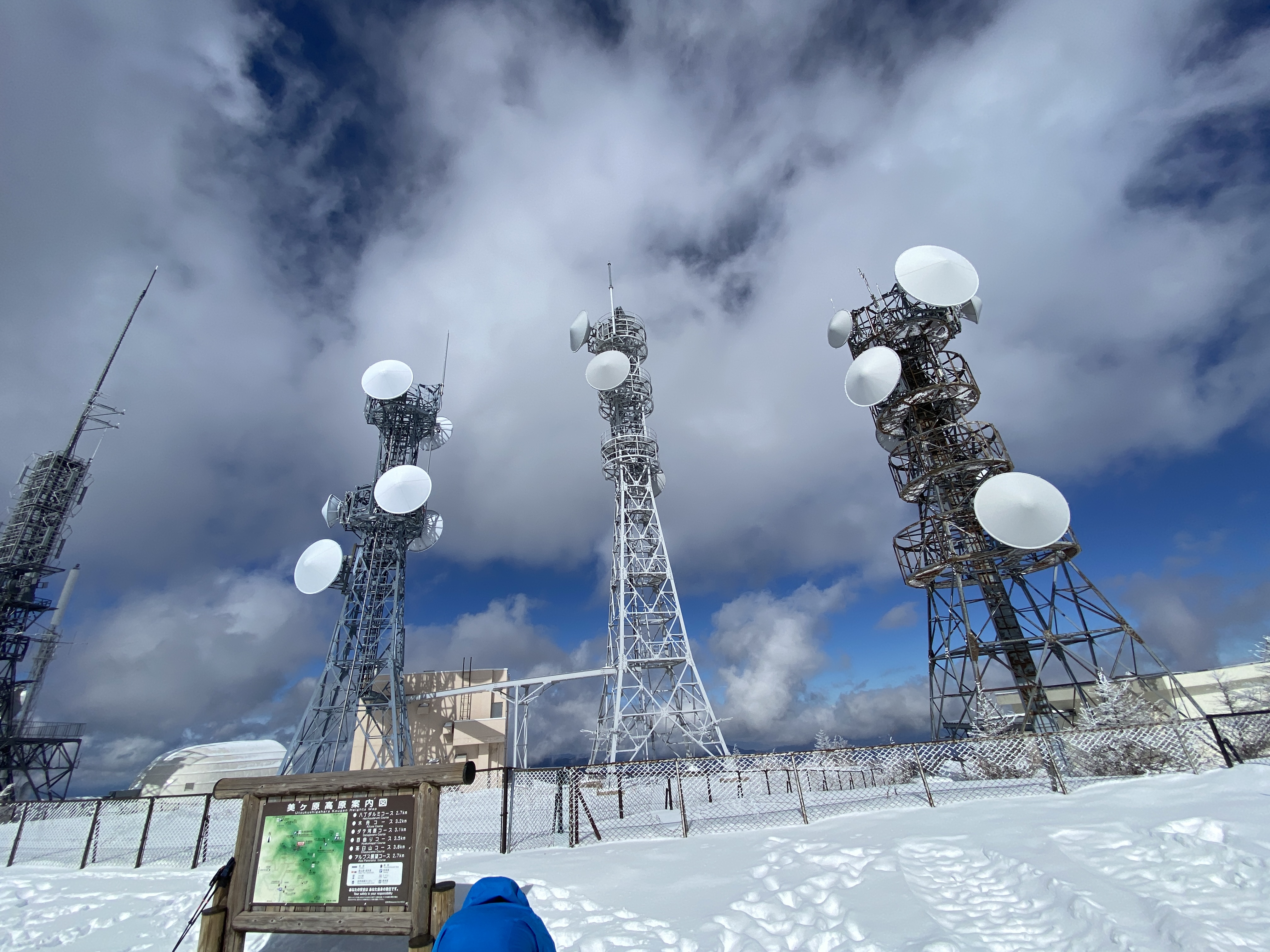
The top.
There are a lot of antennae up there. It makes this place easy to spot from other mountains.
We had lunch at the Ogato Hotel. The Caveman usually doesn't do store-bought food. This was a special treat, though.
Considering lunch was at a restaurant on a mountain, the prices weren't bad. Unlike other mountains huts, they obviously don't get their supply by helicopter. The beef stew was ¥1,200. ¥500 for a coffee was a bit dear, though.
That hotel actually has a shuttle bus service. I also noticed they had a lot of snowshoes and boots for their guests to borrow. My guess is you could go there "tebura" (Japanese for "empty-handed") and do the hiking thing.