Total Time: 7:48Break time: 1:24 Distance: 12.6 km
Elevation:Lowest: 1,085 Highest: 1,449 Total Ascent: 1,367 Total Descent: 1,367
Technical considerations/difficulty: Each of these mountains, by itself, is not particularly challenging. Any of these peaks could be done in just a few hours. Circumambulating (I love that word.) the lake, as I did, makes for several ascents and descents. There are some areas where the snow is deep and some places with ropes where you need some upper-body strength.
The snow conditions varied widely on this trek. In spots, it is waist-deep. On the south side of Haruna Fuji, there is no snow at all. I needed snowshoes only for about 30 minutes. Most of the rest of the day I needed crampons. Going down was very slippery and icy in places.
Facilities: There is nothing on the trails or mountaintops, but the lake is nearby and has many public facilities and tourist attractions. Not much is open in the off-season, but the Yusuge Onsen is open and only costs ¥520.
Thoughts/observations/recommendations: If you want to catch the view but are lazy, you could take the gondola to the Haruna Fuji Ropeway. ¥950 roundtrip for adults.
I don't feel particularly witty today, so I'll just jump into the pictures.
On go the snowshoes.
Thankfully, the temp. stayed at or below freezing all day. I didn't need to deal with much melting snow or mud.
After going up to the first two peaks, I came back down to the water level--before going up again. I repeated this a few times this day. 😜
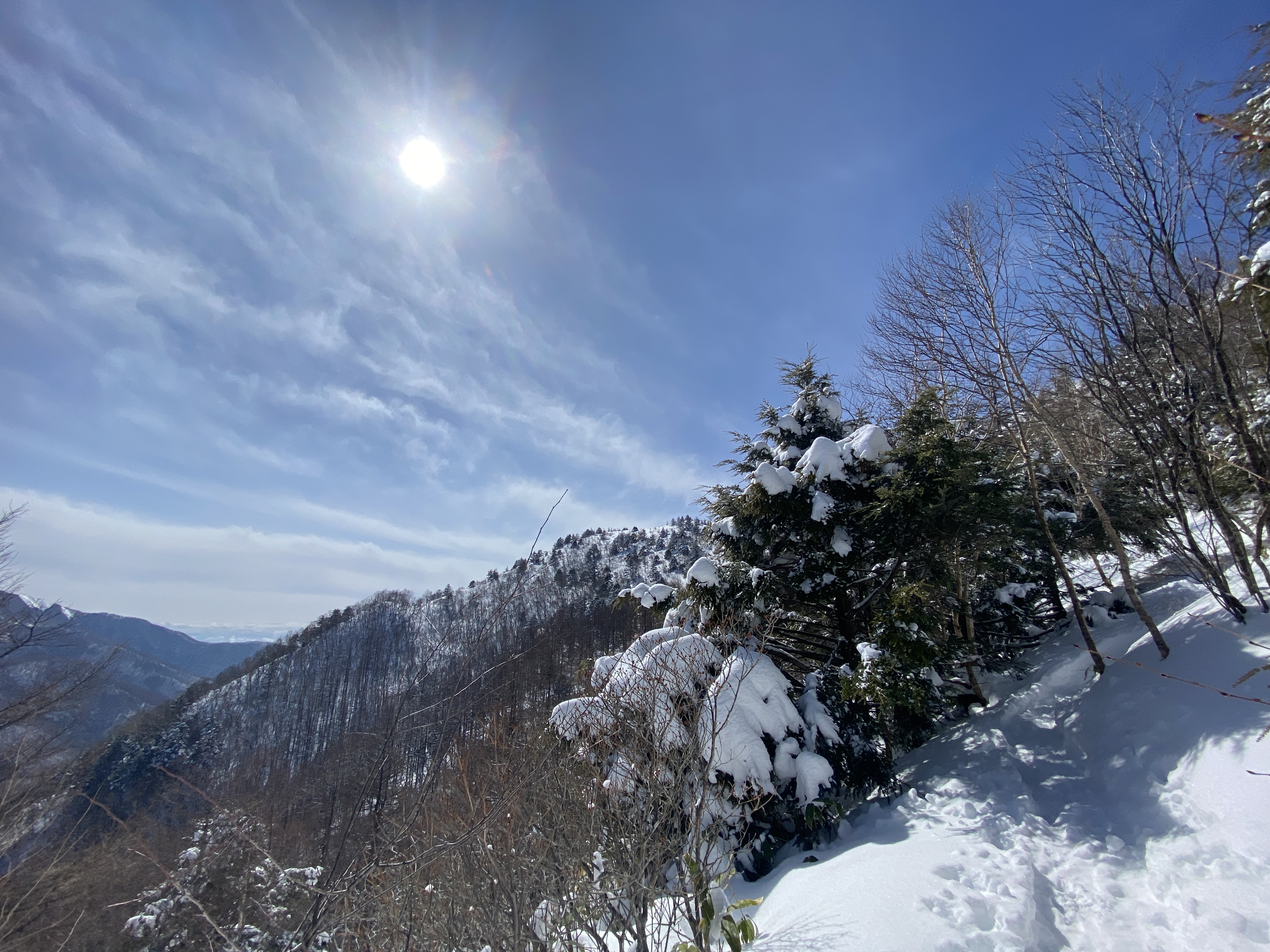
Looking up toward Haruna Fuji
The view from Suzuri Iwa ("Inkstone Boulder") is the best one of the lake.
Kamongatake is the highest peak of the Haruna Mountains. That was my last peak of the day.
The hike up to Haruna Fuji is on the south face of the mountain so all the snow was melted. That was the only snowless trail of the day. In contrast, the other side of the mountain was very deep.
Asama is 32 km away.
Mountain Graffiti!
"Sagamihara F.D."
"Isesaki F.D."
Ropeway prices.
Just beside the ropeway, there is a viewpoint.
It's 124 km to Mt. Fuji.
On a clear day, you can pick out Mt. Tsukuba (113 km) and Tokyo's Skytree (119 km). It was too hazy to see Tsukuba. I was able to find Skytree with the naked eye but my iPhone couldn't pick it up.
From the Ropeway, it's maybe a ten-minute walk up to the top.
"This way to the top and to the Haruna Fuji Shrine"
The shrine
Time to put the crampons on. This side of Haruna Fuji is very snowy.
Time to go down.
Again.
Lots of critters out here.
A few times I could actually smell the deer.
After slipping and sliding down the 300 meters to the lakeside, I looked up at my next destination--Mt. Eboshi--in disbelief.
"Did I really put that in my plan?"
Eboshi is the word for traditional pointed hats. There are many mountains named eboshi here.
This dude Lord Ashikaga really rocked one of those hats back in1868!
The trailhead to Eboshi.
From the top
Dining al fresco.
After Eboshi, the next stops were Mt. Bingushi and Suzuri Iwa.
From Suzuri Iwa ("Inkstone Boulder")
On the way up to Suzuri Iwa, I passed a young couple wearing jeans, sneakers and sweatshirts. It was a nice day, so they just hopped out of their car on a whim to head up to the overlook. They did not really think it through, though. They got up to the top and then considered that going down would be harder than coming up. The trail isn't long, but it is very steep and icy in many places.
Oh, to be young and in love . . . stupid. 😆
I gave them my hiking poles and wished them luck.
The biggest mountain in the next picture is Mt. Akagi. I climbed that last year.
I snuck a picture of the bath. I won't put it up here, though.
When I got home and looked at the picture, I realized there was a person in it! When I took the picture, he was not visible to me and I doubt he could see me either, because he was outside and the window was all steamed up. Imagine my surprise when I got home and looked at my pictures to realize the iPhone had picked up his image.
Thank God it was too blurry to see anything. I'd have to wash my eyes with bleach or something.
This is a snowshoeing hike I took around Mt. Yunomaru and Mt. Eboshi on the border between Gunma and Nagano. It was a great day and I hope you enjoy the pictures as much as I enjoyed taking them.
You probably won't. I take way too many pictures and find it difficult to discard any.
On this hike, I climbed Mt. Yunomaru (again) and Mts. Koeboshigatake and Mt. Eboshigatake. E-boshi-take means "crow" "hat" "mountain". The "Ko" of Koeboshigatake means "little."
Elevation:Lowest: 1,730 m Highest: 2,099 m Total Ascent: 692 m Total Descent: 692 m
Technical considerations/difficulty: Not tremendously technical.
Facilities: Nothing
Thoughts/observations/recommendations: What a great area. This was my second time back in the last few weeks. I wanted to connect the dots of my footprints and I wanted to climb the two Eboshi peaks. I was blessed with another day of great weather. It wasn't as clear as last time, though, and I couldn't see Mt. Fuji. That's ok, though.
This is todays destination.
I absolutely love looking up and around and being able to say "I've been there."
And away I go!
Lots of critters out there.
Starting out climbing the trail at the Yunomaru Ski Area. I started up the slope even before the chairlift started running.
That bump on the left is Mt. Kakuma. I climbed that last time, but not today.
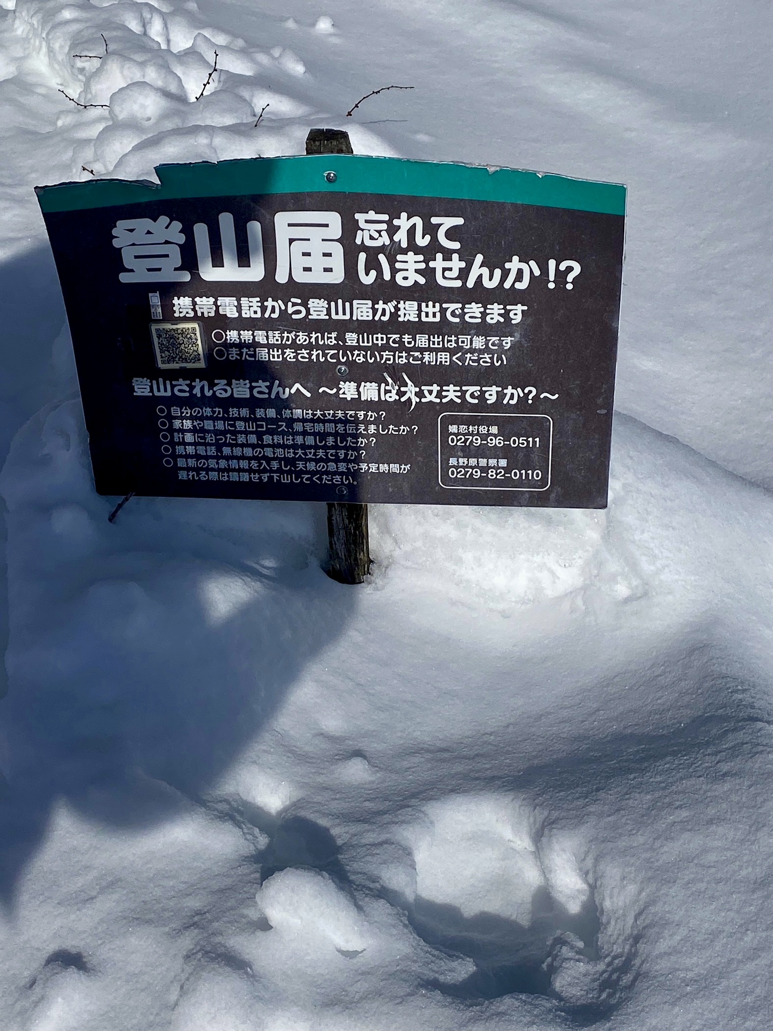
You can register a hiking plan by using the QR code on the sign.
Yatsugatake
Mt. Fuji hid today
Mt. Sajiki on the left. Mt. Kosajiki on the right.
The top of Yunomaru
The pointy one below is Eboshi. That's my ultimate goal for the day.
Most of the day, I didn't really need the snowshoes because there were many traces of previous hikers. I did still sink in a few times, though.
Mt. Eboshigatake
And with that, dear spelunker, I leave you until next time.
Subscribe to the blog. Tell your friends about it.