Caveman hikes on the last day of fall in 2021. Mt. Mishotai


Mt. Mishotai

The last day of fall was a good day for a hike around Doshi Village and Tsuru City.  


This is what Mt. Mishotai looks like from below.

Mt. Mishotai

. . .  this is what it looks like from above (from Mt. Fuji)


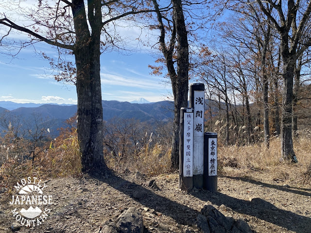
. . . and this is what it looks like at the top.  

Mt. Mishotai Top 御正体山山頂

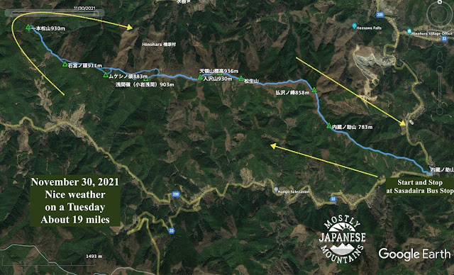
I started out at Mishotai Bashi and climbed up to Mt. Mishotai before then heading south over Maenodake, Nakanodake and Okunodake toward Mt. Fuji before hopping off the trail returning to the starting point by walking along route 413.


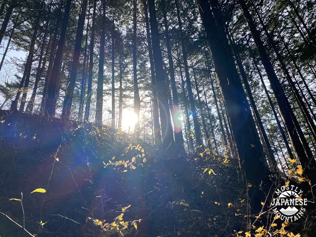
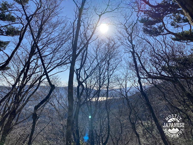
It was a pleasant day for a hike but the scarcity of views didn't make for a lot of photo opps.  I was in fairly close proximity to Mt. Fuji and even though I was walking in its direction, it was mostly hidden by trees 90% of the time.  Because it was so close, it loomed really large but still was never visible enough to justify stopping and taking a picture.  


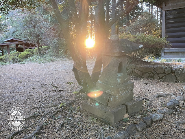
Most of the day looked like this.


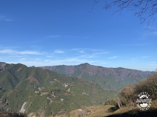
When I finally did get to the one clear spot of the day though, it was stunning.  I took about 20 pictures of Mt. Fuji but will suppress the urge to post them all.

Fuji from Doshi Mura


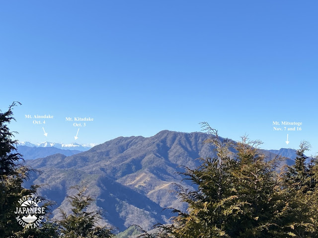
That vantage point also gave a good view of the Minami Alps to the west . . .


Minami Alps from Doshi Village

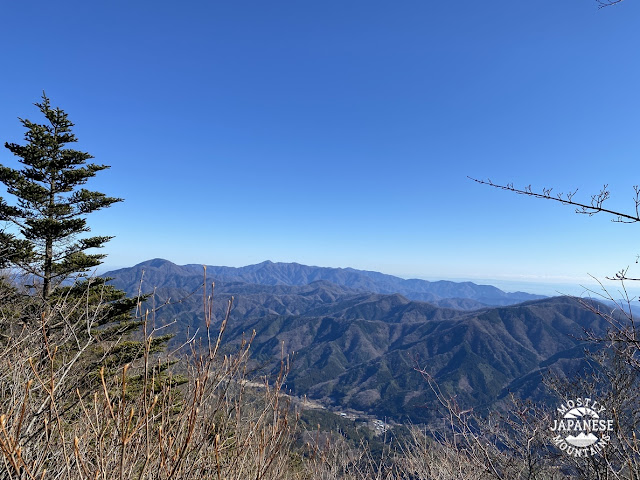
. . . and of the Tanzawa Range in the east.

Tanzawa Range from Doshi Village


I was close to Lake Yamanaka, too, but that never really came into view.

Lake Yamanaka from Doshi Village


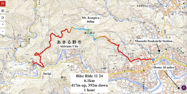
This is the route I took.  I took my scooter down there but there is a bus that runs along Route 413 so you can get there by public transportation.  The highlight of the hike was that one good viewpoint.  If you're interested, that spot is just to the north of Mt. Okunodake (奥ノ岳).  I think that might be a good starting point for a hike going down to Lake Yamanaka.


See you soon.  There is time for one more hike before the year ends.  Where shall I go?  

Caveman out


Third time is not a charm. Fuji is hiding again. Koshu City to Otsuki City hike. Mt. Takigo


Yesterday I hiked from Kai Yamato Station in Koshu City to Sasago Station in Otsuki via Mt. Ojika, Mt. Ottate and Mt. Takigo.  It was a nice hike.  

This lamp is just around the corner from the Kaiyamato Station.  Somehow it gave me a craving for Taco Bell.

My trek took me to the north of the Sasago (rail and road) Tunnels.  You may recall there was an unfortunate tunnel collapse in 2012.  That was in the Sasago Tunnel.

A few months back, I climbed over the tunnels from the southwest to the same area I hiked yesterday. Last time I started at the Sasago Pass (Denoted as "笹子峠" and a white pushpin on the map below).  Yesterday's hike is the blue line.


The weather was nice and brisk starting out.  29 Fahrenheit is about -2 degrees Celsius.


Glimpsing the South Alps at the trailhead.


Approaching the top of Mt. Takigo


The top of Mt. Takigo.

Mt.Takigo 滝子山


Mt. Takigo is touted as having one of the best views of Mt. Fuji.  I've been here 3 times and the weather has been bad each time so I have to take everyone's word for it.  Thankfully my app could give me an idea of what I was missing.


It started to snow on top.  That was fine with me.  A chance of rain had been forecast.  Snow was definitely more welcome than rain.


This warning was posted at both ends of the trail I'd planned on using to descend.  I decided to choose a different path.


The last few miles of the descent were along the Ojika ("Big Deer") River.  I love walking next to running water.

大鹿川 Ojika River

大鹿川 Ojika River2


The last couple of miles is on pavement.


The entrance to the Sakura Forest.  The gate is just to keep the animals in.


Not long after this point, I checked my watch and the train schedule.  I realized that unless I picked up the pace I would have to wait about an hour for a train.  I ran the last mile or so and made the next train with about 2 minutes to spare.  Go me.


That's all for today.  There are two more weeks left in this year so I should be back out there two more times before December 31st.

Happy Advent


Quick, before the floods come! Bunbori and Shiroyama. Low hills in Tokyo.

I have today and tomorrow off.  I was hoping to go for a long hike during this time, maybe even an overnight trip.

Since the weather people have been forecasting rain for the past few days, though, I decided to curtail my plans and try to fit in a quick hike this morning before the deluge.  I only hiked about 3.5 miles.

I was successful.  I've been to the mountains and back and it hasn't started raining yet.  I've been home for 4 hours and nary a drop has fallen.  

I feel like I got gypped.  They told me quite authoritatively (100% chance!) that it would start raining at 2 pm.

I'm starting to trust the meteorologists about the next few hours' weather about as much as I trust Prince Charles or Greta Thunberg about what the climate will be in a century or a decade.

All they say is blah, blah blah.


Anyway,  I'll share what I did today.  It may give someone an idea for a light excursion.  Today does show that you don't need to overtax yourself in order to experience some of nature's beauty in Tokyo.


Today, I took my scooter to the Nishi Kura Bus Stop on Route 33.  You can reach there by bus from Musashi Itsukaichi Station.  Normally I would take my bicycle since it's only about 12 miles from home but I was afraid I'd be caught in a downpour.  For those familiar with this road, it's a mile or two past the Kurochaya (黒茶屋.)

Anyway, I poked around the trails between the Nishi Kura and the Jurigi bus stops.  I hiked to two little "mountains" and took a peek at few shrines.  


It is true that you don't have to go far to get some cool views.  Since these foothills are higher than anything to their east, you can see really far.  I couldn't pick it up in a picture, but even as overcast as it was today, I could see Tokyo Skytree with the naked eye.  That's on the other side of Tokyo.    I also got some great views of USAF C-130s flying over Yokota Air Base.  For opsec purposes, I won't post any pictures here.  ;-)

This is from Shiroyama.


Shiroyama 城山


This is an artist's rendition, and an historian's imagining of what this area used to be.  This mountain's name, Shiro, means castle.  They believe it was a castle and that samurai used it in the past.  They're not quite sure who or when, though.


This guy is at a temple (Kogonji) I passed through.  There are a few temples and shrines in the area and several small cemeteries.

Kogonji


This big cherry tree is at the same temple.  It's called Oosakura in Japanese.  That means "Big Cherry Tree" in English.  I'll bet you didn't see that coming.  

It must be something to see in the spring.
https://goo.gl/maps/X2NveGdaKXZbYdL28


One thing that I find interesting is that the Japanese soil is so fertile that the growing season never seems to end.  It's not uncommon to see root crops growing under a cover of snow.


One last pic of the trail...


That's all for today.  I had thought of going to a nearby onsen today since I had such a short hike and would have more time available than usual.  I skipped it though.  I didn't work up enough of a sweat to justify it.  

If you are interested in an onsen in this area, the nearest one is the Seoto no Yu.  Nice place.  http://www.seotonoyu.jp/

Drop by the cave again sometime.


Hinohara Village Hike along the Sengen Ridge

Hello Cave Creatures


Today was a nice off-season hike from the Sasadaira Bus Stop to Ipponmatsuyama and back.  This hike was along the Sengen Ridge.  That ridge runs more-or-less east to west and is sandwiched between route 205 to the north and 206 to the south from the Sasadaira Bus Stop to the Kazahari Pass on the Okutama Shuuyuudo (that's a street name) about 10km away.  


This ridge allows views to the north of Mts Mazukari, Otake and Gozen and of Takanosu, Nanatsuishi and Kumotori further beyond.  To the west, you see Mt. Mito.  To the south, you can take in Fuji and the mountains of the Tanzawa range in Kanagawa, etc.

This area is not far from Hossawa Falls and there is camping and fishing nearby.  The Kazuma Onsen is about 30 minutes' walk down below the ridge.  That is a popular place for hikers after they hike in this area of the Sengen Ridge or for those returning from Mt. Mito.

For transportation, I took my scooter to the Sasadaira Bus Stop which is right next to the trailhead.  Of course, you could take the bus, too.  That bus route starts at Musashi Itsukaichi Station.


Anyway, here goes:


That is Mt. Mito to the left and Mt. Gozen to the right.  Lake Okutama is on the other side of the ridge that runs between those two mountains.


Mt. Otake

Otake view


This is the lookout point of Sengen Rei.  It's a nice spot for lunch with several benches.

浅間嶺あきる野 Sengenrei in Hinohara


Who did this?  It wasn't Bambi.  Winnie the Pooh?


map of hike on Sengen Ridge, Hinohara 桧原の浅間尾根のトレイル


Come again.  I am sure I'll blog again soon.  I am determined to get out at least once a week at least until the end of 2021.

Caveman out


Mt. Konpira

The other day I was taking a long walk with a friend along the Tama River in Tachikawa.  I was happy to enjoy that time but I kept looking west to the mountains as we were walking along.  It was an "akibare" day.   Akibare is the word for a clear autumn day.  


The mountains kept calling me so when I dropped my friend at the train station I answered.  I took my bike about 15 miles into the mountains and rode up to the top of the nearest mountain I could get to.  That was Mt. Konpira in Akiruno.  

It's not a high mountain but it has a great unobstructed view of Tokyo as you can see.  


It's not high, but getting up it will get your heart pumping whether you are walking or riding.


There's a shrine and a rest area near the top.

Konpira, Musashi Itsukaichi, 武蔵五日市金毘羅山


The top is really not much to write home about.

Konpira, Musashi Itsukaichi, 武蔵五日市金毘羅山1


Just after this spot, the trail intersects with a forest road.  I jumped on it and took a left to get back down to Hinohara Kaido (Rt. 33). 


If you want to hike Konpira, you can get there directly from Musashi Itsukaichi Station.  It's only about 2km to the top from there.  Or, you can ride, as I did.  (This map only shows my route near the mountain.)


If you're interested in bicycling in this area and want to rent a bike, you can rent a road or mountain bike right across the street from Musashi Itsukaichi Station at the Urayama Base.  Make a reservation here: https://ura-yama.com/bicycle.  

On the streets or on the forest roads, bicycling out here is a lot of fun!  


Thanks for dropping by the cave.  Come again.