My better-half/lovely bride/love of my life let me go to the mountains again the other day. Mrs. Cave Dweller really is special that way.
I decided to try a mountain fairly close to Mt. Fuji with hopes of catching some leaves turning. I was having a difficult time deciding just where to go and finally hit upon going to one of Japan's 200 Famous Mountains called Mt. Mitsutoge (三ツ峠山). I've seen this mountain from quite far away but had never climbed it or seen it close up.
The name of the mountain translates literally to "Three Pass Mountain". That makes sense. It's comprised of three peaks or about the same height quite close to each other.
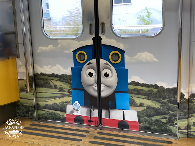
I opted for public transportation for this trip. For me, that means taking the JR Chuo Line to Otsuki and then transferring to the Fujikyu railway. The Fujikyu railway runs to Lake Kawaguchi via the Fuji Q Highland amusement park and the bus station to one of the 4 main trailheads of Mt. Fuji. Since it goes to an amusement park, the trains are really cute. The one I took had a Thomas the Tank Engine theme.
People who aren't on holiday get to commute on these trains, too. I love Japan.
I didn't go to the end of the line. I got off at Shimoyoshida Station and started hiking from there. Being early on Sunday morning, the station was un-manned.
Here's the train leaving that station.
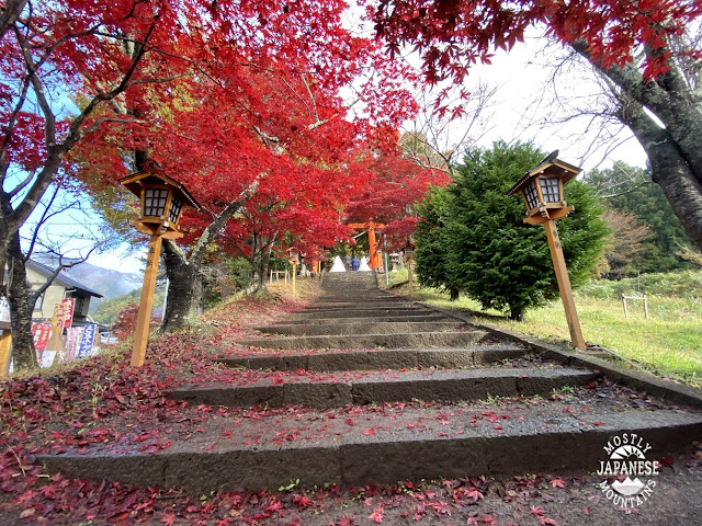
The first thing I passed through on my hike was a park/shrine called Arakurayamasengen Koen (新倉山浅間公園).
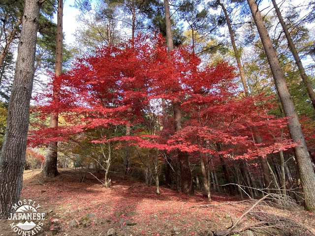
This stairway, with its brilliant red maples made for an inviting welcome to the Koen.
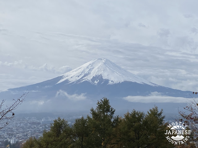
The spectacular views of Mt. Fuji make it a pretty cool place to take wedding pictures.
By the way, I don't know these couples. I'm pretty sure they don't know each other, either! Word is that they were getting a discount on their photos by having them taken together. Don't tell anyone. It'll be our little secret.
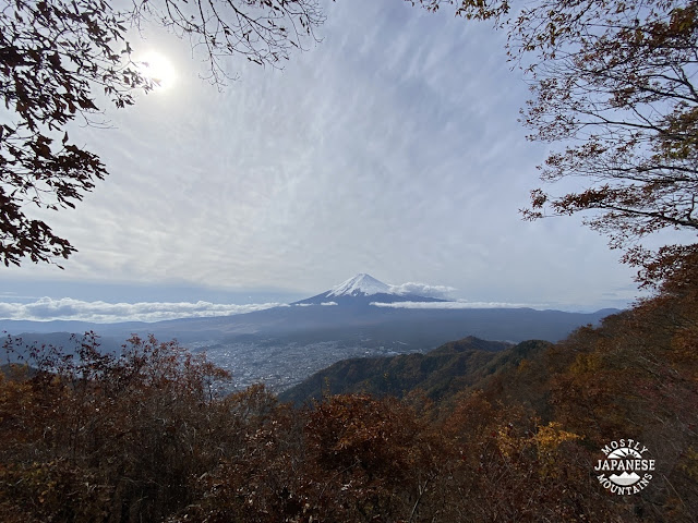
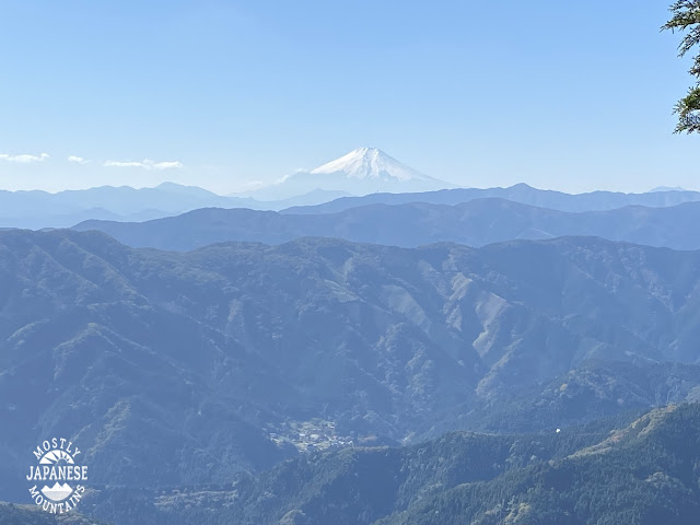
It was hard not to keep turning around and taking pictures of Fuji. Looking at it with binoculars was really cool. You can see the varioustrails as they switch back and forth up the slopes.
That park is a nice place for a walk with your family or for a date. It's a fairly steep hill but it only takes 15~20 minutes to get from one end to the other.
It is the home of the Chureito Pagoda. The view of Fuji taken from behind this pagoda is quite iconic. Unfortunately, they are building a new viewing deck behind the pagoda and that particular picture can't be taken until construction is completed next March. This is the front of the pagoda.
Once I passed through the park and hit the first mountain peak of the day, I saw very few people until I got near the top of Mitsutoge a few hours later. It was pleasant walking. Even though it was 46 degrees Fahrenheit (8 Celsius), I was hiking in a t-shirt most of the day.
I encountered Bambi's family along the way.
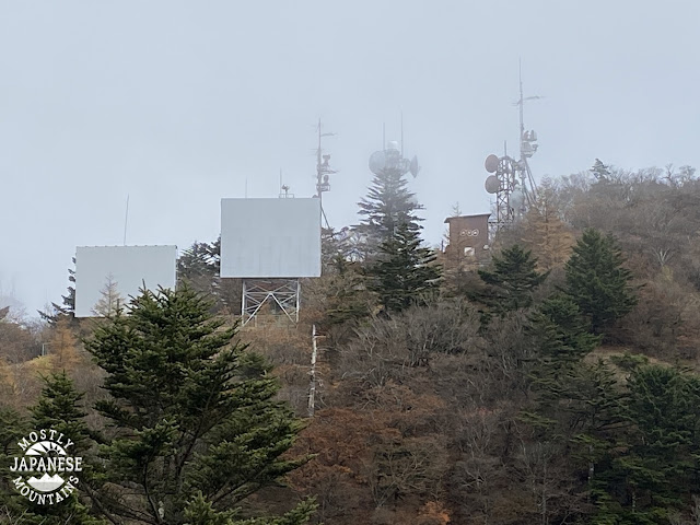
This is one of the three peaks. Can you see on the brown shed the letters NHK? NHK is Japan's National Broadcasting Coroporation (Nippon Housou Koukai). Can you spot the guy working on the antenna?
(I can't stand NHK. They want you to pay to support it--even if you don't watch it or if you don't even have a TV.)
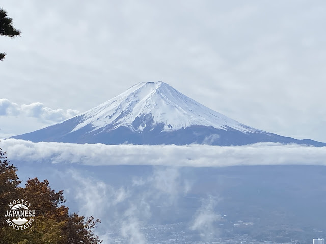
The view of Fuji from here is one of the best 100 in Japan. Or so I'm told. It was cloudy then and Fuji disappeared while I was on top.
This gaggle of people is on top.
This is looking down at one of the passes from near the NHK antenna.
There were a lot of people climbing here. It was something to see.
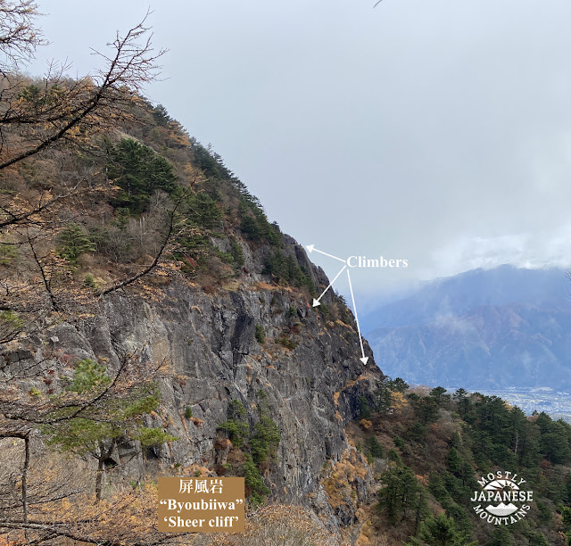
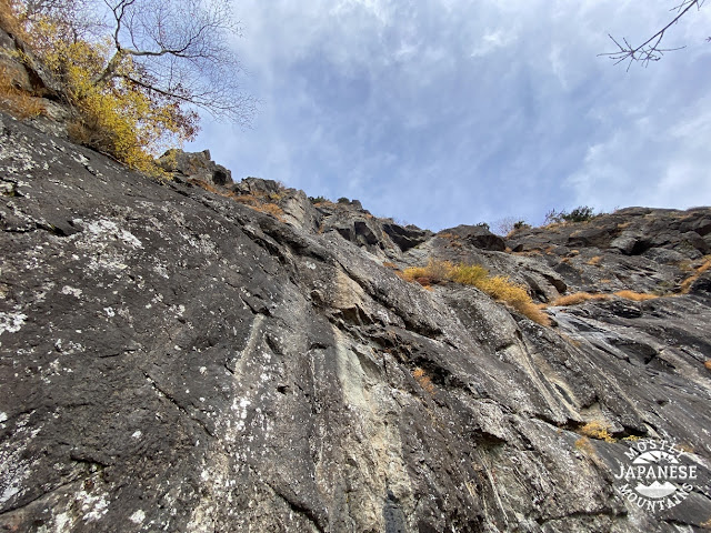
I'll only post one pic of the cliff. I could post 20. That is one gargantuan rock.
The name of this rock gave me a kick. Wisdom tooth is "oyashirazu" in Japanese which literally means something like "unknown to parents". I guess wisdom teeth are different than regular teeth, which are preceded by baby teeth--the existence of which every parent is aware. Just my guess. There is another rock formation down the trail that means something like "The empty-wombed saint."
It was all downhill from there.
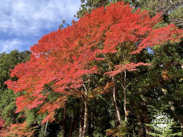
The last 2 or 3 miles were mostly on a lovely, winding paved road lined with Japanese maples and lots of flowers.
Mt. Mitsutoge is 3 peaks, not just the one pointed at in this picture.
This is the route I took. Feel free to ask me any questions you want about it if you are interested in hiking around here.
Come again! I hope to get in some more leaf-peeping before the snow flies.
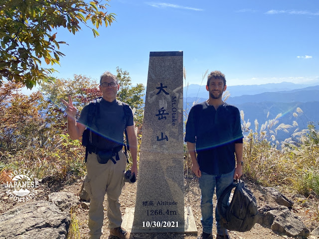
What a wonderful, warm fall day for a hike! It was really nice and I was happy to take a hike up over Mt. Otake with my buddy, Mike.
For this hike, since it was a beautiful fall day and seeing as the COVID restrictions have just recently been lifted in Tokyo, I knew the usual routes would be heavily trafficked so I opted to head up to Otake from the Senzoku bus stop in Hinohara. Most people go to Otake from the north side of the mountain and take the cablecar up to Mitake on the way.
I think it was a good choice. We saw very few people on the trail but there were about 100 people on top of Otake when we got there. I shudder to think what their hike was like coming from the other direction. Even on Nokogiri there were about 25 people. I've been there 4 or 5 times and have never seen anyone there before.
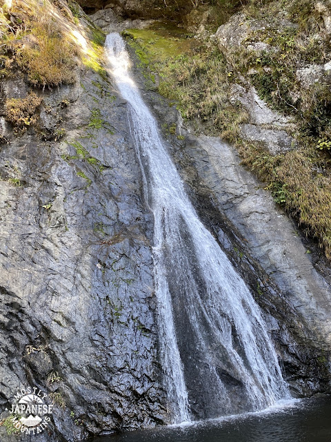
Tengu Falls is just up the trail a bit from the Senzoku Bus Stop. It's a silly place as you will see later in this blogpost. Stay tuned.
Fuji was there in all its glory today. On this route, there are a few spots to see it.
Otake is only a few hours' climb. It was packed up there. Mike and I had to wait in line to get this picture taken.
I was surprised that so many leaves had changed. My last hike was just last week to a colder place and at a higher elevation, but the leaves were changing here faster than there.
From Otake, we descended to Mt. Nokogiri and soon after that took a right turn so we could climb Mt Tenchi before finally descending through the Unazawa area to get to the train at Shiromaru Station. The trail traversing Mt Tenchi doesn't really show up on maps so I had never done it before but I'd always been curious about whether Tenchi could be climbed or not. It can!
. . . and it has a nice view. The highest mountain in this picture is Mt Honnita.
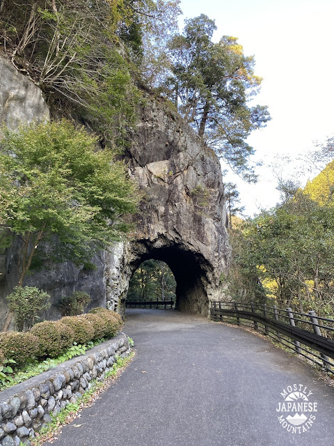
Before reaching the station, there were a few more interesting things to see walking along Ome Kaido and the Tama River.
This is the route for the day. We used public transportation for this hike. There is a bus from Musashi Itsukaichi Station bound for Fujikura that stops at Senzoku. Returning, we took the Okutama Line from Shiromaru Station.
As I said, Tengu Falls was a funny place.
See you soon. I hope to get in some serious leaf-peeping soon.
This trek reminded me of the video above. I had the chance for a fall overnight and scooted up to one of the most beautiful places in the world for fall foliage, Nikko.
I was a bit sad about my being too early for the fall colors. They really haven't even started to change in Nikko yet.
So I really didn't expect to experience winter.
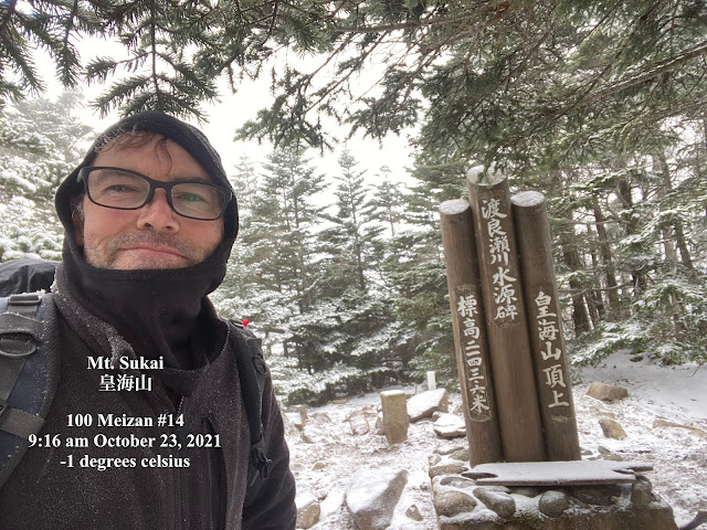
My last overnight was to Japan's 2nd and 3rd highest mountains and I had been planning to do a few mountains of similar elevation on these few days off. Logistically, it just couldn't make it work so I opted for the next nearest one of the 100 Famous Mountains; Mount Sukai on the border of Nikko in Tochigi Prefecture and Numata in Gunma.
I'd never even heard of the mountain before. It was nice to go somewhere completely different. Of course, I've been to Nikko before--I've even climbed there--but I've never been to this corner of it.
Let's get to some pictures.
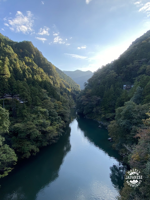
I'll put this one first. If any of you have been to my blog before, you probably already know that I'm mad about pictures of water.
My initial plan was to pitch a tent at a campground called Ginzandaira. That is a municipally-run campground whose contact is through the Kokuminsokajikaso ("Kajikaso"), an onsen/lodge next door. When I called to make a reservation and they heard my plan was to hike up to Sukaisan they told me a better plan would be to stay at an (un-manned) mountain hut they also run which is a few hours further up the trail. That place is called the Koshinsanso. Boy, I am grateful for their advice and for the existence of that place. It costs ¥2,080/night and is a super-sturdy lodge with space for probably 20-30 people and futons you can use. What a godsend. Without this place, my initial plan really wasn't feasible. These trails are not conducive to moving as quickly as I usually do so I would have been very hard-pressed to cover the distance I wanted to. Also, since it rained on my first day, staying in a tent would have really made for a miserable time.
To stay at the Koshinsanso, you first stop in at the Kokuminsokajikaso and pay. Also, you must register a hiking plan with them.
Info for all of the facilities is here https://kajikasou.info/
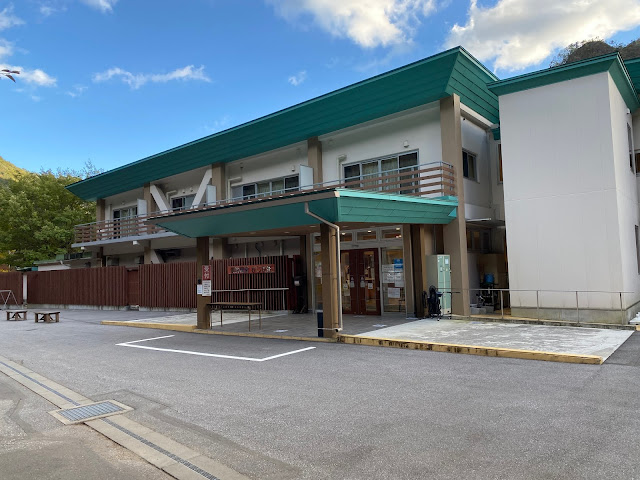
This is what the outside of the Kajikaso looks like.
I took a taxi to this point from the station. ¥3,000. Ouch. Because of the time of day after all the necessary changes of trains, a taxi was unavoidable.
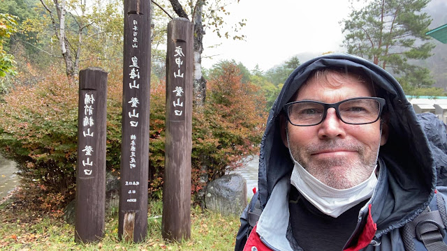
The entrance to the mountain trail is right outside. Do you know this handsome guy?
Day 1 was rainy, but it wasn't unpleasant. There was a beautiful stream and some falls to look at.
Bambi's family made a noisy appearance, too.
Did I mention I love pictures of water?
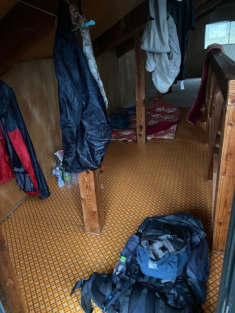
A couple short hours up the trail and I reached the Koshinsanso.
Home-sweet home
Not too shabby, eh?
I was up before three and out the door at 4.
Even though it was a full moon, light wasn't reaching under the trees and the mountainpeaks. It was pitch dark.
I hit the first major mountaintop just after 5. I'd hoped to catch a brilliant sunrise there but it wasn't meant to be. The mountaintop was covered with trees. The best I could get was a few glimpses of orange over my shoulder as I hiked along.
The early morning offered some nice views. It wasn't akibare (crisp, clear fall weather), but it was nice.
That is Mount Nantai in the middle of the next picture. If you have been to Nikko, you have probably seen this mountain. It looms very large over the most touristy section of Chuzenji Lake.
After a few hours, I encountered this chain. Yikes.
This is looking up the same chain.
Keen readers will note that you can't see the bottom from the top or the top from the bottom. It's long.
It was an exciting few minutes getting down the chain. I made a few notes to myself on the way down. 1. My glasses fog up when I'm really huffing and puffing. They needed to be removed. 2. The palms of the ski gloves I was wearing have no grip at all. They got changed out for my lighter work gloves.
To add fuel to the fire, just 100 meters or so in front of this obstacle is another similarly anxiety-inducing Rube Goldberg-series of chutes and ladders. I could see it with the naked eye but the camera didn't pick up everything so I added a note or two to the picture. I'm guessing it is about 50~75 meters from the bottom of the ladder to the top of the rope.
I got down the chain ok. I got up the rope ok, too.
This is what it looks like from the top of the rope.
Just then, everything changed. I decided to call it quits for the day. A minute or so after I took this picture, it REALLY started snowing. I mean, Wonder Bread-level whiteness.
I'm from New England. I like snow. I'm ok with being cold. I don't mind physical exertion.--that's why I go to the mountains in the first place. But I knew there were more chains and ladders ahead and I didn't want to try climbing a frozen chain or rope. Not alone without climbing gear or at least a Sherpa to carry my carcass out in the event. I like a challenge, but I don't want to become a statistic.
So, about 60 seconds after I completed my second obstacle, I was scurrying back down the rope.
When I got to the bottom, this happened.
So, 10 seconds after I climbed down the rope I'd just climbed up 60 seconds before that, I was climbing up the rope again to restart my journey.
(In case any of you thinks I am an idiot and was unprepared, I'll have you know that I carry enough food and equipment to stay out overnight if need be. I also carry rescue insurance and have apps on my phone to notify authorities in emergencies. I also check 3 different mountain weather reports before leaving my door. The problem is, the weather reports never seem to agree. They certainly didn't this time. One said it would be beautiful, one said partly sunny, and the last reported the apocalypse was coming.)
The rest of the way to the top was sometimes blustery and very windy. Snow alternated with sun until about noon. It was just below freezing all morning. That was good. The precipitation was nice, dry snow. It could have been cold, wet rain. Yuck.
I only mentioned one rope before. There were lots and lots of other ropes, chains and ladders in this area. I see why these mountains are graded 4/5 for muscular strength needed.
The last part of the journey was quite different than being up around the peaks. Around noonish, I started to descend and got to see what couldn't be seen at 0 dark thirty. On the one hand, it was a bit unnerving to realize how perilous a path I'd trodden. On the other, it was cool because it was full of caves. Big, big rocks and caves. Very cool.
The next two pictures are different perspectives of the same thing. It was really weird crouching down to squeeze through that in the dark.
A lot of the boulders are named. I thought this one was interesting.
It's almost midnight now and I have to go to work tomorrow. I would dearly love to keep blogging. These are really fun things to relive but I need to get on with life. I'll leave a pic of my route and leave it at that. If you have any questions about this trip, or any questions about hiking in Japan in general, fire away. Don't be afraid to ask. It's intimidating for non-Japanese to start hiking and camping here and I'm happy to help pass on what I've learned.