I wasn't planning on hiking yesterday but my gym was full so I shifted gears and went to the mountains. I initially planned on just doing some bushwhacking/trail running to bag a particular unimportant peak (Mt. Myogen). It's not got any trails to it and there are no views. It's only utility is for me to add another peak to my count (894) so I won't blog about that.
Anyway, it was a really gorgeous afternoon and I decided to make another quick run up to a viewpoint in the area to catch the sunset after I finished the first run. It's kind of a bookend I guess. I went to the same general area to catch the sunrise just last month.
Elevation:Lowest: 1,228m Highest: 1,375m Total Ascent: 266m Total Descent: 266m
Technical considerations/difficulty: A lot of this is runnable.
Facilities: There is a public restroom and a free parking lot by the campground. Arafune Panorama Campfield
Thoughts/observations/recommendations: There are a lot of deer in this area. The trail runs beside a cow pasture. I've never seen cows there myself, but have seen pictures.
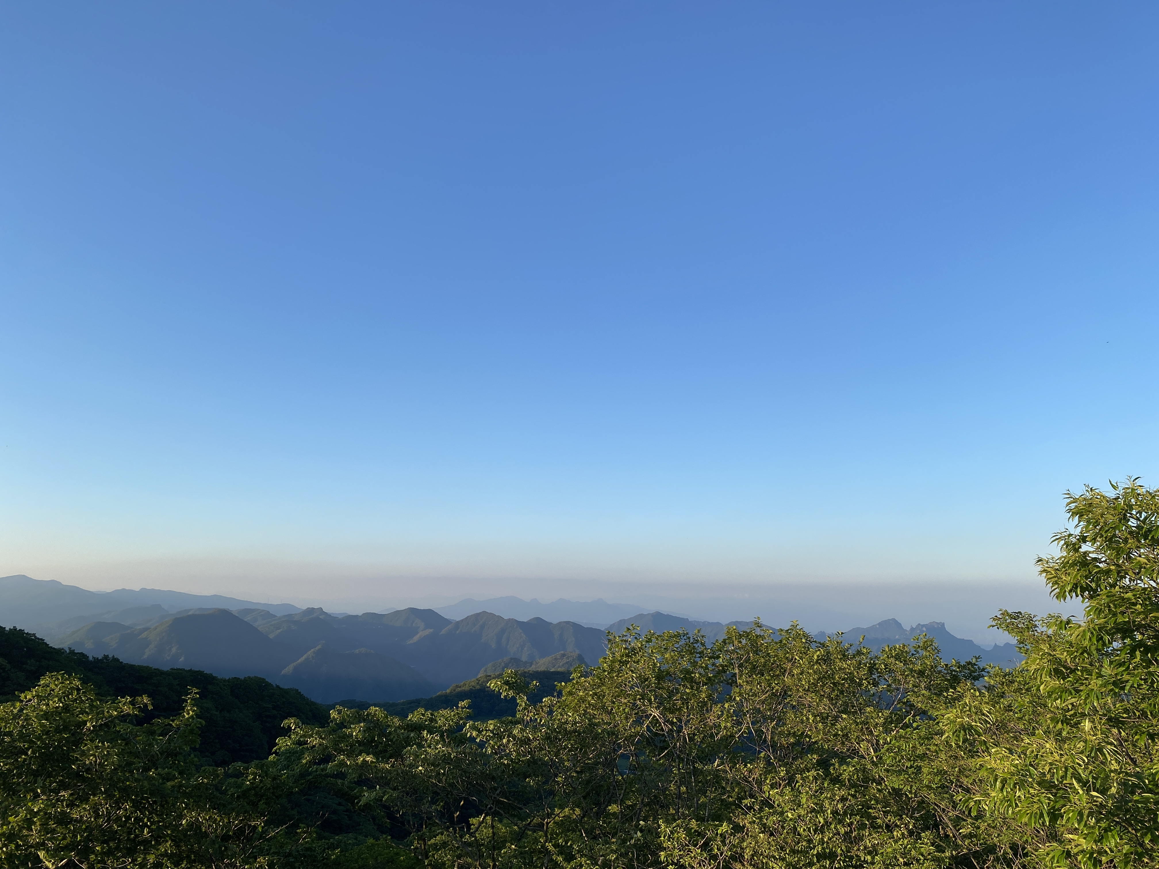
From the Uchiyama Wireless Relay Tower Observation Deck
If you want a loooooong video with music.
Here are links to a few other trips I've made to Monomi.
S'up? Welcome back for another tale from the mancave.
This is about Mt. Amakazari (雨飾山). The name is a combination of two Japanese characters. The first is rain and the second is decoration. I went there during rainy season. I shouldn't be surprised that it rained the whole day and that I didn't see anything. It was well and truly decorated in rain. I have to take everyones' word for it that the views are breathtaking.
Elevation:Lowest: 1,138 m Highest: 1,963 m Total Ascent: 1,053 m Total Descent: 1,053 m
Technical considerations/difficulty:
The primary concern is that it is steep. There are a lot of ladders and some ropes. No chains. Most of the hike seemed to be hand-over-hand climbing up boulders on the trail. The trail is quite narrow so I am glad I was there on a weekday in rainy season. It is crazily congested during fall foliage time and they have to take measures to limit the number of hikers.
Facilities:
The campground has a public restroom and camp store. There also sell portable toilets that you can use in the portable toilet booth on the mountain. On the mountain, there is a waterhole.
Thoughts/observations/recommendations:
You win some, you lose some. June presents hikers with certain opportunities and risks that demand judgment calls. On the on hand, the days are longer and the chance is there to go for longer hikes farther away than in other seasons. On the other hand, it can rain a lot. Amakazari wasn't my first choice for this day. I had planned on a 4+ hour drive to Fukushima to climb Aizukomagatake. The weather reports on the night before for that area looked less than stellar so I opted for a hike in an area of the map that had a better forecast. The forecast for Amakazari was for just for clouds. The rest of the country seemed to be looking at heavy rain. It didn't look too bad, and it is much closer than Fukushima so I chose that.
Nine times out of ten that I take a risk like this, I'm pleasantly surprised. I usually get at least some clear skies and some views. This was one of those other one times out of ten. 🤦♂️
I probably should have really thought this through better. After all, the word "rain" is half of the name of this mountain.
When I got home, Mrs. Caveman said something like, "Aren't you lucky it was a nice day?" I guess it was nice around our abode. I felt like Charlie Brown hearing that--like I had a cloud just hovering over me wherever I went.
Give yourself time to do this if you need it. Although it is only 8.2 km (about 5 mi.), the steepness seems to slow most people down. The average hiking time seems to be 7 hours but there are signs at the trailhead cautioning hikers that some people take up to 10 hours. I passed a lot of people on my way down whom I had encountered on my way up.
Don't miss the outdoor onsen on the way home. That was nice.
I'm sure it's beautiful during the leaf-peeping season--but it seems to be prohibitively crowded at that time.
Let's look at some pictures.
This is the campground office/store.
Public restroom and hiking notification drop-off spot.
For some reason, they mark off the distance in 400 meter increments. There are 11 markers like this. 1/11, 2/11, 3/11 . . . 11/11. I might not be as smart as an 8th grader but that seems to add up to 4,400 meters.
The first 15 minutes or so of the hike is rather flat. It's through a marshland over a boardwalk.
I thought that I had walked onto the set of Dr. Who for a minute.
Still hoping for a view.
This is the north peak.
That's the south peak, the highest point.
Coming down, there were some nice flowers
In the last 5 minutes of the hike, the sun came out.
Even then, I was denied a view. Mt. Amakazari still managed to hide.
Drat you, Amakazari!
After getting off the mountain, not too far down the road, I dropped by an open air hotspring. (rotenburo). It was awesome. Thankfully, there was nobody on the men's side and I could sneak a few pictures.
There is nobody manning this place. There is a box for donations and the amount you leave is up to you!
After cleaning up, I was very ready for some craft ice cream at my next stop. This is the Otarian Gelato Shop. I had Garden Huckleberry and Red Shiso sherbet. (Shiso is perilla in English. It's an herb related to the mint plant.)
Well, that's all the Caveman has for you today. Tell your friends about the blog. Subscribe. Look at the youtube channel. Or not.
But, if you don't, I hope you get rained on like I did. ☔ 🤣
Until I blog again, how about checking out another of the 100 Famous Mountains in the same national park?
I had the chance to hit a few nice mountains the other day. Thanks to a case of anticipatory insomnia, I got up super-early and was able to hike about twice as many as I'd planned.
I had something to do in Tokyo on Saturday night. Since I wasn't committed until dinnertime, I thought it would be a good chance to bag a few peaks on the way. There are a lot of mountains between here and there but I decided to retrace some of my footsteps from a past camping trip in order to bag just the one peak that got away. On that past trip, I hiked from Mizugaki to Kobushigatake on a 3-day trip. On the way I skipped Mt. Okusenjo. So I decided to go to the middle of that last hike and hike up to Okusenjo before heading on to Tokyo.
This is an animation of that first camping trip, by the way. I highly recommend mimicking my plan. It was awesome. The Caveman would not give you bad advice.
As I mentioned before, I got up too early. I ended up finishing my planned hike around 9:00 am. Even though I still had 3 more hours to drive to Tokyo, dinner was a long way off. I decided to head back on the other side of the trail up to Mt. Kinpu. That is a great mountain. It's one of the 100 Famous Mountains and is really prominent. You can see it really well from places like Koshu and Kofu across the fruited plain of Yamanashi's grape/peach country.
I'm sorry. This post is way too personal. I want this blog to draw your attention to the mountains. They are more interesting than I am.
Without further ado, here are the deets and some pics.
Location:
Around Kawakami Village, Nagano and Yamanashi City, Yamanashi
Kinpu (Honorable mention for Mt. Kokushi as one of Yamanashi's 100 Famous peaks.)
Getting there/getting around:
I drove. That drive is another in a long list of experiences I am glad to say that I have but that I wouldn't do again if I knew then what I know now. There is a forestry road that goes over the pass. The north side of it, from Kawakami Village in Nagano, is not paved. That's the side I drove up in my little k-car. I wouldn't do that again. The southern side, through Yamanashi, is better. That side is well-paved. It's winding and narrow and there is a fair amount car and bicycle traffic going both ways so that side too has its particular dangers.
There is a parking lot at the Odarumi Pass. The Odarumi Lodge/Campsite has transportation information, in Japanese, on their site. The nearest station is Enzan. It's an hour and a half by taxi from there.
I think that, for most people, the Odarumi Pass is a waypoint on a longer trek and not the starting point. The last time I passed through there was on a 3-day-hike from the Mizugaki Sansou to Mt. Kobushigatake. I take back what I wrote there. I wrote that before making this trip. I think the reason I didn't see anyone in the parking lot last time was because it was a weekday. This time I was there on a Saturday and it was really crowded. The parking lot holds probably 30 cars but it was already overflowing when I arrived--at 5 am. On my way home, I counted the cars lining the road. I stopped counting at 140. 🫨
Map:
For 2024, the Yama to Kogen Map is here: Kinpu Kobushi Map. If that link goes dead in future years, try searching for 金峰・甲武信 on the Mapple web site to get the latest Yama to Kogen Map.
In summer, this is a fairly straightforward hike. There are not so many chains or ladders in this area. To the east of the pass, up to Mt. Kokushi, much of the trail is actually boarded over so it's very easy to walk. Around Mt. Kinpu, there are some boulder fields where you need all four limbs to get along and it is quite exposed. Mt. Kinpu is the highest point around for quite a ways so I imagine it is subject to some extreme weather in the winter.
Facilities:
There is free parking and a public restroom next to the Odarumi Hut. The hut has food, soft creams and a water hole. There is nothing on the trail except for a bench here and there.
Thoughts/observations/recommendations:
Do it. Any of these mountains are great.
Picture Time
This is what the beginning of the forestry road looked like at 4:30 am.
It was a little nerve-racking.
The Odarumi Hut
Easy-peasy
This is the top of Mt. Zen Kokushi ga Take (Mt. Front Kokushi)
Many Japanese mountains have sub-peaks named "Front" or "Back". That is the "Zen" part of this mountain. Kokushi means something like "Country" and "Teacher". The scuttlebut is that the locals named it after a zen master/rennasissance man by the name of Muso Soseki.
Mt. Kinpu is the one just to the right of center in this picture. The spiky thing just to the left of its highest point is a giant boulder. I'll show you an up-close shot later.
I'll also put a lot of pictures with labels on them at the end of the post.
Remember I mentioned that I went here to bag one peak? This was it. Mt. Okusenjo. No view or anything. 🤣
6 hours driving. 6 hours walking. Gas. Wear and tear on the car. . . . Etc.
Still worth it.
Kita Okusenjo
Frost! 🥶 The air temperature was way above freezing. I did see a little--very little--ice on the trail, but this really surprised me.
The top of Mt. Asahi ("Morning Sun")
Mt. Kurogane
The marker on Mt. Kinpu commemorates the 500th anniversary of Kofu.
This is on top of Kinpu.
This pile of stones is the rock I referenced way back in the post. (You were paying attention, I hope.) It's called Gojoiwa (五丈岩). You can't climb it. It's forbidden by the people in charge of the shrine.
That is Mount Mizugaki from Mt. Kinpu. Mizugaki is one of my favorite mountains. Isn't that cool looking? Someday I will try to put it on the blog. Mizugaki is one of many places I went before I started blogging.
More from Kinpu
And, for any of you nerds like me, I'll leave you with some labeled pictures so you can know what you're looking at.
I still had time to kill before going to Tokyo so I lounged at the Hayabusa Onsen over lunch after washing the grime away. Very nice.