Mt. Ena of 100 Famous Mountain Fame in the Chuo Alps.


Hello, everybody

Here is a report on a hike to Mt. Ena which straddles the border between Nagano and Gifu Prefectures.

Location:  Central Alps (Kiso Mountains)

Starting and stopping point:  Trailhead entrance Parking Lot

Peaks bagged: 恵那山 Mt. Ena ~ 大判山 Mt. Oban ~ 千両山 Mt. Senryou ~ 富士見山 Mt. Fujimi

(First-time) peaks # 920~923

(First-time) 100 Famous Mountains peak #35  Mt. Ena

Getting there/getting around:  Car  

Map: ***The Caveman is giving up on posting links to Yama to Kogen maps.  They go out of date and the links die.  If you want one of those maps, comment and I'll get you a current link.

Here is a printable online topo map

Weather Information: 

Mt. Ena Weather in Japanese

Total Time:  7:24 Break time:  :39 Distance:   17.9km

Elevation:  Lowest: 1,145m Highest: 2,191m Total Ascent: 1,472m  Total Descent: 1,472m

Technical considerations/difficulty:  It's steep.  For quite long distances, the "trail" is covered by very tall bamboo grass.  It's not dangerous but very annoying.

Facilities:  There are public restrooms at the parking lot and at the refuge hut near the top of Mt. Ena.  And, as I just mentioned, there is a refuge hut.

Thoughts/observations/recommendations:  

Most days after a hike the caveman enjoys gathering his pictures and thoughts to post them on this blog.  Not today.  I'm putting up this post just because I have a bad memory and need to record these hikes or I will forget.  

This hike was OK, but not as spectacular as my last few--or how promising my next planned hike is.  I'm told there are spectacular views from the mountain I went to yesterday but I can't tell you from experience because most of the day was too hazy or cloudy.  Mt. Ena is one of the 100 Famous Mountains, but I couldn't really see why when I was there.  The route I took up, even if it weren't cloudy, was below the treeline and I wouldn't have been able to see anything from there even if it had been clear.  The top of the mountain has no view.  Near the top, there is a boulder behind the refuge hut that has a great view (I am told.)  


Below is a map showing my route and its pitfall.  My plan was to go straight to Mt. Ena from the Ogawahara Trailhead and return same way.  That would have been a fairly short hike of 13km or so.  I was so disenchanted with the lack of views and with having to bushwhack through so much bamboo grass that I decided to just keep going past Mt. Ena and come around in a circle passing over 3 other peaks on the way.

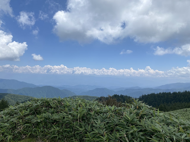
Thankfully, the trail conditions were more pleasant on that side.  It is obvious that the views would be better there, too.  Unfortunately, it was too hazy to see much.

My recommendation:  Start an finish at the Kamisaka Pass/trailhead.


Here are some pictures.

This bridge is just at the beginning of the trail.


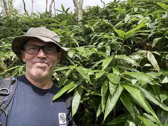
In many spots, the bamboo grass was this high.  It was very wet so I was absolutely soaked through for the first half of the day.


Walk around the back of the refuge hut and climb the boulders behind it for the best view.
(I didn't bother because of the haze.)


leaves

Ena

Tengu no to


bushwhacking


Maybe Fuji is out there?


Sigh

There were a lot of snakes.  I think I saw 4 or 5.


The river conveniently runs by the parking lot.


River

Oh, yeah.  That's the ticket.


My boots and socks aren't the only things that got removed to go in the water and cool off but this is a family blog 😏.


That's all for this report.  Subscribe.  Etc.  Whatever.  Caveman out.


A year ago this week, I made another trip to one of the 100 Famous Mountains in the Chuo Alps.  I got robbed of views there, too, but it was a good trip.  Check it out here:


Caveman Conquers a Volcano. Mt. Tokachidake of 100 Famous Mountains Fame.


Yo!

What is up, cavedwellers?  Mrs. Caveman is the best.  The very best.  She took me to Hokkaido for my birthday and let me climb two of the 100 Famous Mountains.  This report is about the second of the two, Mt. Tokachidake in the Taisetsuzan National Park.

Area:  

Location:  Daisetsuzan National Park, Center of Hokkaido

Map:  Online Printable Topo Map (Now in English!)

***The Caveman is giving up on posting links to Yamatokogen maps.  They go out of date and the links die.  If you want a map, comment and I'll get you a current link.

Starting and stopping point: Tokachidake Onsen

Peaks bagged: Kamifuranodake  Kamihorokamettokusan  Tokachidake

(First-time) peaks # 917~919

(First-time) 💯 Famous Mountain peak # 36, Tokachidake

Getting there/getting around:  

I drove.  There is bus service to the Takachidake Onsen
 

Time and distance*

Total Time:   6:06 Break time:  :39 Distance:  13.1km
Elevation:  Lowest:  1,268m Highest:  2,077m Total Ascent:   1,231m Total Descent:  1,231m


Technical considerations/difficulty:  

For the most part, the trail is very well marked.  In clear weather, it would be very difficult to get lost.  If the weather turns though, visibility gets very bad and thankfully there are guide ropes along the sides of the trail where it is most needed.  

Much of the trail is quite steep.  There aren't any chains or ropes that you need to pull yourself up but it is steep.

Facilities:  

There's nothing on the trail except for the Kamihoro Refuge Hut/Campsite just off the top of Kamihorokamettokusan.  It looks like there is a portapotty there but I didn't go that close to confirm it.  There is nothing for sale there.  

There is no water on the trail.

The onsen, of course, is a nice place to clean up and get some snacks after the hike.
 

Thoughts/observations/recommendations:  

Do it.  If you can get here, do it.  I couldn't sleep the night after my trip.  I kept waking up dreaming about the cool hike of the day before.

Let's look at some pictures and stuff.
google earth map


Here's a long video of the hike.  Don't feel obligated to watch it.  It's longer than my attention span.


sign


Meoto


bug

bug2


Sanddan yama


Mt. Tokachi


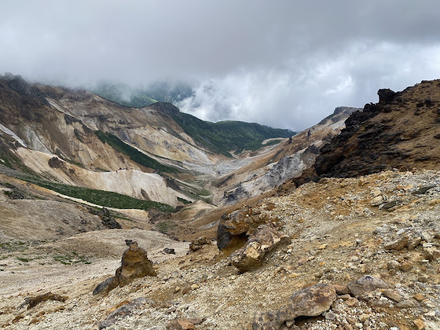
Looking down at the Ansei Crater (安政火口).  At the end of my hike, I wandered around inside for a while. 


This reminded me of scenes of trench warfare in WWI.


Pushing up to the top of Tokachi


Tokachi Top


After coming off the ridges, I took a stroll around the Ansei Crater.  It was cool (but hot!😜)


Bus schedule at the onsen


The Onsen


Well, cavekids, that's it.  I'm still on vacation and am scheming to get to another mountain tomorrow so I want to post this right away.  Take care.  

Oh yeah, don't forget to subscribe and tell your friends about the Caveman.  Google doesn't like me so hides my posts.  😜

If you want to see the other post from our trip to Hokkaido, check it out here.  

Caveman out.