I shouldn't be making this post. I should be in the mountains now. I've caught the Wuflu and have to stay in for a week or so. (I'm really not feeling that ill and am getting better quite rapidly. Don't worry about me.)
Since I can't be there in person, I've decided to go there virtually and blog about a few trips I made before starting this blog. This first one is of one particular bike trip I made out to Okutama and back.
Elevation: Lowest: 106m Highest: 1,161m Total Ascent: 4,120 m Total Descent: 4,120m
Thoughts/observations/recommendations: This was a very cool ride. The Shuyudo winds up and between Mts Mito and Tsukiyomi from Lake Okutama on the north to Hinohara Village on the south. It's a popular road with bicyclists, motorcyclists and sports car drivers. It gives breathtaking views of the lake below and there are a few parking lots with great lookout points to take in the sights. You can get a great view of the profile of the mountains along the Ishione (Rock Ridge) across the lake. The weather didn't cooperate very well for visibility on this day, unfortunately.
You do need to keep your wits about you. I have come upon more than one accident on that road.
This closeup is focused on the Shuyudo area.
One thing I like about these animations is that they are always 30 seconds long. If it is a short hike, the little guy just crawls along. On something long like this, he runs faster than Charlie Sheen on Bolivian marching powder.
This particular bike ride is one I've done a few times. It takes me a couple of hours to get to Lake Okutama. Then, I ride along the north side of the lake for a few more miles . . .
. . . before crossing over to the south side and entering the Shuyudo around the base of Mt. Mito.
Shuyudo translates to something like excursion/circular/fun road. It's gated and locked at night. The opening hours are 8 to 7 from April through the end of September. The rest of the year it's open from 9 to 6.
On this particular trip, I encountered lots of monkeys.
And, of course, I encountered the monkey remains you saw in the first picture.
I still kick myself for not bringing that skull home. It was so cool.
If I recall, I actually saw that skull 3 times in 3 weeks. Once was on this trip. Then, I passed by the dead monkey a week later when hiking to Mt. Mito with my son. I managed to lose my wallet on that trip and returned the next week to retrace my steps. I didn't find my wallet on that trip but eventually, JR (Japan Railways) contacted me. They found my wallet near one of their ticket machines. I got it back in completely intact weeks after dropping it. I love Japan.
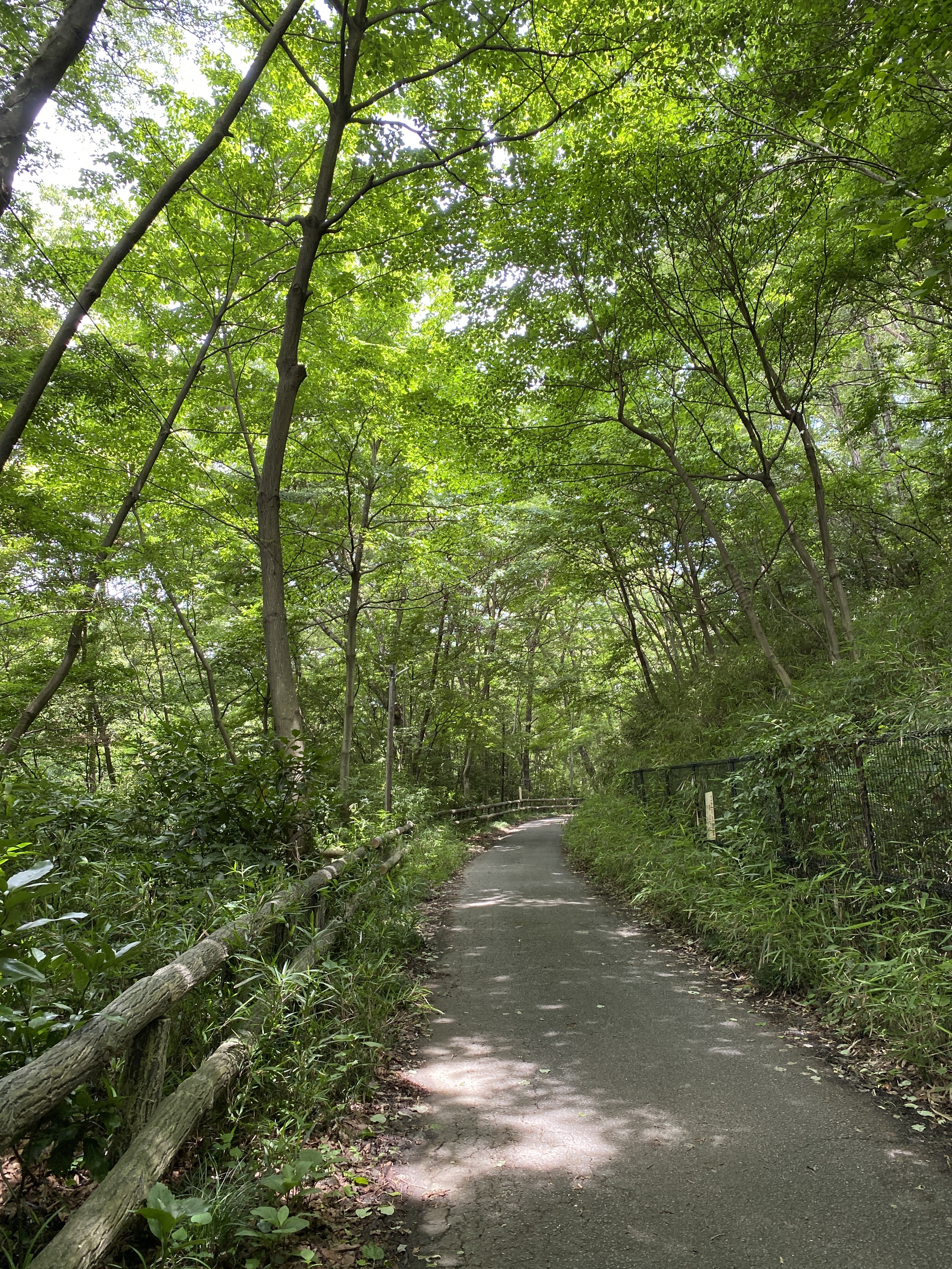
The Shuyudo is fairly steep and winding. It's a lot of work to go up it, but the views make it worthwhile. And going down is just too cool for school.
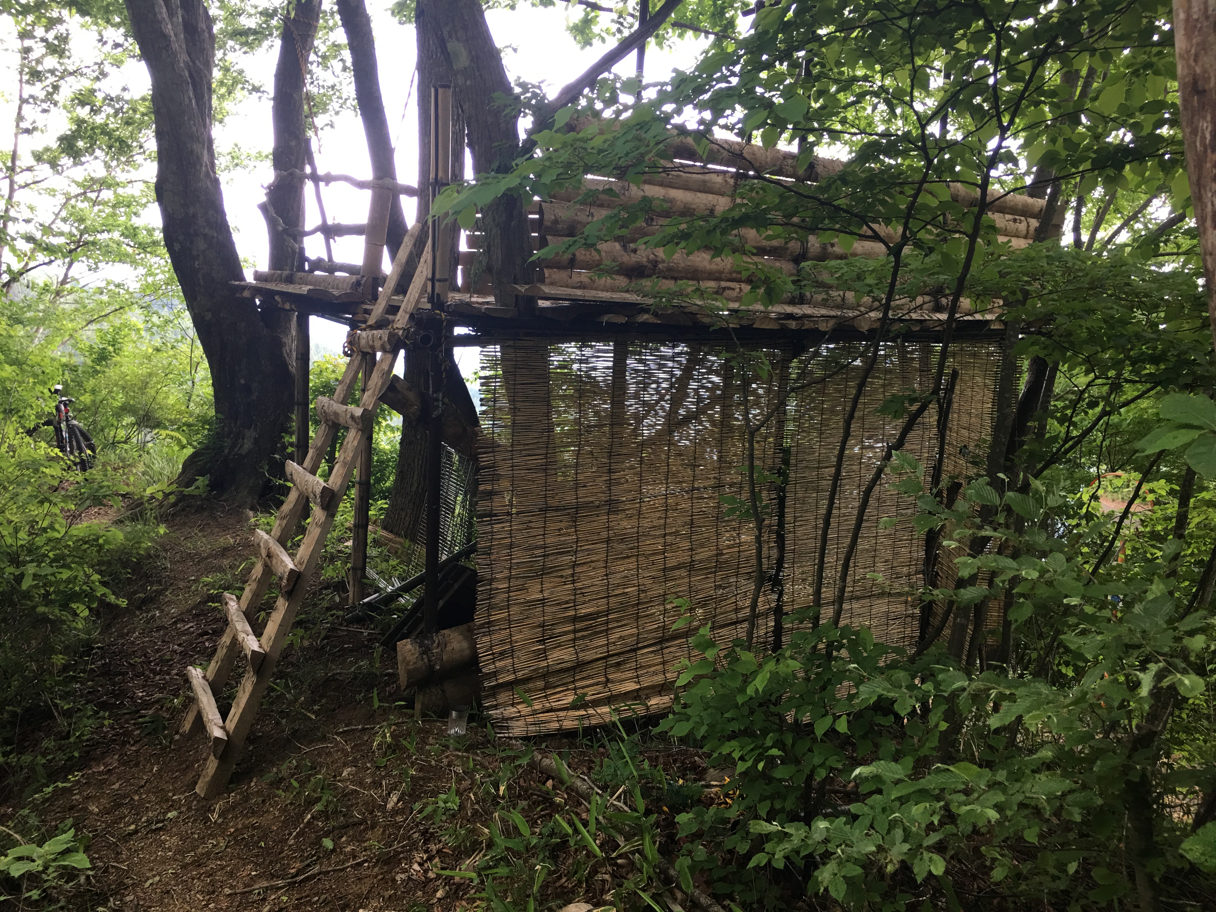
This is where I left the Shuyudo. Were I to continue on it, I would have soon passed the Tomin no Mori and then on into Hinohara Village from there. Instead, I did a little B and E to get through this gate into what I came to think of as Deliverance country. Seriously, you could almost hear Dueling Banjoes in the distance.
There were a few structures like this in that area. Is it a hunter's hide?
I got off the bike for just a short time to walk up to the top of Mt. Kurakake. It wasn't the safest place to be.
And that's all I'm going to say about that.
I'm stuck at home for another 3 or 4 (5?) days so I'm sure I'll be blogging more later. Take care and be sure to subscribe. If you don't, a pit viper might come and bite you.
This post is dedicated to Michael B., a legend of mountain biking. He left us too soon.
Welcome to the mancave. I trust you are beating the heat this summer.
I decided to drop by a cooler part of the man-cave today since the heat of July is upon us. It has been quite a while since I ventured up to the Sayama Hills and Tama Lake area and since today was a better day for a bike ride than a hike, I headed up there.
The Sayama Nature Park is a sprawling wooded area surrounding two large lakes divided between two prefectures and spreading across several cities and towns.
The two lakes, Sayama Lake to the west in Saitama, and Tama Lake to the east in Tokyo are both drinking water reservoirs. Both lakes offer great views of the mountains to the north, west, and south.
Since they are sources of drinking water, there is no boating, swimming, or fishing. The area surrounding the lake does have plenty of opportunities for leisure. As I already said, there are LOTS of hiking and biking trails. The trail surfaces range from rocky and bumpy mountain trails to smooth, level hiking paths to paved dedicated bicycle paths to paved roads for car traffic. Along with those pathways, there are numerous picnic spots, restaurants, onsens, and love hotels. (Rest ¥4,000! Stay ¥8,000. You can imagine.) The Seibu Lions (pro baseball) play at the Belunna Dome and kids of all ages can play at the Seibu Yuenchi (Amusement Park). There are too many shrines and temples to count.
I can get to the general area from home in about a half-hour. To take a trip around both lakes is about 20 km. You could cut the trip more than in half by circumventing only one of the lakes. There are also too-many-to-count minor trails you can detour on. As a matter of fact, I should tell you that a GPS is a good thing to have here because it's easy to get twisted around.
Japan cracks me up. There is so much random cuteness. This is the last house before entering the park.
Starting out. This is one type of road surface.
I actually got off my bike and did some "climbing" today.
I made it to the "top" of this 145-meter-tall "mountain." I try to climb at least one mountain a week. I guess this counts.
Tama Lake below with the Belluna/Seibu Dome in the distance. That dome is a great landmark from the mountains. It is visible for a long way.
The domed structures in the foreground are water intake towers. They are where the drinking water pipelines begin.
The Ferris Wheel at Seibu Yuenchi from Tama Lake
Getting to the area between the two lakes now. This is the dome up close. I think there actually was a game going on.
Now starting around Sayama Lake. The road surface on this side of the park is much rougher. I wouldn't do it if I weren't on a mountain bike.
"Takane Ridge Road" in the "Rokudoyama Park"
I really should have taken a more representative picture of the road through this area. It's quite rocky and bumpy for a few miles. (ie, it's fun!)
This place is Rokudoyama (六道山) Observatory at Rokudoyama Park. There is a water fountain, a public restroom, and picnic tables in the park. You can climb to the top of the observatory for a great panorama. It wasn't clear enough to bother climbing up it today so I'll post some pics I took on a past trip.
March, 2021
Speaking of pictures I didn't take today . . . On a past trip, I stumbled on this spot which has a fantastic view of the runway at Yokota Air Base and I was able to watch C-130s landing and taking off. I had my binoculars with me that day, so it was really cool. The exact spot is here:
I am Patrick, a sinner, most uncultivated and least of all the faithful and despised in the eyes of many.
St. Patrick
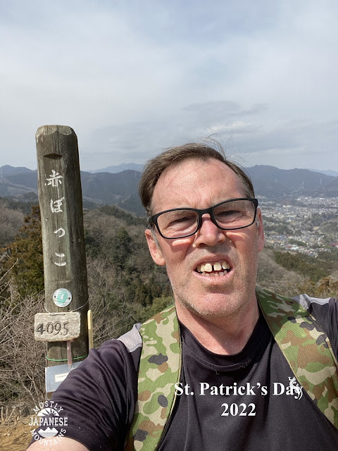
For March 17, I did a bit of hikeling and even a little hanami (flower viewing).
I worked for about 15 years in Akiruno and I came to love the mountains so much in large part because of these trails and forestry roads that are so accessible to my former workplace. It was a huge treat to be able to take a hike right from the school grounds.
Yesterday I headed out on my bike to a trail that runs between Hinode and Ome City. I passed over a nice little bump called Mt. Akabokko on my way to 梅の公園 (Plum Park). I was not actually planning about blogging this because it wasn't the most photogenic tour but I do think I can share some information that people looking for hanami or hiking recommendations in the area might like. Don't expect a lot of beautiful pictures in this post, though.
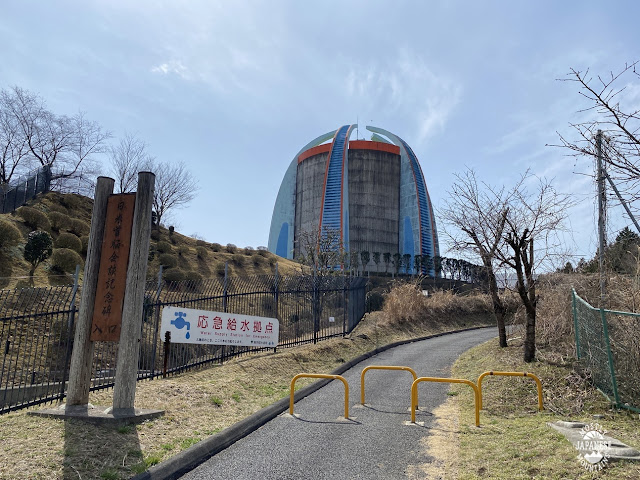
On the way out there, I passed through Oguno. If you have spent any time in Akiruno or Hinode, maybe you've noticed this thing in the picture and wondered what it is. It's an emergency water tank on top of a hill. It's visible from quite a distance. It's behind a junior high school and there is a little park and a peace memorial nearby. The memorial commemorates a visit by President Ronald Reagan to Japan. I always wondered if it wasn't a backhanded compliment to put that memorial in a place where it's a sure bet that almost nobody will ever see it. The Gipper is like Rodney Dangerfield; he don't get no respect. No respect at all.
This spot is a worthy destination if you need an excuse to go for a bike ride.
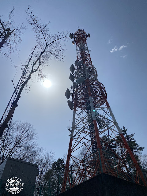
I entered the woods near Futatsuzuka Pass at Tokyo FM's antenna.
It's a hiking trail but about 50% of it is ridable.
That's much steeper than it looks. And bumpier. Those are stairs.
This is Akabokko. This little hill has surprisingly nice views. This is looking west towards Yoshino Kaido and Okutama.
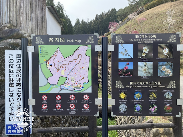
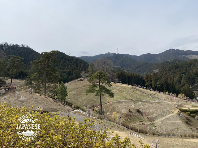
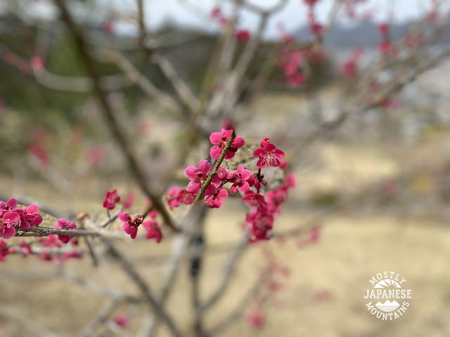
This is at the Umenokoen (梅の公園).
https://www.omekanko.gr.jp/spot/81501/
I have walked or ridden past this place a few times because one of the trailheads to Mt. Hinode is nearby but this was my first time to go in. The nearest station is Hinatawada or Miyanohira. I walked there once after coming out of the woods. It was a little longer than most people would probably want to walk for a picnic. I assume you could get there by bus from Ome. There is parking for cars and bicycles.
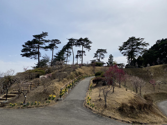
The grounds are very nice but the trees are all very young and small. Evidently, there was some tree blight that wiped out the trees around 2013 and they had to be replanted in 2015. It was a nice place for a picnic but not much to write home about. It's too bad because the neighborhood around the park is geared for tourists. There is a restaurant right in front of the park and there are plenty of small businesses selling local delicacies. I'm looking forward to seeing what it will be like in about 15 years.