This Caveman has not blogged in a while. I've been hiking, just not anywhere worth telling you about. I've been spending a lot of time hiking places that have been on the blog before.
This past weekend, though, I got to a trail I've had my eye on all winter as I waited for the road to open up.
I hiked the portion of the Mt. Kirigamine/Utsukushigahara Central Divide Trail (霧ヶ峰/美ヶ原中央分水嶺トレイル) between Mt. Mitsumine and Mt. Chausu.
. . . about the Mt. Kirigamine/Utsukushigahara Central Divide Trail (霧ヶ峰/美ヶ原中央分水嶺トレイル)
This trail is 38 km long. I guess it's like North America's Continental Divide because any raindrop that falls on the north side of the trail will drain into the Sea of Japan, and any raindrop that falls to the south will drain into the Pacific.
All of the trail is great! It doesn't have that much change in elevation, so much of the trail is snowshoeable in winter. It has two of Japan's 100 Famous Mountains along it and the trail offers views of Yatsugatake, Mt. Fuji, the Southern, Central and Northern Alps, Mt. Asama, and some of the mountains of Tochigi, Gunma and Saitama.
Area:
Between Nagawacho and Matsumoto City in Nagano Prefecture.
Location:
Map: ***If you want a link to the latest Yama to Kogen map, comment and I'll get you a link. This link is to a printable topo map centered of the Tobira Pass.
n.b. The road here is closed from November to April.
Peaks bagged: Mt. Mitsumine (三峰山)* Not sure why it got this name, but it literally means "Three Peak Mountain." ~ Mt. Chausu (茶臼山)* "Chausu" seems to refer to a sort of mill or grinder used for making matcha tea. The mountain's shape resembles one of these. It's a very common mountain name. There are supposedly 200 peaks with this name in Japan.
(First-time) peaks # ---
Getting there/getting around:I parked at the Tobira Pass Parking Lot on the Venus Skyline. This road is not open in winter.
The Caveman did it in: Total Time: 4:53 Break time: :54 Distance: 11.8 km
Elevation:Lowest: 1,601m Highest: 2,006 m Total Ascent: 1,033 m Total Descent: 1,033 m
Technical considerations/difficulty:
Nothing especially difficult or dangerous. The trail is well-marked. There are no ropes, chains, or ladders. The hike from the parking lot up to Chausu is a bit steep, but not too bad.
Facilities:
The parking lot has portapoddies. The restaurant there is out of business. I snuck behind it to catch the view. (It was 👌 nice.) 😊 Be careful if you go back there, though. I managed to fall into a drain pipe back there. I stepped on its cap and it shattered. It must brittle be because it's so old. If you hike in winter, you can probably understand when I say it was the same sensation as when one foot breaks through the top crust of snow and you sink in up to your crotch. There's a picture below.
Thoughts/observations/recommendations:
I'm glad I did this. These are lovely mountains and the hike allows for some really great views. I have been on both mountains I summited before but this enabled me to connect the dots with past hikes. Now I can trace my footsteps in an unbroken line to the far side of the Utsukushigahara Plateau.
(Along with all the regular stuff such as maps, headlamps, boots, feet, and brains, . . .) don't forget:
to watch your step always.
Let's look at some pictures.
The reason I chose this particular route is that I needed to connect the dots of past hikes. Several months ago, I took this picture after I'd passed Mt. Mitsumine from Mt. Futatsu.
I had been to both mountains, but wanted to walk the trail between them or I would never feel complete in life.
The red circle represents the area between the two mountains.
I had to wait all winter before I could make this hike because the road is closed from November to April.
By the way, the mountains to the north of Chausu are the Utsukushigahara ("Beautiful Plateau"). They really are beautiful.
This is what my map looks like now after the hike.
Now I can sleep at night.
This is what the hike looked like.
I started near the midpoint between the two mountains at the Tobira Pass Parking Lot where this defunct restaurant stands. Even though it is closed, I couldn't help but sneak around the back to take advantage of the viewing point it boasted of.
That's how I almost injured myself before the day even began!
Some of the Northern Alps
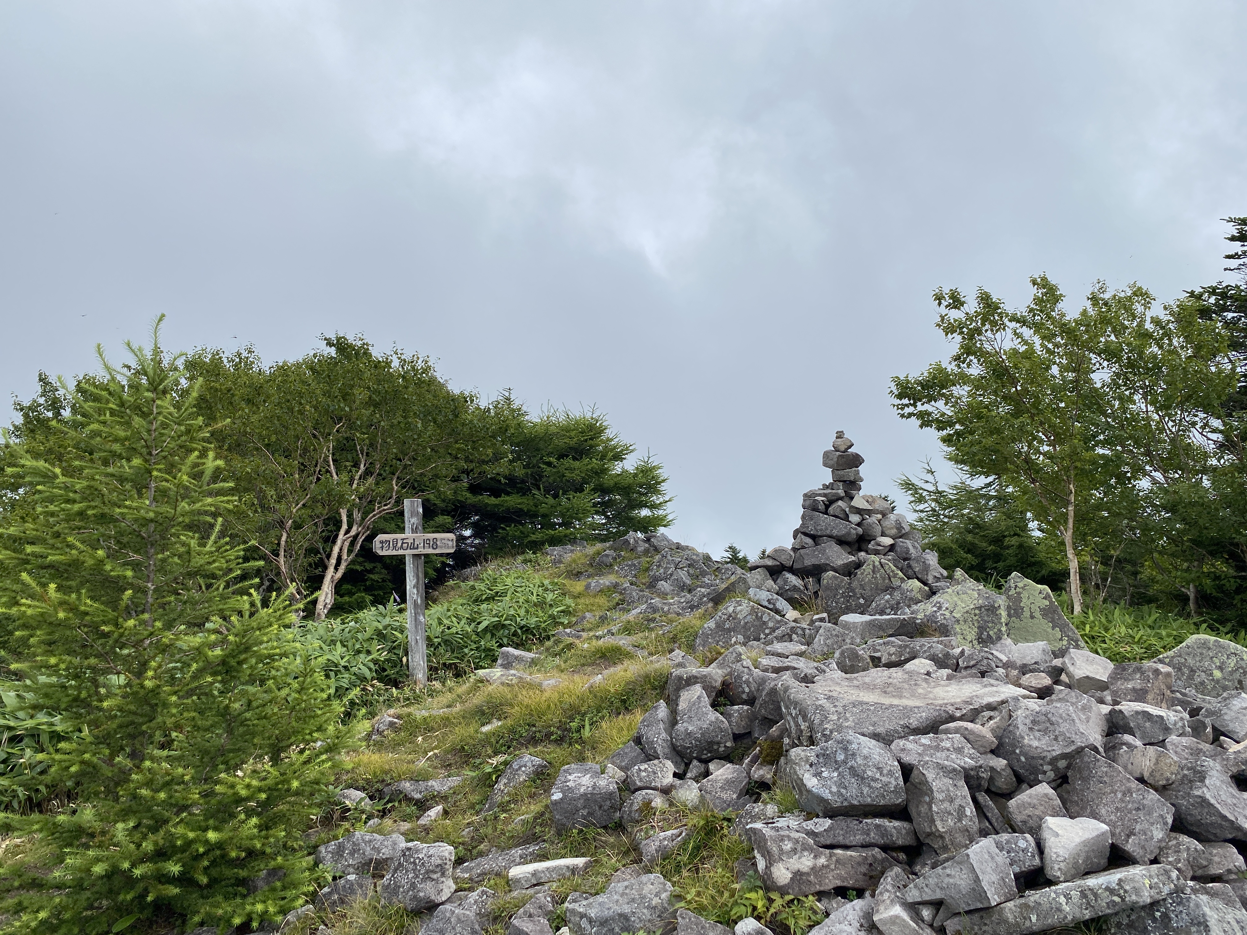
That is Mitsumine ahead.
Oila, the top!
Same place, in fall.
From Mitsumine, you can see Mt. Kuruma (or Kirigamine). There is a big, round antenna on top.
This is what the antenna looks like up close.
And this is what the mountains I hiked on this particular day look like from that antenna's location.
After a bit of a walk back, I passed through the area where I'd parked and then headed up to Chausu.
The trailhead is right across the street from the parking lot.
The top of Chausu.
Oila!
Straight ahead is Ogato--one of the peaks on Utsukushigahara. You might see the antennae on it.
To the right, you might see a red thing and a white thing. Those are art installations of the Utsukushigahara Open Air Museum. It's really cool.
By car from Tokyo: Take the Shuto Expressway to the Chuo Expressway and exit at the Suwa I.C. Then follow the signs to the Venus Line roadway and take that from Kirigamine. Take the Kan-Etsu Expressway to the Joshin-Etsu Expressway and exit at the Tobu-Yunomaru I.C. Then follow the signs to Route 81 and Route 152 via Takeshi.
By train from Tokyo: Take the Azusa or Super Azusa Limited-Express train (JR) from Shinjuku Station. Get off at Matsumoto Station and take a bus or a taxi along the Venus Line road via Tobiratoge. (The bus runs only in summer) ** I stole these directions from the museum's web site. I hope they don't mind!
Elevation:Lowest: 1,930m Highest: 2,034m Total Ascent: 547m Total Descent: 544m
Technical considerations/difficulty: Anyone can do this walk. Most of the trails are gravel roads along cow pastures. There are no ropes, chains or anything strenuous. Much of this plateau is actually traversed by buses ferrying people between the main street and hotels on the plateau. I walked over ten miles today and don't feel like I did anything more strenuous than going to 7-11.
Facilities: A large outdoor museum. Utsukushigahara Outdoor Museum The michino eki has a restaurant and gift shops. There are also two lodging facilities which have their own restaurants and gift shops.
Thoughts/observations/recommendations:
"Utsukushigahara" means "Beautiful Field." This area lives up to its name.
What a great place this is. I'll have to go back when it's not cloudy. 😭
Although this plateau is a very easy walk, it has commanding views of each quadrant of the compass. Unfortunately, you don't get to take in those views on cloudy days. I will most definitely be going back here someday when it's nice.
It turns out that I logged my 800th peak on this hike. I think my climbing app stops counting at 1,000. Maybe I'll slow down a bit when I reach that number.
It is kind of neat to look back at where I've been. I can trace my footsteps from Nagano to Tokyo Station, from there to the Izu Peninsula, from there to--and up--Mt. Fuji. I can also trace my path around all of the 5 Lakes of Mt. Fuji. Today, when I was manipulating google earth to take a screenshot, I was a bit surprised to see all these green triangles appear when I took a long view from this area toward the south. Each one of the triangles represents a peak I've been on.
Enough about me. Let me show you some pictures from my day. 😆
The trail goes by, but not through, the open-air museum. That museum looks cool, actually. I don't know art, but I know if I like something. I liked this place. Most outdoor art makes me think, "This 'artist' should get a job." These installations made me think, "Wow. Good job."
There are a LOT of cows up there.
Fun fact, they eat bamboo grass.
This poor cow looks different than all the others. His only friends seem to be humans. I hear they don't even let him join in any bovine games.
Last week, when I was on Kirigamine (AKA Mt. Kuruma), I spotted these antennae and thought they looked cool. I didn't realize at the time that they are atop one of the 100 Meizan.
The Ogato Hotel is right next to the top of Mt. Ogato. (What a coincidence.) They have a restaurant and gift shop. Nice place.
The top of Mt. Ogato (AKA Utsukushigahara)
Ogato (王ヶ頭) translates to "King"~"Head." That word for head often is used to denote a mountaintop. eg, Tokyo's Mt. Mito (三頭山) means "Three-headed mountain."
This is on the top of the next peak, Mt. Ogahana.
Ogahana (王が鼻) means "King"~"nose." Supposedly, if you look up at the plateau from a particular area, the peak of Ogato looks like the crowned head of a king and this peak looks like his nose.
Cool, huh?
This plaque bummed me out. Around the circumference are all the mountains you could see there if it was clear.
Since I drove up here, I easily forgot how high it is. The way these trees have been shaped by the wind reminded me that this must be a rough place in inclement weather. It it the highest point around for quite a ways so it much catch a lot of extreme weather.