

Here are the details:

Location: Mt. Sekison. Nagano Prefecture, Karuizawa
Starting and stopping point: Oiwake
Peaks bagged: Mt. Sekison
Getting there/getting around: I drove and parked on a dirt road. No bus stops in evidence. You could just walk from Shinano Oiwake Station. It would be about an extra hour or two.
Map: Yama to Kogen Chizu 19 浅間山軽井沢・長野原の山々ASAMA-YAMA KARUIZAWA-NAGANOHARA-MOUNTAINS
Weather: Asama Weather
Total Time: 3:54 Break time: 0 Distance: 14.1km
Elevation: Lowest: 1,051m Highest: 1,677m Total Ascent: 761m Total Descent: 761m
Technical considerations/difficulty:
A GPS device is a good idea here. Most of the way is very easy to discern, but at one or two points, you could get twisted around.
Most of this was just a very pleasant walk in the woods. As I was driving to the trailhead, I entered a long stretch of un-paved rugged road and decided to start walking ahead of time in order to save my car the wear and tear. Since I did not start at a regular trailhead I did need to do some bushwhacking to get to the trail, but with my smartphone in hand, it wasn't too hard to find. I did cut across some private property on the way but nobody caught me so no harm, no foul. (This reminds me...If a B and E is done in the woods, has a felony been committed?)
From the trail entrance for most of the way, it was just a nice path through the woods.
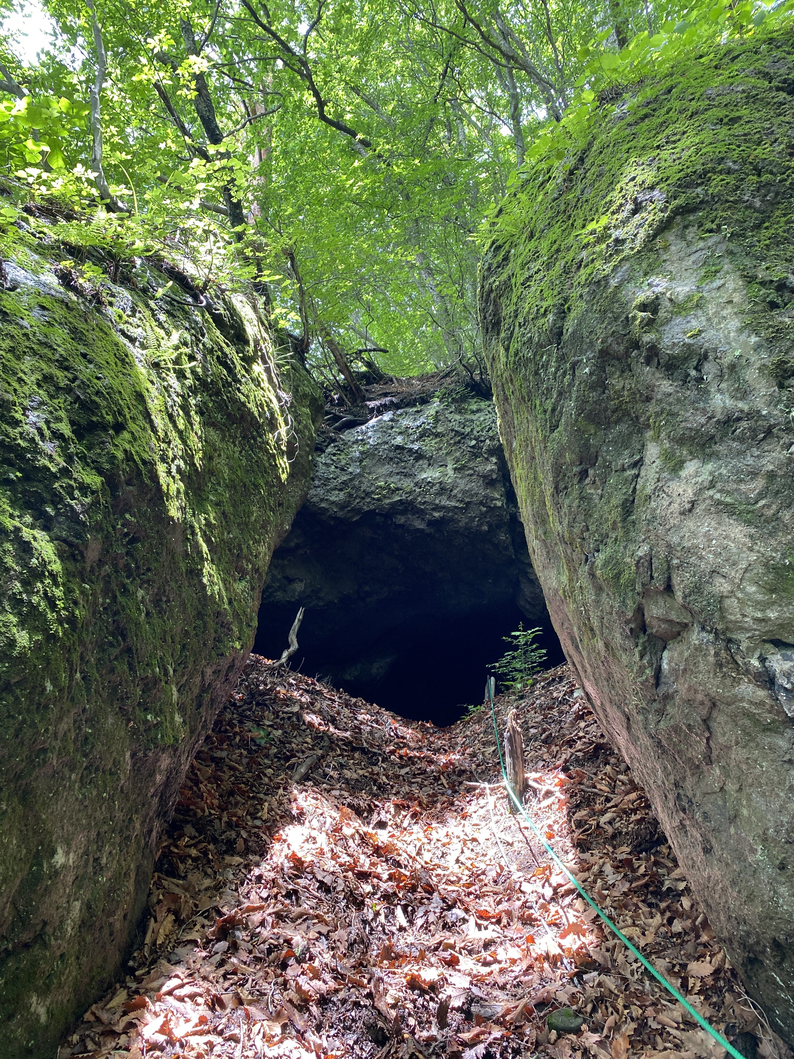
There was only one place I encountered any ropes. If you notice from my track, there is a bit of a detour before going to the peak. That trail leads to a cave (evidently for zazen meditation). Getting up to the cave, there is one steep part with a rope. It's not challenging or dangerous, though.
This hike is on the side of the volcano and there are safety considerations. Below are the notes I included for my hike on the mountains to the west of Mt. Asama in May:
First and foremost, it's important to remember that this is an active volcano and there are usually restrictions on where you can go. Depending on the air quality, you may not even be able to climb it at all. The authorities have 5 levels of caution. 1=no restriction, 2=the fewest restrictions, 3=climbing nearby allowed with more restrictions, 4=local residences are in danger and should prepare for evacuation, 5, Run you fools!
You can check the current levels on this page from Komoro City's web page. It's in Japanese but you can figure out the level by finding something that looks like this near the top of the page:
火口周辺警報(レベル2:火口周辺規制)(令和5年3月23日)
火口周辺警報=caldera area warning
(レベル2:火口周辺規制)=Level 2: restrictions around the caldera
(令和5年3月23日)=Reiwa Year 5, May 23
Here are some pictures for your perusal:
Where I parked. Next to where I parked, there was a sign noting the time and date of a bear sighting just 2 weeks before. (Let's not divulge that factoid to Mrs. Caveman.)


Facilities: Nothing
Thoughts/observations/recommendations: One thing I liked about this hike was that it was pretty secluded. Karuizawa is a happening place but I only bumped into two groups of people on my hike. I had the peak to myself.
Bring bug spray. I had planned to pick some up at 7-11 but they didn't have any. There weren't mosquitoes but there were giant bugs with swept-back wings. I am pretty sure they were horseflies. If you stand still they'll land on you and give you a painful bite.
Today's listening:
Babbling brooks and summering cicadas
Postscript
I had the pleasure of Mrs. Caveman's company for (some of) this trip. While I was hiking, she was sketching at the Wild Bird Preserve. Check out her blog here: Put Out Into The Deep
On the way home, we dropped by the Shiraito ("White" "Thread") Falls and the Ryugaeshi ("Dragon" "turn back") Falls.
Shiraito Falls


