Elevation:Lowest: 1,017m Highest: 1,422m Total Ascent: 430m Total Descent: 430m
Technical considerations/difficulty: There are some steep slopes off the side of the trail but there are no parts that are difficult to climb. The signage is old and hard to read but if you pay attention, you shouldn't get lost.
Facilities: Nothing.
Thoughts/observations/recommendations: This hike doesn't have much to recommend for views. Better views are to be had on the other end of Mt. Arafune at Tomonoiwa.
Speaking of "Mt. Arafune", the naming of this mountain is odd. The peak I went to today is called "Mt. Arafune (Mt. Kyozuka)" and down the trail a little bit, at a much lower point, is "Mt. Arafune." The mind boggles. Why not choose one distinct name for each place? I'm often puzzled by the names of mountains (and streets and towns and people . . . ) here.
Today's listening: The Great Detectives Jeff ReganBefore Jack Webb was Joe Friday, he played a few private detectives in noir dramas. Jeff Regan was one radio show. He was also Pat Novak for hire. Those shows are a hoot. Some of the one-liners he delivers are so funny:
“It was hard to figure. It was like trying to throw a saddle on a porpoise.”
“I had about as much chance as a snowball in a Turkish bath.”
“When she said, ‘Hello,’ it melted all over you, like honey on a hot biscuit.”
“He was crumpled up against the desk and she was staring down at him as if she forgot to water the plants.”
(h/t to this site https://thrillingdetective.com/2020/09/22/jeff-regan-2/)
Today wasn't super-photogenic. It was just a chance to get into the woods before work this morning. Here are a few pictures.
The top
Well, kids. That's all for today.
Caveman out.
ps A conversation with the little woman I had yesterday.
Caveman: I'm glad I have a blog. I have a bad memory and want to remember where I have been.
Mrs. Caveman: I'm glad you have a blog, too. I can remember you when you're gone.
Elevation:Lowest: 1,107m Highest: 1,368m Total Ascent: 464m Total Descent: 464m
Technical considerations/difficulty: It's not a terribly demanding hike. There are no chains, ropes or ladders. Much of it is along a very steep ridge. I would not want to fall off the ridge! The trail is not marked or traveled very much. I would encourage not coming on this hike without some sort of GPS because you could get disoriented and start following the wrong ridge.
Facilities: Nothing.
Thoughts/observations/recommendations:
This was a hike to 兜岩山 (Kabuto Iwa Yama). Kabuto means helmet and Iwa means boulder. That's why I think of it as Mt. Rockhead.
It's almost a scenic hike. There are gorgeous scenes hinted at all along the way but the trees are just a bit too thick to ever give an unobstructed view. It was fun, nevertheless. I did see some wildlife on the way. As I pulled up to where I parked, there was a smallish critter on the trail I was about to hop on. I think it was a marten, but I did not get a good look. On the trail, I caught a glimpse of a bevy of about 5 does about 100~200 yards away. They gave themselves away by barking at me.
There wasn't enough snow to necessitate wearing crampons but it was frozen crisply enough that it gave a satisfying crunch when stepping on it.
Mrs. Caveman bought me a nice pair of winter boots for Christmas. Wow. I like them. When I think of all the years of my life having cold feet in the snow and cold, I feel spoiled now.
This trail is not used much so it was pleasant to see no (two-legged) footprints other than my own. I did see plenty of pawprints on the trail.
I chose this route for the distance and time available. I frequently go for short hikes before work but was getting bored with the same areas. I wanted to do one that was a bit more substantial--yet still get to work on time. So I decided to pick just one of the peaks near Arafune for a piston (out and back on the same trail) hike. The trailhead is a half-hour drive from home and the route I chose was about 6km (about 3.5 mi.). I figured that if I started before sunrise, I could make it there and back and get to work by about 9:30. It worked out fairly well. I was able to do the hike and get home with about 10 minutes to spare to get ready for work. Perfect. Score one for the caveman.
The trailhead is just before the prefectural boundary between Nagano and Gunma at the Taguchi Pass** on Route 93. (**One of the reasons I like hiking is that I get to use the word, pass. I always feel like I'm in a western and my posse is going to head some black-hatted bandits off at the pass. But I digress.) Route 93 is a very narrow mountain road and is a great place to go spotting deer at dusk. I had reason to get worried on the road this morning, though. There were signs saying that the road was "closed end to end between the hours of 8-12 and 1-5 for maintenance for this week." I decided to push my luck and try to drive on to the trailhead. I didn't see any construction equipment on the road and hoped that all of the maintenance was going to be on the other side of the pass and wouldn't actually affect my side. I knew I wouldn't finish my hike before 8 so I was taking a risk. I was imagining how to beg in Japanese for passage back out of the mountains in case they closed the road behind me. ("Road closed sign? Is that what that sign meant? I'm sorry. I don't read Japanese." No. I can't lie so well. [That's a lie, in case you're wondering.] Maybe I would go with "Please, let me out. I'll never do it again.") Then I was imagining not being allowed passage back to civilization. What would I tell my employer on the phone--assuming there was a signal out there by which to make the call?) Thankfully, I had no problems getting home. I didn't see any road crews on my way home and no gate or anything was blocking the road.
OK. It's official. I'm doing the thing bloggers do that I hate--telling me about themselves. You don't need to know all this--the same way I don't need to know about how every time Sally the baker makes cornbread she remembers how her grandpa used to talk about his boyhood days back in Nebraska when he used to sit on his grandaddy's lap on the tractor and really loved the smell of the cornfields of the back 40 in July . . . I just want her stupid recipe for cornbread!
I swear. Sometimes you have to wade through about 20,000 words before you get to a recipe on a food blog. I shouldn't subject you to that same kind of treatment.
So, without further ado, I will shut up.
Today's listening: Just the birds in the air and deer barking on the ground.
These are the details:
Sunrise was at 7:00. I started at about 6:45.
That road through the valley below is Rt. 254, the Cosmos Road. The bridge in the foreground is by the Uchiyama Pass Tunnel. Trailheads for Mt. Arafune and Mt. Monomi are near there.
I live in that cluster of civilization not far from where Route 254 comes out of the mountains.
-9.7 Celsius about 15 degrees Fahrenheit.
I still managed to work up a sweat.
That flat thing with the cliff to the left is Mt. Arafune.
Rosoku Iwa (Candle Rock)
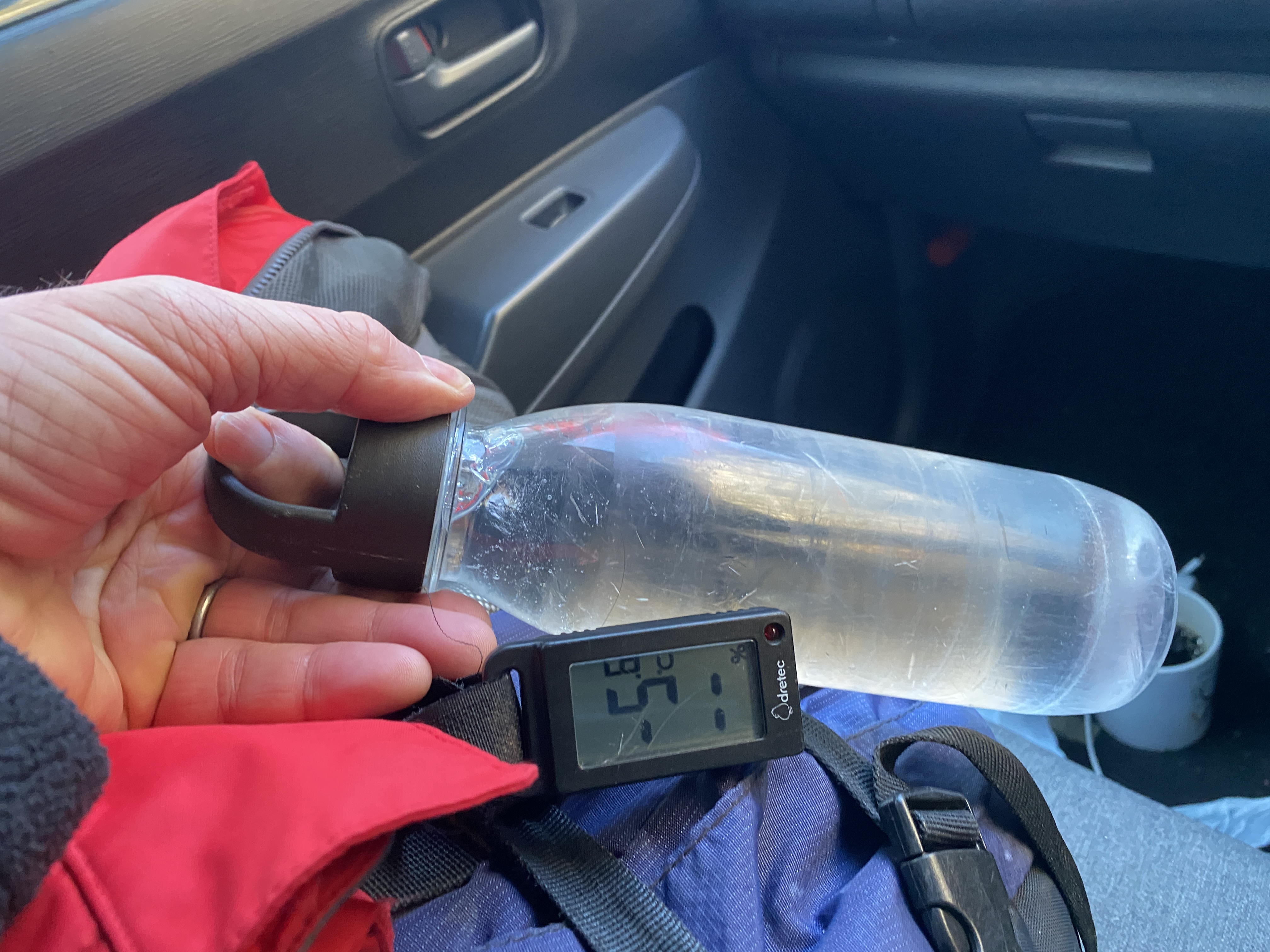
It had warmed up before I got to the car but my water still froze.
Elevation:Lowest: 1,337m Highest: 1,756.7m Total Ascent: 700m Total Descent: 700m
Technical considerations/difficulty:
Facilities: Nothing on the trail. The trailhead does have a sign which sports a QR code to allow you to post a hiking plan electronically. That's convenient.
Thoughts/observations/recommendations: What a nice mountain Asama Kakushi is. It's obvious why it is on the list of Japan's 200 Famous Mountains. The 360-degree view at the top is superb. I could even pick out Mt. Fuji 119 km away.
It's fairly steep, but there are no ropes or chains. There is a lot of bamboo grass which seems to offer some difficulty to hikers when it isn't trimmed. Today, the path was clear. All but the top of Asama Kakushi is below the treeline.
It is not a full-day hike but could be nicely paired with a trip to the nearby Asama Falls or the Onioshidashi Volcano Park to make a day of it.
First of all, please accept my apologies. Christmas deliveries are canceled this year because I ate Rudolph for lunch.
Ho ho ho
Wow. That was yummy.
No, it did not taste like chicken.
(Actually, it was steaklike and surprisingly tender. It was a great sandwich 🥩 meat.)
A few days ago I went for a run up one of my local favorites, Mt. Hirao Fuji. If you are familiar with this area, you might know the Sakudaira Interchange on the highway. Hirao Fuji is the little hilltop above the ski area and onsen by the interchange. That run was a bit of an adventure in itself because I found a new trail. I go there a lot, though, so didn't bother blogging about it. I did get this picture of where I was to be headed the next day, though.
I parked at Nidoage Pass (二度上峠) right on the line between Kitakaruizawa, Nagano and Takasaki, Gunma. My first stop was a steep, short hike up to Mt. Komagami (駒髪) from there. The view from the top would be spectacular but for the fact that it's obscured by trees.
Just starting out
The top
This was taken from the parking lot.
After that little excursion, a short walk down the street brought me to the trailhead to Mt. Asama Kakushi.
This sign has a QR code to put in a hiking plan.
The top
Looking at Mt. Asama
I don't typically take long breaks but the viewpoint here was so good that I stayed up here taking pictures for about a half hour. It was really fun to look around all points of the compass and to pick out places I've been. That's one of the things I like most about hiking.
Yatsugatake is in the middle of the frame.
The orange figures depict mountains on the 100 Famous Mountain list. The red markers are peaks over 3,000 meters.
?? Do you see what I see?
That was Mt. Fuji a bit to the right of center. I was so surprised to see it since the clouds were blocking mountains even in the immediate vicinity.
In case you're interested . . .
to the south
to the southwest
to the east southeast
I bumped into this guy on my way up to Mt. Iwabuchi.
That is a kamoshika. Kamoshika sounds like the words for duck and deer but a kamoshika is neither a duck nor a deer. It's a serow. It's more like a goat-antelope. They are supposed to be very fast--there's even a motorcycle called serow--but every time I've come across them, they've been very chill. They don't seem to be bothered by humans at all. I was standing in one spot making some adjustments to my pack for about 5 minutes before I realized this guy's (gal's--what do I know, I'm not a biologist) presence. He/she must have been watching me the whole time. Thank God it wasn't a bear.
This is the top of Mt. Iwabuchi. It's probably the last peak for me of 2023. It's been a great year in the mountains.
Asama from the parking lot
Well, that's all (probably) for 2023
I hope you and yours have a Merry Christmas and
a great 2024
Make sure you subscribe so you get the first post of 2024 before anyone else!