Showing posts with label . Show all posts

Little Crow Hat and Crow Hat. 小烏帽子岳, 烏帽子岳


What's up, spelunkers?

This is a snowshoeing hike I took around Mt. Yunomaru and Mt. Eboshi on the border between Gunma and Nagano.  It was a great day and I hope you enjoy the pictures as much as I enjoyed taking them.  
You probably won't.  I take way too many pictures and find it difficult to discard any.

On this hike, I climbed Mt. Yunomaru (again) and Mts. Koeboshigatake and Mt. Eboshigatake.  E-boshi-take means "crow" "hat" "mountain".  The "Ko" of Koeboshigatake means "little."

Location:  Yunomaru Kogen Heights Tomi, Nagano

Starting and stopping point:  Yunomaru-kogen Heights Visitor Center 湯の丸高原ビジターセンター

Peaks bagged: Yunomaru (湯の丸山) Yunomaru Kitamine (湯の丸北峰) Koeboshi (小烏帽子) Eboshigatake (烏帽子が岳)

(First-time) peaks # 864 and 865

Getting there/getting around:  I drove.  

Map: Yama to Kogen Chizu 19 浅間山軽井沢・長野原の山々ASAMA-YAMA KARUIZAWA-NAGANOHARA-MOUNTAINS

Weather Information:  Asama Weather

Total Time: 4:52  Break time:  1:03 Distance:  9.1km

Elevation:  Lowest: 1,730 m Highest: 2,099 m Total Ascent: 692 m  Total Descent: 692 m

Technical considerations/difficulty:  Not tremendously technical.

Facilities:  Nothing

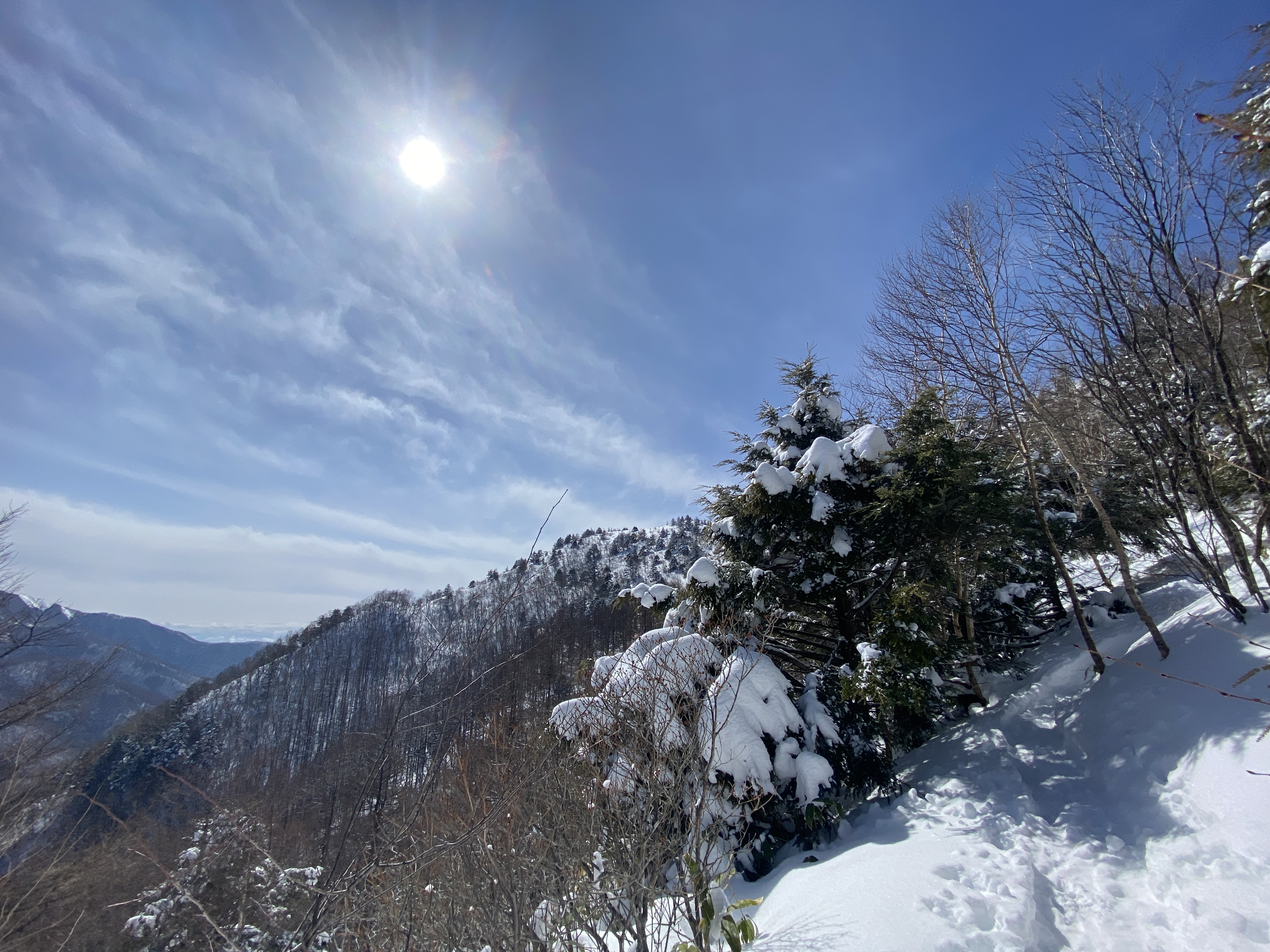
Thoughts/observations/recommendations:  What a great area.  This was my second time back in the last few weeks.  I wanted to connect the dots of my footprints and I wanted to climb the two Eboshi peaks.  I was blessed with another day of great weather.  It wasn't as clear as last time, though, and I couldn't see Mt. Fuji.  That's ok, though.


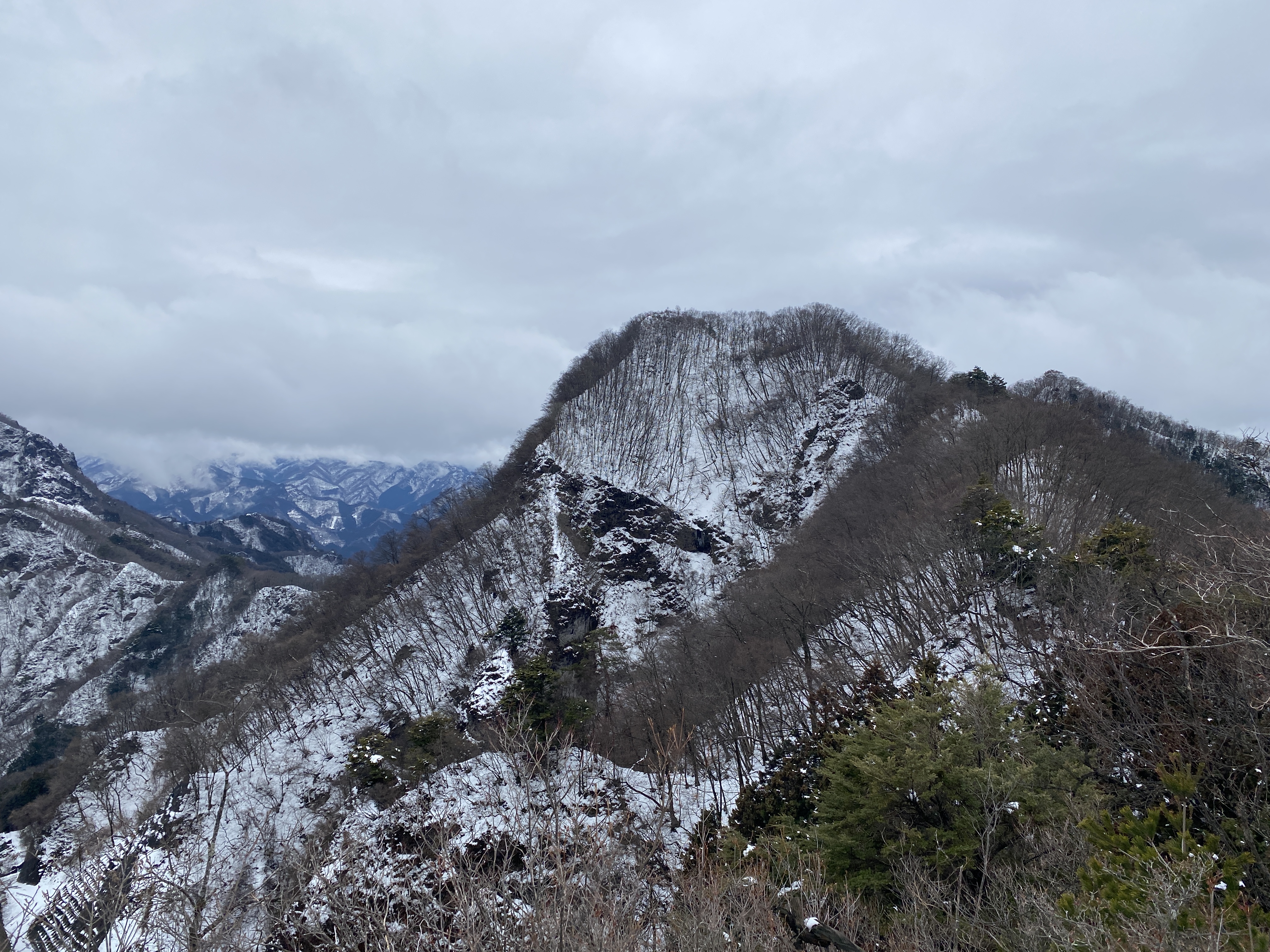
This is todays destination.

Eboshi Yunomaru Takamine Kurofu Maekake 烏帽子岳 湯ノ丸山 高峰山 黒斑山 前掛け

I absolutely love looking up and around and being able to say "I've been there."


And away I go!


Lots of critters out there.


Starting out climbing the trail at the Yunomaru Ski Area.  I started up the slope even before the chairlift started running.


That bump on the left is Mt. Kakuma.  I climbed that last time, but not today.


You can register a hiking plan by using the QR code on the sign.


Yatsugatake
Mt. Fuji hid today


Mt. Sajiki on the left.  Mt. Kosajiki on the right.


The top of Yunomaru

雪の湯ノ丸山 snow on Mt. Yunomaru


The pointy one below is Eboshi.  That's my ultimate goal for the day.


Most of the day, I didn't really need the snowshoes because there were many traces of previous hikers.  I did still sink in a few times, though.


小烏帽子岳 Mt. Koeboshi Nagano


Mt. Eboshigatake
烏帽子岳上田市長野 Mt. Eboshi Ueda, Nagano


And with that, dear spelunker, I leave you until next time.
Subscribe to the blog.  Tell your friends about it. 

Caveman out.


Mt. Akiya, Shimonita, Gunma 秋葉山


Location:  Shimonita, Gunma

Starting and stopping point:  Side of the road

Peaks bagged: Mt. Akiya (秋葉山)

(First-time) peaks #863

Getting there/getting around:  Car

Map:  Yama to Kogen Chizu #21 西上州 妙義山・荒船山

Weather Information: Mt. Arafune's weather (not too far away)

Total Time: 3:05   Break time: :13  Distance:  6.59km

Elevation:  Lowest: 456m Highest: 861m Total Ascent:  633m Total Descent: 639m

Technical considerations/difficulty:  Very steep.  I mean, very steep.  There is only one place with a rope; I wish there were more.  You don't want to make a misstep here.  I have no idea what the trail looks like in non-snow seasons, but there is very little signage and not so many pink ribbons to follow.  A working GPS is a must.

Facilities:  Nothing

Thoughts/observations/recommendations:  

We got some snow last night and I got out of work early today so I picked one of my shorter hiking plans and headed to the hills in hopes of possibly using my snowshoes and also of catching some nice snowscapes.  I didn't use the snowshoes; crampons were more suitable today.  Unfortunately, it warmed up too much during the day and there was a lot of melting going on.  Thankfully, there wasn't an avalanche.

I had planned on this trip to tackle Mt. Akiya and nearby Goshuyama but prudence dictated putting the second mountain off for a day when I have more time available.  This area, like much of Gunma and a lot of Saitama demands a lot of respect.  There are a lot of  hills here that, although they are low in elevation, are very rugged.  It's not the type of place you can rush.

Still, I was glad to put a few more miles on my hiking boots today and to get some nice views of snowy mountains.  The caves here are cool, too!


Without further ado, here are some pictures.


There are a lot of caves on the way up.  Thankfully, they are home to shrines and statues and not bears.


The top


Mt. Akiya Shimonita, Gunma 秋葉山下仁田町群馬


Still on the top


Mt. Asama is hiding in the clouds there.


I wish it were minus 3 and not plus 3.


I got this shot of Mt. Arafune's Tomoiwa from Route 254 on the way home.


That's all for today.
Caveman out.