Greetings cave dwellers of all ages.
I was blessed to get into the woods today. the weather isn't cooperating too much these days but--if it's true that a bad day fishing is better than a good day at work, it must be doubly true about days in the mountains.
I had all sorts of mountain plans for this summer vacation but the weather and schedules aren't making the longer treks feasible. I gave up on a planned 3-day trip to the Alps this week. Today I only drove about an hour away and did a not-so-long hike in case the weather went bad. It did go bad, so I guess I did the right thing.
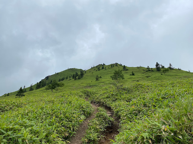
The main mountain I climbed was Mt. Azumaya (四阿山) in Gunma. It's one of the 100 Famous Mountains so I assume it's beautiful. I can't really say though. Because of the weather, I really didn't get a good look at it. Nor from it, either. I'll have to go back on a clear day sometime.
Here are the details:
Location:
Starting and stopping point:
Peaks bagged:
Neko (根子岳) ~~ Koneko (小根子岳) ~~ Azumaya (四阿山) ~~ Nishiazumaya (西四阿山) ~~ Nakaazumaya (中四阿山)
Getting there/getting around:
I drove. There is a parking lot (200 yen) near the trailhead at Sugadaira Farm. A bus from Ueda Station will go as far as the Tengu Bus Stop, which is a 37-minute walk from the trailhead.
Map:
***If you want a link to the latest Yama to Kogen map, comment and I'll get you a link. This link is to a printable topo map of Azumaya and its environs.
Weather Information:
***I checked 3 different weather reports. As usual, they all conflicted. One forecast lightning, thunderstorms, the four horsemen, of the apocolypse, sharknadoes . . . Another forecast partly sunny skies. The other predicted a perfect day. Of the forecasts I checked, the first link I posted above was the best. There were thunderstorms.
Time
Total Time: 5:52 Break time: :43 Distance: 11.3km
Elevation
Lowest: 1,580m Highest: 2,354m Total Ascent: 1,094m Total Descent: 1,094m
Technical considerations/difficulty:
Fairly straightforward hike. There is a lot of bamboo grass. I encountered one snake on the trail.
Facilities:
Public restroom, cafe, gift shop at the trailhead. Nothing on the trail.
Thoughts/observations/recommendations:
I'll have to do this again on a clear day. I was robbed of any views because of the weather. It really poured a few times and there were thunder and lightning. Thankfully, not when I was near the top.


