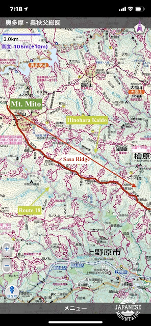
Yesterday I took another in a seemingly endless string of nearly viewless hikes. The Sasa Ridge runs a little over 10 miles (about 18km) more or less northwest to southeast from Mt Mito on the Yamanashi and Tokyo border down toward Mt. Jinba in Kanagawa. There are trails up to the ridge from Route 18 in Uenohara City, Yamanashi on the south side and from Hinohara Kaido on the north side from Tokyo.
I really like to make connections when I hike. I don't want to merely hit every mountain, I want to hit every trail to every mountain. A few years ago, I concentrated on the Sasa Ridge for a good 2 months and hiked just about each one of the access trails. Trails I've hiked are traced in red. The brighter the lines, the more recent the hike.
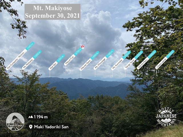
Yesterday's hike was from Fujio in Uenohara up to Fuefuki Pass on the Sasa Ridge, over to Mt. Maru and then all the way up to Mt. Makiyose before backtracking on the ridge again to one of the trails down to Route 18 in the Tawa area. To date, I have now climbed Mt. Maru 5 times and Mt. Makiyose 7 times. In all of these hikes, I have yet to have a clear day. Haha. It is a bit unfortunate because this ridge faces the Tanzawa Mountains, Mt. Fuji and some of the Minami Alps.
Someday I'll see something.
n.b. Peakvisor in this picture calls this Maki Yadoriki. It's wrong. It's Makiyose.
The best views I got all day were in the locals' gardens.
No idea what is up with this guy. I saw this on the street. I don't know if it's indigenous or if it escaped someone's kitchen. It's much smaller than it looks. Maybe 1 inch (2.5cm) across.
More later. I will keep hiking until it clears up! It has to clear up someday.


No comments:
Post a Comment
Have a comment? Please, keep it clean.