Greetings and salutations to cave dwellers of all ages and sizes.
I'm happy to say that I was able to get out to my mancave again yesterday. This time I was able to knock off a few more peaks in the Fujigoko area. Yesterday I was hiking along a ridgeline north of Saiko ("West Lake"). Let me give the hard-cold facts first and then I'll tell a bit of a story with pictures.
Location: Ridge north of Saiko. Mostly in Fujikawaguchiko
41 minutes by bus from Kawaguchiko Station. The first bus (on a weekday in August) leaves at 9:10 am. The last bus back leaves about at 3:50 pm. Check ahead!!! Then check again. Bus schedules are seasonal. Fujikyuko Bus English information
Lowest: 910m. Highest: 1,738m. Total Ascent: 1,458m and Total Descent 1,459m
Technical considerations/difficulty:
Some ropes and steep spots necessitate some upper body strength. Some of the steep spots are a bit slippery so you must watch your step.
Facilities:
Nothing on the trail. No water, toilets or commerce. The parking lot at the Iyashinosato Nenba place is free. There are vending machines there and (seasonal, I'm sure) restaurants and souvenir shops just outside the Iyashinosato Traditional Village. I don't think there is even a public toilet there unless you pay the admission fee and actually enter the Traditional Village.
Thoughts/observations:
I was more pleased with this hike than I expected. My first visit to Saiko left me unimpressed. I descended to the lake from Junigatake after hiking over from Lake Kawaguchi. Mt. Fuji isn't really visible at the lake level there so the views weren't great. I must say the views from above the lake and, at water level also on the west side, are really great. This hike could definitely be done year-round but I would bring spikes in the winter. If you want to hike around here, you might want to skip the last peak I went to. There was nothing to see. I only went that far because I plan on continuing this trail at a later date.
Today was the first time I've seen actual crowds of tourists in a long time. The campgrounds are full. The lakes are dotted with people in various boats and SUPs. I was happy to see Japanese getting out and enjoying themselves. I'm happy for the tourist businesses, too. I didn't enjoy the traffic coming home, though. 😂
If you looked very closely at the map, you may notice there are two mountains pronounced "Settodake." If you looked even closer, you might notice that the Japanese characters for the two mountains are different. This is a particularly frustrating aspect of the Japanese language. Because the writing system is based on ideographs, there are a lot of homophones that are written completely differently and mean different things. The fact that these mountains are in spitting distance of one another adds another level of danger of miscommunication. Yesterday I had a conversation on the trail about Settodake with another hiker only to ask myself later if we were talking about the same place.
One other thing about one of the names of these mountains. One of them is Onidake. "Oni" (Owe knee) means ogre or demon. It is also the word Japanese kids use when they play tag. In English, we'd say, "You're it." In Japanese you say "O mae ha oni da!" (You are the oni!)
These days the first rays of the sun wake me up. That is useful for these hikes because it's about a 3-hour ride to get to the areas I've been going to lately. Yesterday I was wondering upon awakening if it was a good idea to go--the weather forecast wasn't spectacular and it's a drag to go so far and then be denied a picture-perfect day. And couldn't my feet use a break anyway? Blah blah blah
Nothing ventured, nothing gained. My hesitancy about the day usually dissipates by the time I open my front door and head outside. I'm always happy that I just go.
Of course, I was happy that I went.
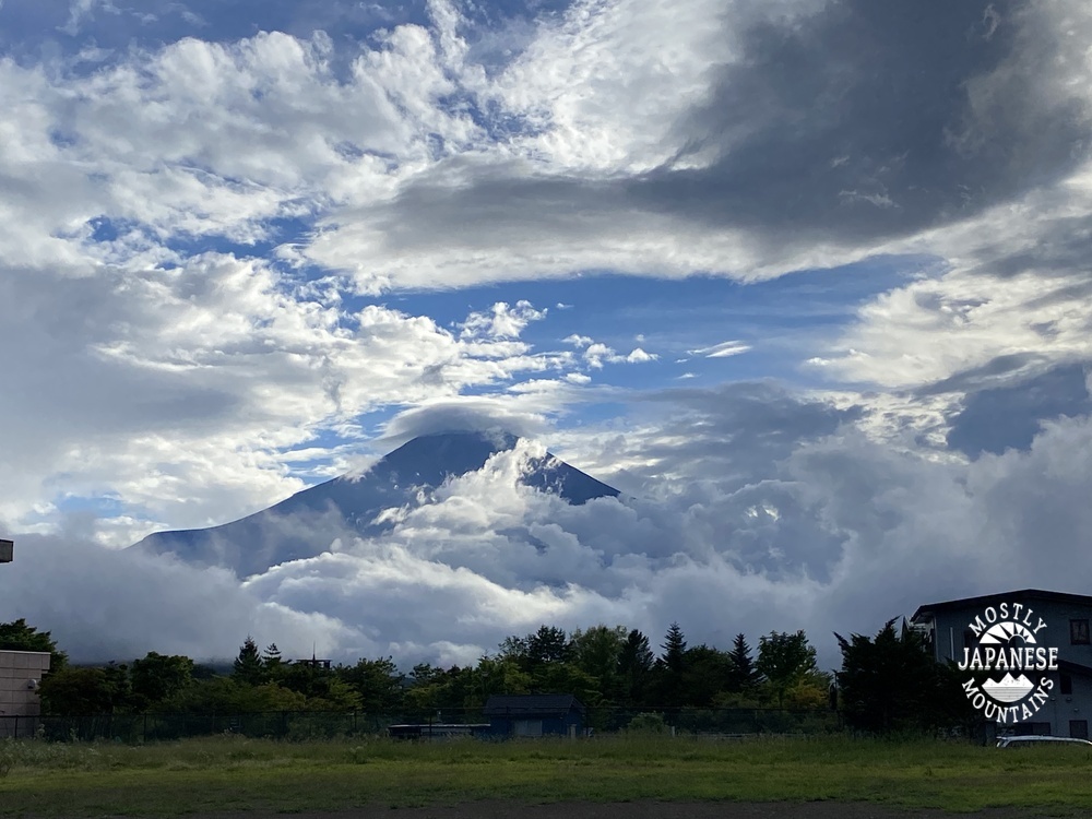
It was a nice ride.
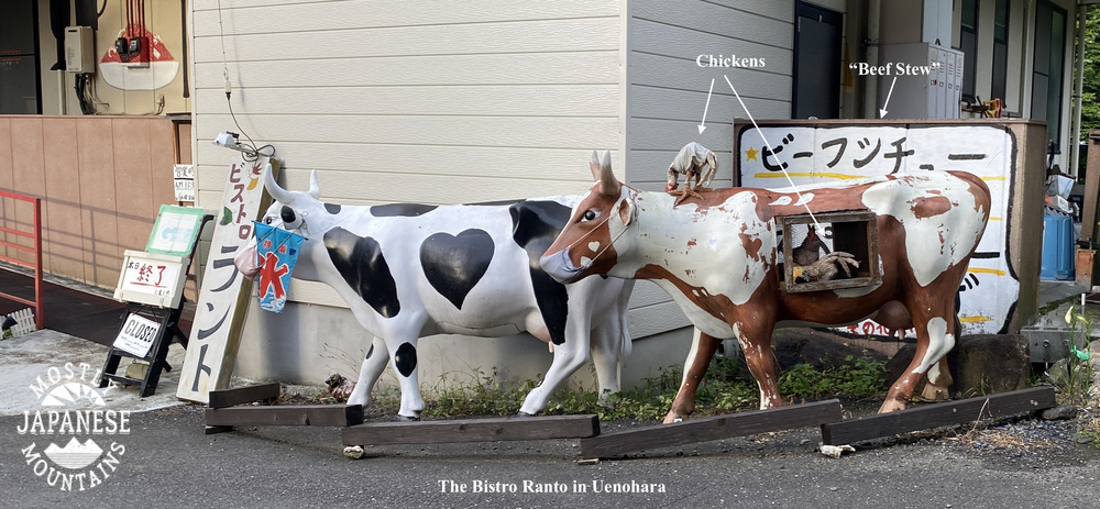
These two pictures from the road are exemplary of the random weirdness I encounter in Japan that bewilders and amuses me.
Almost there . . .
One of the things I really like to do is to identify the mountains I've been on in the past. Hiking around Mt. Fuji makes this especially fun because it gives such a great vantage point to look in all directions. I took this picture quite a while back from Mt. Fuji and it takes in where I hiked yesterday as well as a couple hikes I made one week previously on Mt. Ryugatake and Mt. Omuro.
From yesterday's hike:
That was way more information than you wanted, I'm sure. I liked playing with the pictures, though.
On to yesterday's activities.
Off to the trail . . .
It was steep getting up to the first mountain but once at elevation, the view was worth it. This ridgeline has great views all along the way.
Mt. Kagitake. Not the most exciting mountaintop.
This is the marker for the last mountaintop of the day. Not exactly breathtaking.
The last couple miles were on an old paved road.
These last several photos are not of the mountain but of the Iyashinosato place. Being sweaty and carrying my backpack, I wasn't into this type of sightseeing thing but if you were sightseeing around Saiko I think this would be a nice place to spend a few hours while getting a sense of what life was like here back in the day.
There are various and sundry exhibits, restaurants and shops.
This sign says "Koshu Silk". If you are familiar with Tokyo, you may know Koshu Kaido (Street). It runs past Shinjuku Station. Koshu Kaido, which runs out to Yamanashi, to a city named--wait for it--Koshu City, was the Japanese silk road.
The Caveman is a cheapskate but he pried his wallet open here just long enough to buy Mrs. Caveman a souvenir.
Well, like Porky Pig says, "That's it, everyone." I have one more excursion planned for this summer vacation that I'm really excited about. Stay right there on the edge of your seat and I'll give you a report next week.
Or better yet, subscribe to the blog to get notified without having to wait on the edge of your seat. You do that by pressing the giant round button that says "subscribe" below. Easy-peasy Japaneasy.
Greetings cave dwellers. The caveman here. Welcoming you back to another spelunking episode. Hope you have your helmets and headlamps on because we're dropping into my cave.
I'm taking advantage of the long summer days while they're here to travel farther and take longer hikes than I can the rest of the year. Yesterday was my 4th (maybe 5th?) venture to Shizuoka in just the last month or so. It's about a 3-hour-ride each way for me to get down there. My backside is sorer than my feet but it's been fun to see some new places. Shizuoka is really a playground. If you like nature, fishing, golfing, onsens, you're sure to find something you like down there.
Yesterday, I went to Mt. Ashitaka, in Japanese, 愛鷹山,--Ashitakasan. It's called "san", mountain, but the "san" is actually kind of a mountain range composed of several "take"* or "dake"--another word for mountain.
*pronounced "tah kay" or "dah kay"
Here's the lowdown. Mt. Ashitaka is a volcano and the name for the elevated general area is Ashitakasan. The individual peaks are named and called "take" or "dake". "Take" means something like sharp, pointy thing sticking up out of the ground pointing at the sky.
Forgive me for continually digressing, but there are actually many words for mountain. "san", "yama", "take", "dake", "mine", "rei", "gaku", "maunten" . . . and they all have different meanings. Trying to understand them is a bit like trying to understand the whiskey vs. whisky or Scotch vs. Scottish arguments. At a certain point, I just give up caring. I've seen some virtual fisticuffs online about things like whether Mt. Fuji is pronounced "Fujisan" or "Fujiyama." That gets tempers flaring even more than disputes about the ratio of sheep to humans in New Zealand.
I don't have the energy to fight. When these things come up, I just grab my popcorn and watch.
Anyway, as I was saying . . . Mt. Ashitaka. Lovely mountain. Unfortunately, the weather wasn't the best. I had clear skies in the morning, but most of the best viewing points were fogged in while I was there. I'll have to get back in the fall or winter.
Parking for 30 cars there. Fujikyu Buses come from Gotemba in 30 minutes. The Fujikyu City Bus from Mishima takes 51 minutes.
Map:
Yama to Kogen Chizu #32 富士山
Weather Information:
This is a Japanese link but you can see the weather report graded for climbing in 3 hour increments. "A" is best. "C" is worst. Weather for Ashitaka
Distance:
14.5km (about 9 mi.) Took me about 8 hours.
Elevation:
Minimum: about 750m, Maximum: 1,504m Total elevation climbed: 1,636, descended: 1,631
Technical considerations/difficulty:
There are some fairly steep spots. Looking at the statistics distance and elevation of this hike, I found it interesting that this hike was more arduous than the one I made up Mt. Fuji last week. I first climbed up to Mt. Ihai. There is a steep ascent up to the top with a lot of ropes. Throughout this area, there were a lot of ropes and some narrow ridge walks. In a few places there were rickety-looking ladders but they were stable enough. Quite a bit of the area going up to Wariishi Pass (割石峠), is scree. You must be confident with a map and have a good sense for the trail because you really have to be able to almost sniff out the next red ribbon marking the trail. The scree area could be concerning in very heavy rain.
Two of the peaks are inaccessible these days due to rock slides. I wanted to climb them but will have to come back another day.
Facilities:
There is a porta potty at the parking lot. If you need water or food, bring it with you because there is nothing on the trail.
Thoughts/observations:
Really top-notch views of Mt. Fuji to be had here. I got some spectacular peeks at Mt. Fuji and the surrounding ski areas, military training areas (Japan Self Defense Forces and USMC), and other things on its south side. Mt. Hoei and its volcano crater on that side of Fuji, is so cool. Unfortunately, the weather turned early in the day and I can only guess how beautiful the view of Suruga Bay to the south of Mt. Ashitaka might be. Like I said, I'll have to go back when the weather is better.
You could make this a much shorter hike than I did. If you're not into straining too much, you could just go to Kurodake from the parking lot and be done in just 3 or 4 hours--but still get a great view.
Trivia:
Japanese mountain names are interesting and sometimes infuriating. There are so many mountains, that many of them have the same name. Case in point is this hike's Kurotake, "Black Mountain". There are too many Black Mountains to count and there are many "Round Mountains" and "Big Mountains", etc. One of the peaks on this hike is 位牌岳 ("ee high"). I had to look up eehigh in the dictionary. It means "Buddhist mortuary tablet."
Let's close out by looking at some pictures. I'll start by showing some pictures I took from Mt. Fuji last August.
Mt. Hoei, that I mentioned before, is the bump in the middle foreground of the next picture. The dark spot on the right is the top of its crater.
Mt. Echizen is to the right side of the picture. Behind that is Banzaburo. I climbed that the day I climbed Mt. Amagi earlier this summer.
Mt. Echizen is actually higher than the mountain behind it. It just looks smaller because of the perspective.
This is a nice picture but it's kind of cheating. I took it by Lake Yamanaka on the way home.
Drop by again soon.
Make sure you subscribe before the available subscriptions run out.
Leave a comment and ¥5,000 and I promise Mr. Umanami will deliver a slice of pizza to you. Either that or he will at least deliver a smile. That's what he does. As he says, he delivers surprise and smiles to mountaintops. He is the king of delivery!
「山頂まで「驚き」と「笑顔」を
デリバリーしています。
配達王に俺はなるっ!」
How about another 100 Famous Mountain in the Fuji Hakone Izu National Park? Mt. Amagi
Want to see the place where the legendary Kintaro was born? Mt. Kintoki
Yesterday was my first venture to the area around Lake Motosu and Lake Shoji. Those are the two most western of the Fuji 5 Lakes. I've hiked around most areas of the other three lakes. In my never-ending quest to connect the dots of my hikes, I have a few loose ends to tie up around Kawaguchi and Saiko Lakes and I'm looking forward to spending more time in this particular area.
Yesterday's plan was to climb Ryugatake (Dragon Mountain) and Kenashi (Hairless Mountain) from Lake Motosu. I stopped at Ryugatake because there was just nothing to see. Clouds obscured everything and I decided to call it a day with an eye to returning at a later date so that I could catch the views.
Upon descending to my bike, I decided to ride around the lake and then look into visiting some of the caves or other tourist spots in the area before heading home. By the time I'd ridden around the lake, the weather had broken enough that hiking seemed like an option for the afternoon. I decided to head toward Mt. Omuro--the mountaintop with the nearest unobscured view of Fuji from its west side.
Here's a map of both hikes. Please note that it is oriented with north at the bottom of the picture. I'll put more details about the hikes at the end of the post.
The day started out beautifully. The weather was great on the 3-hour ride from my home.
I reached Lake Motosu around 7:45. It's a nice lake. Each of the 5 lakes has a different vibe.
This lake is absolutely surrounded by campgrounds--in distinction to the other lakes which are surrounded by cafes, hotels or other more upscale tourist attractions.
The lake itself is different, too. There are a lot of SUPs, kayaks and sailboards on Lake Motosu. I really like the atmosphere around this lake. I think camping here would be fun.
For my hike up to Ryugatake, I started at the lake and reached the top in about an hour and a half, if I recall. The weather and visibility were great--until I reached the altitude where I might see something!
I'm sure it would be a spectacular view of Mt. Fuji . . .
The bamboo grass (笹, "sasa") was quite thick. It's not that much of a nuisance but it is concerning that snakes might be hiding in it.
Sometimes it can be dangerous if the sasa is concealing a hole or something to trip over.
This is one of the few times I've ever turned back for a reason other than danger. I got here and felt "What's the use?"
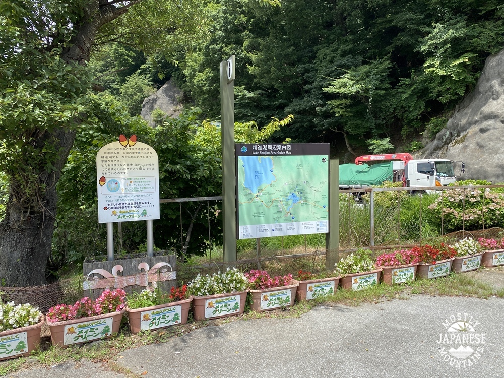
On to Lake Shoji, the starting point for the next trek. This is at the parking lot of the Akaike Restaurant.
This is the actual trailhead. I could have parked here but didn't know where the trailhead was until I hunted around a bit. I didn't realize that this is the starting point for a trail up to Mt. Fuji. This trail meets up with the Yoshida Trail at the 5th Station.
For the first several miles, the trail could accommodate vehicular traffic. Pretty easy walking.
Pictures don't capture how green this area is.
The Aokigahara Forest is famous for an unfortunate reason which I won't go into. I will say this--it's a beautiful, well-maintained forest. I bumped into several happy and healthy groups of hikers and two groups touring the caves.
On the way, I dropped by the Wind Caves. A tourguide gave me the lowdown. Would you believe he told me, your caveman, I couldn't go in because I didn't have permission? I almost said to him, "Do you know who I am?" But, seriously, even the caveman can't go in there without permission and you need a helmet and headlamp.
The south peak of Mt. Omuro. According to YAMAP, this is my 600th peak.
The view from just off the south peak of Mt. Omuro.
I took the next few pictures looking down and this area from Mt. Fuji last August. That dark cone is Fuji's shadow. Isn't that cool? I wonder what effect that shadow might have on property values in that area.
This was taken from the road.
Observations, etc.
Getting there/around: I took my bike. A car or bike makes one of these hikes possible in a (long) day. There are buses from Kawaguchiko Station. Taking the bus would leave only a 6-hour window to be in the area if you go just for one day. It's the blue line that goes to Motosu. Fujikyu Bus Info
Ryugatake hike: 7.2km. 3 hours. 600 meters up, 600 meters down. If I had gone on to Mt. Kenashi, it would have been 16.5km. Not too strenuous.
Omuro hike: 15.4km. 4 hours, 20 minutes. 619 meters up, 619 meters down. Much of it is paved. Don't stop at the first peak. The view is from the second peak. Mt. Omuro is off the path which goes to Fuji. Make sure you are good with a map.
That's it for today! Keep your fingers crossed for good weather. I'm hoping to get out again this week.