A nice walk from Okutama Lake to Okutama Station. Pleasantly surprised to see not one but two kamoshikas on the way.
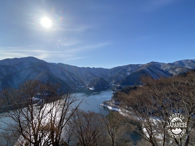
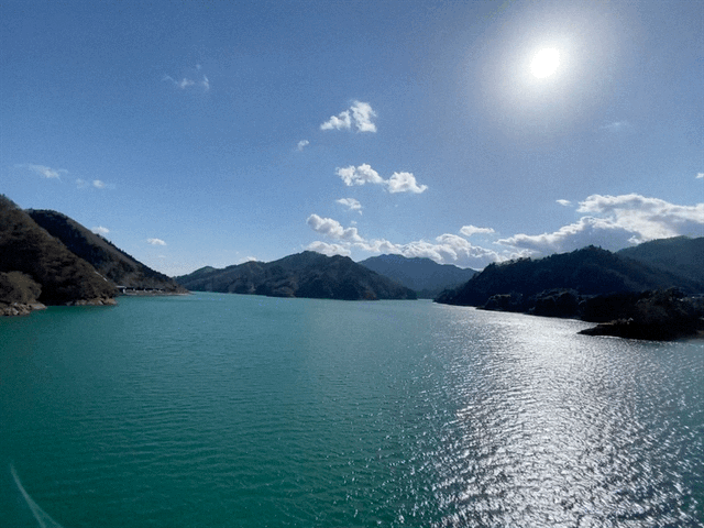
This is Okutama Lake, a major source of Tokyo's water supply. It was created by damming the Tama River in 1957.
I took a bus here from Okutama Station. My plan, basically, was to walk along the Okutama Mukashi Michi from the lake back to the station. Muskashi means old. Michi means road. One way to translate it would be "The Old Okutama Road". Mukashi has another use, though. Japanese fairy tales always begin with "Mukashi mukashi"; ie, "Once upon a time."
Before actually going to the Mukashi Michi, I wandered around the dam and took a few pictures. Then I headed uphill behind the Okutama Water and Green Friendship Hall to check out those trails. There are a lot of switchbacks up a steep, southeast-facing slope and it offered some really spectacular views of the lake as the morning sun rose higher and higher over it.
As you can see from this map, a lot of trails were closed. I had to retrace my steps and start over to continue onto the Mukashi Michi but I had wanted to take a look around that hill for a long time and decided it was worth it.
It was! I ran into this guy. This is called, in Japanese, a kamoshika. The name is similar to the Japanese word for deer, but it's not. It's a serow in English. Out of all my trips into the Japanese woods, this is only my 4th sighting. And I got to see two at the same time today!
Not only were there kamoshika here, but there were a lot of monkeys. It was like a petting zoo.
My wildlife encounters weren't over. I found some poop!
I encounter scat (poop) in the woods often but usually have no idea what it is. Today I dropped into the Okutama Visitor's station before getting on the train and was told the poop in my picture is probably from a tanuki. (Japanese raccoon.) The reason the pile is so large is that they poop in a communal spot.
While I was there, I asked about bear poop. I know I've seen that before, too.
The Mukashi Michi was a very gentle, pleasant walk. I think this is my first hike in a few years that didn't bring me to some mountaintop or other. Most of the road is paved. Since I started at the lake (upstream), most of my walk was downhill. The only people I met on the trail were coming from the other direction. I liked my plan much more than theirs!
Remnants...
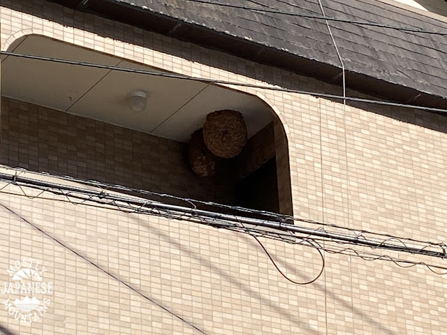
This is on the 3rd floor at the business across the street from the Mizune Parking Lot. On the street just below, there is a sign warning people to be careful of bees' nests. I don't think they are kidding.
A "grow operation" in the mountains.
The green stuff behind the fence is wasabi.
Getting there from Tachikawa means taking the Ome/Okutama train line to Okutama and then the #14 bus. From Tachikawa it would take about an hour and a half.
My jaunt was a nice, fairly gentle hike. I took my time because I took so many pictures and gawked at the kamoshikas but still finished in about 4 hours. It was a little more than 8 miles or 13 km. I walk a lot, though. Many might balk at walking 8 miles.
The Okutama Water and Green Friendship Hall has a lot of exhibits about drinking water and forests, but it's not geared to people who don't speak Japanese. That place has a nice cafeteria-type restaurant and a gift shop.
The dam has some exhibits, too. I seem to recall a diorama-type exhibit there.
If you are interested in the area but don't want to walk all the way back to Okutama Station, you might enjoy spending a few hours around the dam. One option would be to start at that Hall and take a walk to the far side of the dam to the Ikoinoro trail (いこいの路). https://goo.gl/maps/U1MBnBTPgCsNRW4w5
That trail traces along the lake so it's basically flat. It still manages to offer great views. I've seen lots of monkeys and once a bear on that side of the lake. I have even seen masses of bullfrogs doing things that I don't want to describe. It was yucky. My biologist nephew would probably think their activity was interesting. There are plenty of picnic tables around if you want to bring a lunch or you could drop into the restaurant at the Hall.
Welcome to my cave. Sit down by the fire and let me tell you the story of the 500th that almost got away.
Choose a comfortable rock. This may take a while.
Sometime in late November, a glance at my mountain climbing app notified me that I had climbed about 470 mountains in Japan. (It only counts Japanese mountains.) I was a bit surprised at the number and thought it would be a neat way to round out the year if I were to get it to 500 before the end of the year.
Japanese mountains, generally speaking, are much like Japanese people. Many of them are not too tall, but there are a lot of them and they tend to be crowded together. Because of these facts, it isn't uncommon to cross 3 to 5 peaks on a day hike. In order to achieve my goal of 500 by the end of the year, I planned on doing some hikes I'd done before that I knew had a lot of peaks.
In the first week of December, I did a long hike that took me over 10 peaks or so. When I left home, the total on my app was around 470.
When I got home and checked the app, the total hadn't changed. I thought maybe it was a software problem. I tried turning my iphone on and off. I thought maybe that company's engineers had the day off.
The next week, I tried my next hike. The same thing happened. I left home with a total of around 470 and it had not changed when I returned.
That was when my mind was really blown. I realized the app counts each mountain climbed only one time. It was hard to wrap my head around the idea that I have climbed that many different mountains. I can only imagine how many times I have summited in total because there are mountains that I have climbed 6 or 8 times.
In order to bump the number up to 500, I had to go a bit further from home than usual to be sure of getting to mountains I'd never climbed. I was getting close to 500 by the end of January.
Then I got the idea to try and climb someplace special to commemorate this number.
David Lowe over at https://ridgelineimages.com/ mentioned searching the Japan GSI Map databasefor a certain mountain name recently and that gave me the inspiration to see if there are any mountains named 500. My search revealed two mountains named 五百山 ("gohyakusan"), which means "500" "Mountain".
At that point, I was at 498 on my count, so I knew that my next hike had to be it or I would miss the chance to commemorate the 500th by going to one of those mountains. They are both small and far away. I would never want to go to the trouble of getting to either of them unless it was for this special occasion.
One of the gohyakusans is in Niigata. The other is in Nagano. I really have no experience in either area where these are and I had no idea what the lay of the land was. I decided to try the one in Niigata. Niigata is on the Sea of Japan side of the island (I'm on the Pacific side) so the weather is different. I knew there was snow on the ground, but had no way of knowing how much until I actually went there to see. I knew I would be going through ski country to get there. I thought the mountain was on the other side of ski country but I was wrong.
After 3 hours on trains and half an hour in a taxi, this is what greeted me when I got out of the taxi on my way to the trailhead. Oops.
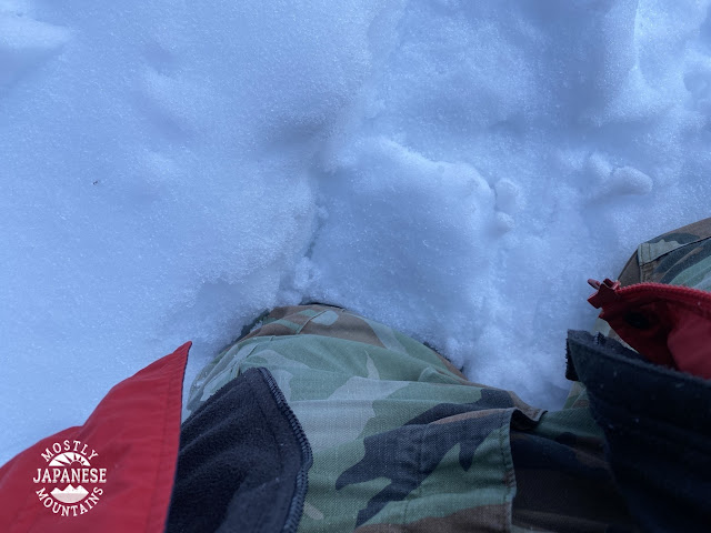
I knew right away that I was not going to get to that mountain that day. This was the condition of the street and the trail was still a mile away! I didn't want to waste the day, so I tramped around for about an hour through the waist-deep snow before turning around and walking along the street to the station.
It was a failure and an embarrassment but if I didn't go there and try I would never have known whether it was possible or not.
It wasn't a total waste. It is a gorgeous area and the walk to the station through the snow-covered rice terraces was beautiful.
I decided to give Gohyakusan in Nagano a try next. ** That "summit" seemed much more doable from a simple map recon because it's just a hilltop next to a tertiary road. As long as the road was passable, getting to the top would be no problem. After all, for this hike, it was more about the name of the mountain than for anything like the grandeur someplace high and hard to reach.
**There was another hike between these two but that's another story.
I called the local police station to inquire about the snow conditions on the road. I was sure the local constabulary could give me a good appraisal of the roads in their village. Especially since their station was right at the base of the hill I wanted to climb.
The cop I got on the phone was non-commital. He wouldn't give me an answer about the road. He told me to call the tourist board at the village office.
I called there. The woman there didn't want to give me an answer either. She told me she'd have someone call me back from the public works department.
I got a call back from the public works dept. and that guy said that that road isn't plowed in the winter and probably is impassable. He also said something about the abominable snow monster, thundersnow, and sharknadoes.
He left me with the distinct impression that it might be so bad that cats and dogs might be even living together there in mass hysteria.
I decided to rent some snowshoes for this try.
So, for the second time in about a week, I got up at 0 dark thirty to ride a shinkansen 3 or 4 hours to climb a pimple of a hill in a tiny town in the middle of nowhere.
(Mrs. Caveman really is a sport to put up with me. She's the best.)
This was my first time actually stopping in Nagano on a train. I've made slight incursions when hiking on the prefectural boundary lines with Nagano but I've never gone there by train.
This is what the platform in Nagano looked like.
After arriving in Nagano Station, it was a 40-minute bus ride to a little place called Shinshumachi (Shinshu Town). This sign is one of the first things I saw. "Roukakuko" means Lake Rokaku. It was lovely.
Then, I started up the hill.
This is what the road's condition was like for 90% of the journey. I began to wonder if the bumble needed to migrate north for the winter.
Thankfully, eventually, there was some snow!
And I put on my snowshoes for the ascent. The "peak" was just off to the side of the road and was a hike of only a few hundred meters.
It was just enough to make the rental of the snowshoes worth it.
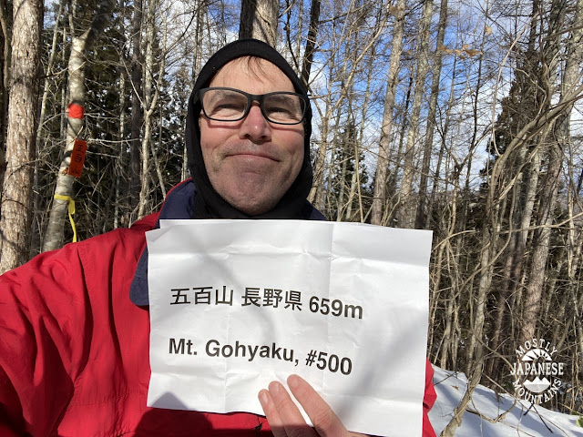
Voila. I brought this paper in case there was no marker. I was almost right. There was a marker but it was very small.
This makes it official.
Coming down.
As always, thank you for dropping by my cave. I really love the mountains and am happy to share them with others.
Make sure you press on the subscribe button down below so you can become a cave dweller and be notified of my posts.
If you really want to be my friend, click on the "support me" button and duke me a few shekels. I can be bought. I'm shallow like that.
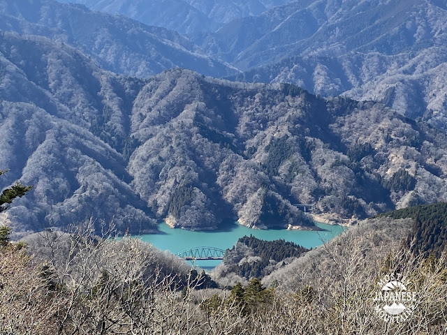
This was another lovely day in the Tanzawa area. Lake Miyagase, like all the dammed-up reservoirs around here, offers some beautiful views.
This was a short trip. I only wanted to get to one new peak on this trip. According to the climbing app I use, I am approaching 500 peaks. I have something special in mind for #500 so yesterday's goal was to get to #499.
Considerable planning and expense have gone into the plan for number 500 so you can imagine my shock when I got home yesterday and saw this statistic on my iphone.
Say what?! How could I possibly have miscounted?
The plan I had/have for #500 is meaningless except for my 500th. Drastic measures were necessary.
I deleted yesterday's hike from my app. Voila, problem solved.
I am now a mere tenderfoot with only 499 peaks under my belt.
So, onto yesterday. This sign is where I started. This trailhead is right next to a bus stop. From there, it's only an hour or so hike up to Mt. Bukka.
Mt. Bukka has some great views.
Looking to the west and northwest, you can see the Minami Alps.
Looking north, you can see up to Okutama and beyond to Saitama.
I was also able to see Mt. Nantai, Mt. Tsukuba and Tokyo Skytree with the naked eye. I could even pick out the mall we live by with binoculars. I've never been able to catch a glimpse of it it from this area.
The trailhead where I started is at a bus stop. There is also a parking lot and some picnic benches nearby. The point where I popped out of the woods back onto the road also is a similar setup. These mountains are not very high yet offer some spectacular views. Despite these good points, these hills aren't as heavily trafficked as mountains like Takao.
I recommend this area for families, date-type hikes, or to other people who want to get out but are not interested in anything too strenuous.
The buses to this area start at Hon-Atsugi Station.
Stay tuned for #500. I should be posting about that trip real soon. I'm hoping it will be interesting. I've put a fair amount of planning into this hike and am even spending a lot more than the usual tank of gas. (Feel free to hit that support me button if you can! Papa needs a new pair of socks after all this walking.)
I don't want to give away any spoilers. I'll just say I will be going much farther from home than I usually do and I'll be employing some special winter equipment my next time out.
Thanks for dropping by my man-cave. Looking forward to having you by again.
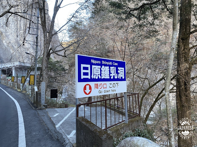
Greetings cave lovers. Today was a day that started, appropriately enough, at a cave. This is the Nippara Limestone Cave. You can reach it by bus from Okutama Station.
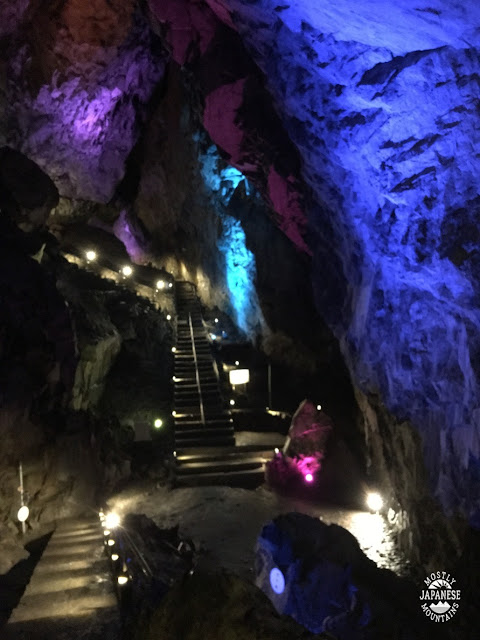
I didn't actually go in the cave this time. This picture is from the day I did go into the cave. This was in July several years ago. It was a superhot day, so I almost froze to death. Seriously, I thought I was going into hypothermia. I had taken my bicycle the 40-odd kilometers into the mountains to this cave and I was really hot and sweaty when I went in wearing just my shorts and a soaking wet t-shirt. Being a cave, it was cool. It felt like I was in a freezer.
Their site is here: http://www.nippara.com/nippara/syounyuudou/syounyuudou.html
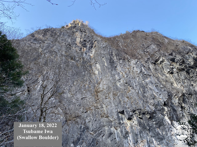
Today, the cave was just my starting point for my hike. These two boulders in the first pictures are right next to the cave entrance.
The trail starts with the red stairs at the bottom of this picture. That building is part of a temple/shrine complex the trail passes through.
The trail I chose today is the dotted one I circled on the map below. Dotted trails are not so well-marked or maintained. The trail was fairly slow-going but not that difficult to follow. There's quite a steep ascent for a bit and it gets a bit more gentle as the trail follows a ridge. I went from the bottom right in the picture to about the place on the map marked with an exclamation point and then turned around.
The second mountain I passed over, 金袋--"kane-bukuro", made me laugh. It means "sack of gold." I didn't see any rainbows or leprechauns around, though.
It was a pleasant day for hiking. Temps were between -4C~5C. Not too cold.
There wasn't much snow and there wasn't much scenery. This ridge is hidden a bit between two higher ridges so there were precious few long-distance views. Those ridges seemed to have gathered quite a bit more snow on them than the one I was on. I didn't need my crampons.
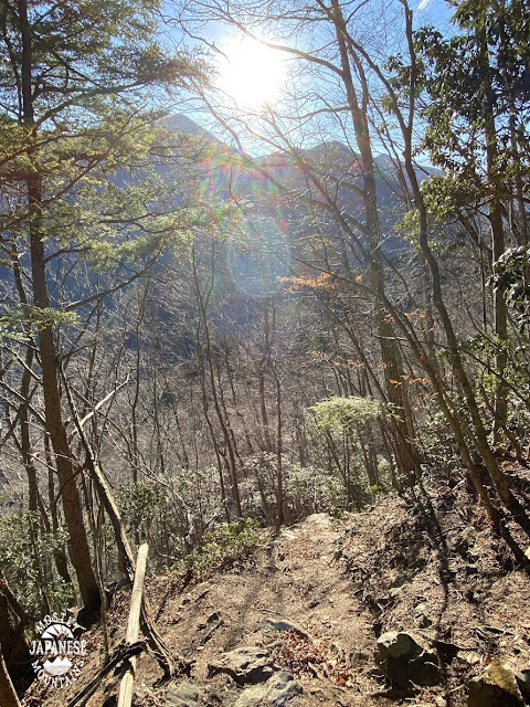
This picture is the only unobstructed view I got all day.
The trail looked cool. Lots of rocks that reminded me of the Shire.
The good thing about hiking an out-of-the-way trail like this is that there are no other hikers. The only life forms I saw was a rangale of deer.
This is today's path. Like I said, it was slow-going. This took nearly 6 hours to go about 10 km. Last week I went 48 km just a little over double that time.
As I mentioned above, you can get to this area by bus from the Okutama Station. There is also trout fishing at several spots in this area.
Where to go next? According to this app, apparently, I've climbed almost 500 mountains! Where should I go for #500?