For the last hike of 2021, I dropped by Sagamihara City in Kanagawa to tackle a trail I'd had my eye on for a long time. I'd wanted to climb Mt. Yakeyama since 2019. (Yakiyama? I've seen it written both ways.) The trail was closed due to typhoon damage most of that time.
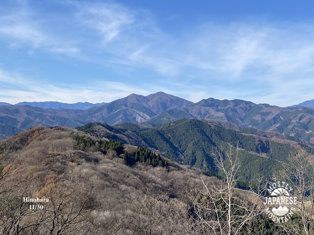
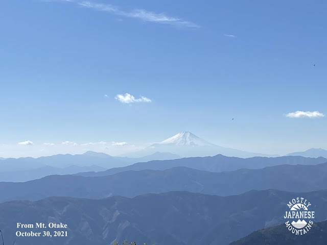
The view from Yakiyama (Yakeyama?) was great. It was there that I spied Mt. Bukka and decided that it had to go on the bucket list.
So, I went back to the area and climbed Mt. Bukka yesterday.
For this hike, I started at this park near the Miyagase Dam. I didn't actually know this park existed until I was passing by it on my way to the other side of the dam where I had initially planned to start.
This park is run by the Kanagawa Prefectural government and looks like a great place for a picnic or some kind of family outing. There are wide open areas to play on the grass, flowerbeds, gardens, an "adventure forest" and the dam nearby. It looks like a nice place to spend a day.
The park's website is here. http://www.aikawa-park.jp/
The park is part of the dam complex.
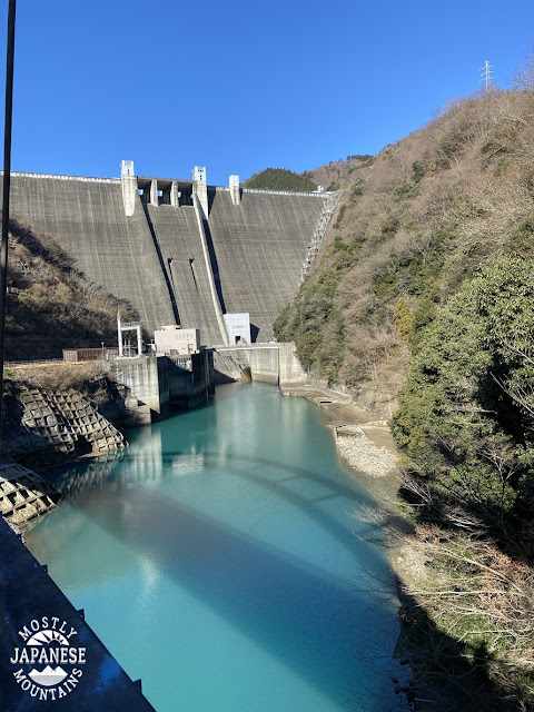
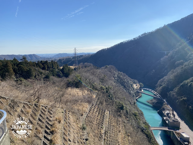
This picture is from the dam. There are lots of exhibits in the dam but they were closed when I was
there--and I was only interested in passing from one side to the other anyway.
If you are interested in learning more about this dam, check out this blogpost I found. It's very detailed!
Just about the first thing I encountered on the trail was this sign. I can attest to its veracity. They aren't kidding. See this post if you want proof.
(The word for leech in Japanese, 蛭, is pronounced like "hiru". The highest mountain in the area is 蛭ヶ岳, Mt. Hiru. I mentioned this interesting factoid to an old guy I met on the trail yesterday and he tried to tell me that the "hiru" of the mountain's name is a different word than leech, that the Japanese character pronounced "hiru" for the mountain really is a Buddhist word. I can read enough Japanese to know he's full of it, though. It's not the first time Japanese people have tried to gaslight me about mountain information. Another time another old guy tried to tell me there was no mountain named Tanzawa when we were both looking directly at it. Sheesh.
I didn't tell either of these guys what I knew. I just said "ah so.")
One of the reasons I wanted to do this hike is because of the lake. I love walking next to water. Some of these reservoirs in Japan, despite being manmade, are really beautiful.
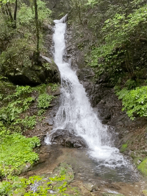
This is on the way up the trail.
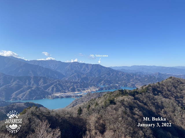
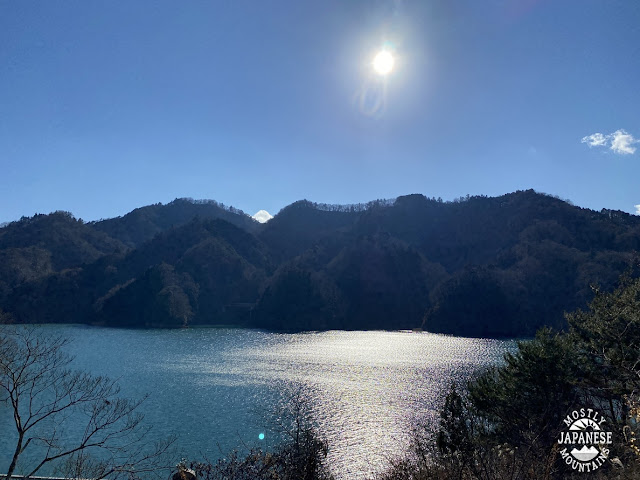
And this is when I was walking back along the road. I got lots of great views of the lake.
You may notice that my trail was in something of a figure 8 pattern. That is because the road that I returned along didn't intersect the mountain trail as I assumed it would. I couldn't close the loop as I hoped. That was a pretty dumb mistake. The road passed under the trail in a tunnel and I had to walk an extra few miles before I reached a roadway which looped back to the Aikawa Park. It's a good thing I like walking!
Getting there/final thoughts
Public transportation to the dam or a trailhead would be very difficult. You could get to the dam from Sagamiko or Hashimoto in about an hour after a few bus transfers. Alternatively, you could get to a trailhead for Mt. Bukka (quite far from the dam) after a 45-minute bus ride from Hon Atsugi.
Car or bike are better bets. The dam/Aikawa Park are accessible from Route 412 in Sagamihara. It's about 30 minutes by car from Hachioji.
The park, the dam and even the mountains offer a great opportunity for leisure suitable for all ages. The mountains are not very high. Not only did I see grandparents and small children, I even saw some pets on the trail. I do think that wasn't the best idea, though. I saw one guy hand-carrying his dog up the trail! Poor little Fifi couldn't handle it, I guess.
(How do you say Happy New Year in your country? Please let me know.)
This morning I had the pleasure to go to a mountain called Hinode in a town called Hinode to see something special, the first Hinode (sunrise), of the year.
The moon gave a show first.
I--and the countless other hikers I met at the top--was treated to a roaringly beautiful start to this year of the tiger.
I was really surprised at how many people were there already when I got to the top. I only saw two people on the trail but there must have been hundreds up here.
I went into an overflow spot down below the summit to watch the fireworks.
A funny thing was that I was the only person who said "Banzai." On Fuji, at sunrise, everyone really shouted out banzai. Maybe they were too uptight because this mountain is in Tokyo. People are different outside Tokyo. An old (Japanese) guy a few feet away from me said "It's beautiful." in English so I replied, "Banzai." He laughed.
I watched the sunrise next to a couple from the other side of Tokyo. I thought I was a hero for leaving the house before 5. They had gotten up at 2:30! They were so nice. The girl gave me a piece of candy she'd brought from her hometown when we parted. This is the second treat I have received from a Japanese hiker in just the past few days. On my last hike of 2021, a guy gave me a Snicker's bar.
I'd say it really satisfied, but Snickers and I haven't come to an endorsement agreement yet.
The last picture and the next video are about 10~15 minutes below the summit. It probably would be an even better viewing spot than the top because there's nobody there and the view is unobstructed.
When I got back to my scooter, I saw the bird of luck had left me an auspicious present to help me greet the year ahead!
The route/getting there:
There are many ways to get to Hinode. The most common is to go via Mitake Shrine. For that, you take a bus from Mitake Station on the Ome Line. Then take a cable car to the trail that heads up to Mitake. It's very well-trafficked and is downright crowded on holidays because it is a fun outing without being too strenuous.
I took the sneakiest and easiest way. I took my scooter up onto a forest road (林道, "rindo") that starts just a hundred meters or so beyond the Tsurutsuru Onsen in Hinode. That forest road intersects with a few other roads at the Umenoki Pass (梅の木峠)**. I parked about a hundred meters up the trail toward Mt. Hinode from there. I had a hike of just over 1 km each way. Everyone else took a longer trail than I did. Many people used the Tsurutsuru onsen as their base and were returning there to go into the onsen after their hike. Indeed, when I drove by just before it opened at 8 there was a long line of people at the door. I was happy that I could be home in my own bath by about 8:30. :-)
**The network of 林道 here is really useful. I've used that road I took this morning many times on my bicycle to go over that pass from the Hinode side to the Ome City side. (And on the way, hike up to a mountaintop near the pass! Win-win.) The 林道 allow for a great workout and enable access to mountains and trails that trains, buses and even cars just can't reach. Caution needs to be exercised on these roads, however. They are not the #1 priority for maintenance and many of them are closed off after natural disasters for long periods until the crews get to them. For example, this one I used today is only open for cars to the point that I went to this morning. The roads it intersects are blocked by locked gates because repairs still haven't been completed since a massive typhoon in 2019. Bicycles can get through, but you need to exercise caution. You can check the local municipal offices or ranger stations to find out about the road conditions, but it is even harder than finding hiking trail conditions through the same avenues.
Here's to a great year. I hope the bird of luck has blessed you all as he has me.
"Piston" is the word in Japanese for returning by the same route you went out on. I pistoned in Kanagawa today.
Today I got to hike a trail and climb a mountain that I've been looking forward to for a few years. It was closed after a typhoon in 2019 and was out of action until this year.
It was a gorgeous day. It's a great trail. If you want more details, hit me up. I want to make this a short post because I'm over blogging these days. 😜
What a great viewpoint from this tower on Mt. Yake. I could see Nikko, Mt. Tsukuba, Okutama, Skytree, Yokohama and Lake Miyagase.
Mt. Sodehira was a great spot for lunch.
I parked my scooter at a parking lot in front of the gate to the rindo (forest road). You can access this trailhead by bus. The nearest bus stop is Yakeyama Tozanguchi (焼山登山口) on Route 413 in Sagamihara.
One more post coming tomorrow to round out the year. Take care.