Drats. Foiled again. Mt. Kuriyama in Saitama near the Urayama Dam.


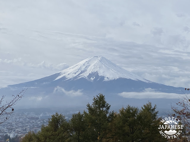
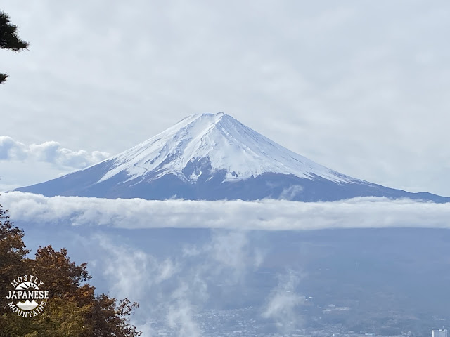
This week I had a couple of chances to get out.  On Tuesday, I planned a trip to a few mountains in Chichibu City, Saitama.  This picture shows what the weather was like.  Nice.


Unfortunately my plans were thwarted.  I planned on starting at Lake Chichibusakura and hiking about 21km (13 miles).  I would have hit several mountains if I made the whole circuit but I decided to turn back early on in the hike.  This map shows the original plan.


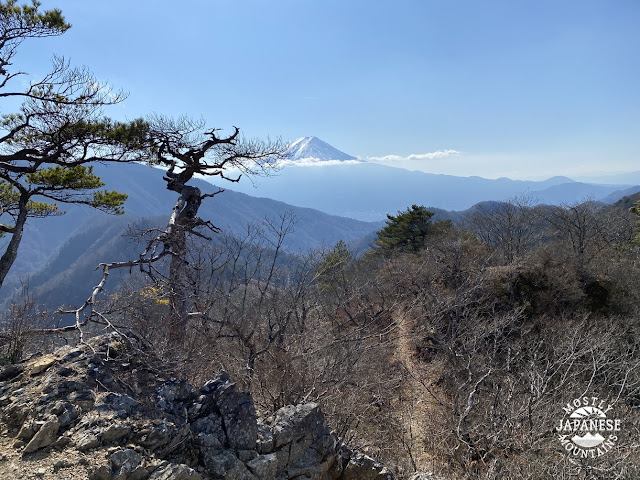
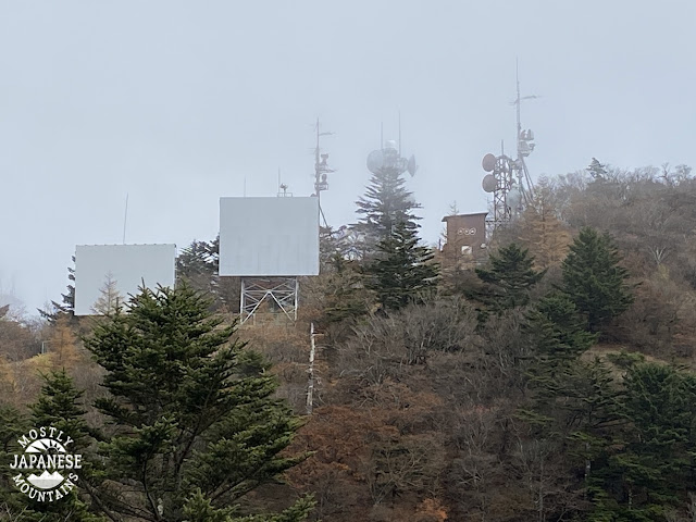
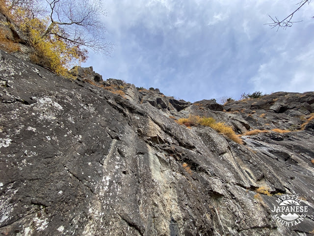
This is as far as I got.


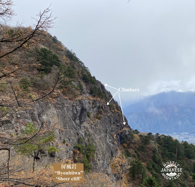
The trail I was on shows up on one or two maps but not on others.  It's not well-marked on the ground and I got to a point where it just seemed dangerous.  The ridge I was walking on top of got really narrow at the top and really steep on the sides.  Then the drop-off directly in front of me, too, became unnerving.  I got the feeling you should get when your car's navigation system tells you to turn off a bridge into the ocean.

I took these few pictures near that point.  Unfortunately, they don't quite capture the scene really well.  I'm sorry, but when I took the pictures I was more concerned about getting home alive than in showing you a scary photo. 


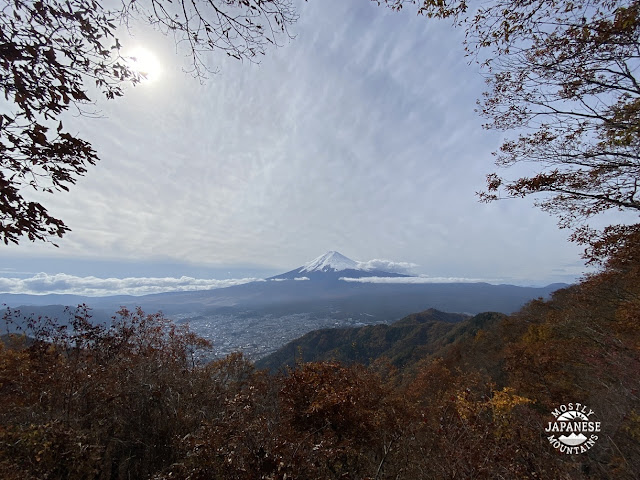
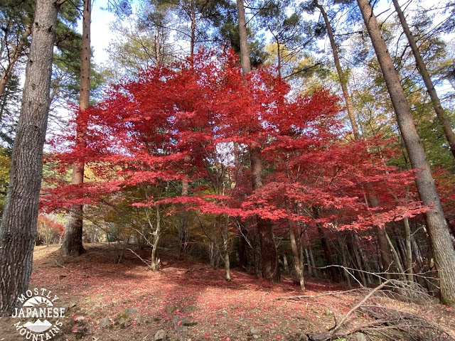
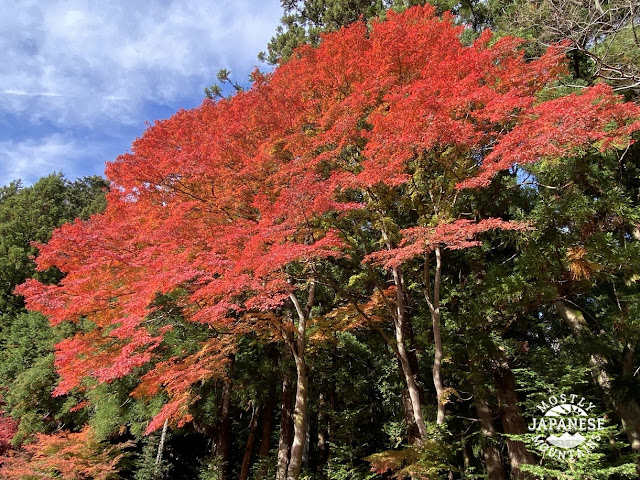
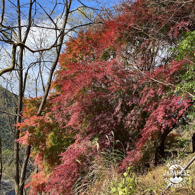
Aside from the hike being cut short, I did get to see some neat stuff and it was a beautiful day.

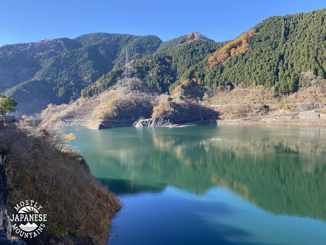
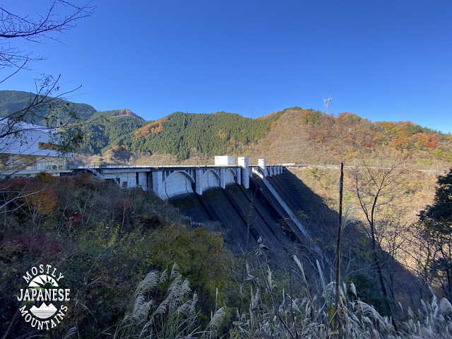
The lake I started at is the result of the damming of the Urayama River.  On the way to the trailhead, I stopped by the Urayama Dam.  I was glad to do that because I've driven by the sign for it 100 times but had never looked before.  

浦山川 Urayama River

浦山ダム Urayama Dam

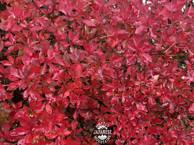
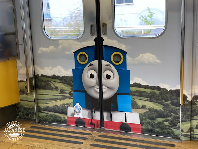
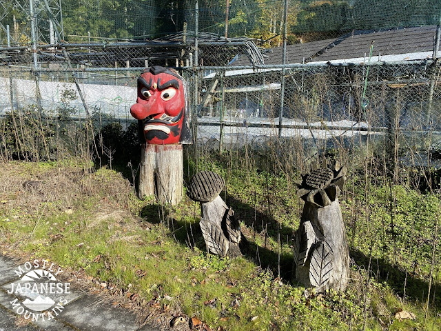
On the road, I saw some neat stuff.  That's part of the pleasure of touring around the backstreets and country roads in Japan.  There are random pieces of art and curios everywhere.  


There is one stretch of road lined with woodcarvings.  It's awesome.


This next picture was taken from the trail.  I started next to that bridge.


It was a gorgeous day.  The hiking part just ended too soon.


After I got out of the mountains, I stopped for lunch by the lake.  I met this guy there.

Monkey in Saitama 猿

There were actually about 10 monkeys around.  They all scattered too soon for me to capture their images.  Except for this guy.  He just didn't give a care about me.  Like a boss.


This is what it was like by the lake.  (By the way, there is a boat ramp and you can fish there.)


Soon after I left the lake behind, I dropped into the Hashidate Limestone Caves (橋立鍾乳洞).  I decided to pony up the 200 yen and go inside.  I am sorry, dear reader, but they didn't allow pictures!  
https://goo.gl/maps/8xxX7xZCjNHJeWLK9
http://www.city.chichibu.lg.jp.e.qg.hp.transer.com/4444.html

Speaking of limestone, Mt. Buko is one of the prime sources of limestone for use in concrete in downtown Tokyo.  Check out one of my blogposts on hiking Mt. Buko here:
https://mymancaveisthemountains.blogspot.com/2021/03/mt-buko-tokyos-limestone-source.html
or here:
https://mymancaveisthemountains.blogspot.com/2021/06/mt-buko-again.html

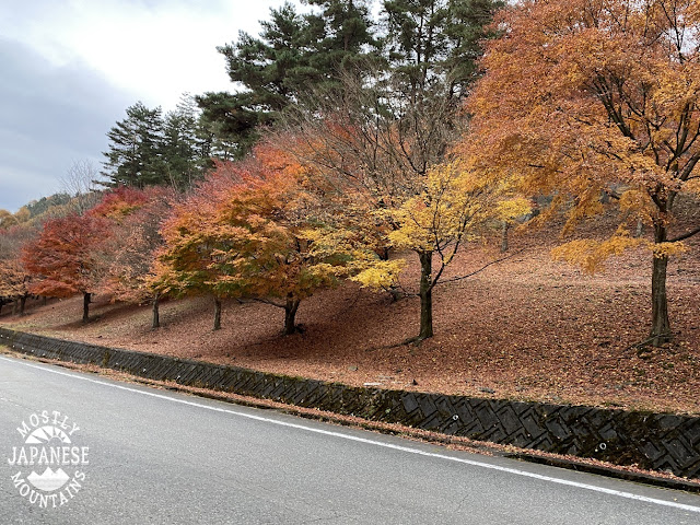
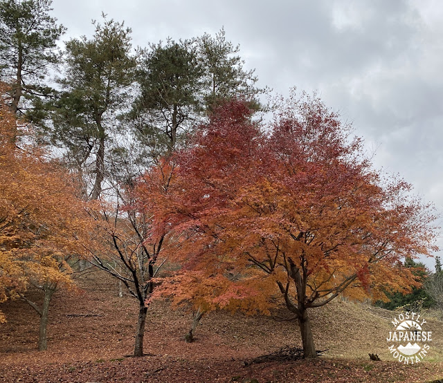
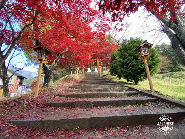
These last pictures are of the immediate vicinity of the caves.  It is near the end of one of the trails on Mt. Buko so it's a good spot for hikers to take a well-deserved break on their way home.


Hashidate Limestone Caves 橋立鍾乳洞


Hanitsuen


The last time I passed through here was after climbing Mt. Buko.  We stopped into this place for coffee.  It was absolutely superb.


Hashidatedo (橋立堂) Temple


Hashidatedo (橋立堂) Temple


I hope you enjoyed that.  I liked that trip and I liked sharing it with you.  If you want any advice on hiking in the area, don't be afraid to ask me.  It is about 2~2.5 hours from Shinjuku to this area by train or by car.  The nearest station to the dam is Urayamaguchi.

Come back again.


Mitsutoge Redux; More leaf-peeping

 Hello all you cave lovers.

I had the chance to get out yesterday and opted to go back to Mt. Mitsutoge which is in Yamanashi near Mt. Fuji.  I first climbed it earlier this month but I went up a different route this time.  Last time I climbed it from the southeast.  This time I came down from the north.  I really like to connect the dots of the places that I've trodden so I often climb the same mountain from different routes.  It occurred to me that I just might find myself connecting these dots all the way to Fuji.  I guess I could connect the dots all the way to Fuji by just walking another 20km or so.   (The more I think about it, the more I like the idea.  I've already been to the top of Fuji from this side so I just need to get to the trailhead where I started in order to make ends meet.  The next goal will be to climb up it from the other side starting at the ocean.)**

**After I posted this to my blog, I spent the next two hours planning the hike up onto Mt. Fuji.  Stay posted.  :-)

The first two pictures are my hike from earlier this month followed by the one yesterday.  Yesterday's hike was just a little longer but was much slower and more strenuous.


It was a pleasant morning to start.  Temps were around 45 f (8 degrees C).  I was moving enough though, that most of the day I hiked in a t-shirt.  


This month was my first time in this area but I have seen Mt. Mitsutoge from afar before.  It's fairly prominent so you can see it from a distance.  I think its prominence is the reason it has so many antennas on it.

Honjagamaru and Mitsutoge 三ツ峠山 本社が丸

三つ峠と富士山 Mitsutoge and Fuji


Mt. Honjagamaru (本社ヶ丸) allowed for some wonderful panoramas.  I must have spent a half hour there looking through my binoculars and picking out places I know.  This next picture is looking to the west at the Minami Alps.

Mt. Honjagamaru 本社ヶ丸から南アルプス


I've climbed ten of the mountains in this picture (and the rest are on my bucket list!).  It was really fun to see them all at once.


This is from the next mountain, Mt. Seihachi.  (清八山)
Mt. Seihachi.  (清八山)

I loved that little scene.


Unfortunately, it got a bit cloudy around noon.


This next picture is from one of the mountain peaks on Mitsutoge.  This particular spot is billed as one of the absolute best viewpoints of Mt. Fuji.  This is my second time here in about 10 days and I didn't see anything either time.  

Who do I see about getting my money back for this ride?


I shouldn't complain, though.  The old guy behind me in that picture is a local.  He said he's climbed this mountain 10 times and has never seen Mt. Fuji.

One of the many antennas:


This sign was so random.  I got a kick out of it.  "I love Mitsutoge."

I love 三つ峠


Coming down the route I did was slow.  I descended to the Kitaguchi Tozanguchi ("North entrance Trailhead") and this trail is evidently not used much.  It's very steep and not well marked.  I had to really concentrate because fallen leaves obscured the path and each footstep had to be tested.  

The nice thing about it was that the trail runs parallel to a stream and since it is so steep, there are lots of waterfalls to see.


The climbing apparatuses on this trail were of questionable reliability.  This rickety bridge is only about 12 inches (30cm) wide and it moves when you touch it.  Absolutely nothing is anchoring it down and it drops off quite sharply on one side.  On the other side is a cable pinned into the rock.  If the bridge gave way, you'd be left hanging onto the cable, I guess.


This door gives one pause for thought.  Why is there a door to nowhere?


 . . . and why is the lock locked, even though the door is open?


. . .  and why is there barbed wire that just ends at the trees to the left and right of the door?  Is this a door to another dimension or something?


Maybe if you step through it there is a lampost or a wardrobe . . .


Leaf-peeping season is running out.  I need to get out again soon.  Hopefully, I'll get in another good day before winter.


Thanks for dropping by.  Come by the cave anytime.


Here's an addendum.  I was hiking in Sagamihara today and got a glimpse of Mitsutoge from afar.


Leaf-peeping in front of Mt. Fuji. Arakurayamasengen Koen (新倉山浅間公園) and Mt. Mitsutoge

s


Greetings and salutations cave-lovers everywhere.


Japanese fall foliage 紅葉


My better-half/lovely bride/love of my life let me go to the mountains again the other day.  Mrs. Cave Dweller really is special that way.  

I decided to try a mountain fairly close to Mt. Fuji with hopes of catching some leaves turning.  I was having a difficult time deciding just where to go and finally hit upon going to one of Japan's 200 Famous Mountains called Mt. Mitsutoge (三ツ峠山).  I've seen this mountain from quite far away but had never climbed it or seen it close up.

The name of the mountain translates literally to "Three Pass Mountain".  That makes sense.  It's comprised of three peaks or about the same height quite close to each other.

I opted for public transportation for this trip.  For me, that means taking the JR Chuo Line to Otsuki and then transferring to the Fujikyu railway.  The Fujikyu railway runs to Lake Kawaguchi via the Fuji Q Highland amusement park and the bus station to one of the 4 main trailheads of Mt. Fuji.  Since it goes to an amusement park, the trains are really cute.  The one I took had a Thomas the Tank Engine theme.  


People who aren't on holiday get to commute on these trains, too.  I love Japan.

I didn't go to the end of the line.  I got off at Shimoyoshida Station and started hiking from there.  Being early on Sunday morning, the station was un-manned.

Here's the train leaving that station.


The first thing I passed through on my hike was a park/shrine called Arakurayamasengen Koen (新倉山浅間公園). 

This stairway, with its brilliant red maples made for an inviting welcome to the Koen. 


The spectacular views of Mt. Fuji make it a pretty cool place to take wedding pictures.


新倉山浅間公園 Arakurayamasengenkoen wedding pic
By the way, I don't know these couples.  I'm pretty sure they don't know each other, either!  Word is that they were getting a discount on their photos by having them taken together.  Don't tell anyone.  It'll be our little secret.

It was hard not to keep turning around and taking pictures of Fuji.  Looking at it with binoculars was really cool.  You can see the varioustrails as they switch back and forth up the slopes.


That park is a nice place for a walk with your family or for a date.  It's a fairly steep hill but it only takes 15~20 minutes to get from one end to the other.  

It is the home of the Chureito Pagoda.  The view of Fuji taken from behind this pagoda is quite iconic.  Unfortunately, they are building a new viewing deck behind the pagoda and that particular picture can't be taken until construction is completed next March.  This is the front of the pagoda.

忠霊塔, Chureito Pagoda


Once I passed through the park and hit the first mountain peak of the day, I saw very few people until I got near the top of Mitsutoge a few hours later.  It was pleasant walking.  Even though it was 46 degrees Fahrenheit (8 Celsius), I was hiking in a t-shirt most of the day.  

I encountered Bambi's family along the way.


This is one of the three peaks.  Can you see on the brown shed the letters NHK?  NHK is Japan's National Broadcasting Coroporation (Nippon Housou Koukai).  Can you spot the guy working on the antenna?


三ツ峠山 Mt. Mitsutoge

(I can't stand NHK.  They want you to pay to support it--even if you don't watch it or if you don't even have a TV.)


The view of Fuji from here is one of the best 100 in Japan.  Or so I'm told.  It was cloudy then and Fuji disappeared while I was on top.  

This gaggle of people is on top.


This is looking down at one of the passes from near the NHK antenna.

美しい富士山 Beautiful Fuji


There were a lot of people climbing here.  It was something to see. 


I'll only post one pic of the cliff.  I could post 20.  That is one gargantuan rock.


The name of this rock gave me a kick.  Wisdom tooth is "oyashirazu" in Japanese which literally means something like "unknown to parents".  I guess wisdom teeth are different than regular teeth, which are preceded by baby teeth--the existence of which every parent is aware.  Just my guess.  There is another rock formation down the trail that means something like "The empty-wombed saint."


It was all downhill from there.  


The last 2 or 3 miles were mostly on a lovely, winding paved road lined with Japanese maples and lots of flowers.


Mt. Mitsutoge is 3 peaks, not just the one pointed at in this picture.


This is the route I took.  Feel free to ask me any questions you want about it if you are interested in hiking around here.
Shimoyoshida Station to Mitsutoge Station via Mitsutoge


Come again!  I hope to get in some more leaf-peeping before the snow flies.