The Bandai/Urabandai area

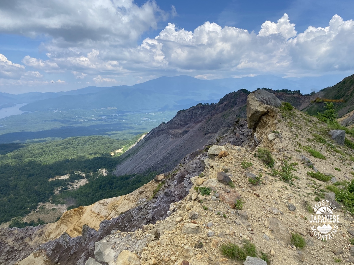
S'up cave lovers?  I want to share with you some of the places around Mt. Bandai in Fukushima.  As I said in the last post, aside from the mountain, there are a lot of recreational things to do here.


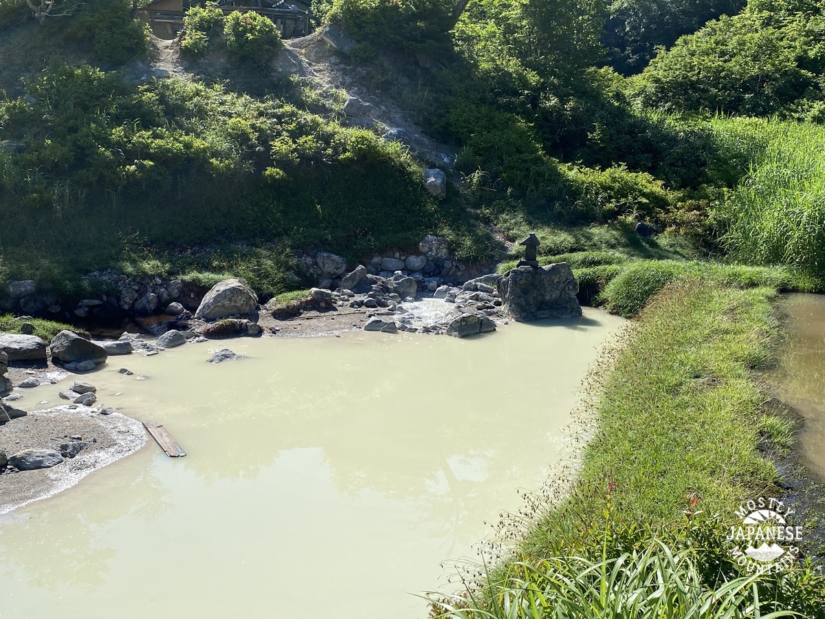
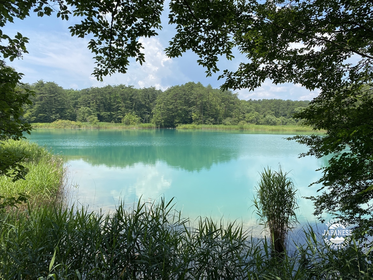
The volcanic eruption greatly interrupted the drainage of the area and created numerous lakes and marshes.  These first few pictures are of the Goshiki Numa,  "5-colored Marsh", (五色沼).  There is a fairly flat walking trail of about 4~5 km through it.  Along the way there is a restaurant, an ice cream stand, a souvenir shop, and rental boats.  Great fun for kids from eight to eighty!


Some of the watery sights in the Goshiki Numa.

Goshiki Numa 五色沼


There are some well-fed, well-coordinated Koi here.  

Goshiki Numa 五色沼 1


Goshiki Numa 五色沼 2


The next place I'd like to share is the Matsubara Campground on Lake Hibara.  The Matsubara Campground is a great place.  It faces the mountain across the lake and the views of Bandai are just incredible.  It also offers a front-row seat to the annual fireworks display held over the lake.  (Unfortunately, that display has been on hold since the COVID era began.)  The campground has swimming, tenting, cabins, boats, canoes, kayaks, fishing, bicycles, hiking, cooking facilities, water, a bath, great bathrooms . . . and they pick you up in a boat to bring you to the campground!  Since there are no cars it offers a more serene experience than the usual car-camping lollapalooza.  

The owner is a descendant of one of the 4 people that survived the eruption in 1888 and likes to show old pictures and tell the story.
Their website it here:
http://www.urabandai-camp.com/


Matsubara Campground 松原キャンプ場


Note the slide and the rope swing on the left.  The water is so clean.  I dropped my glasses in about 10 feet of water but was able to spot them from the surface.  There are lots of fish to see, too.

Matsubara Campground 松原キャンプ場2


Since I'm a walker, even after climbing the mountain, I was happy to have the trail along the lake to perambulate.  There were some spots along the way that were just so beautiful I couldn't help but linger to look.


Lake Hibara 桧原湖


The water is very high compared to my last trip.  Then, these islands were above water.


Goodbye, Bandai.  See you again someday.


Mt. Bandai, one of Japan's 100 Famous Mountains

 Mt. Bandai (磐梯山)

磐梯山 Mt. Bandai


Mt. Bandai, in Fukushima, is a really beautiful, interesting mountain.  It's shape and the topography all around it is the result of massive volcanic eruptions in the past.  The latest eruption, in 1888, nearly wiped out the entire local population--all but 4 people who were out of the area for work at the time perished--eradicated a mountain peak, stopped a river, and created numerous swamps and lakes.  Along with the mountain, these spots offer innumerable leisure opportunities from hiking and boating to ice fishing and skiing.  


I think I will make another post about the stuff below the mountain in the near future.


It's my blog.  I'll post about whatever I please.  ;-)

This is a view of the north side of Mt. Bandai from our campground on Lake Hibara.  Bandai is the higher peak on the right.  

磐梯山 檜原湖 Mt. Bandai Lake Hibaara


I was a bit nervous about this trip.  The weather forecast was for thunderstorms, hail, brimstone, frogs, locusts, bats from Wuhan . . .   This was my third trip up to this area.  The first time it rained so hard, I just stayed in the campground the whole time.  My first climb up Bandai was two years ago but this is all I got to see from the top. 

磐梯の山頂 Top of Mt. Bandai

Thankfully, the weathermen were wrong.  It was gorgeous.  Who says you need a weatherman to know which way the wind blows?


Our route:


That is a hotspring we encountered on the trail.  There used to be public bath here.  This spot is called Nakanoyu (中の湯).

It smells like hell.  Really.  It's the smell of sulfur.

Nakanoyu 中の湯

Nakanoyu 中の湯 hotspring on Mt. Bandai


From the top:

from the top of Mt. Bandai 磐梯の山頂


Looking south to Lake Inawashiro, the largest lake in the area.  
Much better view than the last time!

磐梯からの猪苗代湖 Lake Inawashiro seen from Bandai


There were a lot of dragonflies on the top.


This is Kevin, my sherpa.


When we were coming down, it was something to imagine that there used to be a mountainpeak towering here.  Kevin kept saying, "The mountain blew up."


Bandai 磐梯


I hope I didn't post too many pictures for you.  Less is more but it was really difficult to keep the number of pictures down.  It's such a beautiful place.


More soon.  Like I said, I think I'll make another post about the area below the mountain.   Take care of yourselves.  


Where are you from?

 I'm looking at the statistics on my blog and I am seeing people viewing it from every continent.  That makes me curious.  Who are you?  How did you end up at my blog?  Have we met?


Anyway, whoever and wherever you are, I hope you enjoy this blog.  I try to pass on beautiful things that I come across and hope it brightens your day.  If you're in Japan and are able to pick up some ideas for places to go and things to do, I'm really happy.

Snakes, why did it have to be snakes?  Sasagogangaharasuriyama


I'm with Indiana Jones.

Snakes creep me out.  


This is the second one I've seen in as many weeks.


I was hiking around Otsuki and Koshu yesterday.  I discovered a cool tool on one of my hiking apps.  Check this out.


I wish I had a better avatar than the one they assigned me.


Not many pictures yesterday.  This one shows my path.  
笹子雁ヶ腹摺山, Sasagogangaharasuriyama hike map

To get to the trailhead, you take Koshu Kaido west from Otsuki and follow the signs for Sasago Pass just before the long Shin-Sasago Tunnel that goes to Koshu City.

On the way to the pass, you go past the 矢立杉 ("archery quiver" "cedar"), a tree that is supposedly over 1,000 years old.  The locals seem to be proud of it.  There are lots of signs promoting it and a memorial there.  The memorial has a device that will play the song for you.  I'm sure it's all more meaningful to a native speaker.  I would have been more interested if they billed it as an ent.  


矢立杉 Yatatesugi


It wasn't a day with a lot of breathtaking views--but it was nice to see the sun for a change.  Rainy season officially ended the day before.  This picture shows Koshu City.


More next week.


Mt Keikan, Koshu, Yamanashi

 Greetings cave creatures.


I had the good fortune to get a hike in between the raindrops at the end of this rainy season.  I went to one of my favorite areas, just below Mt Daibosatsurei in Yamanashi.


Looking south.  The tallest mountain is Daibosatsurei.  That's one of my favorite mountains.

Daibosatsurei 大菩薩嶺


Looking north toward Karamatsuo and Saitama beyond.


This little shrine takes a bit of nerve to get to.  There is a bit of bouldering involved.  The views from this spot make it worthwhile, though.

鶏冠山(黒川山) Mt. Keikan


Since we're still in rainy season, the streams and falls were spectacular.  It's really tempting to post a million pictures.  I'll hold back, though.  


It was a great day for wildlife, too!

Yamanashi deer 鹿


Closer . . .

Yamanashi deer 鹿 2


and . . .


monkey 日本猿


This was a great way to end the day.