HeARTworks: Share the Joy!
 I'm the caveman. My mancave is the mountains. Google dislikes me so nobody can find my blog. I keep doing it though, because I want to remember all the great places I've been able to see and I have a bad memory.
Large thanks
A big shout out and thank you Mrs. Caveman's sisters, Patsty and Meldy, for stepping up and buying me some equipment for the winter hiking season! That's pretty nice of them, considering I did club their sister over the head and drag her back to my cave all those years ago.
I like this jacket so much that when I went hiking yesterday, I couldn't bring myself to actually put it on. Even though it was getting a bit windy and cold, I didn't want to put it on because I was all sweaty.
 I'm the caveman. My mancave is the mountains. Google dislikes me so nobody can find my blog. I keep doing it though, because I want to remember all the great places I've been able to see and I have a bad memory.
Caveman hikes the 💯 Famous Mountain, Mt. Takatsuma (高妻山), Nagano/Niigata.
Location:
高妻山 Mt. Takatsuma Togakushi, Nagano
Starting and stopping point:
Peaks bagged:
Mt. Gojizo 五地蔵山 and Mt. Takatsuma 高妻山
(First-time) peaks
#835 and #836
(100 Famous Mountains) peak
#29
Getting there/getting around:
I drove. There is free parking near the trailhead. The trailhead is inside the Togakushi Campsite. The campsite just closed for the season but you can walk through to the trailhead.
It is possible to get there by public transportation. From Tokyo, take the Hokuriku Shinkansen to Nagano Station. (Or you could take the bus from Shinjuku to Nagano Station.) Change to the Nagano Togakushi Bus Line for the Togakushi Camp Ground. Depending on your choice of routes, it should take between 4 and 6 hours and cost between 6,900 yen and 10,000 yen each way.
Map:
Search for 山と高原地図 妙高・戸隠・雨飾 火打山・高妻山・信越トレイル on the Mapple web site to get the latest Yama to Kogen Map.
Weather Information:
Time
Total Time: 7:28 Break time: 1:02 Distance: 13.1km
Elevation
Lowest: 1,173m Highest: 2,352m Total Ascent: 1,498m Total Descent: 1,498
Technical considerations/difficulty:
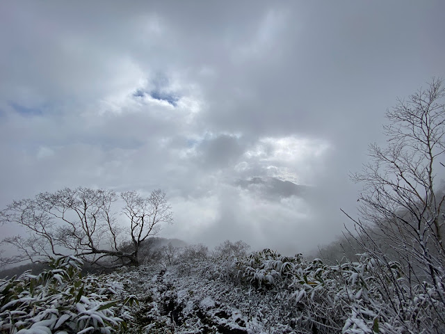
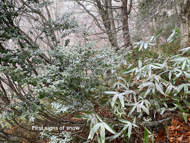
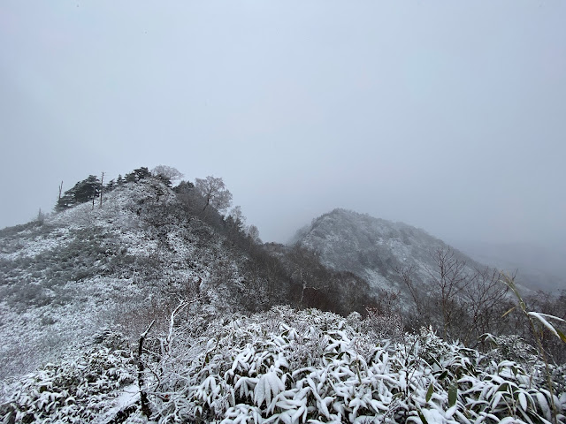
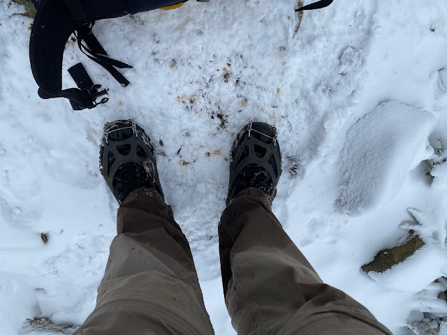
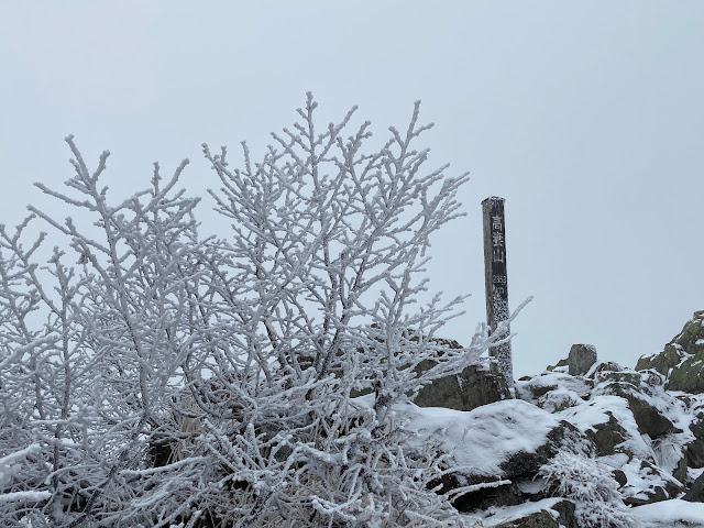
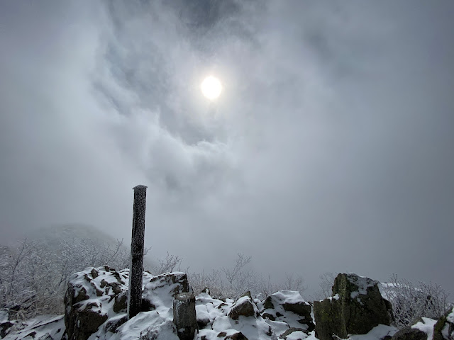
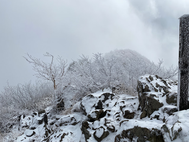
As you can see from the picture, there was snow. It was fresh and wasn't deep yet. I was glad I had my crampons. Snow remains on Mt. Takatsuma into May, so keep that in mind if you want to bag this one.
The hike is fairly steep and the level of ascent is noteworthy. This hike is comparable in distance and change in elevation to climbing to the top of Mt. Fuji from one of the usual routes.
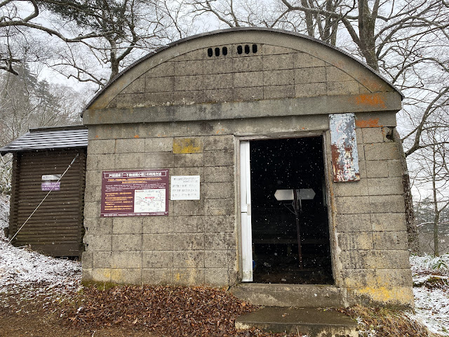
I climbed up to Takatsuma on the east side and that section was fairly straightforward. There are some spots with chains, but not too many. It is just steep and rocky. I came down to the west, passing by Mt. Jizo and the Ichifudo Refuge Hut (一不動避難小屋) on the way. From the refuge hut to the bottom has a few more exciting spots--nothing too challenging physically but a wrong step could really ruin your day. Also, that trail crosses over and through a stream several times. I was glad that I was doing this at the end of the hike and not at the beginning. My feet were absolutely soaked from the stream and it wouldn't have been pleasant to go tramping around in the snow with my boots and feet in that condition.
Facilities:
Togakushi Campground (This closed at the beginning of November.)
Inside the campground, there are few restaurants. This soba restaurant seems to be open year-round.
Thoughts/observations/recommendations:
This is another in a long list of mountains I've climbed which I wouldn't be able to pick out in a line-up if my life depended on it. Visibility was pretty poor all day, so I have no idea what this mountain or the ones around it look like. That isn't to say that the views weren't cool. The snowscape was great to see. I would like to get back some clear day, though. Maybe in summer.
Today's listening:
New season of "For You The War is Over!"
 I'm the caveman. My mancave is the mountains. Google dislikes me so nobody can find my blog. I keep doing it though, because I want to remember all the great places I've been able to see and I have a bad memory.
The one that got away . . . again!
The other day, Mrs. Caveman invited me camping. ⛺ All she needed to say was, "Do people go camping even in this (fall🍁) season?"
Being the sensitive spouse I am, I intuited all she wanted to convey. ie, "Remember that place we went camping in the rain☔ last month and you couldn't hike because it was too wet? Let's go there again this weekend."
To which I replied, "Mrs. Caveman💖, you always have the best ideas.💡"
(She really is a trooper to put up with me.)
Unfortunately, although the weather cooperated this time, my physical condition didn't. We went to the Togakushi Campground on Friday with a plan for me to hike Mt. Takatsuma on Saturday. Mrs. Caveman (who is an artist) would hang out in the campground sketching while I was climbing. Things looked great on Friday. The weather was spectacular and we had a nice day of sightseeing/leaf-peeping before setting up. The problem started in the middle of the night in the tent. I woke up around 1 a.m. with a pounding headache and didn't sleep a wink after that. By the time the sun rose, I was not in the mood for any physical exertion and I thought it better to stay out of the mountains in case I was coming down with something serious.
We packed up and came home soon after breakfast. Thwarted again.
In case anyone is interested in doing the hike I was planning on, I will (re)post the template comments I'd started in anticipation of this hike. It's one of the 100 Famous Mountains, so you should climb it if you want to say you're living your best life.
I'll also put up some pictures I took on our little jaunt. We dropped by Lake Nojiri on the way up and it was a picture-perfect day for fall colors. And, it was warm, too. (Global warming gets such a bad rap. I don't mind it. Heck, maybe England will again have vineyards someday.) Lake Nojiri has a boat tour. (25 minutes, ¥1,400) They discovered some elephant fossils in the lake so there is a museum. We dropped into the Naumann Elephant Museum after the boat ride. When we got to the campground, we took a walk and encountered some animals that are actually still alive.
Pics follow the template.
Location: 高妻山 Mt. Takatsuma Togakushi, Nagano
Starting and stopping point: 戸隠キャンプ場 Togakushi Campground
Peaks bagged:
(First-time) peaks
Getting there/getting around:
I drove. Mrs. Caveman and I spent the night at the Togakushi Campground and I left our car there. There is free parking near the trailhead for daytrippers. Checkout is in the morning, but if you get the basecamp plan, they'll let you check out at 4:30 for just another 500 yen.
It is possible to get there by public transportation. From Tokyo, take the Hokuriku Shinkansen to Nagano Station. (Or you could take the bus from Shinjuku to Nagano Station.) Change to the Nagano Togakushi Bus Line for the Togakushi Camp Ground. Depending on your choice of routes, it should take between 4 and 6 hours and cost between 6,900 yen and 10,000 yen each way.
Map: 山と高原地図18 妙高・戸隠・雨飾 火打山・高妻山・信越トレイル
Weather Information: Japanese weather forecast
Total Time: Break time: Distance:
Elevation: Lowest: Highest: Total Ascent: Total Descent:
Technical considerations/difficulty:
Facilities: Togakushi Campground
Thoughts/observations/recommendations:
Today's listening: Bible in a Year
Here are some pics.
There are still some Cosmos at the lower elevations.
 I'm the caveman. My mancave is the mountains. Google dislikes me so nobody can find my blog. I keep doing it though, because I want to remember all the great places I've been able to see and I have a bad memory.


