Caveman hikes 7 peaks in the Tanzawa Area. Mt. Tonodake, etc. Yabitsu Pass to Shibusawa Station

February Hike in the Tanzawa Range


Saturday, February 20, 2021

The Tanzawa Range in Kanagawa is not as convenient for me to get to as the mountains of Okutama are.  Nor is the commute as pleasurable.  If I want, I can take my bicycle to Okutama and 99.9% of the trip is through the woods.  Going to Kanagawa usually entails train trips with multiple transfers and a longer trip than I would prefer.  Even though it's only 31 km (just under 20 miles for my compatriots in America) from my home in a straight line to Mt Tanzawa, there is no direct route.

That said,  I like to run down there from time to time because I can see the main mountains in profile from my place.  It's an easy way to create a pleasant memory to hike somewhere that I can look back at on an average Tuesday and say, "I've been there."  I do that a lot from work.  Shhh.

A specific reason for this trip is that on one of my hikes down there I bought some swag that I need to justify.  I don't buy a lot of swag, but when I climb one of the mountains on the list of Japan's 100 Famous Mountains, I buy a badge or towel or something.  When I climbed Tanzawa, I bought the t-shirt below.  The problem is, that there are other mountains on it.  Until I climbed every mountain on the shirt, I felt like I was stealing valor.  So, to justify my purchase of this t-shirt, I have traveled down to the area 4 or 5 times and plodded something like 50 miles through the wilderness to hit every peak on the shirt.  

Well worth every blister and frost-bitten digit.  I love this t-shirt.


I never realized it until I took this picture but the caption at the top says "Tanzawa Yuujin."  I had to look up yuujin.  It means something like "man of leisure" or, even better "playboy."  I approve.  

I am a Tanzawa Yuujin.


On to the rest of the pictures.  This is the path I took.  I started at Hadano Station by taking a 45-minute bus ride to Yabitsu Toge (Yabitsu Pass).  It was crowded.  They sent two buses and I was standing in the back of the second bus.


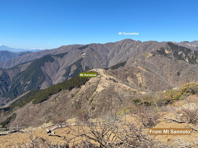
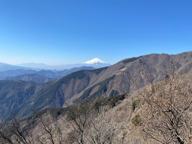
I'm not going to explain anything about the rest of the pictures.  They're pretty self-explanatory.  There were too many good views of Fuji.  I'm sorry if I've put too many.  It is just so beautiful.  The only regret of the day was that the sea wasn't too visible.  Sagami Bay is only about 20km away and is usually more visible.


Mt. Sannoto


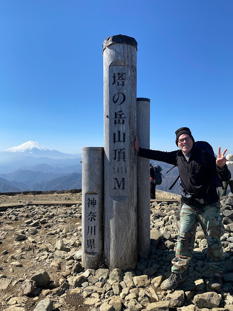
塔ノ岳 Mt. Tonodake

Mt. Tonodake 塔ノ岳


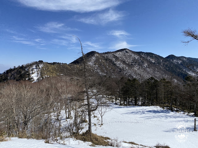
Not too bad for February.  America is frozen these days I hear.


No idea what this installation is.  This is a house I passed after I exited the trail.


I love knowing what I am looking at.  

I can see these mountains from home but this is the other side.

鍋割山荘 Nabewarisanso

Thanks for looking.  Hope you enjoyed it.

Want to see the top of Mt. Tanzawa?  100 Famous Mountain, Tanzawa

Make sure you follow me by email so you get updated.  I won't do anything else with your email address.

That's all for today.

Caveman out


Ushio Daira etc around Enzan

Hike around Enzan on February 11


I'd hoped to bag a few peaks between Shougen Pass and Mt Hiryu on this winter day but was foiled by ice.  I'd gone by bike out there but had to park about 3 miles before the trailhead because of ice on the road.  (I parked near Inukiri Pass and the trailhead I entered at is Sannose Tozanguchi.)  Didn't get to any of the peaks I'd planned on because of the loss of time but it was a beautiful day and I got to get a bit more hiking in the snow while it lasts.

I'll be back after everything has melted.


A nameless peak.  No snow just on the top because of the sun.


I'm looking down here from a spot called Ushio Daira.  

Ushio Daira 牛小平


There were so many nice views of Fuji this day.  Notice it's not all white.  It hasn't been completely covered very often this year.


Thanks for looking.  Hope you enjoyed it.

Make sure you follow me by email so you get updated.  I won't do anything else with your email address.

Mt Hiryu

 Tabayama Village to Mt Hiryu

February 1, 2021


This was the first time I got to make use of my gaters and crampons this year.  There really hasn't been much snow.  On this hike, I did find myself slogging through about a foot of snow at higher elevations.  In some places, the only footprints were animal tracks.  They use human trails, too.  I wonder if they are amused that we use their trails, too.


I had planned on hiking about 15 miles and incorporating one other summit into this trek but turned around at the top of Mt Hiryu.  It was only 10 miles but still took about 8 hours.  According to an app I was using, I ascended over 1,700m so I guess the slowness is understandable.


Fun fact Hiryu (飛龍) means flying dragon in Japanese.


If you are following this blog, you know that I bought some canned inoshishi at Mt Mitake the other day.  That became today's lunch.  It's really yummy.
Yes, that is homemade bread.  That's really yummy, too.


Mt Mito with the Peace Pagoda in the foreground.

三頭山 Looking at Mt. Mito


One of the unfortunate things about this hike is that, while the views are spectacular, they don't translate well into photos.  There aren't many wide shots you can take here.  

It is actually a very narrow trail for much of the way.  There are rhododendrons that flank the path on each side and overarch it.  Much of the time, you have to duck.  I came down this trail a few years ago after an overnight and had a huge pack.  Those rhododendrons were a pain in the neck.


I was happy to have the crampons.  I saw one other hiker today.  He was slipping all over the place.


I've hiked along that ridge many times.  It was nice to see it from this spot.


This is Tabayama Village.  It's just a postage stamp in the middle of nowhere.  Population 529.  One would think it is a quiet place, but you'd be wrong.  When I was coming down the mountain, from a spot miles before I got close enough to take this picture, I was greeted with the sounds of enka music coming up from the village! The mind boggles. 


It's barely visible, but there is a white building on a hill in this picture.  Can you spot it?  The following two pictures are of the same building but taken from Route 411.


When I first saw this thing, I thought it was so cool.  I still do.  I thought it was a castle or something like that.  What it is is a large slide.  I think that's cool.

https://japan.stripes.com/travel/japan%E2%80%99s-longest-roller-slide-isn%E2%80%99t-faint-heart-1571105278


That's all for today.  Thanks for looking at my blog.  I'm still not sure of what I'm doing this or why.  The long and the short of it is that I guess I like taking pictures and feel like I am wasting beauty if I keep what I've seen in nature to myself.


Make sure you follow me by email so you get updated.  I won't do anything else with your email address.


Mt Mitake February 2021

Mt Mitake

January 30, 2021


I had the chance to go hiking with my friend, Russ, for a few hours the other day.  Since time was short, we went to Mt Mitake.  I am tempted not to post these pictures because I didn't take that many on this particular day and there are many great views that I'm not showing here.

Mitake is one of the most trafficked mountains in Tokyo.  Probably #2 only to Takao.  It's not too strenuous, has spectacular views of downtown Tokyo and is connected by trails to Hinode and Otake Mountains which are popular in their own right.


This is the main temple at the top of the mountain:

御岳神社 Mt. Mitake

One thing that I really like about Mitake is the souvenir shops at the cable car stations.  They sell inoshishi (wild boar) and bear meat in a can.  This is an inoshishi sandwich I had a few days later.


The street before the shrine.  There are plenty of shops, restaurants and inns in this little area.


On the trail . . .


Most people take the cable car up and down.  From the top cable car station it's a 45 minute~1 hour walk to the shrine.  We opted to start at Kori Station and extend the hike by a few miles.  Taking this route brings you by Mt Otsuka on the way (and avoids the crowds.)


大塚山東京 Mt. Otsuka near Mitake


This is the first time I ever have seen this place open.  They were charging admission though.  We skipped it.


Behind the main temple, there are a bunch of little shrines in the back.


Shrine on Mitake 御岳神社

Thanks for looking.  Hope you enjoyed it.

Make sure you follow me by email so you get updated.  I won't do anything else with your email address.


This is the third post.

 For now I am posting the pictures I have put in my personal screensaver on my computer.  There's no rhyme or reason beyond the fact that I like them.  To the best of my recollection, all of this particular batch were from Yamanashi with maybe, just maybe, a few from Saitama.


Thanks for looking.  Hope you enjoyed it.

Make sure you follow me by email so you get updated.  I won't do anything else with your email address.