Shiroyama, Tsuiko and Shiroyamako. Hike around Sagamihara City
Greetings cave critters. I managed to dodge the raindrops long enough to get a short hike in yesterday. I went to nearby Kanagawa Prefecture to knock off a hill that I've been meaning to take care of for a long time. Mt. Shiro next to Lake Tsui in Sagamihara City is something I pass by frequently on my way to larger, better-known mountains in Yamanashi. It is not big, but its location adjacent to the lake makes it interesting. Since it's not very big, I decided to combine hiking that with hiking around another lake just to the north, Lake Shiroyama. I have hiked down to that from the Takao area before so I was able to connect some more dots on my maps.
Here are the statistics. I'll get to some pictures later on.
Location: Sagamihara-shi, around Lake Tsukui (津久井湖).
Mountains climbed: I don't know that they deserve to be called mountains but the "peaks" were Enokubo (榎窪山 "mushroom+female genitalis/hollow+mountain"), Kusato (草戸山 "grass+door+mountain"), Otatsugoyama (牡龍籠 "Honorable male+dragon+cage"), and Shiroyama (城山 "castle+mountain").
Getting there/getting around: There aren't any train stations nearby but there are lots of bus stops. I went by scooter. The area around Shiroyama Lake is a good destination for a bike ride.
Elevation: Pretty low. Highest point was only about 380m.
Technical considerations/difficulty: Just a walk in the park.
Facilities: Lots. Many public restrooms and rest stops on the trail.
Thoughts/observations/recommendations: That was a nice way to kill a few hours. There are many areas around here that would be good picnic spots. Check out the local parks.You can fish on Lake Tsukui but not on Lake Shiroyama. There are boat rentals around Lake Tsukui, too.
I started hiking at the lowest elevation of the day, where I'd parked my bike at the Mitsui Ohashi (Mitsui Big Bridge.) From there I would first travel north, up and around Lake Shiroyama. Then I would retrace my steps to the bridge, cross it and climb up to Shiroyama before finally returning to the bridge.
Soon after starting out towards Lake Shiroyama, I was able to look back across Lake Tsukui at Shiroyama. That is the hill I would climb later in the day.
This was my first glimpse of Lake Shiroyama that morning. Lake Shiroyama and Lake Tsukui are both dammed. (Too proud to repent, I guess.) Both of the lakes are sources of hydroelectricity.
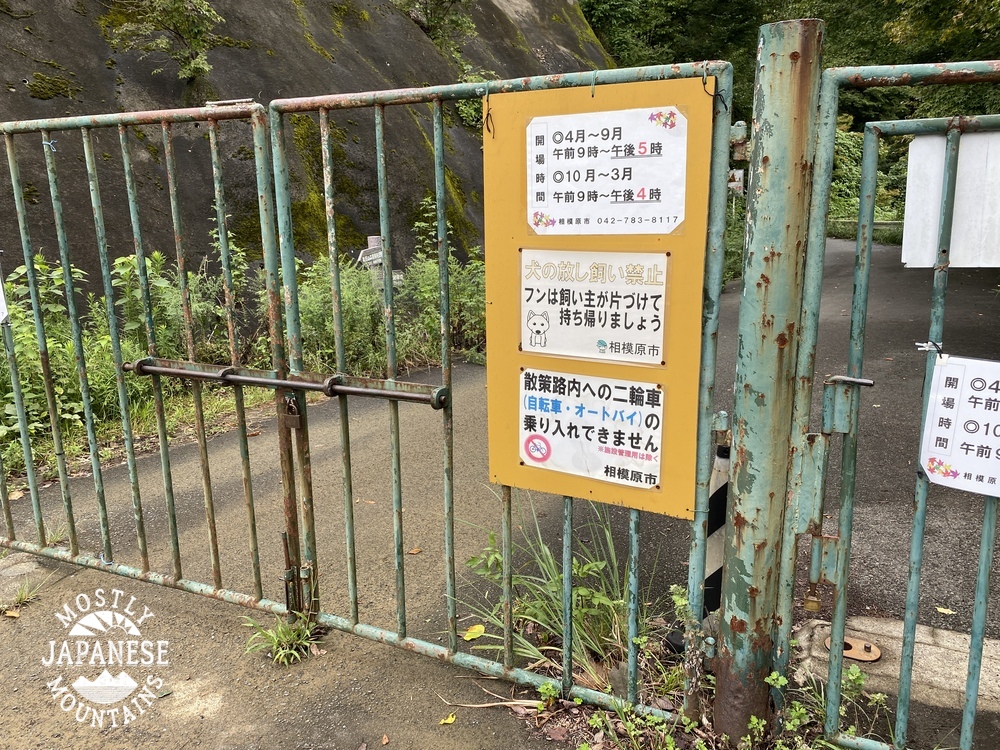
Looking back at the dam. The shrubbery in the upper portion of the middle of the picture is shaped to spell "しろやまこ"--Lake Shiroyama.
The electric company only opens the gates from 9~4 or 9~5 daily.
(They aren't hard to climb over, though, in case you're there outside of those hours. A friend told me that.)
I never would have expected to see one of these in Japan! This was next to the trail.
The Mitsuiohashi
All I could think of when I saw that green algae was the fish in the stream next to the nuke plant in the Simpson's TV show. I'm sure it's fine, but I don't think I'd fish there.
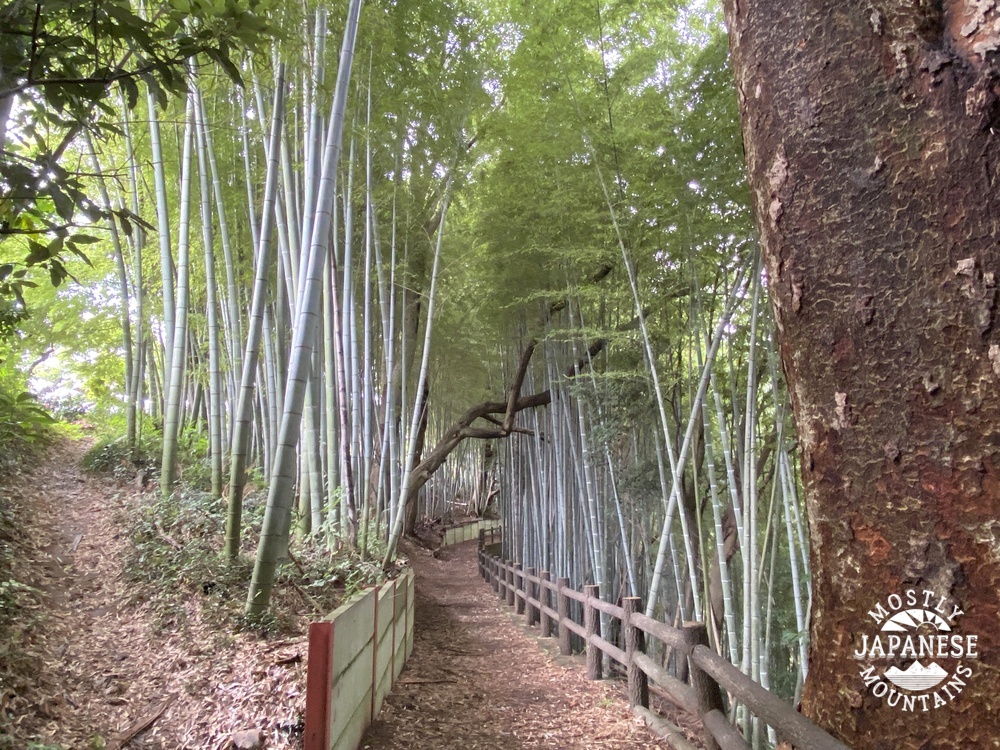
I've lived in Japan something like 25 years and I still find bamboo exotic and beautiful.
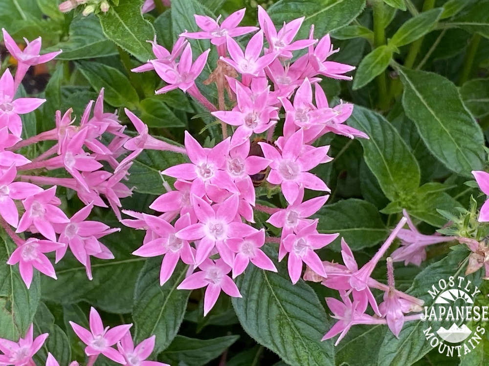
After walking across the bridge and heading south for a little bit, I arrived at the Tsuiko Shiroyama Park.
It's got some great flowers.
Visitor's Center
The playground is really cool. I wanted to play on those things.
It seems a bit dangerous, though. Every piece of playground equipment had this warning about the potential for burns. One wonders why they installed equipment that could cause burns to little kids. Who would build playground structures that could cause burns, anyway? (Another thing I often wonder about here is why so many surfaces we drive or walk on here in Japan are so d###ed slippery!)
Speaking of danger, I saw but neglected to get a picture of the sign warning of mamushi. (Japanese copperhead/pit viper.) They're poisonous.
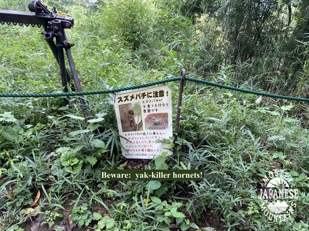
I did get a picture warning about the homicide hornets!
Those hornets (suzumebachi) really are dangerous. They can kill. They worry me more than bears in the woods.
I did get this delightful sign, too.
I've encountered leeches before. Yuck. That is nice they provide the salt. If you find a leech attached to you, you can get it off by pouring salt on it.
Here's the view from the top of Shiroyama.
The first "mountain" I climbed today, 榎窪山, is in the middle of the picture.
That's all for today. More in the next week or so.
Stay dry. Don't forget to subscribe if you haven't already. Leave a comment or question if you like. I'm happy to give you some advice on hiking in Japan if you have any questions. I know how bewildering this place can be and am happy to pass on anything I've learned.
I agree it's an interesting mountain, close to Tokyo, and not that crowded. I "discovered" it last year, and went up the east side, and then extended the hike to the south over Mt Amagoi. Did you follow the Fureai no Michi from the Takao area? I might try that next time.
I think I probably was. I'm not sure. I know that when I did this hike the other day I was on the Fureai Michi. This is the route I took way back when. https://yamap.com/activities/11293623 Have a good one.


I agree it's an interesting mountain, close to Tokyo, and not that crowded. I "discovered" it last year, and went up the east side, and then extended the hike to the south over Mt Amagoi. Did you follow the Fureai no Michi from the Takao area? I might try that next time.
ReplyDeleteI think I probably was. I'm not sure. I know that when I did this hike the other day I was on the Fureai Michi. This is the route I took way back when. https://yamap.com/activities/11293623
DeleteHave a good one.