
This week I did some hikeling. Hikeling is the term I coined for riding into the mountains and then hiking when I run out of road. This activity is something I stumbled on a few years ago and doing that was one of the serendipitous little events that hooked me on the mountains so much.
At the time, I would go for bike rides occasionally to the edge of the mountains. 5 or 10 miles on the bike seemed like a really long ride then. One day I decided on a whim to turn onto a side street. I rode on that a bit and encountered the chained-off entrance to a gravel road next to a stream. I decided to try that road too and the adventure began!
The birds were singing, the water was bubbling. It was beautiful. After following this gravel road for a bit, the terrain got more rugged and I had to cross the stream a few times. Eventually, the road gave way to being just a path. Even though I didn't really know where I was and had no map, I parked the bike and started to follow the trail. Soon, the trail became quite rough, I had to use my arms as well as legs to climb.
Not long after that, I popped out on top of a mountain! And it was a mountain that I had climbed before but had no idea how close I was to it that day.
That was my first encounter with a 林道 "rindo"; a forest or logging road. There are rindo criss-crossing all over the mountains. It was my first acquaintance with how the rindo intersect with hiking trails and it opened up entirely new opportunities for hiking and learning about the topography. I love maps and drawing connections between the locations of places on the ground and the rindo have made it possible to interact with the terrain in many ways that weren't possible before.
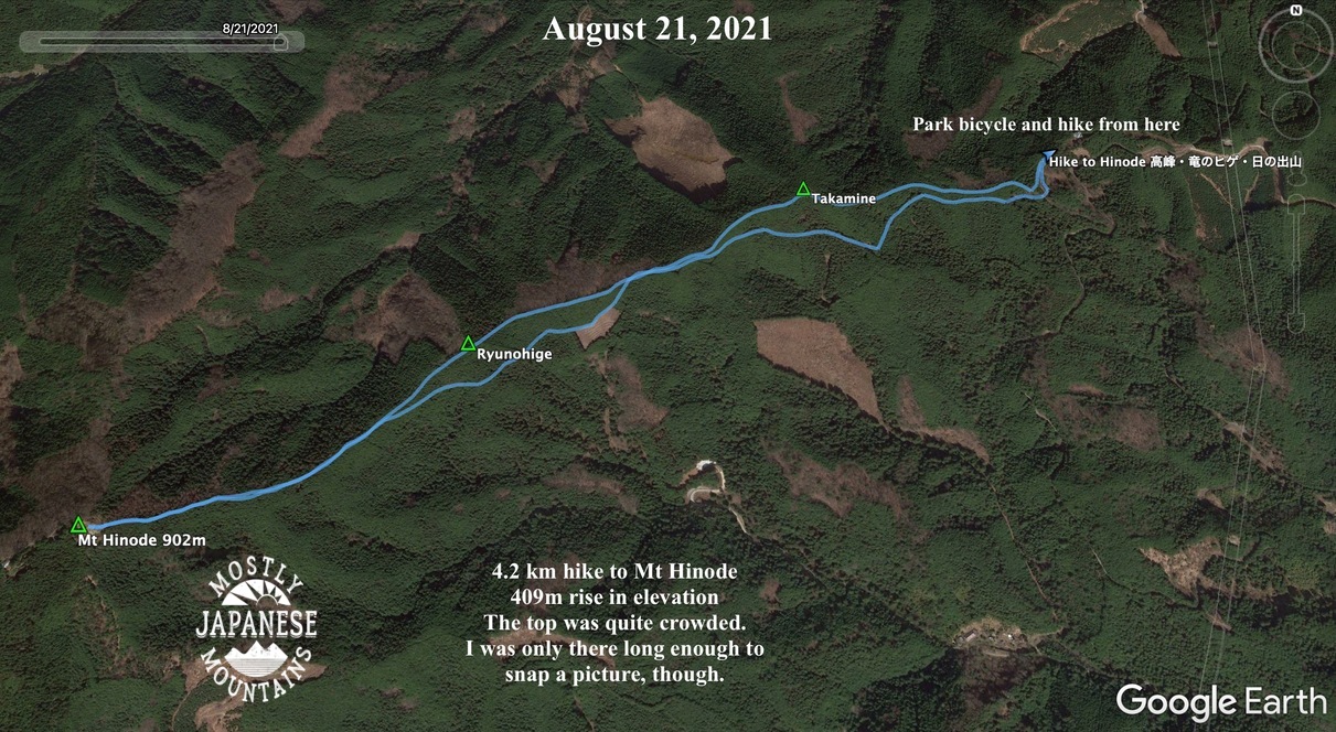
I haven't been hikeling much this year but went on two trips this week. The first was up to Mt. Hinode. Although this is one of the most trafficked mountains in Japan because of its proximity to Tokyo, using the rindo enables me to get near the top without seeing one other person until I get off the bicycle.
Here is my route. If you're interested, the entrance to this rindo is off Yoshino Kaido at Yugimachi.

The hike
Almost all downhill on the way home. Weeee!

This is on the trail, not the rindo. There are quite a few areas around here where it's possible to ride on the hiking trails. Some places don't allow bikes, though. And, it's best not to take your bike on a trail unless you know beforehand whether it's ridable. I've learned that the hard way.

The weather hasn't cooperated this month for pictures. :-(


This gate at the bottom is always closed. They must really mean it now. If you look closely at the sides of the gate, they've tried to seal the gaps. I had to climb over.

Yesterday I went for a much longer hikeling trip. I went to Okutama and up and over the pass between Mt. Gozen and Mt. Nokogiri before descending on the other side into Hinohara Village.
Here is the route I took:

This picture is on the way. I think this was on the side street behind Futamatao Station if I recall.

There are freaky-good scarecrows in Japan. This is right beside Route 411.

The entrance to the rindo (林道) is maybe 1km past Okutama Station. It's between the fire station and the hospital.

Looking down toward Okutama

This forest road is mostly paved.

The road took me near the top of Mt. Nokogiri. I couldn't pass by a peak without taking a peek. (It's a boring mountaintop as they go, though. No view.)

Then back to the bike for the descent.
The sign: "None shall pass." "Go back, fool." "Abandon hope all ye who enter here."
Me: "Hold my beer."
(Seriously. I don't drink. You can hold my beer forever.)


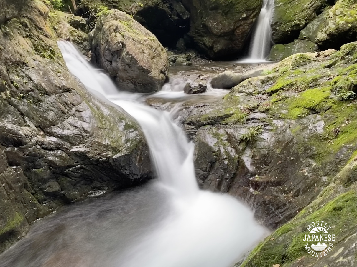
The treat on the way down is Kanato Iwa. It's really out of the way and I would never have discovered it without hikeling--but it is a really neat gorge. (I entered Kanatoiwa as the location for this post if you are interested in going there. It's in the general vicinity of Hossawa Falls if you know where they are.)

The iwa (boulder).
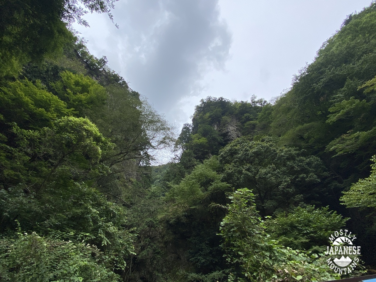
The gorge


Between Kanatoiwa and the next big street, Route 205, there is a campground and some cabins along the river. The cabins are called Kanatoiwa Lodge. When my kids were little, we went there for a Sunday School camp with our parish one weekend. It was a great place for a group outing like that. I highly recommend it if you have a group event like that.
That's all for now. Drop by the cave again sometime.

No comments:
Post a Comment
Have a comment? Please, keep it clean.