. . . about Mt. Washimine
Washi means eagle and mine (pronounced mee nay) means peak.
This is an interim peak just between Mt. Kuruma and the Yashima Wetlands and the Wada Pass and Mt. Hachibuse area. It is high enough and has enough prominence that it has truly fantastic panoramic views. I would really like to see the sunset from there someday. By my calculations, at the right time of year, you would be able to see the sunset over the Northern Alps from there. It must be spectacular.
The drive there is pretty wonderful, too. It is on the Venus Line which winds around Mt. Kuruma on its way and offers many parking spots with great views of the Yatsugatake, Mt. Fuji, the Southern Alps, Mt. Ontake, the Northern Alps and Mt. Asama.
Area:
Location: Mt. Washigamine
Map: ***If you want a link to the latest Yama to Kogen map, comment and I'll get you a link. This link is to a printable topo map
Starting and stopping point: Yashima Sanso Hut (Closed in winter)
Peaks bagged: Washigamine (鷲ヶ峰)
(First-time) peaks # 996
Getting there/getting around: I drove. There is a parking lot at the Sanso. The road is closed for the winter between the Yashima Sanso and the Wada Pass. There is bus and taxi service to the Yashima Sanso during the hiking season run by Alpico.
Helpful Info
Weather Information: (Not so far away) Mt. Mitsumine
Time and distance
Total Time: 4:27 Break time: :28 Distance: 9 km
Elevation: Lowest: 1,511 m Highest: 1,789 m Total Ascent: 489 m Total Descent: 489 m
Technical considerations/difficulty:
I would say this is not a particularly difficult hike. The trailhead starts at about 1,650 meters so there is not a large change in elevation between there and the top of Mt. Washigamine. That's not a long hike, either. You could be up to the top of that and back down to the parking lot in a leisurely 2 hours--and still have time for coffee on top.
The trail between Washigamine and Wada Pass had few discernible markings in the snow and there were no human footprints to follow but since it was on a ridge, it wasn't terribly difficult to discern. The trail through the mountains paralleled the Venus Line a few hundred meters below so I wasn't too worried about getting lost.
Since I kept going beyond Washigamine, I descended a fair amount on my way to the Wada Pass and actually walked much further beyond the top than I had walked to get to the peak.
I really wish I brought my snowshoes. The snow at the beginning was so easy to walk on that I thought they'd just be extra weight. Beyond the top of Washigamine, however, the snow got deeper and powdery. I spend the better part of the day slogging through knee-deep snow, sinking in about every other step that I took. I opted to follow the Venus Line from Wada Pass back to the car because as a vehicular road it was more level than the mountain trail and thus easier to pass. That doesn't mean there wasn't just as much snow, though! It just meant I didn't have the steep inclines. I had to slog on that road, too.
There are a few steep parts between Washigamine and the Wada Pass, but it seems like this would be a very gentle trail to take in summer.
Facilities:
Parking lots and mountain huts at the Yashimasanso and the Wada Pass. Nothing on the trail. No water on the trail, either.
Thoughts/observations/recommendations:
I really wish I had my snowshoes. I turned back a little bit earlier than I planned on because I wasn't sure how long my return would take in the snow conditions I found myself in. I had hoped to get my peak count up to 998 on this day because I really have an eye on getting to 1,000 in the next month. Keep your fingers crossed for me!
OK, let's look at some pictures.

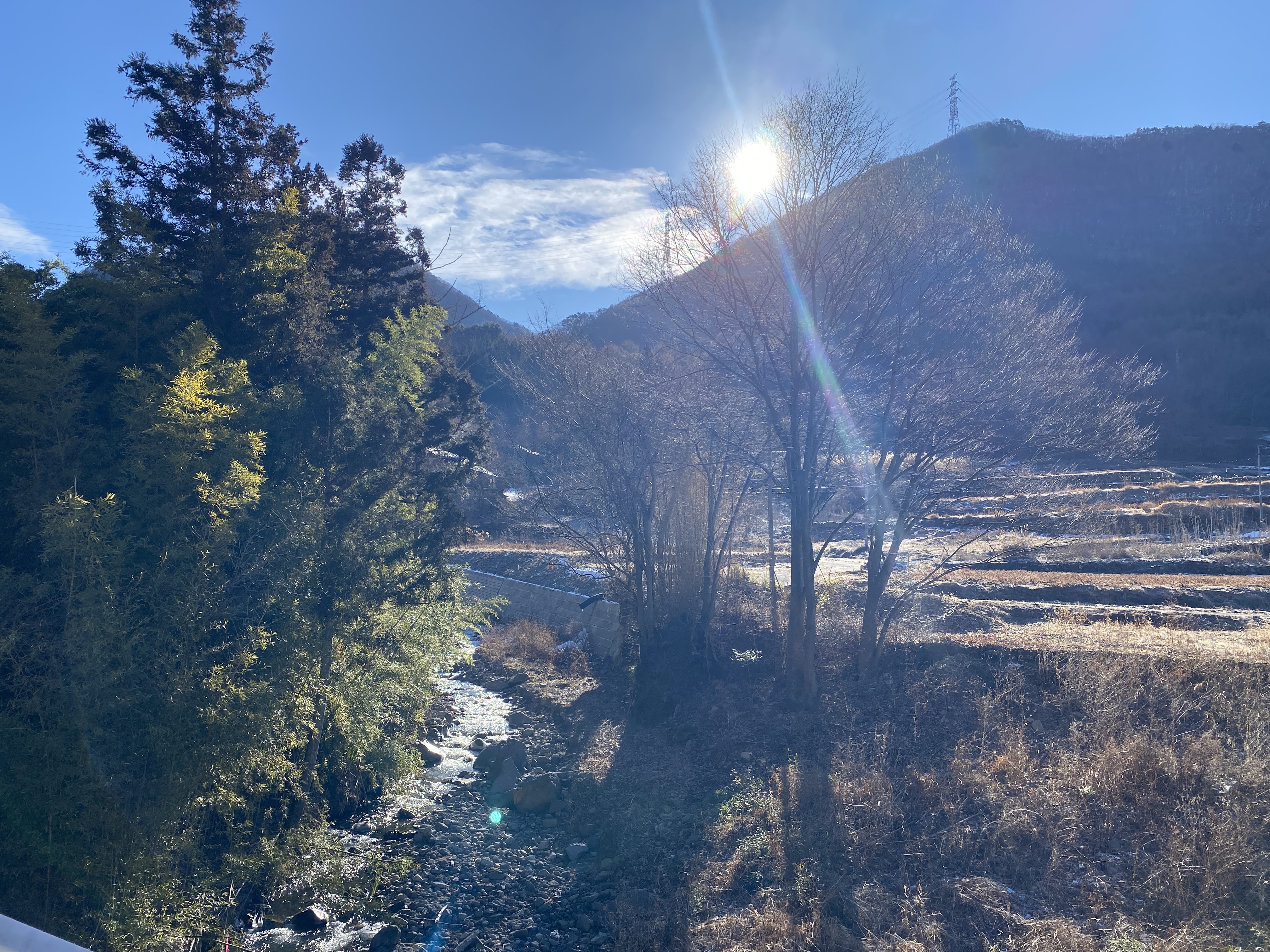
The first few pictures were taken from the car on the Venus Line.
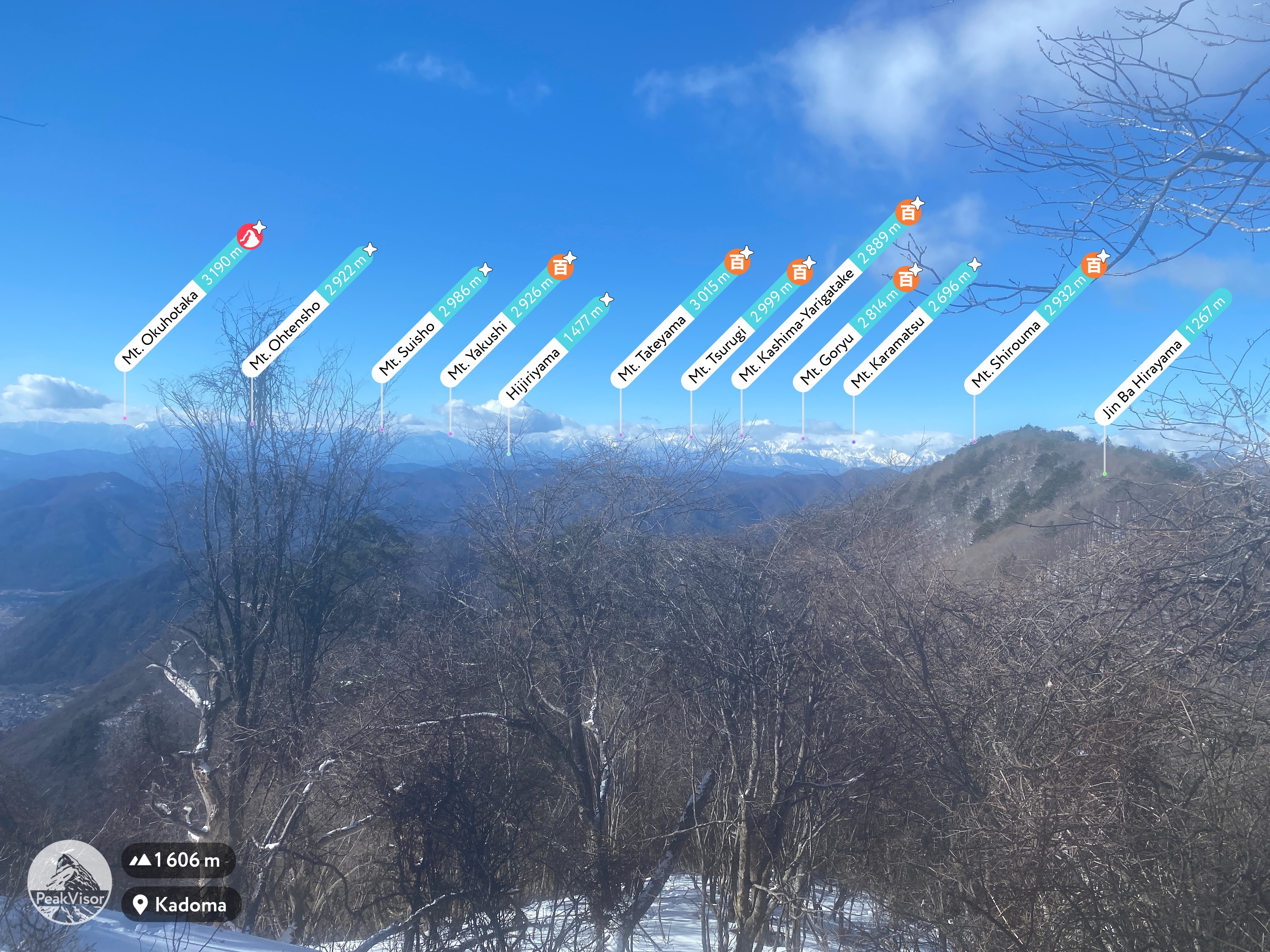
Can you spot the big daddy of Japanese mountains?

Mt. Kitadake is in that pic.

Mt. Ontake

Here're some labelled pics for any of you geography nerds.


It was a crisp, gorgeous morning.
(Celsius)

(Fahrenheit)

Closed for the season but the parking lot is somewhat plowed.


The Yashimagahara Wetlands is a large swamp. It would be a nice place for a walk for anyone. It's flat.

The Wetland


Getting into the trail


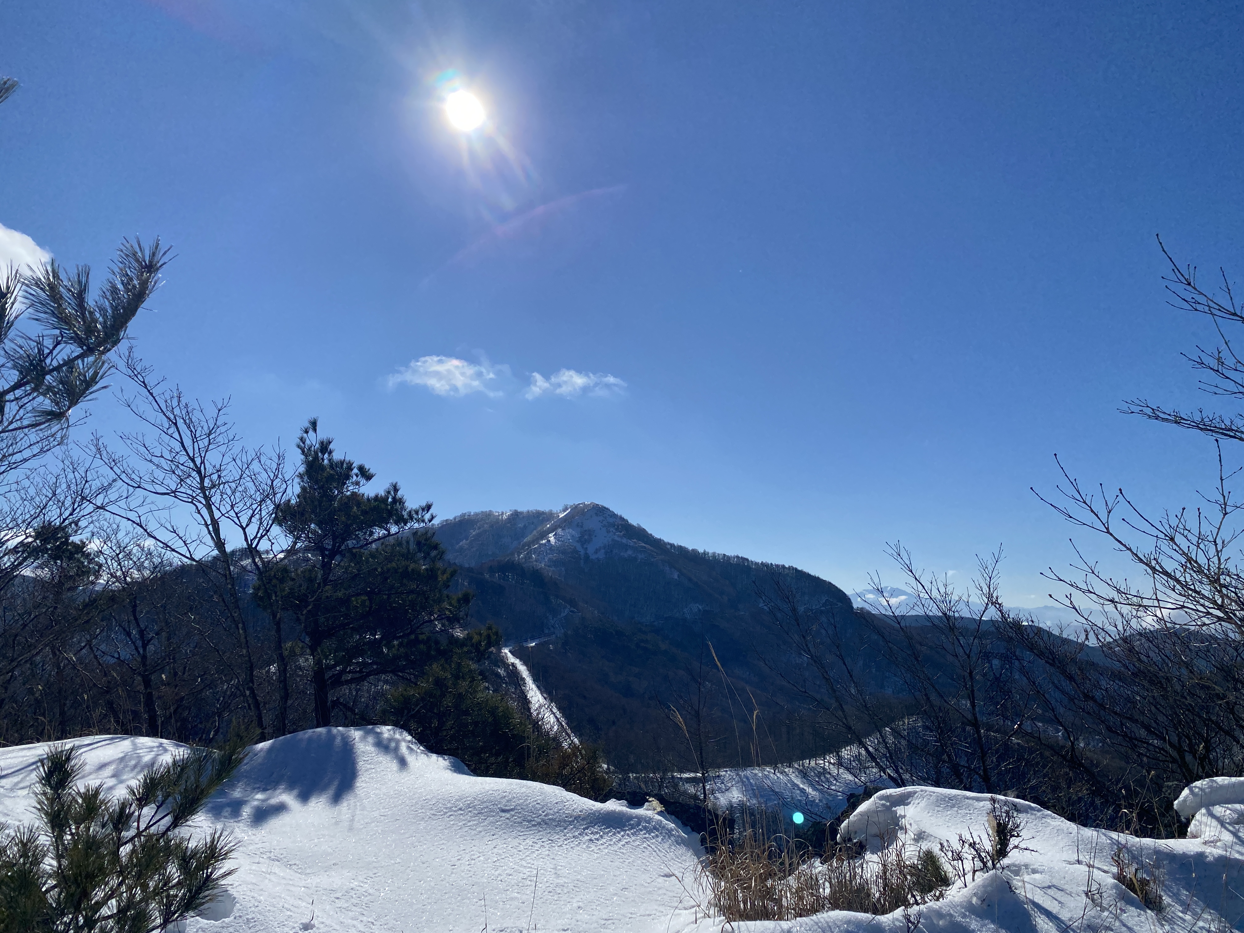
The top


Looking toward the Northern Alps

It got deep.


I encountered lots of footprints--none of them human after the top of Washimine.

This is at the Wada Pass. The road is closed between here and where I started during the winter.


That's all for today. I hope you enjoyed it. I did!
Want to see another spot that would be great for a sunset? Check out
Like, share, subscribe. Tell your friends. Send me wheelbarrows of cash I will make all my dreams come true.