Map: ***The Caveman is giving up on posting links to Yama to Kogen maps. They go out of date after a year or so and the links die. If you want a link to their latest map, comment and I'll get you a link to their latest map of the area.
I drove. The closest parking is at the 三股駐車場トイレ (Mimata Parking Lot Toilet), about 15 minutes walk from the trailhead. There are two other parking lots further away down the road if that one is full.
Some people take taxis there. It is about a 40 minute/7,000 yen ride from Hotaka Mae Station by taxi. This is a real-time camera of the parking lot.
Elevation:Lowest: 1,278 m Highest: 2,662 m Total Ascent: 1,407 m Total Descent: 1,407 m
Technical considerations/difficulty:
It's steep. The lateral distance is only about 6 miles but there is a change in elevation of something like 14 football fields. If you're not in shape, spend some time on a stairmaster before trying this.
There are no chains, only one rope and only one ladder, but much of this hike necessitates using both hands as well as your feet to climb. There is a boulder field below the peak that took me about 40 minutes to traverse. I was there on a fairly wet day and had to be careful not to slip.
The majority of people come to this area for a two-day trip and stay at the Jonen Goya Lodge. I was optimistic in hoping to bang out Mt. Jonendake proper as well as Maejonen in a one-day trip. I am sure I could do it but other considerations caused me to change plans and do a shorter hike (Mrs. Caveman was waiting below and we had wet camping gear to pack up.) It would probably take me about 9-10 hours to go as far as Jonendake and would have been a hike of 11.5 km with a change in elevation of about 1,610 meters.
Facilities:
Toilets at all the parking lots. Bring water (not for the toilets, for drinking. 😉)
Thoughts/observations/recommendations:
Must. Go. Again. Need. Revenge.
Here are some pictures, etc.
Our campsite . . . before the deluge. We stayed at the Susado Campground at Holiday Yu.
It rained all night. The tent ended up under the canopy. That worked out really well!
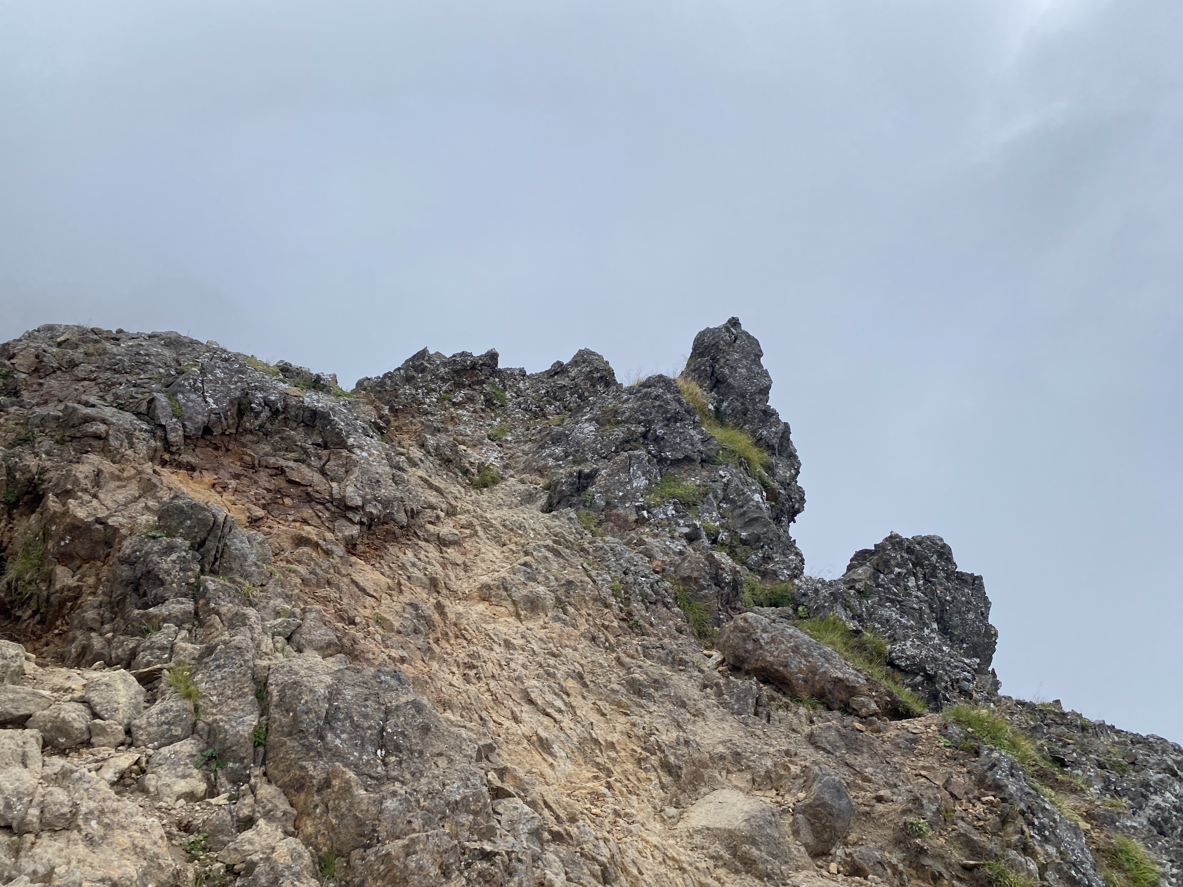
The hike looked mostly like this. Misty, foggy, cloudy all day.
Peaks bagged:御小屋山(Okoyasan) ~ 阿弥陀岳(Amidadake) ~ 中岳(Nakadake) ~ 赤岳(Akadake)
First-time peaks: #930~932
100 Famous Mountain:Mount Akadake (second time)
Getting there/getting around:
I drove. I had hoped to park at the Yatsugatake Sanso (Lodge) but got there too late. It was already overflowing when I arrived at 6:30. (Man, there were a lot of people.) Luckily, they have a second parking lot. Unluckily, it's 2 miles (about 3.2km) downhill. Luckily, they don't charge for that parking lot.
There is a bus from Chino Station to the Minoto Bus Stop near the Yatsugatake Sanso. It costs 1,500 yen and takes 40 minutes.
I recommend doing a lot of research in planning your best route for hiking and for getting to the best trailhead for your needs. My hike was very long but there are shorter options. Most people are not gluttons for punishment as I am. For hikers that will stay overnight, the various lodges have parking lots further up the trail. Pay attention to the road conditions to the place you decide to park. Although one or two of the lodges have parking further into the mountains, you will need to do a bit of driving off of pavement.
This is a bit challenging. Mt. Amidada and up to Akadake is kind of exciting. There are a lot of places with chains, ropes or ladders. Much of it above the treeline and is exposed. In the middle between Amidada and Akadake is Nakadake. And between Nakadake and the two mountains to its sides are steep cols. Think of a very high, (very sluggish) roller coaster and you get the picture. Up and down, up and down. That was cool but took some attention. The steep slopes on the sides of the cols have winding paths through boulders and spots with loose rock and gravel. I slipped once on the loose rocks and almost lost my iphone. (I marvel at the strength of that screen. My phone landed screen down and there isn't even a scratch.)
A lot of hikers make a two-day trek in this area and make use of the lodges/campgrounds. The Caveman is a cheapskate and tries to make only daytrips down there.
There is water on the trail at one point on the Minoto One (Minoto Ridge) and, of course, at all the lodges.
Thoughts/observations/recommendations:
If you're coming to this area of Yatsugatake, your time available and the distance you want to go are factors to weigh. Many people starting where I did go as far as Amidadake and turn back. Or they do a hike like I did and spread it over two days. I really wanted to get as far as Akadake from this side to connect the dots with my tracks there from a previous hike I made last year from the other side. This made for a long day. If you don't have that much time or that much of a yearning for pain, don't do what I did.😜
On a more general note about recommendations, make sure your apps on your smartphone are updated and that you've tested the new updates before going out. I learned the hard way before to update ahead of time. This time, I learned the necessity of also testing the updated app ahead of time. I had updated my peakvisor app the day before. On the hike, I saw a mountain I wanted to identify and opened the app. Long-story short, the app rendered my iphone inoperable. It made the touchscreen unresponsive. I couldn't use any other apps. I couldn't even turn it off. Siri showed up. That was strange because I never use it. I find it creepy and have it off in my settings. Since Siri was talking to me, I thought I would ask its help for a change. I said "Siri, turn off my iphone." Siri said, "OK. But first you have to un-lock it." "Siri, my touchscreen doesn't work. . ." "I don't understand." I'm pretty sure that if Siri is a foreign word that means Catch 22 in English. This went back and forth until I started to say some things to Siri that I won't repeat here. Mrs. Caveman might read this and she doesn't approve of salty language.
I was so annoyed with this situation because I really hated the thought of not getting any pictures. I wanted to come up with a witty metaphor for how upset I was but failed. That proved to be as tough as a geriatric trying to chew beef jerky after their Polident has run out.
Sometimes I really am as sharp as a bowling ball.
Thankfully, I met a Japanese couple that used their smartphones to search the Apple website for advice. They told me the combination of buttons to press. It didn't work at first. About an hour later, it did work. I was able to turn my phone off and on again and it was AOK again. Hooray. I could use my phone the rest of the day.
I contacted peakvisor and they haven't straightened things out yet. It wasn't a life and death situation because I had a paper map and knew where I was going but it good be a life and death situation. I mean, what if I was alone on a mountain and got hurt and couldn't contact emergency services? What if I was tenting it and needed to contact Mrs. Caveman at night to let her know I was ok. Yikes. It turns out that it was an issue that arose because I have two Apple ids.
The Yatsugatake Range is a collection of mountains between the border of Nagano and Yamashi that runs north to south for about 19 miles. I live in the valley to the northeast of the range. This picture is a profile of it as if you were looking at the range from the east side. Each colored line you see represents my footprints. My latest trek is in red.
This is what the range looks like from the town I live in.
I absolutely love to look up and around and identify places I've been and that I'm planning to go to. Looking at the picture above, I can remember so many great hikes. My first hike started on my bicycle at home down in this valley. On that day, I rode my bike uphill 25km and then hiked to the snow-capped peak you see at the right side of the picture above. I also can recall a hike I made near that spot with one of my nephews. What a great memory.
When I lived it Tokyo, I first got this bug, this desire to plant my footprints across the skyline. Maria von Trapp has got nothing on me. She just wanted to climb every mountain. I want to climb every trail on every mountain.
Looking west from Tokyo, Mt. Otake sticks out. You can even see it from Shinjuku on a clear day. When I first started hiking, that was one of the first mountains I did. I've climbed it five or six times. I've climbed that with my son. I've climbed it with my best friend, Bill. That is a special place. After climbing it, I would gaze westward from my home toward the area and get more and more curious about the mountains surrounding it. Eventually I climbed all the mountains around there, and beyond. It seemed like a real accomplishment to realize I'd walked all the way from Musashi Itsukaichi to Okutama--and then to walk from Musashi Itsukaichi to Takao. By now I've walked thousands of miles. I can trace my unbroken footprints from Tokyo Station to Mt Fuji and to Saitama, Gunma and Nagano.
I took this picture from my old apartment in Akishima. Otake is the pointy one. Unfortunately the tree blocks the rest of the skyline.
Enough of waxing philosophical. Let's look at some more pictures.
On the way, I saw some monkeys.
This monkey I saw at the end of the day. This was near the Minotosanso
If you like monkeys, you'll love my monkey movie. Here's the trailer.
I wanted to park at the Yatsugatake Sanso. It's a happening place! There's a lot of activity there. Pay toilets, lodging, food, gear for sale, bus stop, taxi stand. It was full when I got there. I had to drive back (down) the road about 3km to their other parking lot.
At least parking is free in this lot. It's ¥1,000 at the lodge.
The road from the parking lot
I saw so many people around the lodge, I was so pleasantly surprised that none of them had chosen the trail I had. I was alone for the first few hours. I did encounter a lot of people later but it was very quiet when I got on the trail.
This rhododendron made me think of an old friend I used to work for in the summers doing landscaping about 25 years ago. I tracked down his snail mail address online and sent him a letter. I wonder if I'll get a reply.🤔
After about two weeks away from the mountains because of rain, it felt so nice to start out on a nice morning!
First Peak
That's one of the Komagatake Mountains there. I think it's Kisokoma.
Note the ruler for snow measurement.
The top of Amidadake
The last push up to Akadake was quite narrow and only allowed for traffic one way. I had to spend a fair amount of time waiting.
The top was quite crowded. I wasn't able to stay at the very top for a picture for more than a minute or so.
Heading back down. On the way I would pass by the Gyojakoya(行者小屋), the Akadake Kosen Cabin(赤岳鉱泉), the Minoto Sanso(美濃戸山荘), the Akadake Sanso(赤岳山荘) and the Yatsugatake Sanso(赤岳山荘) before getting to my car.
Gyojakoya
Akadake Kosen Cabin(赤岳鉱泉)
I was surprised at the amount of gear these places are selling. I have come to expect these lodges to sell cup noodle, chips and t-shirts.
I think this was the only flower I saw all day. Unusual.
The Kitasawa (North Stream) took me back to civilization.
Minotosanso
Akadake Sanso
And that's it for today.
Check this post out if you want to see more of Mt. Akadake.